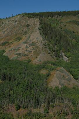
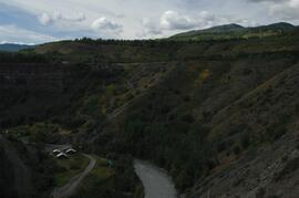
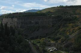
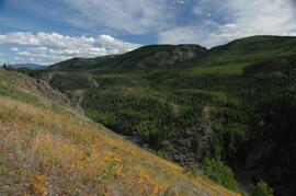
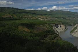
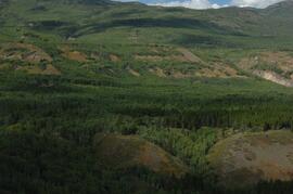
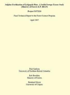
Unpublished results for the Sulphur stable isotope tracer study (E.P. 886.15) were presented in annual reports to the funding agencies, including this Final Technical Report from April 2007.
Document is a BC Ministry of Forests update on proposed research for the Sulphur stable isotope tracer study (E.P. 886.15) from March 1998.
Document is a research installation layout map for the Holy Cross Creek site of the Sulphur stable isotope tracer study (E.P. 886.15).
Document is a research installation layout map for the Kenneth Creek site of the Sulphur stable isotope tracer study (E.P. 886.15).
Data sets for the Sulphur stable isotope tracer study (E.P. 886.15) include:
- 03-095 UNBC PS-For.xls Particle size analyses (Kenneth Creek 0-20 & 20-40 cm)
- 03-096 UNBC PS-For.xls Particle size analyses (Holy Cross 0-20 & 20-40 cm)
- 082037.xls XRF elemental analysis (Holy Cross pedon)
- 082038.xls XRF elemental analysis (Kenneth Creek pedon)
- 084996.xlsx XRF elemental analysis (HC & KC parent materials)
- EP 886 15 S isotope data (2001-2005) - foliage_completed (Feb 18).xls Pine foliage d34S (total S & total SO4-S)
- EP 886.15 2003 Foliage & Soil Chemistry Summary.xls
- EP 886.15 Foliar Analyses (selected) 2001-2006.xls Total N & S, SO4-S
- EP 886.15 Holy Cross & Kenneth Creek 2005 foliage.xls
- EP 886.15 Holy Cross & Kenneth Creek 2006 foliage.xls
- EP 886.15 Holy Cross 2001 FH (S516FINL).xls
- EP 886.15 Holy Cross 2001 Foliage (T727FINL).xls
- EP 886.15 Holy Cross 2001 Litter (S515FINL).xls
- EP 886.15 Holy Cross 2001 Mineral Soil (0-20 cm) (S507FINL).xls
- EP 886.15 Holy Cross 2002 Foliage (T785FINL).xls
- EP 886.15 Holy Cross 2003 FH (S642FINL).xls
- EP 886.15 Holy Cross 2003 Foliage (T836FINL).xls
- EP 886.15 Holy Cross 2003 Litter (S641FINL).xls
- EP 886.15 Holy Cross 2003 Mineral Soil (0-20 cm) (S643FINL).xls
- EP 886.15 Holy Cross 2004 FH (S702FINL).xls
- EP 886.15 Holy Cross 2004 Foliage (T904FINL).xls
- EP 886.15 Holy Cross 2004 Litter (S701FINL).xls
- EP 886.15 Holy Cross 2004 Mineral Soil (0-20 cm) (S703FINL).xls
- EP 886.15 Kenneth Creek 2001 FH (S521FINL).xls
- EP 886.15 Kenneth Creek 2001 Foliage (T727FINL).xls
- EP 886.15 Kenneth Creek 2001 Litter (S520FINL).xls
- EP 886.15 Kenneth Creek 2001 Mineral Soil (0-20 cm) (S508FINL).xls
- EP 886.15 Kenneth Creek 2001 Mineral Soil (20-40 cm) (S509FINL).xls
- EP 886.15 Kenneth Creek 2002 Foliage (T785FINL).xls
- EP 886.15 Kenneth Creek 2003 FH (S645FINL).xls
- EP 886.15 Kenneth Creek 2003 Foliage (T837FINL).xls
- EP 886.15 Kenneth Creek 2003 Litter (S644FINL).xls
- EP 886.15 Kenneth Creek 2003 Mineral Soil (0-20 cm) (S646FINL).xls
- EP 886.15 Kenneth Creek 2003 Mineral Soil (20-40 cm) (S647FINL).xls
- EP 886.15 Kenneth Creek 2004 FH (S705FINL).xls
- EP 886.15 Kenneth Creek 2004 Foliage (T905FINL).xls
- EP 886.15 Kenneth Creek 2004 Litter (S704FINL).xls
- EP 886.15 Kenneth Creek 2004 Mineral Soil (0-20 cm) (S706FINL).xls
- EP 886.15 Kenneth Creek 2004 Mineral Soil (20-40 cm) (S707FINL).xls
- EP 886.15 Sample Inventory.xls Listing of MoF Lab Job No.'s
- Fertilizer March 2003.xls d34S data for commercial fertilizer S sources
- hc_2002.xls Initial (2002) pine tree measurement data - Holy Cross
- kc_2002.xls Initial (2002) pine tree measurement data - Kenneth Creek
While at the Ministry of Forests, Dr. Paul Sanborn carried out two retrospective studies which examined soil chemical properties at long-term silvicultural research sites where different vegetation types had been created, either as planned or unplanned experiments. These studies were Experimental Project (EP) 660 and a research project at the Archie Creek site.
EP 660 was a conventional silvicultural trial established in 1967 which involved single species plantings of lodgepole pine (Pl), white spruce (Sw), and Douglas-fir (Fd) at different spacings. Three installations were established in the Prince George - Vanderhoof area: Buckhorn Ridge, Bobtail Road, and Chilco Creek.
General details on EP 660 are given by:
Coopersmith, D., M. McLellan, and J. Stork. 1997a. Experimental Project 660 overview of three experimental installations – a 30-year progress report. B.C. Min. For., Prince George For. Reg., Res. Note #PG-12.
Details on the Buckhorn installation are given by:
Coopersmith, D., M. McLellan, and J. Stork. 1997b. Experimental Project 660 30-year progress report: Buckhorn Installation. B.C. Min. For., Prince George For. Reg., Res. Note #PG-12-1.
This digital document is a scanned PDF of a Prince George Forest Region Forest Research Note #PG-12: "Experimental Project 660 - Overview of Three Experimental Installations - A 30-year Progress Report".
This digital document is a scanned PDF of a Prince George Forest Region Forest Research Note #PG-12-1: "Experimental Project 660 - 30-year Progress Report - Buckhorn Installation".
This digital document is a born-digital PDF containing details of forest floor sample collection & handling for the EP 660 Buckhorn Ridge installation.
File contains the following data sets:
- S300FINL.XLS [Ministry of Forests lab data report: non-woody forest floor components]
- S301FINL.XLS [Ministry of Forests lab data report: woody forest floor components]
- 660FF97.xls [non-woody and woody forest floor components: mass / unit area (corrected to oven-dry basis)]
- BUCKLIST.xls [table showing internal sample numbers corresponding to lab sample numbers used in MoF lab reports]
File contains 8 slides from 2 rolls, taken August 1997:
Roll 1 - Buckhorn Ridge:
- Slide 31 – Fd (2 x 2 m) – stand view
- Slide 32 – Fd (2 x 2 m) – forest floor view
- Slide 33 – Pl (2x 2 m) – stand view
- Slide 34 – Pl (2 x 2 m) – forest floor view
Roll 2 – Bobtail Road: - Slide 20 – Pl (2 x 2 m) – east plot, stand view
- Slide 21 – Pl (2 x 2 m) – east plot, stand view
- Slide 22 – Fd (2 x 2 m) – east plot, stand view
- Slide 23 – Sw (2 x 2 m) – stand view
The Archie Creek site is the informal name used for a research installation established in 1971 east of Prince George by the Canadian Forest Service, and subsequently abandoned by the end of that decade. Dr. Paul Sanborn revisited the site in 1995, and sampled forest floors and mineral soils across a range of conifer-broadleaf mixtures established by natural establishment of broadleaf trees among planted lodgepole pines.
Details of the site conditions, sampling methods, and results were published in:
Sanborn, P. 2001. Influence of broadleaf trees on soil chemical properties: A retrospective study in the Sub-Boreal Spruce Zone, British Columbia, Canada. Plant and Soil 236: 75–82. https://doi.org/10.1023/A:1011973402414
This map depicts the location of the Archie Creek site, annotated on a photocopied 93I.011 BC government map (undated).
This document is an undated 1990s handout for a field trip to the Archie Road (North) demonstration plot.
This unpublished 1993 UBC undergraduate thesis by J. Hickling entitled "Some long term effects of scarification on soil properties and site productivity" includes some soils data from the Archie Creek site.
This document is an unpublished 1995 UNBC co-op work term report by B. Roosdahl entitled "Forest Floor Development on Bladed Trails in the SBS: A retrospective study of the Archie Creek site". B. Roosdahl was a co-op student who was one of the student research assistants involved in the field work at the Archie Creek site in fall 1995.
This document is a photocopy of a 1994 draft report prepared by Scagel, Hickling, and Evans for BC Ministry of Forests, Silviculture Branch. The document includes annotations by Lorne Bedford, BC MoF (ret.).
File contains the following data sets:
- Archie Site Tree Data.xls [diameter (dbh) and basal area of trees within and overhanging plots]
- Archie Site non-woody forest floor properties (1995).xls [non-woody forest floor chemical properties – individual sample results & plot means]
- Archie Site woody forest floor component properties (1995).xls [total C, N & S concentrations, pool sizes for woody forest floor components]
- Archie Site mineral soil properties (1995).xlsx [0-20 cm mineral soil chemical properties – individual sample results & plot means]
- Archie Site forest floor mass (1995).xlsx [mass per unit area of non-woody & woody forest floor components, corrected to oven-dry basis]
- S221FINL.xls [MoF lab data report: non-woody forest floor components]
- S222FINL.xls [MoF lab data report: woody forest floor components]
- S251FINL.xls [MoF lab data report: 0-20 cm mineral soil]
File contains 2 rolls (51 slides) taken September 25-26, 1995 that depict paired views of plot vegetation and forest floor surface. Handwritten number notations on slide frames indicate plot numbers from the original research installation.
The BC Ministry of Forest's EP 1148 Long-term Soil Productivity (LTSP) study addresses two key factors— soil porosity and site organic matter—that potentially limit tree growth and site productivity in the timber-harvesting land base and that can be affected by forestry operations.
This establishment report for EP 1148, "The effects of soil compaction and organic matter retention on long-term soil productivity in British Columbia (Experimental Project 1148)", is accompanied by a floppy disk containing 12 data sets (see 2023.2.2.11.2).
This 3.5" floppy contains the following EP 1148 .TXT data sets from 1995-1997:
- sbsapc.txt "Long-term soil productivity study, Sub-Boreal Spruce" Intact soil cores
- sbsbd.txt "Long-term soil productivity study, Sub-Boreal Spruce" Bulk density mineral soil 0-20cm
- sbsffc.txt "Long-term Soil Productivity Study, Sub-boreal Spruce" SBS forest floor bulk density and mass3
- sbsfc.txt "Long-term Soil Productivity Study, Sub-boreal spruce" SBS forest floor chemistry
- sbsmc.txt "Long-term Soil Productivity Study, Sub-boreal Spruce sites" SBS mineral soil chemistry
- sbskgff.txt "Long-term soil productivity study, Sub-boreal spruce zone" SBS forest floor nutrient mass in kg/ha
- sbskgmm.txt "Long-term soil productivity study, Sub-boreal spruce" SBS mineral nutrient mass in kg/ha
- sbsom.txt "Long-term Soil Productivity Study, SBS" "SBS bole-only treatment, slash levels"
- sbscr.txt "Long-term soil productivity study, Sub-boreal spruce zone" Timber cruise of initial stands
- sbshtcr.txt "Long-term soil productivity study, SBS" Age vs height curves - pretreatment data (mature stand)
- sbssi.txt "Long-term soil productivity study, Sub-Boreal Spruce zone" Carmean estimates of site indices for initial stand
- sbstr.txt "Long-term soil productivity study, Sub-Boreal Spruce" Tree measurements
A comparative study of grassland soils at 3 sites in northwestern BC and southern Yukon was published as:
Sanborn, P. 2010. Topographically controlled grassland soils in the Boreal Cordillera ecozone, northwestern Canada. Canadian Journal of Soil Science 90: 89-101. https://doi.org/10.4141/CJSS09048
This grew out of a field trip with Ministry of Forests range personnel to the Stikine and Tuya River valleys, near Telegraph Creek BC on August 27-28, 2007. (Two pedons were sampled in 2007, BC07-03 and BC07-04, but those results were not included in the paper.)
In August 2008, Dr. Paul Sanborn returned to the Stikine to sample pedon BC08-06, after field work in Yukon which collected the other two pedons used in the paper, from near Carmacks (Y08-39) and Kluane Lake (Y08-41). (An additional pedon from Kluane, Y08-43, was sampled and analyzed, but it was from a forested site and was not included in the paper.)
This document contains pedon descriptions for sites BC07-03 & BC07-04 for Sanborn's comparative study of grassland soils in the Boreal Cordillera ecozone.
This document contains location and vegetation notes for 5 observation sites for Sanborn's comparative study of grassland soils in the Boreal Cordillera ecozone.
This document contains transcribed August 2007 field notes from 5 observation sites for Sanborn's comparative study of grassland soils in the Boreal Cordillera ecozone.
This document contains soil descriptions taken from BC and Yukon sites in 2008 for Sanborn's comparative study of grassland soils in the Boreal Cordillera ecozone.
File contains the following data sets:
- BC & Yukon 2008 soils data – compiled.xls [combined chemical & physical data for BC08-06, Y08-39, Y08-41, Y08-43]
- S925finl.xls [chemical analysis data, Ministry of Forests & Range, Analytical Chemistry Laboratory for pedons BC07-03 & BC07-04; also includes data for Y07-06 & Y07-07 (Klutlan Glacier – see associated file note)]
- S979finl(revised) – PS edits.xls [chemical analysis data, Ministry of Forests & Range, Analytical Chemistry Laboratory for BC08-06, Y08-39, Y08-41, Y08-43]
- S994finl_revised.xls [chemical analysis data, Ministry of Forests & Range, Analytical Chemistry Laboratory for BC07-04 (CaCO3-equiv, total & inorganic C, pyrophosphate, oxalate & dithionite extractions) & selected horizons from BC07-07 & BC07-09 (Nazko basaltic soils))
- CANTEST lab report 91010076.pdf [particle size analyses for BC08-06, Y08-39, Y08-41, Y08-43]
- CANTEST lab report 90206003.pdf [particle size analyses for Tuya pedons BC07-03 & BC07-04 & Klutan Glacier pedons Y07-06 & Y07-07]