Showing 658 results
Archival description
Cartographic Material
Cartographic Material
City of Prince George: Proposed electoral district boundary
City of Prince George: Proposed electoral district boundary
City of Victoria: Proposed electoral district boundary
City of Victoria: Proposed electoral district boundary
City of Vancouver: Proposed electoral district boundary
City of Vancouver: Proposed electoral district boundary
Fantail Lake, Cassiar District, British Columbia
Fantail Lake, Cassiar District, British Columbia
World Aeronautical Chart: Iskut River
World Aeronautical Chart: Iskut River
Beautiful British Columbia: Road Map, Campground and Angling Guide
Beautiful British Columbia: Road Map, Campground and Angling Guide
Major Oil and Gas Fields and Pipelines in Canada
Major Oil and Gas Fields and Pipelines in Canada
Arctic Offshore Oil and Gas Areas
Arctic Offshore Oil and Gas Areas
Beaufort Sea Typical Seismic Section Across Dome Acreage
Beaufort Sea Typical Seismic Section Across Dome Acreage
Location Map of Mining Properties in British Columbia and the Yukon Territory (including part of the Northwest Territories)
Location Map of Mining Properties in British Columbia and the Yukon Territory (including part of the Northwest Territories)
Oilweek: Pipeline Wall Map
Oilweek: Pipeline Wall Map
British Columbia's Proposals on West Coast Maritime Boundaries between Canada and the United States
British Columbia's Proposals on West Coast Maritime Boundaries between Canada and the United States
Prince Edward Island Official Tourist Map
Prince Edward Island Official Tourist Map
Canada: Indian Treaties
Canada: Indian Treaties
Regional District of Kitimat-Stikine
Regional District of Kitimat-Stikine
British Columbia Freight Routes
British Columbia Freight Routes
Canadian Highway System
Canadian Highway System
Highways of Canada and Northern United States - Western Sheet
Highways of Canada and Northern United States - Western Sheet
Terrace, British Columbia
Terrace, British Columbia
Regina, Saskatchewan Complimentary City Guide and Map
Regina, Saskatchewan Complimentary City Guide and Map
XI Commonwealth Games: Edmonton 1978
XI Commonwealth Games: Edmonton 1978
Corner Brook, Newfoundland Tourist Map
Corner Brook, Newfoundland Tourist Map
Terrace Industrial Plan
Terrace Industrial Plan
Stewart B.C. Existing Harbour Development
Stewart B.C. Existing Harbour Development
District of Kitimat Land Ownership
District of Kitimat Land Ownership
Existing Development - Mont Ste. Marie, Lac Ste-Marie, Quebec
Existing Development - Mont Ste. Marie, Lac Ste-Marie, Quebec
Archdeacon W. H. Collison fonds
Archdeacon W. H. Collison fonds
Cartographic Materials Series
Cartographic Materials Series
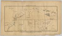
Map showing locations of placer streams in British Columbia south of latitude 54 degrees North, with Queen Charlotte Islands inset in north east corner
Map showing locations of placer streams in British Columbia south of latitude 54 degrees North, with Queen Charlotte Islands inset in north east corner
Columbia Cellulose Company, Ltd. fonds
Columbia Cellulose Company, Ltd. fonds
Company Operating History series
Company Operating History series
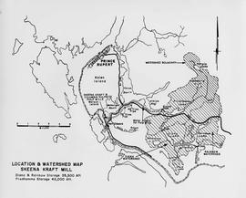
Skeena Kraft Limited Press kit
Skeena Kraft Limited Press kit
Development Study - Northern Resources
Development Study - Northern Resources
J. Kent Sedgwick fonds
J. Kent Sedgwick fonds
Research Subject Files
Research Subject Files
Prince George City Incorporation
Prince George City Incorporation
City of Prince George boundary expansion
City of Prince George boundary expansion
"City of Prince George Boundary Expansions Since Incorporation in 1915"
"City of Prince George Boundary Expansions Since Incorporation in 1915"
