Presentation slides for the January 2023 meeting of the Soil Classification Working Group, Canadian Society of Soil Science
File consists an audio recording of an oral history with Harry Coates recorded by Barbara Coupe.
Poster presentation at 2013 Canadian Society of Soil Science Conference
Image is a panoramic view of north-facing slope (sites BC12-08 and BC12-09) overlooking the Tetsa River crossing of the Alaska Highway, taken from across the valley.
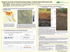
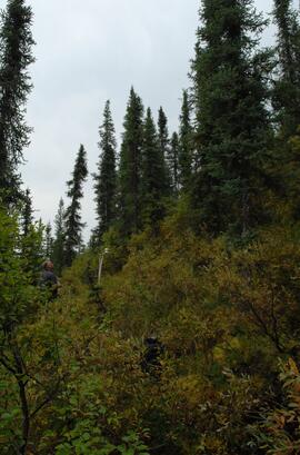
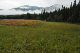
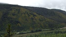
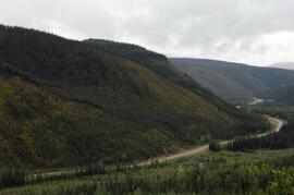
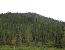
For this Northern Rockies pedological study, Dr. Paul Sanborn conducted field work jointly with researchers from the Ministry of Forests and Agriculture Canada from August 21-24, 2012, at two clusters of sites along the Alaska Highway west of Fort Nelson: near the Tetsa River crossing at km 585, and ~4.5 km west of Toad River at the "Poplars" campsite.
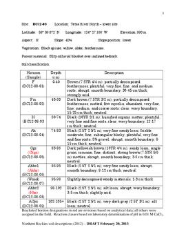
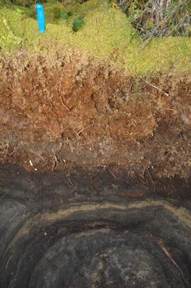
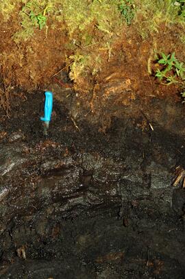
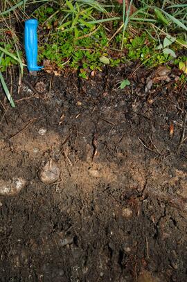
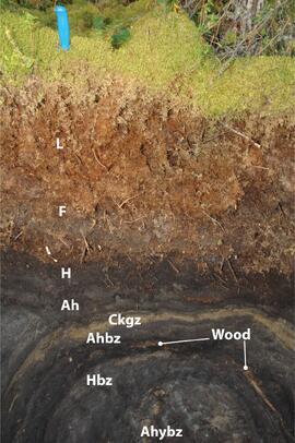
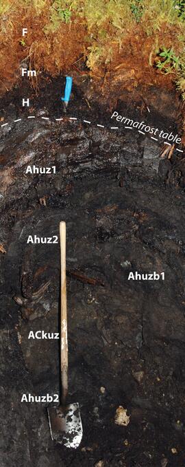
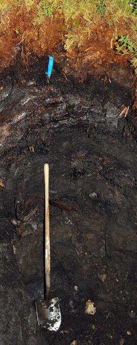
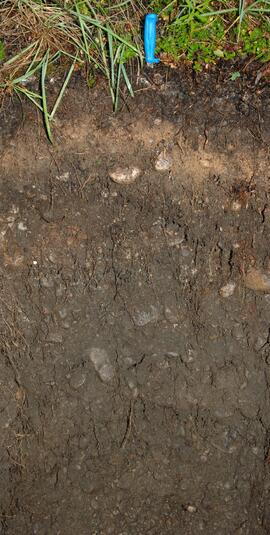
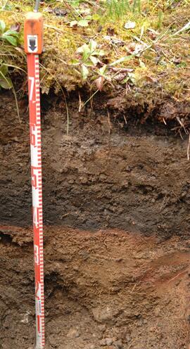
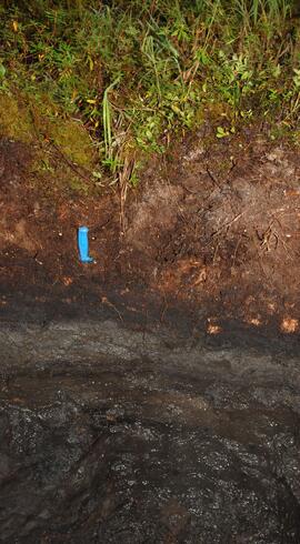
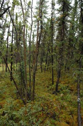
The focus of the study was on soils currently or recently containing permafrost as well as associated soils on nearby sites with warmer microclimates, with a total of 6 pedons described and sampled. One of these, an Organic Cryosol (pedon BC12-08), was documented in a short paper:
Sanborn, P., C. Bulmer, M. Geertsema, and S. Smith. 2022. A proposed Folic subgroup for the Organic Cryosols. Canadian Journal of Soil Science 102: 811–816. https://doi.org/10.1139/cjss-2021-0182
Associated soil microclimate monitoring occurred at this site, and is documented in:
Hasler A., Geertsema M., Foord V., Gruber S., Noetzli J. 2015. The influence of surface characteristics, topography and continentality on mountain permafrost in British Columbia. The Cryosphere 9: 1025–1038. https://doi.org/10.5194/tc-9-1025-2015
Some of the data from both papers was presented as a poster at the Canadian Society of Soil Science annual conference in 2013.
The highlights of the 2022 paper were presented at an online meeting of the Soil Classification Working Group of CSSS on January 20, 2023.
The sequence of site numbers is BC12-08, -09, (-10 was not used), -11, -12, -13, -14, and -15. Note that BC12-13 was described and sampled, but not photographed. An additional pedon designated as BC12-13A was located within ~10 m of BC12-13 on the same terrace, and had what appeared to be a buried fire-reddened layer under a possible buried Ah horizon. This pedon was photographed but not described or sampled.
File contains the following data sets:
- S1292Final.xlsx [chemical analysis data for mineral horizons, Ministry of Forests & Range, Analytical Chemistry Laboratory]
- S1293Final.xlsx [chemical analysis data for organic horizons, Ministry of Forests & Range, Analytical Chemistry Laboratory]
- B299530-R2013-02-18_15-47-21_N001.xls [particle size analysis data for mineral horizons, Maxxam Laboratories]
- B299530-R2013-02-18_15-47-21_R014.pdf [particle size analysis data for mineral horizons, Maxxam Laboratories]
- Northern Rockies 2012 sample list - Maxxam.xls [list of samples submitted to Maxxam Laboratories for particle size analysis; indicates which samples needed carbonate removal pretreatment]
- N Rockies 2012 - master data file.xlsx [working copy of combined chemical and particle size data in report format]
Image is a panoramic view of north-facing slope (sites BC12-08 and BC12-09) overlooking the Tetsa River crossing of the Alaska Highway, taken from across the valley.
Document is a research installation layout map for the Kenneth Creek site of the Sulphur stable isotope tracer study (E.P. 886.15).
Document is a research installation layout map for the Holy Cross Creek site of the Sulphur stable isotope tracer study (E.P. 886.15).
This data set consists of elemental analysis data for selected B horizons from Wounded Moose paleosols sampled by Tarnocai and Smith. The file includes the original ALS lab report, additional panes showing comparison of replicates, and calculation of a weathering index.
In July 2009, Dr. Paul Sanborn undertook the first soils field research at the Fort Selkirk volcanic field in central Yukon, with helicopter support and funding from the Yukon Geological Survey. This file includes the following data sets gathered from the research:
- Ft Selkirk 110114069.xls [particle size analysis data, CANTEST]
- S1090final.xlsx [chemical analysis data, Ministry of Forests & Range, Analytical Chemistry Laboratory]
- S1112final.xlsx [chemical analysis data, Ministry of Forests & Range, Analytical Chemistry Laboratory]
- Ft Selkirk 2009 soils data (updated Sept 15, 2010 and April 10, 2023).xls [consolidated lab data for all 2009 samples]