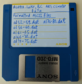
File contains information, including diagrams, measurement charts, and a map, for experimental plot 118.
File contains information, including measurement charts and a map, from experimental plot 150.
File contains handwritten tables and graphs of measurements of plots, photocopied reports, 9 black and white photos, and handwritten notes.
File contains photocopies of data sheets and charts, handwritten ledger pages, and a photocopied study of plot 106.
Photograph is one of six relating to Plot 108. Multiple copies of the photographs exist.
File contains handwritten measurements and charts for Plot 114.
File contains original handwritten notes and photocopied data listing reports for Plot 116.
File contains photocopies of measurement charts, and the report for Plot 115.
File contains handwritten and photocopies of measurement charts, and a photocopy of the the related study for Plot 118.
Item is the field copy of a 1929 BC Forest Service report from Myra, BC titled "Southern Interior District Experimental Plot No. 160: Conditions After Logging of a Spruce-Balsam Forest in Relation to Spruce Reproduction and to the Rate of Growth of the Second Story".
Item is the office copy of a 1929 BC Forest Service report from Myra, BC titled "Southern Interior District Experimental Plot No. 160: Conditions After Logging of a Spruce-Balsam Forest in Relation to Spruce Reproduction and to the Rate of Growth of the Second Story".
Item is the 1958 BC Forest Service report from Myra, BC titled "E.P. 160 & 503: Development of a Residual Stand of Interior Spruce-Alpine Fir During the First 28 Years Following Cutting". This report is the follow-up to the 1926 and 1936 reports titled "Conditions After Logging of a Spruce-Balsam Forest in Relation to Spruce Reproduction and to the Rate of Growth of the Second Story".
Map of Timber Sale X72108 shows area to be scarified, as well as previously logged areas. Location is outside Prince George in the Upper Fraser area near Kenneth Creek.
Logging plan of Sinclair Spruce Lumber Company's T.S.X. 73378 at Hubble Creek shows areas to be cut.
Caption of back of photograph states: "R877 Forest Branch Cabin X9696"
Photographer's photo number R883. Caption on back of photograph states: "Typical patch of old windfall in cutting in X9696."
Photographer's photo number R884. No caption on back of photograph to glean further information. Title provided based on contextual information from related photographs and documents.
Photographer's photo number R885. Caption on back of photograph states: "Plot '9' X9696 --McCulloch"
Caption on back of photograph states: "Facing W on Plot 13 showing windfall"
No caption on back of photograph to glean further information. Title provided based on contextual information from related photographs and documents. Photograph may depict windfall on Plot 13 similar to the previous photograph 2007.1.45.49.38.
File contains official government reports on tree types, correspondence regarding research proposals, and working plans.
File consists of working copies of aerial photos, vegetation tables printed from computer disk, photocopies of plot sheets, and lists identifying species.
Item is a photocopied map of the Aleza Lake area annotated to show transects.
Item is a photocopied and annotated Aleza Lake Forest map with forest cover labels.
Item is a photocopied Aleza Lake Forest map with forest cover labels, annotated to show 1995 sample transects.
File contains photcopies of progress reports, the final study on the project, maps of the studied plot, and measurement tables.
File contains correspondence relating to project funding and reports on the significance of the project.
File contains proposal updates and project expenditure lists.
File contains reports on soil rehabilitation project and related correspondence, photocopied tables of soil measurements, and photocopied pages of ledgers with diagrams and notes.
File contains photocopies of seedling measurement tables.
File contains Aleza Lake Experiment Station Climate Station data from 1952 to 1980 and three accompanying floppies with weather data and Fortran programs.
Floppy contains the following files: AL52-55.dat, AL56-60.dat, AL61-65.dat, AL66-70.dat, AL71-75.dat, AL76-80.dat
Series contains project reports, invoices, work orders, daily costs, maps, correspondence, forest related brochures and books, and trail guides.
Item is "Cluculz Lake Silviculture Demonstration Area Trail Guide" by the BC Ministry of Forests.
Item is the BC Forest Service's "A Guide to Stand Treatment".
File contains road reconstruction project reports, photocopies of invoices and work orders, records of daily costs, photocopies of hired equipment daily time reports, related correspondence, and maps.
Map reflects reserve boundary, roads, trails, 20 feet contour intervals, air photo centre, declination, swamps, and mile post at the Aleza Lake Forest Reserve.
Technical drawing reflects depth of sand established as more and less than 6 feet.
Map reflects soil and landforms of Giscome area.
Large scale map shows Aleza Lake Research Forest permanent sample plot 103. Includes information about live and dead trees and their species (spruce, balsam, birch, douglas fir). Also includes remeasurement history. Plot 103 was established in 1926 and is an unlogged, old growth, uneven aged, spruce-balsam stand.
Photograph is a remote-sensing image of the Aleza Lake Research Forest from 1994.