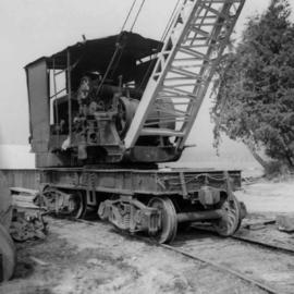
Imprimir vista previa Cerrar

Mostrando 139 resultados

Archival description
82 resultados con objetos digitales Muestra los resultados con objetos digitales
"Map of Lower Mainland Railways"
2013.6.35.16 · Item · Mar. 1971
Parte de David Davies Railway Collection

Map depicts rail lines in the BC lower mainland, including BC Hydro Railway, Burlington Northern Railway, the Canadian Pacific Railway, the Canadian National Railway, and the Pacific Great Eastern Railway.

2013.6.36.1.004.39 · Item · Apr. 1966
Parte de David Davies Railway Collection

Photograph depicts a steam crane in a lumber yard on the north side of Porpoise Bay in Sechelt on the Sechelt Peninsula. The steam crane has been converted to diesel and was made by the Brown Hoisting Co. from Cleveland, Ohio. It lifts 21 tons at a 12ft radius and 5 tons at 35ft radius, and is in daily use. The 200 yards of rail track form a "Y" with the bottom piece onto the wharf.

Old booming boat on seashore
2013.6.36.1.004.42 · Item · Apr. 1966
Parte de David Davies Railway Collection

Photograph depicts a once used booming boat made of log sections at a log dump on seashore about 5 miles north of Powell River, and opposite Harwood Island. Stern at left with prop guard.

Log dump on seashore
2013.6.36.1.004.43 · Item · Apr. 1966
Parte de David Davies Railway Collection

Photograph depicts a log dump on seashore about 5 miles north of Powell River and opposite Hardwood Island. The view is looking north.

Lumber yard in Sechelt, B.C.
2013.6.36.1.004.44 · Item · Apr. 1966
Parte de David Davies Railway Collection

Photograph depicts a lumber yard on the north side of Porpoise Bay in Sechelt on the Sechelt Peninsula. The tank in the photograph is about 8 to 10 feet in diameter.

Oxen powered log carrier
2013.6.36.1.004.41 · Item · Oct. 1965
Parte de David Davies Railway Collection

Photograph depicts an oxen powered log carrier with wheels that are approximately 10 feet in diameter. It is at Pioneer Park and Museum near Totem Lake, 3 miles north of Yahk and 30 miles east of Creston.

Mine car at Moyie Mine
2013.6.36.1.005.12 · Item · Oct. 1965
Parte de David Davies Railway Collection

Photograph depicts a mine car at Moyie mine, at Moyie, 20 miles south of Cranbrook. The mine produced silver, zinc, and lead, and worked principally from 1900-1910. It is now disused.

Abandoned coal mine east of Fernie, BC
2013.6.36.1.005.33 · Item · Oct. 1965
Parte de David Davies Railway Collection

Photograph depicts an abandoned coal mine in Coal Creek, 5 miles east of Fernie, BCThe entrance to the mine is unusual and is 2/3rds up the mountainside. The mine was closed in 1959. Flat ground in foreground is littered with at least 100 mine tubs of approximately 3'0' gauge.

Mine buildings of mine at Coal Creek
2013.6.36.1.005.36 · Item · Oct. 1965
Parte de David Davies Railway Collection

Photograph depicts the mine buildings of the mine at Coal Creek that closed in 1959. The newer buildings date to circa 1930. Much of the standard gauge trackage of Morrissey, Fernie, and Michel railway (subsidiary of the Great Northern Railway) in mine area remains. The track between Coal Creek and Fernie has not been lifted.

2013.6.36.1.004.37 · Item · [July 1965]
Parte de David Davies Railway Collection

Photograph depicts a steam crane in the yard of the Lions Gate Lumber Co. at the foot of Lloyd St. in North Vancouver. The crane was made by the Brown Hoisting Machinery Co. in Cleveland, Ohio and is undated. It has a 20 ton capacity, is well maintained, and freshly painted.

Mine near Moyie, BC
2013.6.36.1.005.10 · Item · Oct. 1965
Parte de David Davies Railway Collection

Photograph depicts a mine 200 yards south of Moyie village, which is 20 miles south of Cranbrook. It produced silver, zinc, and lead from 1900-1910 and had a smelter a quarter mile away. The shaft was 900 ft. deep, with levels going under Moyie Lake. The head gear dates from 1925-1935 and has electric winding.