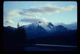
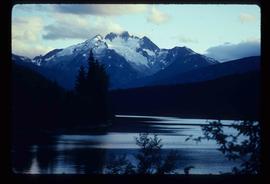
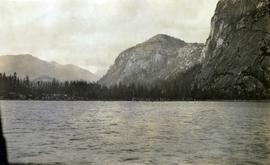
Image depicts the north aspect of Oscar Peak overlooking Lava Lake in the Nass Valley.
Image depicts the north aspect of Oscar Peak overlooking Lava Lake in the Nass Valley.
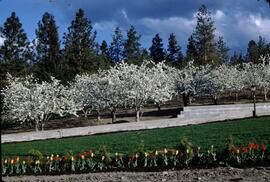
Slide depicts a row of red and yellow tulips in front of a row of blossoming cherry trees. Original slide index description: "Tulips & Chery Blossoms Ok. Mission."
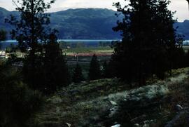
Slide depicts orchards surrounding Mount Boucherie. The Okanagan Lake and mountains can be seen in the background. Original slide index description: "Orchards & sunflowers from Mt. Boucherie."
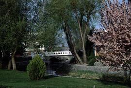
Slide depicts the park entranceway to Kelowna on the East side of the Okanagan Lake Bridge. Original slide index description: "Park entrance to Kelowna."
File consists of material relating to the Yukon Telegraph. Materials include newspaper clippings, correspondence, a magazine, pamphlets, a newspaper, and reproductions of articles. Highlights include:
- Beautiful British Columbia Magazine, Vol. 32 No. 2 , 1990
- Ministry of Lands, Parks, and Housing, "Provincial Parks of British Columbia Map", 1980 (pamphlet)
- Telegraph Trail Preservation Society, "Telegraph trail Hiking & Recreational Guide", [198-?] (pamphlet)
- BC Provincial Archives, "Atlin- Quesnel Telegraph Line", [191-?] (photograph reproduction)
- BC Provincial Archives, "Pack Train Atlin Quesnel Telegraph Line", [191-?] (photograph reproduction)
- BC Provincial Archives, "Cooking at Teamsters Camp Atlin Quesnel Telegraph Line", [191-?] (photograph reproduction)
- Original photographic slides from 1981 depicting Sinkut Lake Ranch and Nulki Lake Resort south of Vanderhoof
Fonds consists of maps, plans, and drawings collected by faculty in the UNBC School of Planning and Sustainability. The majority of these maps reflect the planning history of the City of Prince George and include large format, hand-drawn plans created by the City Planning Department from the 1970s and 1980s. Maps from City of Prince George Official Community Plans are also included.
Series consists of maps, plans, and drawings collected by faculty in the UNBC School of Planning and Sustainability. The majority of these maps reflect the planning history of the City of Prince George and include large format, hand-drawn plans created by the City Planning Department from the 1970s and 1980s. Maps from City of Prince George Official Community Plans are also included.
Kent Sedgwick’s research subject files contain original research notes, interviews and oral histories, news clippings, and collected primary and secondary sources. The series also includes both original and reproduction photographs, audio recordings, and maps. The subject files primarily relate to the history, urban planning, and historical geography of the Central Interior of British Columbia, especially Prince George area and the East Line communities over the course of the 20th century. They also include extensive notes on geographic features, landscapes, interpretative trails, architectural history, industrial history, history of Western exploration and land survey, and the First Nations history of the region.
This fonds consists of material created and collected by Kent Sedgwick, author, professor, Prince George urban planner, and prominent local historian. This body of records documents Sedgwick’s research interests in the history and geography of the Central Interior of British Columbia. The fonds also reflects his work as a Prince George Senior City Planner, his involvement in local community organizations, and his teaching at the College of New Caledonia and the University of Northern British Columbia.
The fonds includes:
1) Photographs taken by Kent Sedgwick across British Columbia, predominantly in the Central Interior region;
2) Research subject files consisting of original research documentation and collected reference material, predominantly focusing on topics relating to local history, city planning, and geography in the Prince George area and the British Columbia Central Interior;
3) Documentation of Kent Sedgwick’s community involvement, including records created over the course of his work with the Prince George Heritage Commission, , the Alexander Mackenzie Heritage Trail Association, and other local organizations;
4) Writings, publications, and lectures written, edited, or conducted by Kent Sedgwick;
5) Professorial records consisting of lectures and material relating to Sedgwick’s teaching appointments at the College of New Caledonia and the University of Northern British Columbia;
6) Maps collected by Kent Sedgwick covering historical and contemporary British Columbia.
Subseries consists of materials collected by Kent Sedgwick for research on the geography and natural resources in Prince George and its region. Includes material on the natural resource industry, including the opening of the McArthur Sawmill, the W. Lamb and Sons Lumber Sawmill, and mining; photocopied aerial photographs of Prince George; the climate, temperatures, and flooding; and the geographical features of Prince George.
File consists of notes, clippings, and reproductions relating to flooding in Prince George. Includes: "RE: Ice Jams in Nechako River at Prince George" typescript letter from Peter Campbell to Graham Farstad (30 May 1984) and "Floods" typed document by Kent Sedgwick (1 Feb. 1996). Also includes photographs depicting low water and flooding in Prince George (1937 and 2006).
File consists of photographs separated from other boxes and subseries depicting downtown Prince George, historic Prince George, the North Thompson region, Fort St. James historic site, Brooks, Alberta, Sinclair Mills, and Soda Creek.
File consists of notes and reproductions relating to floods in Prince George. Also includes photographs depicting a sign describing the importance of floods in Prince George.
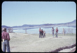
Photograph depicts a game of horseshoes in foreground. Fence crosses midground in front of water, and hills can be seen on opposite shore in background. Handwritten annotation on recto of mounted slide reads: "Playing horse [shoes?] in Legac".
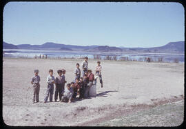
Group stands in foreground on what appears to be a wooden teeter totter. Fence crosses midground in front of water, and hills can be seen on opposite shore in background. Handwritten annotation on recto of mounted slide reads: "play ground in Legak [sic]".
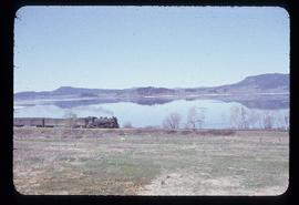
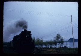
Photograph depicts the engine and first two cars of a railway train in left foreground. Water crosses midground, hills stand on opposite shore in background. Handwritten annotation on recto of mounted slide reads: "Lejak [sic] & Fraser Lake in [?]" See also item 2006.20.1.196 for image featuring similar content.
Front view of railway train. Fraser Lake believed to be visible in background, behind power lines. Handwritten annotation on recto of mounted slide reads: "Train coming to Lejak [sic]" See also item 2006.20.1.195 for image featuring similar content.
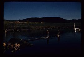
Photograph depicts two boys standing on platform extending into lake. Buildings and fenced areas can be seen on shore in background. Handwritten annotation on recto of mounted slide reads: "boys playing on the lake / Legac".
File consists of research material relating to the Omineca Gold Rush which was a gold rush in British Columbia in the Omineca region of the Northern Interior of the province. Gold was first discovered there in 1861, but the rush didn't begin until late in 1869 with the discovery at Vital Creek. There were several routes to the goldfields: two were from Fort St. James, one of which was a water route through the Stuart and Tachie Rivers to Trembleur Lake to Takla Lake and the other was overland, called the Baldy Mountain route. A third route came in overland from Hazelton on the Skeena River and a fourth route used the Fraser River and crossed over the Giscome Portage to Summit Lake, through McLeod Lake, and up the Finlay River to the Omineca River. Materials include one large photograph from the BC Provincial Archives of Machanry of the SS Enterprise at Tremblay Lake in June 7th, 1913. Other materials include newspaper clippings and two photographic negatives of the machinery of the SS Enterprise.
File consists of maps and notes relating to the original Prince George city plans by Brett and Hall. Brett & Hall were landscape architects from Boston, MA who designed the original plan for Prince George, including features such as the Crescents neighbourhood. Includes photographs depicting the original plans by Brett & Hall for Prince George (2006).
File consists of clippings, notes, and reproductions relating to heritage homes in Central Fort George. Includes a "BC Rail" typescript letter from Dick Rowe at BC Rail to Kent Sedgwick (10 Nov. 1987); "Irene Jordan brothel location" handwritten notes by Kent Sedgwick (1990); and "Heritage inventory record" booklet describing heritage buildings in Prince George (1990). Also includes photographs depicting veteran housing on Burden Street in Prince George; a house at the address 510 Douglas Street in Prince George (2003); and Erle's Iron Works shop with a man outside welding the turrets for the Sikh temple (Aug. 1990).
Photograph depicts a view of St'a7mes village looking north, taken from the original Government Wharf in Squamish (Newport). This wharf was built in 1902 and was temporarily replaced by other docks to the west built by the PGE Railway in 1913-14. This photograph was taken after 1914, since the houses in the photo were built by the PGE Railway Company as part of the 1914 reserves sale deal.
Further details that date this photograph between late 1914 and 1920:
- the Merrill & Ring logging operation beach camp is not depicted (opened in 1926)
- the dock from which the photo is taken fell into disrepair after 1914 and was not rebuilt until 1929.
Drawing depicts visual notes taken at the 2020 Public Health Summer Institute with the theme "Think Globally, Act Locally: Public Health and the Anthropocene". Themes related to the COVID-19 pandemic are depicted.
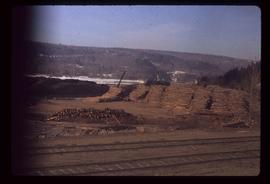
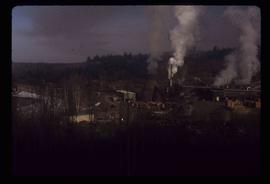
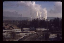
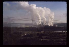
Image depicts numerous wood piles near the sawmill somewhere in Quesnel, B.C.
Image depicts a sawmill somewhere in Quesnel, B.C.
Image depicts a sawmill somewhere in Quesnel, B.C.
Image depicts a sawmill somewhere in Quesnel, B.C.
Series consists of photographs taken and collected by Kent Sedgwick that primarily depict communities within the Central Interior of British Columbia, especially Prince George, Giscome, and the East Line area. Kent Sedgwick used photography to document the development and history of the natural and built landscape of the British Columbia Central Interior. The photographs depict geographic features, landscapes, previous settlements, architectural history, and industrial history.
File consists of a printed email correspondence between Ramona Rose, Florence Smith, and Sue Sedgwick regarding an additional donation of photographic negatives. The file includes photographs depicting photographs of Knox United Church and historic Prince George.
Subseries contains material collected and created by Kent Sedgwick for research on various areas in British Columbia and Alberta. Includes written notes by Kent Sedgwick, pamphlets, and newspaper clippings relating to towns and settlements. These areas include Quesnel, Likely, the Yukon Telegraph Trail, Barkerville, Wells, the Cariboo region, Fort Alexandria, Soda Creek, the Chilcotin region, Jasper, the Rocky Mountains, Mackenzie, Tumbler Ridge, the Peace River region, Fort St. James, the Omineca region, Kitimat, Lethbridge, the Bulkley Valley, and Fort Mcleod. These files cover a variety of topics including Chinese people in British Columbia, land settlement, tourism, and historic information on the regions.
Subseries consists of material collected by Kent Sedgwick for research regarding the communities along the East Line of the Grand Trunk Pacific Railway in Central British Columbia, particularly between Prince George and McBride. These communities and locations include, among others, Shelley, Willow River, Sinclair Mills, Longworth, Dunster, Tete Jaune, Valemount, Mount Robson, and the Yellowhead Pass. Research on these communities was conducted during Kent Sedgwick's involvement in the UNBC-led Upper Fraser Historical Geography Project. The files primarily consist of research notes, audio and transcripts of oral interviews, and photographs of the East Line communities.
Subseries consists of material collected and created by Kent Sedgwick for research regarding parks and outdoor recreation in Prince George. Material on parks includes Fort George Park (renamed to Lheidli T’enneh Memorial Park in 2015); Cottonwood Island Park; Connaught Hill; Moore's Meadow; L.C. Gunn Park; the Nechako Cutbanks; Paddlewheel Park; Monkman Provincial Park; Fraser Canyon Park; and Carp Lake. Also includes information on the creation of plaques and monuments, including the Alexander Mackenzie monument; the “Arrival of Steel” CN railway plaque; heritage interpretative signs for the Grand Trunk Pacific Railway; the Millar addition; and flooding and rivers. The files consists of various pamphlets and correspondence regarding the development of parks and the creation of interpretive materials.
File contains slides that reproduce historical photographs of Indigenous peoples of Central Interior, as well as maps.
File consists of notes, reproductions, pamphlets, and postcards relating to the Peyto Glacier, situated in the Canadian Rockies in Banff National Park, Alberta. Includes: "Inland Waters Branch" handwritten letter to Kent Sedgwick (4 Sept. 1970); "Peyto Glacier general information" pamphlet prepared by the Inland Waters Directorate, Water Resources Branch of Environment Canada (1975); and photographs depicting a Peyto Glacier workshop with Kent Sedgwick and colleagues (1996) and personal photographs depicting Kent Sedgwick, his wife, and friends visiting and hiking Peyto Glacier (1990).
File consists of notes, clippings, and reproductions relating to McLeod Lake. Includes a "History of McLeod Lake, BC" typescript document by Kelly Rogers (1982). File also includes photographs depicting McLeod Lake (1999-2000).
File consists of notes and reproductions relating to "Northern Approaches to New Caledonia" lecture conducted by Kent Sedgwick, relating to the article he wrote on "Crossing the Divide: Northern Approaches to New Caledonia". File predominantly contains Kent Sedgwick's handwritten notes and notes and transparent sheets of film depicting various maps of northern British Columbia. File also contains photographs depicting various maps (Oct. 2002).
File consists of photographs depicting the Salmon River Portage. Includes depictions of potential past mill sites, overgrown fields, and derelict buildings.
File consists of notes, clippings, and reproductions relating to a downtown walking tour conducted by Sedgwick for the British Columbia Historical Federation 2003 conference. Also includes photographs depicting participants of the BC Historical Federation Conference on a downtown walking tour in Prince George (2003).
File consists of photographs depicting Kitimat, British Columbia in a bound flip book.
File consists of notes, clippings, and reproductions relating to lava beds in British Columbia, including Aiyansh, also known as the Tseax Cone, in the Nisga'a Memorial Lava Bed Provincial Park. Includes: "Craters of the Moon Guide" special edition newspaper from the United States National Park Service (1990); and "Craters of the Moon: National Monument, Idaho" pamphlet published from the United States National Park Service (1975). File also contains photographs depicting the Nisga'a Memorial Lava Bed Provincial Park.
File consists of clippings related to the Peace River region. Also includes photographs taken by Kent Sedgwick depicting Mackenzie, BC and the Peace River region (2003).
File consists of notes and reproductions relating to Fort Alexandria (later renamed Alexandria). Fort Alexandria was an HBC trading post, ferry site, and steamboat landing in the North Cariboo, 45 km south of Quesnel. File contains photographs depicting Fort Chilcotin, the landscape and buildings (Sept. 1983 and Aug. 2006).
File consists of notes, clippings, and reproductions relating to Mount Robson and the Red Pass. Also includes photographs reproduced in 1982 depicting the Mount Robson Ranch (date of original photographs unknown).
File consists of notes, clippings, and reproductions relating to Mcbride and Dunster. Includes photographs depicting the Croyden cemetery and the Dunster ferry site (2005).
File consists of notes and reproductions relating to Penny. Also includes photographs depicting various areas of Penny (2004).
File consists of notes, clippings, and reproductions relating to various communities along the East Line. Includes material regarding Penny; the Robson Valley; the Ancient Rainforest; Dome Creek; Bend; Loos; Crescent Spur; and Dewey. File includes photographs depicting the Fraser River and Morkill Forest Service Road near Crescent Spur and Dome Creek (2010).
File consists of aeriel photographs depicting the Fraser River Big Bend, where the Fraser River changes direction from westbound to southbound at its "Big Bend" near the Huble Homestead Historic Site, 45 km north of Prince George, British Columbia.
File consists of notes and reproductions relating to the Upper Fraser historical geography field trip for the BC Historical Federation by Kent Sedgwick. Includes photographs depicting a group from the BC Historical Federation standing outside at one of the East Line communities listening to a presentation by Kent Sedgwick and Greg Halseth (May 2003).
