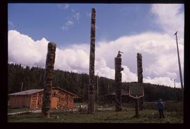
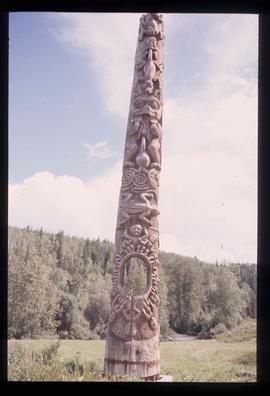
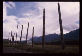
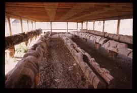
File consists of "The Indian History of British Columbia" book written by Wilson Duff with handwritten annotations by Kent Sedgwick throughout the book.
Subseries consists of material collected and created by Kent Sedgwick for research regarding Indigenous Peoples within British Columbia. These files primarily consist of audio recordings and transcripts of personal oral interviews, documents regarding perceptions of Indigenous peoples, research on historical interactions, Dakelh (Carrier) language, and treaty information including the Nisga'a treaty and Treaty 8. Includes materials on the Carrier Sekani First Nations whose traditional territory includes north central British Columbia and includes the Ts'il Kaz Koh First Nation, Nadleh Whut'en, Saik'uz First Nation, Stellat'en First Nation, Takla Lake First Nation, and Wet'suwet'en First Nations.
File consists of records created and collected by Kent Sedgwick regarding the removal of Island Cache residents after the 1972 flood and suggestions for creation of park on Cottonwood Island. The majority of the file consists of reproduced City of Prince George records. Includes memoranda to and from the mayor, city manager, and aldermen; meeting minutes of the Flood Committee; city reports on Cottonwood Island and the flooding situation; a listing of Cottonwood Island properties offered for sale to the municipality; a report entitled "Cottonwood Island - A report on desirable land use" (Nov. 1970); a "Proposal for Cottonwood Island as a Park Reserve" (1973); a document from the Cottonwood Island Study Committee; correspondence from Mary Fallis; and a City of Prince George memorandum regarding a Public Hearing.
File consists of notes, clippings, and reproductions relating to Indigenous Peoples of British Columbia. Includes: "A selected list of publications on the Indians of British Columbia" published by the British Columbia Provincial Museum (1970) and "Les Indiens Des Cordilleres" printed by the National Museum of Canada (7 Feb. 1939). File also includes a map titled "Native Lands, then and now" depicting British Columbia including outlines of Indigenous territories and a smaller map of Canada with Indigenous language families; the backside of the map is titled "What are you ready for" and includes a timeline of information and Indigenous history in British Columbia (1990).
File consists of notes and reproductions relating to a keekwilee house (kekuli or pithouse) at the College of New Calendona. Includes: "Keekwilee - house A Centennial Project for the College of New Caledonia" typescript document by Kent Sedgwick (Jan. 1971) and "Keekwilee House College of New Caledonia memo" typescript document from Gunar Capan to Kent Sedgwick (28 Jan. 1972).
Image depicts the historical village of 'Ksan near Hazelton, B.C.
Image depicts a totem pole in the historical village of 'Ksan near Hazelton, B.C.
Image depicts a group of people in the historical village of 'Ksan near Hazelton, B.C.
Image depicts numerous totem poles in Kispiox, B.C.
Image depicts an old, partially burnt totem pole in Kispiox, B.C.
Image depicts two totem poles in Skeena Crossing, B.C.
Image depicts a large gathering of people in the interior of a First Nations' longhouse located in the historical village of 'Ksan in Hazelton, B.C.
Image depicts the 'Ksan historical village in Hazelton, B.C.
Image depicts numerous totem poles in Kispiox, B.C.
File consists of records created and collected by Kent Sedgwick regarding Cottonwood Island. Includes: "Welcome to Cottonwood Island Nature Park" brochure [197-?]; "A Brief History of Cottonwood Island Park" by Kent Sedgwick (2001); "History of Cottonwood Island Park and Side Channel Restoration" (2001?); a Regional District of Fraser-Fort George "Notice of Public Hearing" (1973); an outline for "Cottonwood Island Brief" (1973); an original copy of the "Cottonwood Island Study" by the Regional District of Fraser-Fort George (1975); annotated hand-drawn small maps of Cottonwood Island; photocopied aerial photographs; and photocopied newspaper clippings about Cottonwood Island and Island Cache. Also includes 15 colour photographic prints and accompanying negatives taken of Cottonwood Island by Bob Nelson.
File consists of a bound book titled "Indian Issues, Yesterday and Today", prepared as a school unit by the Human Rights Commission summer program. Includes handwritten annotations by Kent Sedgwick.
Image depicts what appears to be a teepee at an uncertain location.
Image depicts a totem pole beside the grave marker of the Chief Lu-dal-da-zuatz, in Kispiox, B.C.
File contains slides that reproduce historical photographs of Indigenous peoples of Central Interior, as well as maps.
Image depicts numerous totem poles in Kispiox, B.C.
Image depicts the entrance to the historical village of 'Ksan in Hazelton, B.C.
Image depicts the historical village of 'Ksan in Hazelton, B.C.
Image depicts the First Nations village of Pavilion, B.C.
Image depicts a totem pole in Kitwanga, B.C.
Image depicts a row of totem poles in Kitwancool, B.C.
Image depicts a totem pole in Kitwancool, B.C.
Image depicts a row of totem poles in Kitwanga, B.C.
Image depicts several old totem poles on their sides in Kitwancool, B.c.
Image depicts the Battle Hill National Historic Site in Kitwanga, B.C.. The sign located there says: "The small knoll in the valley was a native fortress. Legends maintain that it was man-made: built to repel marauding coastal tribes. The hill was the scene of local tribal battles, and at one time was crowned with the defenders' buildings. Known as Dhawdezp, the unique mound is a prominent feature in the legends and history of the Indian people."
Image depicts a totem pole in Kitwanga, B.C.
Image depicts numerous houses in Kitwancool, B.C.
Image depicts Metlakatla, located near Prince Rupert, B.C.
Image depicts an old Hudson Bay Company house, with a totem pole in the foreground, in Kitwanga, B.C.
Image depicts a faded First Nations' rock painting.
Image depicts an unknown woman pointing towards some faded First Nations' rock paintings.
Image depicts a house with some Firts Nations' art painted on the front, somewhere on Haida Gwaii, B.C.
Image depicts a building painted with First Nations art in New Aiyansh.
File consists of records created or collected by Kent Sedgwick relating to various community projects associated with river parks. Example projects included in the file are a proposed Carrier village at Hudson Bay Slough, a Cottonwood Island park, proposed commercial boat tours on the Nechako and Fraser River, and the Quesnel Paddlewheel Park. Includes a project proposal document by the Fort George Band entitled "Establishing a Permanent Carrier Village in Prince George" (1990); a 1991 meeting package of the Nechako and Fraser River Valleys Committee (regarding the Cottonwood Island property and development of the Heritage River Trails System); a 1991 memorandum entitled "Prince George River Runners - Proposed commercial boat tours on the Nechako and Fraser River"; a 1983 "Submission to Rivers Committee Public Hearings by Heritage Advisory Committee, City of Prince George" describing the various river-adjacent heritage sites in Prince George; and documentation from the Quesnel Paddlewheel Association.
File consists of clippings, notes, and reproductions relating to the surrender of the original L'Heidli T'enneh reserve and its cemetery, and the subsequent reserve relocation. Includes "Indian cemetery Fort George Park" typescript document by Kent Sedgwick for the Heritage Advisory Committee, which includes photocopies of original documents for the sale of the Indian reserve to the Grand Trunk Pacific Railway (23 Mar. 1983) and "Plan of the Fort George Indian Reserves" map depicting the locations of the reserves in and around Prince George. File also includes photocopies and reproduced photographs of the Prince George Indian Reserves from the Royal BC Museum and Archives.
Subseries consists of materials collected by Kent Sedgwick for research relating to Lheidli T'enneh First Nations. The Lheidli T'enneh are a sub-group of the Dakelh people whose traditional territory includes the city of Prince George, British Columbia. These files primarily consist of material regarding the original Lheidli T'enneh reserve and cemetery, the reserve relocation, and the desecration of the cemetery.
File primarily consists of material regarding the L'heidli T'enneh Cemetery and the 1914 Royal Commission on Indian Affairs report on Prince George in relation to the "Fort George Tribe" and their lands and cemetery. Includes: photocopies from BC Archives of the Royal Commission transcripts; a report entitled "Archival Research Project - Fort George Park, up to 1998" prepared by Sites N Sounds Consulting for the Fraser-Fort George Regional Museum (1998); "Archaeological Impact Assessment, Fraser-Fort George Regional Museum, Lot 2, District Lots 343 and 417, Plan 32450, Cariboo District, City of Prince George, Permit 1998-218" prepared by Sites N Sounds Consulting (1998); "Indian Cemetery Fort George Park Prince George" typescript document by Kent Sedgwick for the Heritage Advisory Committee (23 Mar. 1983); a photocopied "Indian Cemetery in Fort George Park" plan drawn by the City of Prince George Public Works Department (Dec. 1978); and burial records for the L'heidli T'enneh Cemetery from the City of Prince George Cemetery System.
File consists of notes, clippings, and reproductions relating to Indigenous Peoples of what is now known as the central interior British Columbia. Includes material on Carrier Sekani First Nations whose traditional territory includes north central British Columbia and includes the Ts'il Kaz Koh First Nation, Nadleh Whut'en, Saik'uz First Nation, Stellat'en First Nation, Takla Lake First Nation, and Wet'suwet'en First Nations; and Dakelh, the Carrier First Nations language. Includes: various clipped articles from the Prince George Citizen newspaper and "Carrier-Sekani Tribal Council" pamphlet prepared by the Carrier-Sekani Tribal Council. File also contains photographs depicting a grassy field with flowers and a graveyard (2003).
Image depicts the old Kamloops Residential School which operated until either 1977 or 1978 before becoming part of the Secwepemc Musem in 1982.
File consists of a photocopy of a handwritten essay titled "The Sale of the Fort George Indian Reserve #1" by Jason B. Llewellyn.
Image depicts the old Kamloops Residential School which operated until either 1977 or 1978 before becoming part of the Secwepemc Musem in 1982.