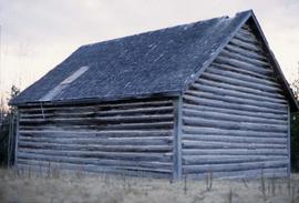
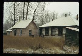
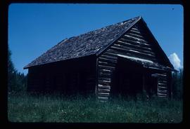
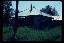
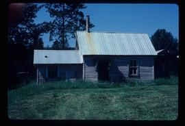
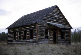
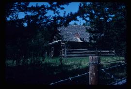
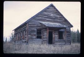
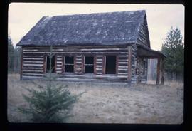
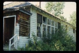
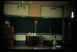
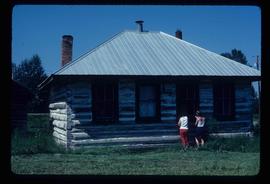
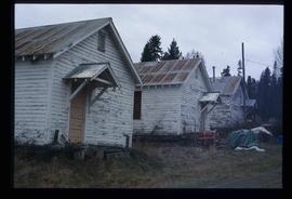
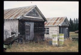
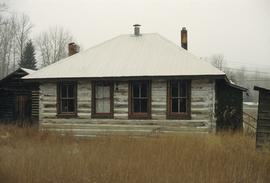
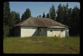
Image depicts an old, boarded-up school building at an uncertain location.
Image depicts the school and teacherage located in Dome Creek, B.C.
Image depicts Upper Fraser Elementary School, after closure of town site. Map coordinates 54°06'54.4"N 121°56'16.6"W
Image depicts the Giscome bunkhouse in Giscome, B.C. Map coordinates 54°04'17.6"N 122°22'06.1"W
Image depicts a group of individuals who appear to be examining a rock. It is possibly part of an educational trip.
Image depicts a large group of people examining the sediment layers in a rock face.
Image depicts a woman standing next to a model of a ship in glass case in what appears to be a museum. The location is uncertain.
Image depicts the Station Museum and the "Alberta Pool Elevators Ltd." building in Dawson Creek, B.C.
Image depicts stuffed wildlife exhibits inside the Station Museum in Dawson Creek, B.C.
Image depicts old machinery, at the Atlin Museum in Atlin, B.C.
Image depicts the Woodpecker School building.
Image depicts the old school in Woodpecker, B.C.
Image depicts the old Woodpecker School.
Image depicts the old Myatovic schools.
Image depicts the old Kamloops Residential School which operated until either 1977 or 1978 before becoming part of the Secwepemc Musem in 1982.
Image depicts an old, boarded up school, possibly the Central Fort George Traditional School in Prince George, B.C.
Image depicts the McBride District Centennial Library.
Image depicts the old school building in Lamming Mills, B.C.
Image depicts Upper Fraser Elementary School, after closure of town site. Map coordinates 54°06'54.4"N 121°56'16.6"W
Image depicts the Giscome mill site in Giscome, B.C. The bunkhouse is no longer there and the school is in the foreground on the right. Map coordinates 54°04'04.8"N 122°22'04.7"W
Image depicts the interior of a classroom at an uncertain location.
Image depicts an unidentified man in a yellow hat who appears to be speaking to large group of people. It is possibly an educational event.
Image depicts an unidentified man in a yellow hat who appears to be speaking to large group of people and showing them small pieces of wood. It is possibly an educational event.
Image depicts an unidentified man holding what appears to be a broken screen of honeycombs. The group is likely at an educational event.
Image depicts stuffed wildlife exhibits inside the Station Museum in Dawson Creek, B.C.
Image depicts the Woodpecker School building.
Image depicts the Hixon School and teacherage buildings in Hixon, B.C.
Image depicts the Red Rock School.
Image depicts the Salmon School in the Prince George vicinity.
Image depicts a the teacherage building in Red Rock.
Image depicts the Prince George Public Library.
Image depicts the old school in Woodpecker, B.C.
Image depicts the Hixon School.
Image depicts the Hixon School Teacherage.
Image depicts the Tumbler Ridge School.
Image depicts the old school at 150 Mile House, with what is likely the modern school visible in the background.
Image depicts the Gitwinksihlkw Elementary School in Gitwinksihlkw, B.C.
Image depicts a few buildings, possibly an old school and teacherage, in Hixon, B.C.
Image depicts a school and playground, possibly in New Aiyansh, B.C.
Image depicts three unknown individuals in a kitchen somewhere in Lillooet, B.C. They are possibly archaeology students.
Image depicts the school site in Stoney Creek.
Image depicts the Hixon School.
Image depicts a man in a yellow cap who appears to be blowing smoke into a bee colony at a bee farm. It appears to be an educational demonstration.
Image depicts the Station Museum in Dawson Creek, B.C.
Image depicts the old Myatovic schools.
Image depicts the old Kamloops Residential School which operated until either 1977 or 1978 before becoming part of the Secwepemc Musem in 1982.
Image depicts the Hixon School building in Hixon, B.C.