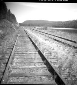
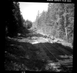
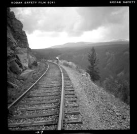
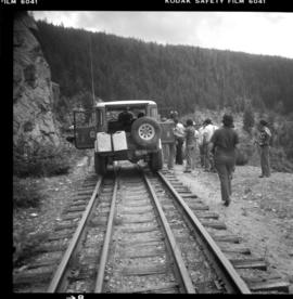
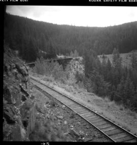
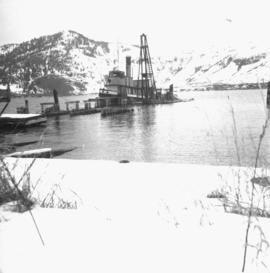
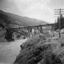
Photograph depicts the CPR line at Arawana, 5 miles northeast of Penticton and at mile 125.7 on the Carmi Subdivision. The photo shows the ruins of the station house and Okanagan Lake in the background. The passing loop in the foreground has been disconnected and partially dismantled. The rear track was used once or twice weekly by the way freight train between Penticton and Midway. The view is looking west.
Photograph depicts the CPR Glenfir passing loop, 15 miles northeast of Penticton on the Carmi Subdivision. To gain height, the track doubles back on itself through 180 degrees. The track here is at a grade of about 1 in 45, having risen 1450 ft. from Penticton. The passing track is not used, as there are only 2 way freights on the line per week. The view is looking south.
Photograph depicts the CPR Glenfir passing loop, 15 miles northeast of Penticton on the Carmi Subdivision, at mile 118.9 from Midway. The way freight is on the down grade of 2.2% towards Penticton and the maximum speed permitted is 20 mph. The train consisted of 2 locies, 1 boxcar, 4 tank cars, and a caboose. The photo was taken at 1pm on a Tuesday and there are only 2 way freights in a week. The switch rail behind the photo is dated 1913 (therefore original) but the loop rail was dated 1932 and 1934. The loop is about half a mile long. The view is looking north from the upper portion of the loop.
Photograph depicts the CPR Glenfir passing loop at mile 118.9 from Midway, on the Carmi Subdivision. It is 15 miles northeast of Penticton, 2572 ft. above sea level, or 1450 ft. above Okanagan Lake. It never had depot buildings or a water point, it was merely a passing point of half a mile in length, forming a 180 degree gradient loop. The grade here is 2.2% or 1 in 45.
Photograph depicts the CPR depot at Chute Lake, on the Carmi Subdivision. It is located at mile 106.5 and 13.5 miles north of Penticton.
Photograph depicts the CPR line at about mile 108.5 on the Carmi Subdivision. The location is about 22.5 miles from Penticton and just south of Chute Lake. The rail here is dated 1942 and 85 lb.
File consists of documentary photographs taken by David Davies of the CPR Kettle Valley Railway in Myra Canyon in British Columbia.
Photograph depicts the CPR Kettle Valley Railway line in Myra Canyon. This is at about mile 84.75, looking south at the end of Myra canyon.
Photograph depicts the CPR Kettle Valley Railway in Myra Canyon. It shows the vehicle carrying the lunch of the preservation party inspection route. The trip was organized by the Kettle Valley Railway Heritage Society.
Photograph depicts the CPR Kettle Valley Railway in Myra Canyon. The view is looking south and it likely shows a trestle at mile 85.4.
Photograph depicts a ferry barge and tug operated by the Department of Highways.
Photograph depicts the "Queen of the Islands" of B.C. Ferries, approaching the pier at the Long Harbour Terminal on the Gulf Islands. It was launched in 1963 and built by Burard Dry Dock Company Ltd. It had a capacity for 40 cars and 400 passengers.
Photograph depicts a tug towing gravel scow that was used to make concrete. Photograph taken at a BCER swing bridge.
Photograph depicts two abandoned fishboats.
Photograph depicts a small tug called "Sea Bark" being renovated on Denman Island.
Photograph depicts a derelict steam tug named "Sea Swell" on the Pitt River.
Photograph depicts a boom tug called "Atlas Captain" that was brought in for refitting, adjacent to a smalll boat repair yard. It was loaded on a CN gondola car and then removed by a derrick crane.
Photograph depicts the stern view of "Gulf Grenadier," a Canadian easr coast fishing dragger. It had not been in use for about a year.
Photograph depicts "Canora," a CNR rail car ferry that was taken out of service in 1967.
Photograph depicts "Canora," a CNR rail ferry.
Photograph depicts a CPR tug called the"Okanagan," at the CPR slip in Kelowna. It had recently been fueled from a tank car that is visible on the left. It was was built in Seattle and assembled at Okanagan Landing.
Photograph depicts a CPR steam tug called the "Naramata." It was built in 1913, retired to standby in 1967, and then sold in 1970.
Photograph depicts a CPR tug called the "Okanagan," located at the Kelowna slip. It was tied to the rail barge wih a steam up.
Photograph depicts a steam tug called "R.F.M". It was believed to not be in steaming condition.
Photograph depicts a replica of the "SS Beaver." It was built by the RCN in Esquimalt and was open for inspection in Vancouver.
Photograph depicts a replica of the "SS Beaver" built by the RCN in Esquimalt and moored in Vancouver, open to the public. The original ship left Gravesend on August 29, 1935 and reached Fort Vancouver (Oregon) on April 10. 1936.
File consists of documentary photographs taken by David Davies of ships in British Columbia.
Photograph depicts "SS Sir James Douglas," a Coastguard supply vessel, built in 1956. Astem from her is "Camsell," a full ice breaker, built in 1959. Out-of-service is CNR "SS Canora" is found in the background.
Photograph depicts "Skeena Prince." The iron chute projecting from the land beyond the steam of a coaster belongs to a long defunct coal mine which ran back horizontally into the hill side.
Photograph depicts a Japanese cadet sailing ship called "Kaiuo Maru" at Centennial Pier, Vancouver. Its visit was part of 1966 Vancouver Sea Festival and the ship was open to the public for inspection.
Photograph depicts the last lighthouse on the mainlain about a mile south of Ucuelet. It was believed to be the Amphitrite Point Light House.
Photograph depicts an old anchor that had been fished out of Coal Habour, Vancouver. One flulke was bent in towards the shank. Image captured outside the office of Kanata Marine Ways Ltd. (1965).
Photo depocts a road bridge in the Inner Harbour of Victoria.
Photograph depicts a bridge near the beginning of the Seton Portage to D'Arcy dirt road over the Portage River. The road was a one and half of a mile connection between the Anderson (upper) and Seton (lower) lakes.
Photograph depicts a bridge over Lardeau River. Survey stakes at the point where the photograph was taken suggested that a new bridge would be built within the next 2 or 3 years.
Photograph depicts the entrance to Kispiox Village, over the Kispiox River.
Photograph depicts Hazelton Bridge that was believed to be built in 1930. Crossing the Skeena River.
Photograph depicts a road bridge in Quesnel.
Photo depiicts a bridge over the Fraser River, south of Williams Lake. It was in poor condition, but was being prepared by the Department of Highways. The bridge was taken on the Gang Ranch public road, and led to the ranch and its uninhabited hinterland.
Photograph depicts Moha Bridge which crosses the Yalakon River. Taken at the side of a derelict mining village.
Photograph depicts a road bridge that led from Fort Langley to a ferry slip on an island.
Photograph depicts Alexandra Bridge that crossed the Fraser Canyon.
Photograph depicts Cisco Bridge, that crossed the Fraser River in Fraser Canyon. Looking upstream with CPR track in the lower right of the photo. 200 yards behind this photo, the CPR tack crossed the Fraser River to the west bank.
Photograph depicts a bridge over the Similkameen River. When track ran to Hedley, there were 3 of these bridges. All stood still at the time the photograph was captured. The other were on the lifted Keremeos to Hedley section.
Photograph depicts a PGE crossing over the Fraser River.
Photograph depicts work in progress on a new CNR lifting span bridge. Immediately in front of it was a coffer dam for a pier. Tidal conditions were a problem.
Photograph depicts the Federal Railway Bridge in New Westminster. Its span had been knocked down by an unmanned scow. New span was to be floated in on by April 22, 1976.
File consists of documentary photographs taken by David Davies of reaction ferries and aerial bridges in British Columbia.
File consists of documentary photographs taken by David Davies of various houses in British Columbia.