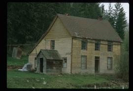
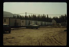
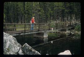
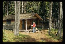
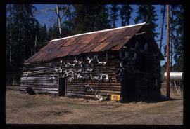
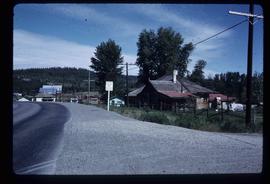
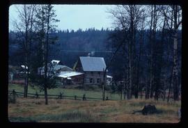
Image depicts the Harrison House in Kersley, B.C.
Image depicts an old, rundown building at an uncertain location.
Image depicts an Anglican church in Old Aiyansh.
Image depicts the Kwinitsa CNR station in Kwinitsa, along the Skeena River.
Image depicts the Kwinitsa CNR station, which is Prince Rupert's railway museum.
Image depicts a log house at an uncertain location.
Image depicts an old theatre owned by Paul Aivazoff in Prince Rupert, B.C. It opened in 1935 and was closed in 1981; it has since been renovated for retail use.
Image depicts a bee-hive burner beside a rail-road track at an unidentified mill somewhere in Prince George, B.C.
Image depicts the Columbus Hotel in Prince George, which was destroyed by a fire in 2008.
Image depicts the Canadian Forces Recruiting Centre on the north side of 3rd Ave in Prince George, B.C.
Image depicts Wells, B.C.
Image depicts many houses somewhere in Wells, B.C.
Image depicts a row of houses somewhere in Wells, B.C.
Image depicts a street in Wells, B.C. The Wells Hotel is present in the image.
Image depicts the Wells Museum in Wells, B.C.
File contains slides depicting schools in Prince George, B.C.
Image depicts a number of trailer homes in Tumbler Ridge, B.C.
Image depicts a row of houses in Tumbler Ridge, B.C.
Image depicts an unidentified man standing on a wood bridge somewhere in South Tweedsmuir Provincial Park.
Image depicts an unknown individual in the J. Edwards Camp in South Tweedsmuir Provincial Park.
Image depicts a wood cabin with antlers somewhere in Mud River, B.C.
Image depicts a rail road bridge over the Mud River.
Image depicts a number of buildings at an uncertain location; the slide labels the older building in the image as potentially being the "original road house."
Image depicts an aerial view of Williams Lake, B.C.
Image depicts a structure that appears to be a type of zipline, ferry platform at an unknown location.
Image depicts the interior of a barn at a dairy farm located somewhere near Quesnel, B.C. Numerous unknown individuals are present.
Image depicts numerous pieces of machinery in the interior of a building at a dairy farm, located somewhere near Quesnel, B.C. Several unknown individuals are present.
Image depicts a bridge at Soda Creek, B.C. There are numerous unknown individuals present.
Image depicts 108 Mile Ranch, B.C.
Image depicts a farm at an uncertain location.
Image depicts what appears to be a sawmill at 100 Mile House, B.C.
Image depicts 100 Mile House, B.C.
Image depicts 153 Mile House.
Image depicts the Bohanon House in Quesnel, B.C.
Image depicts an old barn located somewhere near Dunlevy Creek in the Dawson Creek area.
Image depicts an old barn located at a dairy farm somewhere near Dunlevy Creek in the Dawson Creek area.
Image depicts the Hudson Bay Store in Quesnel, B.C.
Image depicts a church located near Mapes, B.C.
Image depicts a few old buildings, as well as several unknown individuals somewhere in Moricetown, B.C.
Image depicts an unknown individual leaning against a sign at the Stewart Access Road which warns travellers to pack several days of food. Located in Hazelton, B.C.
Image depicts numerous totem poles in Kispiox, B.C.
Image depicts the peak of the Rocher de Boule mountain from Hazelton, B.C.
Image depicts the Inlander Hotel in Hazelton, B.C. The peak of the Rocher de Boule mountain is visible in the background.
Image depicts an old, partially burnt totem pole in Kispiox, B.C.
Image depicts the ferry at Isle Pierre, B.C.
Image depicts the Bulkley River running through Moricetown Canyon.
Image depicts the Endako Hotel in Endako, B.C.
Image depicts the Endako General Store in Endako, B.C.
Image depicts a totem pole beside the grave marker of the Chief Lu-dal-da-zuatz, in Kispiox, B.C.