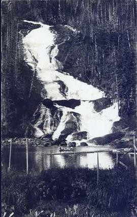
Photograph depicts four men in a boat on a lack with a waterfall in the background running through a forest into the lake. Annotation on verso of photograph states: "The water fall + flume for Brown's sawmill Hoscall River BC"
The collection consists of an assortment of cartographic materials concerning Northern B.C. Included are topographic maps, pre-emptor’s and preliminary maps, physiographic maps, and resource (geological, game, etc.) maps.
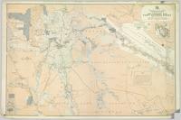
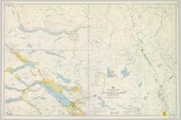
Colour-coded map depicting lands open for pre-emption, lands in “University Reserve,” and lands reserved for public auction. Depicts land recording divisions, communities, bodies of water, transport routes, and game reserves.
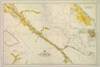
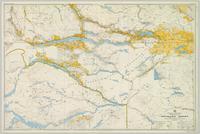
Map depicting surveyed lands, statutory timber lands, land recording divisions, game reserves, communities, bodies of water, and transport routes. Includes inset of McBride townsite.
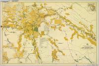
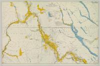
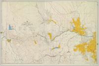
Colour-coded map depicting lands surveyed as alienated, reserved, Statutory Timber Lands, B.C. Land Settlement Board Area, or open for pre-emption. Depicts land districts, land recording divisions, communities, game reserves, bodies of water, transport routes, and communication lines.
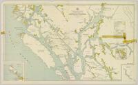
Colour-coded map depicting lands surveyed as alienated, reserved, and having a timber license, lease, or sale. Depicts land recording divisions, land district boundaries, communities, bodies of water, and transport routes. Includes insets of Stephens Island and Egeria Reach.
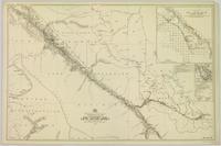
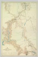
Geological topographic map. Geological Survey produced for the Department of Mines, Canada.
Topographic map depicting regions, communities, government posts. bodies of water, transport routes, surveyed areas, and reserves.
Colour-coded map depicting surveyed lands respectively open and closed to preemption. Depicts land recording divisions, game reserves, communities, bodies of water, and transport routes. Includes inset of McBride townsite.
Colour-coded map depicts lands surveyed as alienated, available for purchase or lease under Taxation Act, or reserved. Depicts land district boundaries, land recording divisions, triangulation stations, telegraph/telephone lines, communities, bodies of water, and transport routes.
Colour-coded topographic map depicting lands surveyed as alienated, available for purchase or lease under Land Act, or reserved. Depicts land district boundaries, land recording divisions, provincial forest boundaries, HBC posts, triangulation stations, telephone lines, communities, bodies of water, and transport routes.
Colour-coded topographic map depicts surveyed lands alienated, available for purchase or lease under Land Act, and available for pre-emption. Depicts land districts, land recording districts, provincial forests, parks, triangulation stations, communities, bodies of water, transport routes, and communication lines.
Colour-coded topographic map depicting surveyed lands alienated, available for purchase or lease, or available for pre-emption. Depicts land districts, land recording districts, parks, communities, bodies of water, transport routes, communication lines, and triangulation stations.
Shows routes and ports of call from Smith Sound to Portland Canal including locations of many canneries and mines now no longer extent.
Photograph depicts rows of palm trees shadowing the Pacific Park Motel with a mountain range in the background.
File contains photographs depicting four different tours that took place at the mine, plant, and towns owned by Cassiar Asbestos Corporation Ltd. Tours include Prime Minister Pierre Trudeau's visit to Clinton Creek in 1968 and Member of Parliament Iona Campagnolo's visit to Cassiar in 1978. Photographs also depict a party of ambassadors touring Cassiar in 1970, and the dedication of a building in the Cassiar plant in the late 1970s.
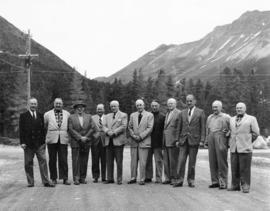
Photograph depicts group of eleven men standing in line in the Cassiar valley. Left to right: Jack Christian, Charles Rainforth Elliot, John Drybrough, John E. Kennedy, Fred Martin Connell, W. Harold Connell, Ken A. Creery, George Washington Smith, Tam Zimmermann, [Fred Murray]?, Nick Gritzuk. Power lines and mountains in background. Most men featured in photo are believed to be members of Cassiar's Board of Directors. Photograph was originally framed with note "Summer 1961" written on cardboard backing.
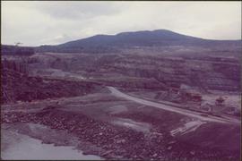
Photograph depicts bench at 6430 elevation. Blasthole drills, shovels, dozers, and dump trucks can be seen on bench in midground. Mine valley in background. Handwritten annotation on verso of photograph: "1961".
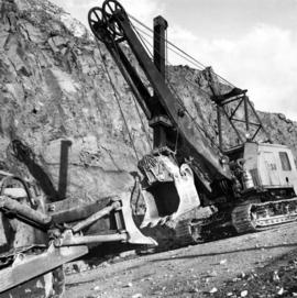
Photograph depicts a crawler cable shovel on right, and bulldozer partially visible on left. Rock face of mountainside in background. Handwritten annotation on verso of photograph: "1961", on recto: "Mining 80 D shovel on [?] 64/70 to 6560 saddle on peak."
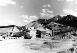
Photograph depicts dry rock storage building on left, mill in foreground, and tailings piles behind mill in midground. Mountains in background. Handwritten annotation on verso of photograph: "1961".
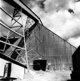
Photograph depicts front of dry rock storage building, conveyor visible above on left. Handwritten annotation on verso of photograph: "1961".
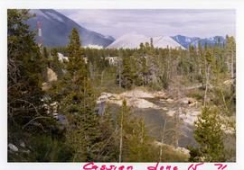
Photograph depicts flowing water believed to be Troutline Creek which ran south of Cassiar, B.C. Tailings pile and plant buildings visible behind forest in midground, northern mountain range in background. Handwritten annotation on verso of photograph: "Cassiar June 15 71".
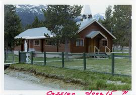
Photograph depicts fenced church building with what appears to be speakers mounted on roof above main entry. Road and trees in foreground, mountains in background. Handwritten annotation on verso of photograph: "Cassiar June 15 71".
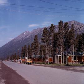
Photograph depicts row of houses behind trees. Power line, road, and vehicles in foreground; mountain in background.
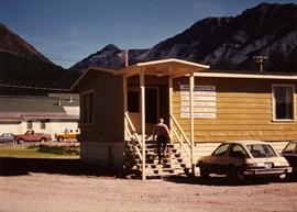
Photograph depicts unidentified man walking up front steps to building with the following sign: "TOWN ADMINISTRATION / MOTOR VEHICLE BRANCH / HCBC AGENCY / DISTRICT REGISTRAR / CDN CITIZENSHIP COURT / FISH & GAME LICENCES". Vehicles parked in foreground and behind at unknown building in midground. Power line and mountains in background.
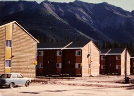
Photograph depicts four orange and brown two-story buildings speculated to be bunkhouse residences. Blue car in foreground, forest and mountains in background.
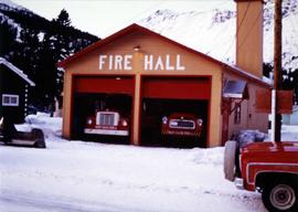
Photograph depicts two fire trucks semi-visible in garage with the sign "FIRE HALL". House and snowmobile can be seen in left midground, truck and power pole in right foreground. Mountains in background. Warning visible on front of trucks: "KEEP BACK 500m".
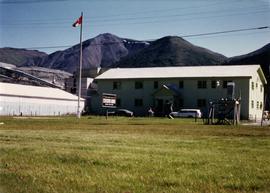
Photograph depicts two-story main office building in right midground behind sign reading "CASSIAR ASBESTOS CORPORATION Ltd / CASSIAR MINE / MAIN OFFICE". Building believed to be warehouse can be seen behind raised Canadian flag on pole in left midground. New mill building and tailings pile visible behind warehouse and office, mountains in background.
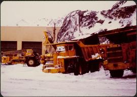
Photograph depicts the new mine garage behind machinery, mountains in background. Mobile blast hole drill can be seen in left foreground (manufactured by Robbins with Caterpillar undercarriage). Two 50-tonne Wabco "haul paks" in right foreground (ore haulage trucks).
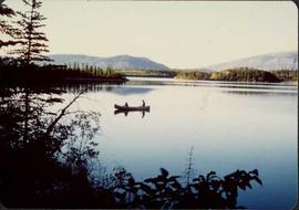
Photograph depicts two unidentified individuals in canoe on Boya Lake, B.C. (formerly known as Chain Lakes). Foliage silhouetted in foreground; forest and hills on opposite shore in background.
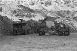
Photograph depicts a shovel loading what appears to be a Euclid ore haulage truck on left. Unidentified Caterpillar machine in foreground.
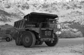
Photograph depicts a Euclid ore haulage truck in foreground. Shovel and unidentified caterpillar machine can be seen in background.
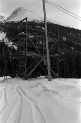
Photograph depicts steel tower. Snow in foreground, mountainside in background.
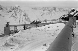
Photograph depicts tramline conveyor (located west of mine). Conveyor ran from crusher plant to tramline loading station. Mine valley and northwestern mountain range in background.
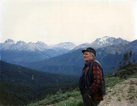
Photograph depicts William (Bill) Storie at location known as Limestone Mountain, southwest of Cassiar, B.C. Photo features profile of Bill, hands in pocket, Cassiar valley and mountains in background. Storie was a renowned prospector in the Cassiar area, and the new school at Cassiar was named for him in 1992.
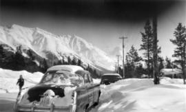
Photograph depicts unidentified individual and cars on street in foreground, snow banks, trees, and power poles on either side. Buildings can be seen on far right, mountains visible in background. Handwritten annotation on recto of photograph: "townsite Looking East".
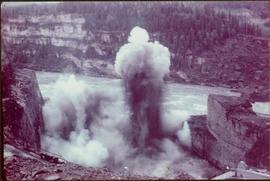
Item is a photograph of the explosion which opened up the diversion route for the Peace River during construction of the W.A.C. Bennett Dam.
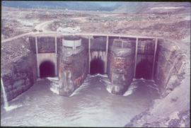
Item is a photograph of the three tunnels built to divert the Peace River around the Bennett Dam construction site.
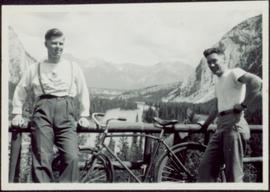
Item is a photograph of Ray Williston and Bruce Brown with a bicycle.
Item is a photograph of construction of the W.A.C. Bennett Dam.
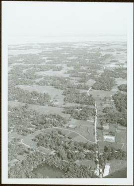
Item is a photograph of forests and farms from the air.
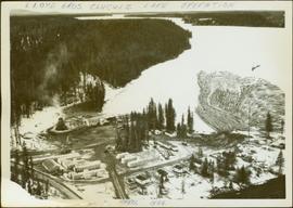
Item is a photograph of the Lloyd Bros. Cluculz Lake Operation in April 1964.
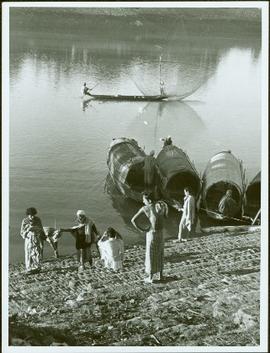
Item is a photograph of a fishing boat with the net deployed with other boats and people on shore.
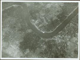
Item is a photograph of a river bend and the surrounding country taken from the air.
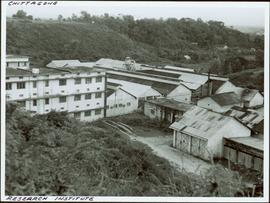
Item is a photograph of the Chittagong Research Institute buildings.
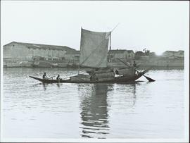
Item is a photograph of a sail boat hauling logs.
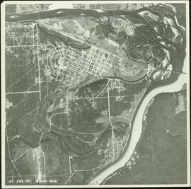
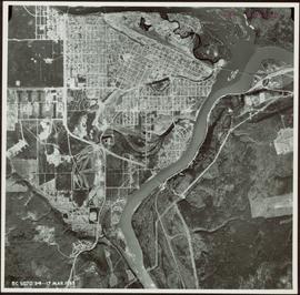
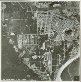
Item is a photograph of Prince George taken from the air.
Item is a photograph of Prince George taken from the air.
Item is a photograph of Prince George taken from the air.
