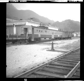
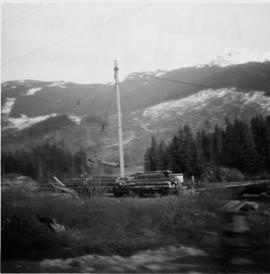
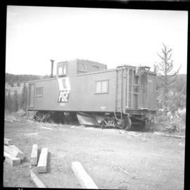
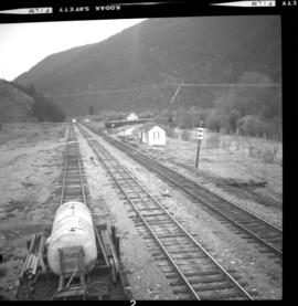
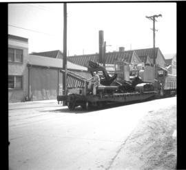
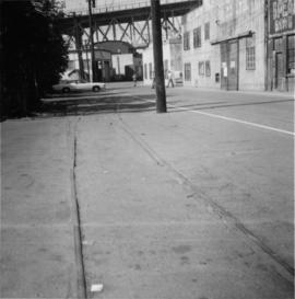
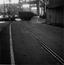
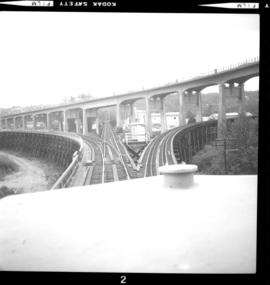
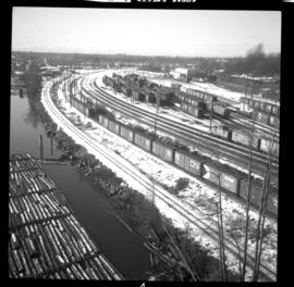
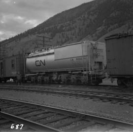
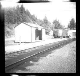
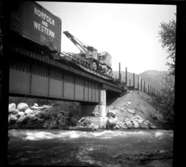
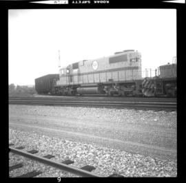
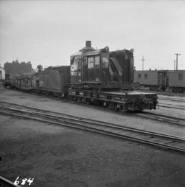
Photograph depicts the Canadian National Railway (CN) yards at Port Mann. A wrecking crane, without a jib, and water tanker are behind.
Photograph depicts an ex-locomotive tender, now a mobile water tank at the Canadian National Railway (CN) depot at Spences Bridge. The mobile water tank holds 11, 600 gallons.
Photograph depicts a disused Canadian National Railway (CN) water tower at Spuzzum, 25 miles north of Hope. The view is looking east across the Fraser Canyon.
Photograph depicts Tilbury dock on the Delta shore of the Fraser River. The stern of the Canadian National Railway (CN) onboard railcar carrier SS "Canora" is about 10ft away, and showing tidal and moving a piece of dock leading to shore.
Photograph depicts the Canadian National Railway (CN) line crossing the south Thompson River. Kamloops Junction and Kamloops city are joined by a 2 mile spur, which crosses the river as shown. The view in the photo is looking north from the site of the former fort.
Photograph depicts the Canadian National Railway (CN) Tilbury dock at Delta on the lower Fraser River. The view is looking east, upstream.
Photograph depicts an the eastern portal of a Pacific Great Eastern tunnel on the west side of the Bridge River Hydro project in Shalalth. Penstocks of the hydro plants are clearly visible on the hill side.
Photograph depicts a section house, track motor shed, and a disused bunk house and supplies shed which are property of the Pacific Great Eastern Railway.
Photograph depicts work cars adjacent to the north portal of the recently (1974) opened tunnel at Horseshoe Bay, West Vancouver. Visible is a train standing on what was formerly the main line of the track.
Photograph depicts northbound freight in Britannia Beach.
Photograph depicts work car #6406 in the Squamish yards.
Photograph depicts the Lone Butte flag station.
Photograph depicts various spurs. One spur was for a work crew train, another led to a gravel pile as well as one which was located at the far end and was for loading heavy equipment onto flat cars. A passing loop to the main line can be seen in the background.
Photograph depicts the remains of Pacific Great Eastern trackage beside a primitive small grain elevator laeding off at the end of the "Y" at Kelly Lake. It was probably not in use for the past 20 or 30 years, as of 1972.
Photograph depicts loading logs on the Pacific Great Eastern, north of Squamish.
Photograph depicts log cars on a siding.
Photograph depicts a Pacific Great Eastern bridge over the Capilano River in northwest Vancouver. Also visible is a switching locomotive.
Photograph depicts a trestle near Australian, BC on mile 364. Visible is a northbound freight of 2 locomotives and about 60 cars.
Photograph depicts a caboose and flanger car #6016
Photograph depicts horses beside track about 300 yards south of the passenger depot in Williams Lake.
Photograph depicts an auxillary car with a powered winch found at the Pacific Great Eastern yards in Lillooet. Inside the roundhouse in the background was a boiler room that contained a locomotive boiler in working order.
Photograph depicts the depot in Shalalth that faces Seton Lake.
Photograph depicts gondola cars sitting on a turning Y, unloaded, and covered with plastic. They were awaiting switching to an ore mine loading loop about 5 miles up the line.
Photograph depicts a steel-lined wreck train car that was used by work crews and consisted of a dining area, kitchen, sleeping quarters, and bathroom.
Photograph depicts the Pacific Great Eastern line beside the Seton River which connects Anderson Lake and Seton Lake. The bridge to the left take the road to D'Arcy and Pemberton.
Photograph depicts a 2 Budd car train travelling northbound and crossing the Portage River (Seton River).
Photograph depicts northbound freight crossing the Portage River (Seton River).
Photograph depicts a 2 car Budd train that mae the North Vancouver to Lillooet round trip daily.
Photograph depicts southbound way freight switching cars.
Photo depicts a derailment in Seton Portage at the Pacific Great Eastern broken switch on mile 139.8.
Photo depicts the general view of the clean up of the derailment in Seton Portage. The track in which a speeder stands a gondola car with rolls were the two tracks of the loop. They were both severed and respliced in making the "second edition" of the shoo-fly.
Photograph taken on Cartwright Street, looking eastward. Track to the right is unusable because the switch towards the right is blocked over.
Photograph depicts a B.C. Hydro Railway locomotive switching a flat car filled with construction equipment.
Photograph depicts a B.C. Hydro locomotive switching a flat car carrying a cat crane. Looking west with Granville road bridge in the background.
Photograph taken looking westward, down Cartwright Street. Trackage seen was not usable. Switch was blacktopped into position. The far end of the spur was used to lead to Columbia Bitolithic Ltd. Unseen track on the right side of the road was still in use.
Photograph taken looking southeast at the trackage underneath Granville Bridge.
Photograph depicts track that had just been relocated as part of the souh side of False Creek redevelopment.
Photograph depicts ballasting of realigned track due to the redevelopment of the south side of False Creek, Vancouver. Existing trackage lay to the north, just behind the front end of visible loader.
Photograph depicts "Extra 382" eastbound freight. Image captured passing Dennison on mile 30.8 from New Westminster.
Photograph depicts locomotive #382 which consisted of 3 locomotives and switching cars at an industrial steel fabrication plant. Freight was travelling from New Westminster to Huntingdon.
Photograph taken approaching Langely from the west at about mile 16 at the by-pass diversion point. Image captured from the cab of locomotive #382, looking eastward as the locomotive pulled 45 freight cars to Huntingdon.
Photograph depicts "Extra 382-Eastbound" freight. Taken from the cab of locomotive #382 on 2% grade between Scott Road and Kennedy in North Surrey. Train had 3 locomotives and about 45 cars.
Photograph taken at the south end of Fraser Bridge in New Westminster. Image captured from the cab of locomotive #382.
Photograph depicts a cross over. Track on the left to right are owned by the BC Hydro Railway, with the tracks on the right going to the Queensborough rail bridge. The tracks receding into the background are believed to be owned by the CPR.
Photograph depicts one of six former sub-stations of the BC Electric Railway's 64 mile interurban railway between New Westminster and Chilliwack. It opened in 1910, but was closed in the 1950's due to electric traction. The interior had been vandalized, but the building (made out of concrete) was so well built that the structure itself was quite sound.
Photograph taken looking southwest at the Langley town centre. Fraser Highway was 2 pole lengths away. The track used to be the main line with a spur leading to the right. Now all of the trackage was spur with the main line skirting the north side of the city.
Photograph taken at the BC Hydro Railway yards in Queensborough, New Westminster.
Photograph depicts BC Hydro Railway freight travelling north towards Abbotsford.
Photograph depicts recently closed B.C. Hydro Railway locomotive sheds. These are also examples of B.C. Electric Railway car barns.
Photograph depicts old BC Electric Railway interurbans purchased for restoration by the government of BC from an Oregon owner. They stood in the CPR Duke Street Yards in Vancouver.