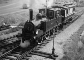
2000.23.1.070.07
·
Item
·
1923
Part of Audrey Smedley L'Heureux fonds
236 results with digital objects
Show results with digital objects
2000.23.1.070.08
·
Item
·
1968
Part of Audrey Smedley L'Heureux fonds
The map depicts the highest mountains in British Columbia; includes the Rocky Mountains, the Northern and Southern Plateaus, and the Mackenzie Mountain area.
2000.23.1.070.14
·
Item
·
1989
Part of Audrey Smedley L'Heureux fonds
The map is taken from the supplement of the Omineca Express/Bugle Caledonia Courier newspaper. The area map depicts highways, secondary roads, lakes, and gravel roads near Fort St. James, Stuart Lake, Fraser Lake, Fort Fraser, and Vanderhoof.
2000.23.1.082.01
·
Item
·
1977
Part of Audrey Smedley L'Heureux fonds
The map depicts where minerals can be found and also includes railways, highways, and roadways for easy access to desired minerals.
2000.23.1.082.02
·
Item
·
1977
Part of Audrey Smedley L'Heureux fonds
The map depicts the distribution locations and transportation routes for the processing of mineral and petroleum in British Columbia.
2008.2.1.034
·
Item
·
29 May 1942
Part of Northern BC Cartographic Collection
Accompanied by a 1942 job estimate cost summary sheet for the "Survey railway location west of Fairbanks" work to be done for the Alaska Western Railway project approved by a Colonel of the U.S. Army Corps of Engineers.
2003.8.4.1.1.2.1
·
Item
·
[1971?]
Part of Adam Zimmerman fonds
Hand annotated map depicts the proposed location of the Northwood Pulp Ltd. Beaver Bridge over the Fraser River near Prince George.

2004.1.1.3.1
·
Item
·
1934
Part of Phipps-Mackenzie Collection
Item is a preliminary plan showing traveled route of the Bedaux Sub-Arctic Expedition in 1934.
2003.8.1.1.4.1
·
Item
·
Apr. 1975
Part of Adam Zimmerman fonds
Map issued as part of the Canadian Pulp and Paper Industry magazine. Depicts locations of all pulp and paper mills in Canada in 1975 and provides a listing of company names.
Zimmerman, Adam
2002.14.1.09.168.1
·
Item
·
1995 (originally created 1852)
Part of Marianne (Marika) Ainley fonds
Item consists of the Kohklux map originally created by Chief Chilkaht Kohklux of Tlingit in 1852. This is one of the earliest known maps of the southern Yukon. Map originally inserted into a book about the map.

2009.7.3.1
·
Item
·
1878
Part of Archdeacon W. H. Collison fonds
2009.7
·
Fonds
·
1870-2006
The Archdeacon W.H. Collison fonds consists of textual materials, maps, published materials and photographs all documenting Collison’s life and work with North Coastal First Nations communities in British Columbia. Types of records found within this fonds include manuscripts, sermon notes, correspondence, oral history summaries, monographs, cartographic items, photographs and postcards. The Collison fonds also includes some records created by his children and grandchildren as well as a family tree created in 1986. The Collison fonds has been divided into four series.
Collison, W.H. (Archdeacon)
2009.6.13.45.06
·
Item
·
[between 1974 and 1979]
Part of The Honourable Iona Campagnolo fonds
Map depicts Bee Peak, Golden Mountain, Mount Fetterly, Mount Brook, Ear Mountain, Sunday Peak, Graham Inlet, and Taku Arm of Tagish Lake.
2009.6.13.45.09
·
Item
·
1976
Part of The Honourable Iona Campagnolo fonds
Map depicts the whole of Canada and notes: gas pipelines, gas gathering lines, proposed gas pipelines, oil pipelines, oil gathering lines, proposed oil pipelines, gas fields, oil fields, refining centres, extraction plants, and oil sands. There is a smaller subsequent map of Alberta highlighting these features in greater detail.
2009.6.13.45.11
·
Item
·
[between 1974 and 1979]
Part of The Honourable Iona Campagnolo fonds
Map depicts sea floor of the Beaufort Sea, fault lines, and diapirs.
2009.6.13.45.12
·
Item
·
Jan. 1974
Part of The Honourable Iona Campagnolo fonds
Map depicts producing mines and prospects in British Columbia and parts of Alberta.
2009.6.13.45.17
·
Item
·
[between 1974 and 1979]
Part of The Honourable Iona Campagnolo fonds
Map depicts the jurisdictions of the various Indian treaties in existence in 1966, including the boundaries of: no surrenders, exempted-royal proclamation, no valid surrenders, land and hunting rights surrenders, and land surrender only. The whole of Canada is depicted in this map.
2009.6.13.45.20
·
Item
·
[between 1974 - 1979]
Part of The Honourable Iona Campagnolo fonds
Map depicts annotations of the freight-way routes throughout British Columbia. These routes include: the Garnet Enterprise Truck Haul from Vancouver to Terrace, the Canadian Freightways from Vancouver to Edmonton to Alaska; the Lindsay Transfer from Terrace to Dease Lake and Telegraph Creek; and the Northland Navigation roll-on and roll-off service.
2009.6.13.45.24
·
Item
·
1976
Part of The Honourable Iona Campagnolo fonds
Map depicts the city of Regina, Saskatchewan, noting main arterial, visitor centre, special interest points, parks and recreational areas, elementary and secondary schools, and shopping centres. A smaller subsequent map of the business district is provided as well.
2009.6.13.45.25
·
Item
·
1978
Part of The Honourable Iona Campagnolo fonds
Cartoon style map of Edmonton with listings of activities and locations for Commonwealth games on the reverse of the map.
2009.6.13.45.29
·
Item
·
9 Mar. 1976
Part of The Honourable Iona Campagnolo fonds
Map depicts existing harbour development in Stewart, with an enlargement of the west side of the harbour.
2009.6.13.45.32
·
Item
·
Jan. 1978
Part of The Honourable Iona Campagnolo fonds
Map shows project boundaries in Mont Ste. Marie for proposed sports training centre at a ski resort.
2012.05
·
Fonds
·
1959-1970
Fonds consists of documents providing information on the Columbia Cellulose Company, Limited covering the period of 1959-1970. These documents detail the company’s history, historical and geographical context, and plans for the future. Files often include photographs, maps, and technical drawings of the mills.
Columbia Cellulose Company, Limited
2012.05.01
·
Series
·
1959-1970
Part of Columbia Cellulose Company, Ltd. fonds
Series consists of documents providing information on the Columbia Cellulose Company, Limited including its history, historical and geographical context, and plans for the future. These documents often include photographs, maps, and technical drawings of the mills. Series consists of Skeena Kraft press kit; Feasibility Study of Nass River Valley Log Transport Systems; A Summary History and Progress; Development Study: Northern resources; Columbia Cellulose Company, Limited.
2012.05.01.01
·
File
·
Jun. 1967
Part of Columbia Cellulose Company, Ltd. fonds
File consists of a folder containing documents describing Skeena Kraft Limited. Folder consists of:
- Svenska Cellulosa Aktiebolaget--A Forest Products Giant
- Columbia Cellulose Company, Limited--A Corporate History
- Two World-Wide Sales Organizations to Market Skeena Kraft Pulp
- Skeena Kraft Limited Adopts Distinctive Housemark Symbol Adapted from Sun Totem, Kee-War-Kow, Family Crest of Sky People
- The Nass and Skeena Valleys--A New Economic Region Terrace and Prince Rupert are Hubs in Finance and Services
- MISSING: Twinriver Timber Limited: New Company Created to Administer Two Tree Farm Licence Areas
- The Forests Behind the Coast Range Produce Superior Pulp
- Efficient New Woodroom Highlights Skeena Mill
- Integrating Two Power Systems--A Marriage with Convenience One Power Group Serves Two Mills
- Pulping Group Features Flexible Bleaching Sequence and World's Largest Flakt Drier
- New Dams Create Huge Storage Area for Skeena Water Supply
- Advanced Process Control Techniques Employ Computers Extensively
- Skeena Kraft Mill Quality Control and Process Control Tune Mill to Produce Prime Quality Pulps
- Co-ordination and Administration of Construction and Design of Skeena Kraft Shared by H.A. Simons and Central Engineering of Columbia Cellulose
- Purchasing and Traffic Departments Buy and Move More than 25,000 Tons of Materials During Skeena Kraft Construction Co-ordinated Sea and Land Transport System Introduced
- Skeena Kraft--Hundreds of New Jobs Canada-Wide Recruiting Programme Attracts New Workers to Growing Nass-Skeena Region;
- Also includes 19 photographs; 12 technical drawings and diagrams; 2 maps;
- Promotional pamphlet "The Skeena Kraft Story."

2012.05.01.02.02
·
Item
·
1962
Part of Columbia Cellulose Company, Ltd. fonds
Item is a map of British Columbia's Status of Sustained-Yield Forestry Programme as at 31 December 1962. The map has been annotated to show forest area surveyed by Celgar Ltd. as base for new kraft mill.
2013.6
·
Collection
·
[before 2020]
The David Davies Railway Collection encompasses all facets of railway history specifically in the province of British Columbia and the Yukon territory. The collection consists of research material accumulated over the course of more than fifty years, and includes monographs, periodicals, articles, clippings, railway timetables, photographs, maps and plans, and excerpts. Material covers public, tourist, and private (industrial) railways, including: CPR, KVR, E&N; CNR, CNoR, GTPR; and PGER, BCR. The collection excludes material regarding streetcar systems and rapid transit, but includes long distance electric interurbans.
2013.6.35.07
·
Item
·
2011
Part of David Davies Railway Collection
Map depicts Canadian railways in operation at 2011.
2013.6.35.10
·
Item
·
Mar. 1992
Part of David Davies Railway Collection
Map depicts historical rail lines in the BC lower mainland, including trackage for the BC Electric Railway, the Canadian Northern Pacific Railway, the Canadian Pacific Railway, the Great Northern Railway, and the Pacific Great Eastern Railway, among others.
2013.6.35.25
·
Item
·
1955
Part of David Davies Railway Collection
Map depicts the Cowichan Lake area, including rail trackage for the Western Forest Industries Logging Railway, the Canadian National Railway, and the BC Forest Products Logging Railway.
2013.6.35.44
·
Item
·
Jan. 1975
Part of David Davies Railway Collection
Map depicts locations of all mining properties in British Columbia. Includes index with names of owners of properties.

2013.6.35.47
·
Item
·
1971
Part of David Davies Railway Collection
Map depicts location of treasure hidden between Clearwater and Clemina, BC.

2013.6.35.48
·
Item
·
1978
Part of David Davies Railway Collection
Map depicts the Shuswap Lakes, Rogers Pass, Kamloops, Yellowhead Pass, Thompson Valley, and the Nicola Valley. Also includes the first clues to a treasure hunt.
2012.13.2.15.29.1
·
Item
·
[before 1980]
Part of J. Kent Sedgwick fonds
The item is a map depicting townsite plans for South Hazelton, BC. Slight water damage on center of map.
2012.13.2.20
·
Subseries
·
1980-2011
Part of J. Kent Sedgwick fonds
Subseries includes material collected by Kent Sedgwick regarding the Duke of Sutherland. The Duke of Sutherland is a title in the Peerage of the United Kingdom. The fourth Duke of Sutherland was Cromartie Sutherland-Leveson-Gower who lived from 1851 to 27 June 1913. Toward the end of his life, the 4th Duke began moving his wealth and life to Canada. The Duke owned land across British Columbia and Alberta and contributed to various settlements, including Strathnaver, BC; Windermere, BC; Brooks, AB; and Clyde, AB. The Duke of Sutherland owned the Sutherland Land Company, creating and selling plots in BC and Alberta. He also worked closely with the Canadian Pacific Railway to support immigration and settlement of the area.
2012.13.2.20.01
·
File
·
1980, 2002-2004
Part of J. Kent Sedgwick fonds
File consists of notes, clippings, and reproductions relating to Strathnaver, BC. Also includes maps depicting Cottonwood River and Hixon areas of the Cariboo Land District (1972 and 1980).
2012.13.3
·
Series
·
1950-2011
Part of J. Kent Sedgwick fonds
Series contains material created and collected by Kent Sedgwick over the course of his work with the Prince George Heritage Commission, the Alexander Mackenzie Heritage Trail Association, and other local organizations. The files primarily consist of meeting minutes, typescript documents, and correspondence between Sedgwick and the organizations.
2012.13.3.1
·
Subseries
·
1950-2011
Part of J. Kent Sedgwick fonds
Subseries contains material created over the course of Kent Sedgwick’s involvement with the Prince George Heritage Commission between 1978 and 2006. The files include correspondence, meeting minutes, typed documents, and research materials collected for heritage projects. Some of the heritage projects Kent Sedgwick was involved in include the creation of a heritage inventory record, particularly heritage houses; developing L.C. Gunn Park; and creating interpretive signage for historic locations throughout Prince George.
2012.13.3.1.01.1
·
Item
·
[between 1980 and 2000]
Part of J. Kent Sedgwick fonds
The map depicts Prince George lots alongside the Fraser River and has annotations by Kent Sedgwick outlining the location of the original cemetery. The map is a reproduction created in August 1910 and revised in 1965. Copy was produced between 1980 and 2000.
2012.13.3.1.10.1
·
Item
·
1966
Part of J. Kent Sedgwick fonds
The item is a promotional map depicting Prince George in 1966 and its amenities including businesses, activities, highways and the Fraser and Nechako rivers. The back depicts the Central Interior and the 1966 directory.
2012.13.2.03.02.1
·
Item
·
7 Aug. 1993
Part of J. Kent Sedgwick fonds
The item is a map that depicts lot plans for the Central Fort George townsite. Reproduction of map originally produced in 1938.
2012.13.2.11
·
Subseries
·
1937-2011
Part of J. Kent Sedgwick fonds
Subseries consists of materials collected by Kent Sedgwick for research on the geography and natural resources in Prince George and its region. Includes material on the natural resource industry, including the opening of the McArthur Sawmill, the W. Lamb and Sons Lumber Sawmill, and mining; photocopied aerial photographs of Prince George; the climate, temperatures, and flooding; and the geographical features of Prince George.
2012.13.2.14.01
·
File
·
1978-2005
Part of J. Kent Sedgwick fonds
File consists of clippings, notes, and reproductions relating to Fort George Park (renamed in 2015 to Lheidli T'enneh Memorial Park). Includes: "Fort George Park" typescript document; "Plan No17962" reproduction of downtown map and plan no 17962 (1969); "Fort George Park" handwritten notes by Kent Sedgwick; and "Park No. JK 85 Fort George Park" map depicting plans for Fort George Park (28 June 1978).
2012.13.2.14.01.1
·
Item
·
8 Sept. 1981
Part of J. Kent Sedgwick fonds
The map depicts plans for Fort George Park in Prince George.
2012.13.2.01.03.4
·
Item
·
Mar. 1977
Part of J. Kent Sedgwick fonds
Map depicts boundaries of study areas, including major study area, community study area, and the city of Prince George boundaries.
2012.13.2.02.33.03
·
Item
·
[1990?]
Part of J. Kent Sedgwick fonds
The item is a reproduction of a survey map drafted on 1 March 1910. The reproduction was likely created in 1990. The area highlighted is along the Fraser River. The map details subdivisions East of Ninth Street and South of Thapage Lane. Land Surveyor J. F. Templeton certified the plan. Annotation on the map states, "Pl. 727."
2012.13.2.02.33.06
·
Item
·
[1990?]
Part of J. Kent Sedgwick fonds
The item is a reproduction of a survey map drafted in approximately 1911 and revised in May 1914. The reproduction was likely created in 1990. The annotation states, "Plan 1391" and is circled in red ink. The area covered is along the Nechako and Fraser Rivers and Northeast of First Avenue.
2012.13.2.02.33.13
·
Item
·
[1990?]
Part of J. Kent Sedgwick fonds
The item is a reproduction of a survey map likely drafted in the 1910s. The reproduction was likely created in 1990. The area covered is South of Baillie Street, East of 22nd Avenue, North of Princess Street and West of 7th Avenue. Annotations state, "Pl. 833" and various lot descriptions.
2012.13.4
·
Series
·
1966-2010
Part of J. Kent Sedgwick fonds
Series consists of material collected and created by Kent Sedgwick in relation to his writings, publications, editorial work, and lectures. The files contain material regarding Kent Sedgwick’s writing and lectures on the Lheidli T’enneh cemetery; his book "Monumental Transformation: The Story of Prince George's National Historic Monument"; his book chapter "Crossing the Divide: Northern Approaches to New Caledonia"; his book "Giscome Chronicle: The rise and demise of a sawmill community in central British Columbia, 1912-1976"; edits done to June Chamberland’s book "From Broadaxe to Clay Chinking: Stories about the Pioneers in and around the Prince George area"; writing for the Prince George Heritage Advisory Committee; and Sedgwick’s MA thesis on the Peyto Glacier. The files primarily consist of notes, correspondence, and completed works.
2012.13.4.09.4
·
Item
·
1991-1999
Part of J. Kent Sedgwick fonds
The item is a map depicting the Crooked River Provincial Forest area. Sections of the map are highlighted and coordinates are annotated in ink.