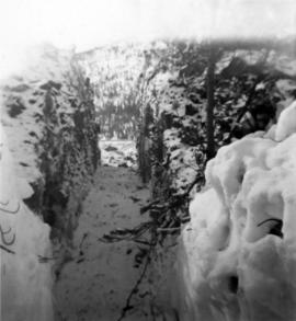
Handwritten caption beside this photo reads: "Work crew eating in open at 10˚ below zero, evicted from Lunchroom, due to damage to, from falling rock." Men are shown sitting in snow. Various metal materials in foreground, snow-covered mountainside in background. It is believed that power lines are also visible in background.
Four construction workers stand to left of blasthole drill number "604" among many empty cardboard boxes. Mountain range can be seen in background.
Conveyor sits on tall steel framework, encased in steel sheeting, and stands to right of snow-covered slope. Propane tank sits on log structure below conveyor. Snowy mountains in background. See also item 2000.1.1.2.373. Handwritten caption below this photo reads: "Project completed - at 52˚ temp."
Photograph depicts the Cassiar valley. Handwritten annotation on verso of photograph: "1958 [1961 crossed through]", on recto: "Cassiar Asbestos Corporation Limited. Cassiar B.C. Townsite in foreground mill and ore storage in left middle ground," "Toronto set". It is believed that this photograph was made into a post card.
Photograph depicts the Cassiar plantsite including the mill, dry rock storage building, tailings pile, and many other buildings. A portion of the townsite can be seen on left.
Photograph depicts large swath of dark waste down mountainside to right of valley. The waste dump is believed to be visible at top of swath on right of image. Bench mining visible on the North and South peak in background. Handwritten annotation on recto of photograph: "Oct. 25 / 65 4:25 PM."
Photograph depicts the Cassiar valley: town in foreground, plant and tailings pile in background. Mountain range visible in distance. Photograph was taken from above, facing east.
Photograph depicts the town of Cassiar, mountain base in background. Mine road visible in top right of image.
Photograph depicts the Cassiar mine above valley, north mountain range in background. Tramline station and crushing plant visible to west of pit. Photograph was taken from the air, portion of plane visible in top left of image.
Photograph depicts the West peak of the Cassiar mine, pit partially visible below. Drill visible in left foreground at highest elevation of mine, north west mountain range in background.
Photograph depicts the Cassiar mine, pit partially visible behind West peak in right centre of image. South west mountain range in background.
Photograph depicts exposed asbestos fibre in talus, shovel in left foreground.
Photograph depicts two men standing on mining bench in mountainside, three boxes and what appears to be a long hose to the left. Third man and tractor plow can be seen in distance at end of bench. Photo caption next to printed copy of image in 1953 Annual Report: "Benches being prepared for mining."
Photograph depicts two unidentified men at high elevation on mountain. Trucks and tanks visible in background, hose (possibly of air track drill) in right foreground. Mountain range in background.
Photograph depicts benches of Cassiar's open mine. Men can be seen standing near machinery speculated to be blasthole drills in bottom left of image. Handwritten annotation on recto of photograph: "Waste Stripping Operations on McDame Mt. Ore Mining in lower right Corner.", on verso: "1961".
Photograph depicts ore haul truck at dump in mine, mountain range in background. Photo also features driver and a second unidentified man standing in front of truck. Handwritten annotation on recto of photograph: "Int. Harvester Payhauler Model 95 dumping stripping waste at 6565 Elevation", on verso: "1961".
Photograph depicts large dry rock storage building in foreground on right, mill on left behind tailings pile, and dryer building in centre behind conveyor belt connecting mill to dry rock storage. A cloud can be seen rising from plantsite. Trees and Troutline Creek cross foreground, mine valley and mountains visible in background. Stamped annotation on recto of photograph: "ANSCO PRINTON Munshaw Colour Service Ltd. MAR 10 1955".
Photograph depicts bench at 6430 elevation. Blasthole drills, shovels, dozers, and dump trucks can be seen on bench in midground. Mine valley in background. Handwritten annotation on verso of photograph: "1961".
Photograph depicts a crawler cable shovel on right, and bulldozer partially visible on left. Rock face of mountainside in background. Handwritten annotation on verso of photograph: "1961", on recto: "Mining 80 D shovel on [?] 64/70 to 6560 saddle on peak."
Photograph depicts dry rock storage building on left, mill in foreground, and tailings piles behind mill in midground. Mountains in background. Handwritten annotation on verso of photograph: "1961".
Photograph depicts Ross Duddy with back to photographer, working at table in lab. Unidentified woman stands in right foreground operating unidentified machinery. Miscellaneous equipment and supplies throughout. Handwritten annotation on recto of photograph: "ROSS DUDDY / LAB SUPER".
Photograph depicts flowing water believed to be Troutline Creek which ran south of Cassiar, B.C. Tailings pile and plant buildings visible behind forest in midground, northern mountain range in background. Handwritten annotation on verso of photograph: "Cassiar June 15 71".
Photograph depicts shovel in excavation area of mine, loading ore haulage truck believed to be a Wabco "haul pak".
Photograph depicts 8 men working on top of unknown wooden structure, dog in foreground, mountain base in background. Corresponding note on accompanying photo description page: "1. Erecting 12"x12"s for mill walls. Looking west. Note boulders in foreground ready to be blasted to clear area."
Photograph depicts track loader moving dirt in semi-cleared area, man and mountains in background. Corresponding note on accompanying photo description page: "3. Excavating for ore haul truck dump. Looking west".
Photograph depicts track loader moving dirt, mountains in background. Corresponding note on accompanying photo description page: "4. Excavating for ore haul truck dump with mill in background. Looking southeast."
Photograph depicts flat area mostly covered in snow. Corresponding note on accompanying photo description page: "11. Indicates snow conditions in the cirque. Taken from near first switchback."
Photograph was taken facing down a narrow, snowy trench, mountain base visible at end. Corresponding note on accompanying photo description page: "1. Trench through snow banks at mill site. We had to dig these trenches to facilitate surveying the mill foundations."
Handwritten annotation below photo on page taped to photograph: "PHOTO #2: Looking N across talus slide of asbestos fibre and serpentine fragments." Handwritten annotation on verso of photograph in blue ink describing sections of photograph which have been pointed to or outlined: "Talus of asbestos fibre & serpentine fragments -->" "Photo #1 -->" "Approx upper contact of serpentine -->".
Handwritten annotation below photo on page taped to photograph: "PHOTO #4 Face of cut 4' wide 3' deep. Showing serpentine fragments in loose asbestos fibre. Assumed to overly serpentine high in fibre veinlets. Frost action."
Photograph depicts two unidentified individuals in canoe on Boya Lake, B.C. (formerly known as Chain Lakes). Foliage silhouetted in foreground; forest and hills on opposite shore in background.
Photograph depicts a shovel loading what appears to be a Euclid ore haulage truck on left. Unidentified Caterpillar machine in foreground.
Photograph depicts a Euclid ore haulage truck in foreground. Shovel and unidentified caterpillar machine can be seen in background.
Photograph depicts unidentified man standing in change house located at the new Mine Dry building. This change house utilized baskets which could be lowered under hinged covers, while the previous change house used baskets which could be raised by chains.
Photograph depicts three men fishing from shore. Water and trees in background. Left to right: Jack Christian, Plato Malezemoff, Tam Zimmermann.
Item is a photograph of construction of the W.A.C. Bennett Dam.
Photograph depicts a landscape shot of a grassy field overlooking a forested shoreline with mountains in the background.
Photograph depicts two unidentified men walking on a wooden bridge in a forest.
Photograph depicts four men in a boat on a lack with a waterfall in the background running through a forest into the lake. Annotation on verso of photograph states: "The water fall + flume for Brown's sawmill Hoscall River BC"
Photograph depicts a cannery on pilings with a body of water in the foreground and houses and trees in the background.
Photograph depicts cannery buildings on pilings with a body of water in the foreground and a deforested area behind the shoreline.
Photograph depicts a lighthouse on a rocky island with water in the foreground. Annotation on verso of photograph states: "Dear Dr. Thanks for the cheque received yesterday. Christmas Greetings. Yours Sincerely Mr. Cruickshank (?) Green Island"
Photograph depicts three men fishing in a boat with a cannery and wooden buildings along the forested shoreline in the background.
Photograph depicts a line of cannery fishing boats being towed across the water with the base of a mountain in the background.
Photograph depicts three buildings and a water tower on top of a deforested hill with water in the foreground.
Photograph depicts a large wave breaking over the stern of a weather ship.
Photograph depicts a weather ship sailing amidst large water swells.
Photograph depicts a water swelling over the bow of a weather ship.
Photograph depicts a weather balloon floating in the air, as seen from below.
Photograph possibly depicts a hummingbird on a nest.