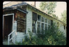
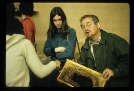
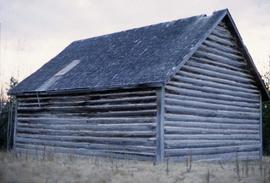
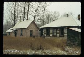
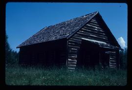
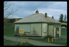
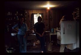
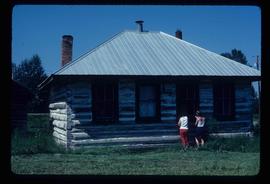
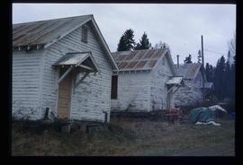
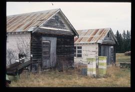
Image depicts the McBride District Centennial Library.
Image depicts the old school building in Lamming Mills, B.C.
Image depicts Upper Fraser Elementary School, after closure of town site. Map coordinates 54°06'54.4"N 121°56'16.6"W
Image depicts the Giscome mill site in Giscome, B.C. The bunkhouse is no longer there and the school is in the foreground on the right. Map coordinates 54°04'04.8"N 122°22'04.7"W
Image depicts the interior of a classroom at an uncertain location.
Image depicts an unidentified man in a yellow hat who appears to be speaking to large group of people. It is possibly an educational event.
Image depicts an unidentified man in a yellow hat who appears to be speaking to large group of people and showing them small pieces of wood. It is possibly an educational event.
Image depicts an unidentified man holding what appears to be a broken screen of honeycombs. The group is likely at an educational event.
Image depicts stuffed wildlife exhibits inside the Station Museum in Dawson Creek, B.C.
Image depicts the Woodpecker School building.
Image depicts the Hixon School and teacherage buildings in Hixon, B.C.
Image depicts the Red Rock School.
Image depicts the Salmon School in the Prince George vicinity.
Image depicts a the teacherage building in Red Rock.
Image depicts the Prince George Public Library.
Image depicts the old school in Woodpecker, B.C.
Image depicts the Hixon School.
Image depicts the Hixon School Teacherage.
File consists of notes, clippings, and reproductions relating to the Central Fort George Elementary School. Also includes photographs depicting the Central Fort George School prior to its demolition (2004).
File consists of notes, clippings, and reproductions relating to the Prince George school dormitories. Includes: "Old Dormitory Property - Senior Citizens Development" typescript letter from the Secretary-Treasurer of School District #57 to Mr. Jefferies, City Manager (20 June 1979).
File consists of notes and reproductions relating to the Willow River Elementary School.
File consists of notes relating to the Shady Valley School. Also includes photographs depicting the Shady Valley Elementary School, Hart Highway Elementary School, and West Lake Elementary School (2001?).
File consists of notes relating to the Salmon Valley Elementary School. Also includes photographs depicting the old weathered wooden Salmon Valley school building [2001?].
File consists of notes relating to Buckhorn Elementary School. Also includes photographs depicting the old Buckhorn School building and the Prince George Snowmobile club building from the exterior (between 2001 and 2005).
File consists of a note and photographs depicting children from the Bonnet Hill Elementary School in a frame hung in the Bonnet Hill Pub (Between 2001 and 2005).
File consists of notes, clippings, and reproductions relating to research of the Upper Fraser as part of the UNBC Upper Fraser Historical Geography Project. Includes photographs depicting students and professors researching in the Upper Fraser region (Dec. 1999).
File consists of notes and reproductions relating to the Upper Fraser Historical Geography Project done on the East Line and Upper Fraser in collaboration with the University of Northern British Columbia researchers. Includes a CD titled "Kent's Upper Fraser Files" containing Kent's research files for the Upper Fraser project (7 Jan. 2004) and a computer diskette titled "Oral Histories" containing an oral history interview with a woman (2004).
File consists of notes, clippings, and reproductions relating to an event for writers on the East Line at the Prince George Railway & Forestry Museum. Includes photographs depicting people visiting Giscome, a community on the East Line (2009).
File consists of notes and reproductions relating to a field trip to Jasper.
Image depicts the Tumbler Ridge School.
Image depicts the old school at 150 Mile House, with what is likely the modern school visible in the background.
Image depicts the Gitwinksihlkw Elementary School in Gitwinksihlkw, B.C.
Image depicts a few buildings, possibly an old school and teacherage, in Hixon, B.C.
Image depicts a school and playground, possibly in New Aiyansh, B.C.
File consists of notes, reproductions, pamphlets, and postcards relating to the Peyto Glacier, situated in the Canadian Rockies in Banff National Park, Alberta. Includes: "Inland Waters Branch" handwritten letter to Kent Sedgwick (4 Sept. 1970); "Peyto Glacier general information" pamphlet prepared by the Inland Waters Directorate, Water Resources Branch of Environment Canada (1975); and photographs depicting a Peyto Glacier workshop with Kent Sedgwick and colleagues (1996) and personal photographs depicting Kent Sedgwick, his wife, and friends visiting and hiking Peyto Glacier (1990).
File consists of notes, clippings, and reproductions relating to Kent Sedgwick's work at the University of Northern British Columbia. Includes: "Gifts in Kind with a Value" award of recognition presented to Susan and J. Sedgwick from the University of Northern British Columbia (31 Mar. 2005); "Re: Guest Lecture in Geography 200" typed letter from Jim Windsor to Kent Sedgwick (15 Apr. 2009); and "Re-appointment" typed letter from J. Howard Brunt, Vice-President of the University of Northern British Columbia to Kent Sedgwick (13 Nov. 2006).
File consists of notes and printed emails relating to a guest lecture by Kent Sedgwick for UNBC course "HIST 407 Local History/Methodology".
File consists of notes, clippings, and reproductions relating to Kent Sedgwick's guest lecture at the University of Northern British Columbia on Prince George. Includes: "Situating Prince George" handwritten lecture notes by Kent Sedgwick (2006) and "Geography of British Columbia" university syllabus (2003). Also includes a CD-R "Situating P.G". containing Kent Sedgwick's notes and photographs (Mar. 2006).
File consists of notes, clippings, and reproductions relating to the UNBC course "GEOG 424 Social Geography of Northern Communities" taught by Greg Halseth.
File consists of notes and reproductions relating to the introductory class GEOG 163 Local Historical Geography, a College of New Caledonia continuing studies course taught by Kent Sedgwick.
File consists of clippings, notes, and reproductions relating to the development of an archive in Prince George and at the University of Northern British Columbia. Includes the following clipped articles from the Prince George Citizen newspaper: "Memories live on in boxes at UNBC, historical book in the works" (23 July 2000); "History in Boxes" (20 June 1997); "Material for archives sought" (May 1990); and "Record collector: Michael Taft works to keep local history alive" (24 Feb. 2000). Also includes a "Prince George City Archives Inventory" document; a Heritage Advisory Committee meeting agenda (30 June 1988); and an "Archives" report from the Heritage Advisory Committee of the City of Prince George.
Image depicts three unknown individuals in a kitchen somewhere in Lillooet, B.C. They are possibly archaeology students.
Image depicts the school site in Stoney Creek.
Image depicts the Hixon School.
File contains slides depicting schools in Prince George, B.C.
Image depicts a man in a yellow cap who appears to be blowing smoke into a bee colony at a bee farm. It appears to be an educational demonstration.
Image depicts the Station Museum in Dawson Creek, B.C.
Image depicts the old Myatovic schools.
Image depicts the old Kamloops Residential School which operated until either 1977 or 1978 before becoming part of the Secwepemc Musem in 1982.