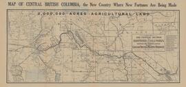
Item is a map that distinguishes the regions covered by Tree Farm Licence No. 1 granted to Columbia Cellulose and Three Farm Licence No. 40 granted to Skeena Kraft. Major locations indicated in this map include: Prince Rupert, Terrace, Hazelton, Smithers, Kitimat, Skeena River, and Nass River. Railway routes are also shown.
File consists of:
- "Development Study - Northern Resources" by the Columbia Cellulose Company, Limited, September, 1963. This report includes: background information on the company and a contextual background of forestry in British Columbia; a description of resources and proposed facilities, which covers northern wood resources and requirements for future sulphite and sulphate mills; an economic study for new Kraft operations.
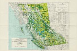
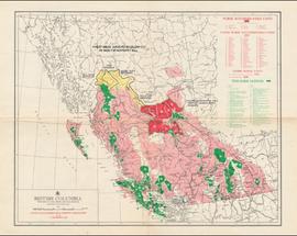
- 2 maps: one of British Columbia entitled "Status of Sustained-Yield Forestry Programme as at 31 December 1962" by the Department of Lands, Forests, and Water Resources; the other of British Columbia Forest Service Forest: Surveys and Inventory Division, Key Map Showing: Maps published on scale 1 inch to 2 miles and summary zones of the provincial forest inventory by the Department of Lands and Forests (1957).
Item is a map of British Columbia and is a key map showing: maps published on scale 1 inch to 2 miles and summary zones of the provincial forest inventory. Map includes index of post offices correct to October 22, 1956.
Item is a map of British Columbia's Status of Sustained-Yield Forestry Programme as at 31 December 1962. The map has been annotated to show forest area surveyed by Celgar Ltd. as base for new kraft mill.
Pope, Frank L. “Sketch Map Showing the Proposed Route of the Western Union Telegraph Between Fort Frazer and the Stekine River, British Columbia. From exploration by the party under the command of Maj. Frank L. Pope Ass’t Engineer, 1866.
Wyld, James. "Map of the Colony of New Caledonia and the British & American Territory West of the Rocky Mountains including Vancouvers Island and the Gold Fields" by James Wyld, Geographer to the Queen & the Prince Consort, Charing Cross East & 2 Royal Exchange, London, July 16, 1858.
This fonds consists of material created and collected by Kent Sedgwick, author, professor, Prince George urban planner, and prominent local historian. This body of records documents Sedgwick’s research interests in the history and geography of the Central Interior of British Columbia. The fonds also reflects his work as a Prince George Senior City Planner, his involvement in local community organizations, and his teaching at the College of New Caledonia and the University of Northern British Columbia.
The fonds includes:
1) Photographs taken by Kent Sedgwick across British Columbia, predominantly in the Central Interior region;
2) Research subject files consisting of original research documentation and collected reference material, predominantly focusing on topics relating to local history, city planning, and geography in the Prince George area and the British Columbia Central Interior;
3) Documentation of Kent Sedgwick’s community involvement, including records created over the course of his work with the Prince George Heritage Commission, , the Alexander Mackenzie Heritage Trail Association, and other local organizations;
4) Writings, publications, and lectures written, edited, or conducted by Kent Sedgwick;
5) Professorial records consisting of lectures and material relating to Sedgwick’s teaching appointments at the College of New Caledonia and the University of Northern British Columbia;
6) Maps collected by Kent Sedgwick covering historical and contemporary British Columbia.
Kent Sedgwick’s research subject files contain original research notes, interviews and oral histories, news clippings, and collected primary and secondary sources. The series also includes both original and reproduction photographs, audio recordings, and maps. The subject files primarily relate to the history, urban planning, and historical geography of the Central Interior of British Columbia, especially Prince George area and the East Line communities over the course of the 20th century. They also include extensive notes on geographic features, landscapes, interpretative trails, architectural history, industrial history, history of Western exploration and land survey, and the First Nations history of the region.
Subseries includes research material created and collected by Kent Sedgwick relating to the incorporation of the City of Prince George. Topics include the naming of the City of Prince George, city boundaries, the city amalgamation with Fort George and South Fort George, city census records, and mayors of Prince George.
File consists of photocopies and notes relating to the boundary expansions of the city of Prince George since its incorporation. Includes a graph drawn by Kent Sedgwick regarding the addition of land and water each year of the boundary expansion and a "Proclamation" photocopy from the B.C. Gazette (23 Apr. 1953). Also includes 5 maps: "City of Prince George Boundary Expansions since Incorporation in 1915" (1979 or 1980); "City of Prince George" (Feb. 1979); "Map of Prince George" (between 1970 and 1985); "Study Area Boundaries" (Mar. 1977); and "City of Prince George" (Feb. 1972).
Map depicts the city of Prince George Boundary expansions since incorporation in 1915.
Map depicts the city of Prince George Boundary expansions since 1913.
Map depicts the city of Prince George with annotations of the boundary expansions from 1915 to 1964.
Map depicts boundaries of study areas, including major study area, community study area, and the city of Prince George boundaries.
Map depicts the city of Prince George boundary expansions from 1913 to 1974.
Map depicts to Canadian federal electoral districts for the 1993 federal election.
Subseries includes research material created and collected by Kent Sedgwick relating to land survey, development, and settlement in Prince George and British Columbia. Land surveys were conducted in British Columbia by surveyors George Dawson, the North Coast Land Company, Alfred R.C. Selwyn, and the Geological Survey of Canada during the late 19th and early 20th centuries. James C. Anderson and engineer J. Gill conducted topographical surveys for the Grand Trunk Pacific Railway on Fort George and the Indian Reserve. Surveyors and land plot companies developed the land for sale to promote settlement in the area. Also includes materials regarding the continued development of the City of Prince George throughout the 20th century. The files primarily consist of newspaper clippings, research notes, and photocopied documents.
File consists of notes, reproductions, and letters relating to the street names in Prince George. Includes: "Canadian Permanent Committee on Geographical Names" typescript document; email from Ramona Rose to Kent Sedgwick (8 Dec. 2000); "Future entrance sign on Tyner Boulevard" typescript letter to Mr. Hamer from Ruth Iversen (10 Jan. 1995); "South Fort George gardens plan of subdivision" reproduced map depicting subdivision lots along the Fraser River in Prince George (2011); and "Porter Creek" letter from the Province of British Columbia to Kent Sedgwick (16 May 1989).
The item is a map that depicts subdivision lots along the Fraser River in Prince George. The subdivision is DL 745 and 747 of the Cariboo District. Map is certified by G. F. Templeton, a BC land surveyor.
File consists of maps and town surveys of early Prince George. Includes various reproduced 1915 maps and surveys depicting Prince George, Central Fort George, and Fort George: "Subdivision of part of Indian Reserve no. 1 lot 343 Cariboo District BC"; "Parcel Z map 1268"; "Plan of Subdivision lot 933"; "First addition to townsite of Central Fort George"; "Subdivision of lot 1511 Cariboo District BC"; "Townsite of Fort George" map originally made by R.H. Holland; "Plan of Subdivision of lot 1426 Fort George Collins Addition"; "Plan of subdivision of lot 932 Cariboo District"; and "Plan of subdivision of part of lot 2507."
The item is a reproduction of a section of survey map drafted on 18 March 1915 and revised on 23 May 1916. The reproduction was likely created in 1990. The Plan Number is 1268 and highlights the area along the Nechako and Fraser Rivers. The map details subdivisions East of Carney Street, North of Twentieth Avenue and South of Ninth Avenue. Annotations in pencil state different map scale variations and "cemetery setback."
The item is a reproduction of a section of survey map drafted in 1915. The reproduction was likely created in 1990. The Plan Number is 1268 and highlights the area along the Nechako River. The map details subdivisions East of Carney Street and North of Fifth Avenue. Some original street and avenue names have been crossed out and replaced with handwritten names. Annotation on reverse side of map states, "D.L. 343 Pl. 1268."
The item is a reproduction of a survey map drafted on 1 March 1910. The reproduction was likely created in 1990. The area highlighted is along the Fraser River. The map details subdivisions East of Ninth Street and South of Thapage Lane. Land Surveyor J. F. Templeton certified the plan. Annotation on the map states, "Pl. 727."
The item is a reproduction of a survey map drafted in January 1910. The reproduction was likely created in 1990. The subdivision is Lot 936 G. I. Cariboo District, B.C. The area covered is North of Twenty First Avenue, East of Quinn Street, South of Eighth Avenue and West of Carney Street. Annotations highlight "Owner Edgar McMickiny," "696" and "Jordan Brothel" written in red pen pointing to a specific location.
The item is a reproduction of a survey map drafted in September 1909. The reproduction was likely created in 1990. The annotations highlight owners of different lots up to approximately 1959. Th area covered is North of Fifteenth Avenue, East of Irwin Street, South of Eighth Avenue and West of Carney Street. Annotations on attached papers indicate different means of scale and measurement for the map.
The item is a reproduction of a survey map drafted in approximately 1911 and revised in May 1914. The reproduction was likely created in 1990. The annotation states, "Plan 1391" and is circled in red ink. The area covered is along the Nechako and Fraser Rivers and Northeast of First Avenue.
The item is a reproduction of a survey map drafted on 10 July 1956 and registered on 31 Oct. 1956. The reproduction was likely created in 1990. The plan number is 7782.
The item is a reproduction of a survey map drafted in July 1914. The reproduction was likely created in 1990. The area covered is along the Fraser River and east of Guelph Street. Annotations state, "PL 1409 D. L. 417 HBCo." and highlight different scales of measurement and changed street names.
The item is a reproduction of a survey map drafted in 1 Oct. 1913. The reproduction was likely created in 1990. The area covered is along the Fraser River and west of Linooln Avenue, south of Jackson Street and North of McKinley Street. Annotations state which maps and lots are adjacent to this one. An illegible signature is highlighted.
The item is a reproduction of a survey map drafted June 1912. The reproduction was likely created in 1990. The area covered is Central Fort George, South of 5th Street, East of Alden Avenue, North of 12th Street and West of Fraser Street. Annotations state, "Plan 1085 Carney Addition."
The item is a reproduction of a survey map drafted on 20 Nov. 1910. The reproduction was likely created in 1990. The subdivision is lot 2610 G. I. and part of lots 2507 and 2608 G. I. Cariboo District. The area covered is South of 8th Avenue, East of 19th Avenue, North of 8th Street and West of Quinn Street. Annotations state, "Pl. 847," and various notations regarding lot information.
The item is a reproduction of a survey map drafted on 29 Oct. 1910. The reproduction was likely created in 1990. The area covered is South of Princess Street, East of James Avenue, North of 8th Street and West of Rupert Avenue. Annotations state, "Jesse Hodgeson Crown grand in 1910 for $800..."
The item is a reproduction of a survey map likely drafted in the 1910s. The reproduction was likely created in 1990. The area covered is South of Baillie Street, East of 22nd Avenue, North of Princess Street and West of 7th Avenue. Annotations state, "Pl. 833" and various lot descriptions.
The item is a reproduction of a survey map drafted on 27 July 1910. The reproduction was likely created in 1990. The area covered is South of Reserve Avenue, East of Victoria, North of Bird Avenue and West of 9th Street. Annotations state, "#796" and highlight the date and registered owner.
The item is a reproduction of a survey map likely drafted in the 1910s. The reproduction was likely created in 1990. The area covered is South of Anderson Street, East of Simpson Street, North of Van Bien Avenue and West of 9th Street. Annotations state, "Pl 721 DL 1426."
The item is a reproduction of a survey map drafted on 1 March 1910. The reproduction was likely created in 1990. The area covered is South of Bernhardt Avenue, East of Simpson Street, North of the Fraser River and West of 9th Street. Annotations state, "DL 1426 Plan 721."
The item is a reproduction of a survey map drafted in 1909. The reproduction was likely created in 1990. The area covered are lots 931 and 417. Annotations state, "Plan 701," and various names are highlighted.
The item is a reproduction of a survey map drafted in 1909. The reproduction was likely created in 1990. The area covered is South of Fort George Avenue, East of Fraser Street, North of Mount Stephen Avenue, and West of Simpson Street. Annotations state, "Pl. 649."
Subseries consists of material collected and created by Kent Sedgwick for research regarding various areas within Prince George. These files include material on neighbourhoods and notable areas within the city, as well as the Regional District of Fraser-Fort George. Notable areas include the Fort George Canyon, downtown Prince George, and Cottonwood Island. The files primarily contain notes and newspaper clippings relating to the development and history of these areas.
File consists of clippings, notes, and reproductions relating to the Central Fort George townsite. File predominantly includes Kent Sedgwick's handwritten notes regarding land plots and development of Central Fort George. Includes: a map depicting Canadian National Railway plans along Hammond Street and the Fraser River (1936) and "Central Fort George lots" map depicting lot plans for the Central Fort George townsite (reproduced 1990).
The item is a map that depicts lot plans for the Central Fort George townsite. Reproduction of map originally produced in 1938.
The item is a map that depicts Canadian National Railway plans along Hammond street and the Fraser River. Includes the railway property, private property, proposed streets, and government owned property in the Prince George area.
Subseries consists of materials collected by Kent Sedgwick for research relating to Lheidli T'enneh First Nations. The Lheidli T'enneh are a sub-group of the Dakelh people whose traditional territory includes the city of Prince George, British Columbia. These files primarily consist of material regarding the original Lheidli T'enneh reserve and cemetery, the reserve relocation, and the desecration of the cemetery.
File consists of clippings, notes, and reproductions relating to the surrender of the original L'Heidli T'enneh reserve and its cemetery, and the subsequent reserve relocation. Includes "Indian cemetery Fort George Park" typescript document by Kent Sedgwick for the Heritage Advisory Committee, which includes photocopies of original documents for the sale of the Indian reserve to the Grand Trunk Pacific Railway (23 Mar. 1983) and "Plan of the Fort George Indian Reserves" map depicting the locations of the reserves in and around Prince George. File also includes photocopies and reproduced photographs of the Prince George Indian Reserves from the Royal BC Museum and Archives.
The item is a reproduction of a map originally surveyed in 1984 by F. A. Deveraux. The map is a plan of the "Fort George Indian Reserves" in the Cariboo District. Annotations include the approved signatures of Leo. B. Martin and R. O'Reilly dated 21 September 1895.
Subseries consists of material collected and created by Kent Sedgwick for research regarding Indigenous Peoples within British Columbia. These files primarily consist of audio recordings and transcripts of personal oral interviews, documents regarding perceptions of Indigenous peoples, research on historical interactions, Dakelh (Carrier) language, and treaty information including the Nisga'a treaty and Treaty 8. Includes materials on the Carrier Sekani First Nations whose traditional territory includes north central British Columbia and includes the Ts'il Kaz Koh First Nation, Nadleh Whut'en, Saik'uz First Nation, Stellat'en First Nation, Takla Lake First Nation, and Wet'suwet'en First Nations.
File consists of notes, clippings, and reproductions relating to Indigenous Peoples of British Columbia. Includes: "A selected list of publications on the Indians of British Columbia" published by the British Columbia Provincial Museum (1970) and "Les Indiens Des Cordilleres" printed by the National Museum of Canada (7 Feb. 1939). File also includes a map titled "Native Lands, then and now" depicting British Columbia including outlines of Indigenous territories and a smaller map of Canada with Indigenous language families; the backside of the map is titled "What are you ready for" and includes a timeline of information and Indigenous history in British Columbia (1990).
The map depicts British Columbia, including outlines of Indigenous tribal territories and a smaller map of Canada with Indigenous language families. The reverse side of the map is titled, "What Are You Ready For" and includes a timeline of information and Indigenous history.


