Aerial photograph of Clinton Creek, south east of plant site.
Flight index for 68 aerial photographs accompanying item. Map depicts Clinton Creek area, identifying airfield and mine. Cartographic legend: "CASSIAR ASBESTOS CORP LTD" "FLIGHT INDEX" "DATE OF PHOTOGRAPHY MAY 1965" "SCALE OF PHOTOGRAPHY 1" = 900 APPROX." "McELHANNEY ASSOCIATES VANCOVER B.C." "JOB No C189/6524".
Photograph collection of various foothills around Cassiar.
Photograph depicts range of hills, clouds in background.
Photograph depicts hill, trees in foreground.
Photograph depicts range of hills, trees at base.
Photograph depicts range of hills. Trees in valley, clouds in background.
Photograph depicts range of hills, trees in valley.
Photograph depicts range of hills, trees in valleys.
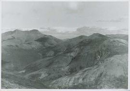
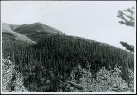
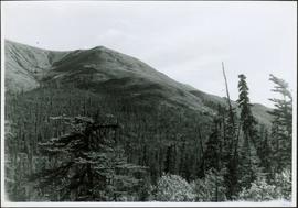
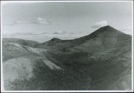
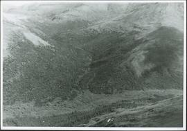
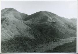
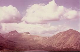
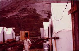
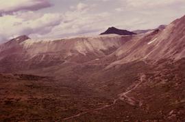
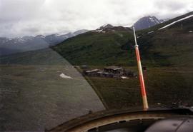
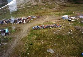
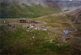
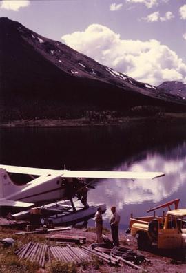
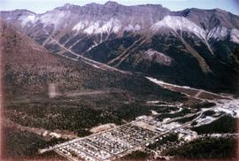
This collection is of Kutcho Creek Camp that was set up by a crew led by Cassiar's Chief Geologist Bill Plumb in 1966.
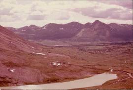
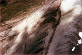
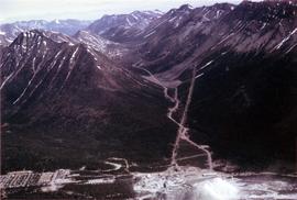
There are six photographs showing the temporary buildings, paths and barrels. These photos were taken from a high hill looking down at the camp. Two photographs depicts the valley of Kutcho Creek area, and the exploration camp is in the distance at foot of hill. One photograph depicts valley of Kutcho Creek area with a body of water in foreground, and mountains in background.
Another photograph depicts man believed to be Matt Bell standing in Kutcho Creek exploration camp. There are tents on either side, a wood structure in background and a sign on wood post: "PLUMB BLVD."
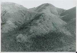
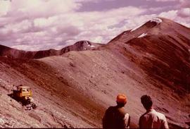
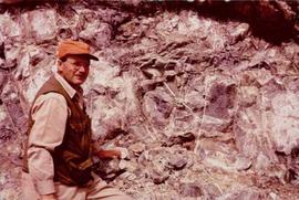
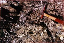
One photograph believed to have been taken near Kutcho Creek, during the initial exploration trip led by Cassiar's Chief Geologist Bill Plumb. Bill stands to left of man believed to be Matt Bell in right foreground. Bulldozer works along talus slope in left foreground.
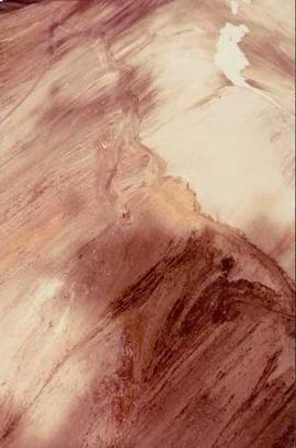
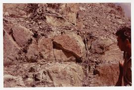
Another photograph of this initial trip shows a bulldozer working along talus slope in centre of image.
Photograph depicts valley in Kutcho Creek area, exploration camp in distance at foot of hill. The camp was set up by a crew led by Cassiar's Chief Geologist Bill Plumb.
Photograph depicts man believed to be Matt Bell standing in Kutcho Creek exploration camp. The camp was set up by a crew led by Cassiar's Chief Geologist Bill Plumb. Tents on either side, wood structure in background. Sign on wood post: "PLUMB BLVD."
Photograph depicts valley in Kutcho Creek area, exploration camp in distance. Body of water in foreground, mountains in background. The camp was set up by a crew led by Chief Geologist Bill Plumb.
Photograph believed to have been taken near Kutcho Creek, BC during an outside exploration trip led by Cassiar's Chief Geologist Bill Plumb. Bill stands to left of man believed to be Matt Bell in right foreground. Bulldozer works along talus slope in left foreground.
Bulldozer works along talus slope in centre of image. Photograph believed to have been taken near Kutcho Creek, BC during an outside exploration trip led by Cassiar's Chief Geologist Bill Plumb.
Photograph depicts a valley in the Kutcho Creek area with an exploration camp in the distance at the foot of a hill. The camp was set up by a crew led by Cassiar's Chief Geologist Bill Plumb.
Photograph depicts an exploration camp in the valley at the Kutcho Creek area in B.C. The camp was set up by a crew led by Cassiar's Chief Geologist Bill Plumb.
Photograph depicts steel drums and wooden buildings at an exploration camp in the Kutcho Creek valley area of B.C. The camp was set up by a crew led by Cassiar's Chief Geologist Bill Plumb.
Photograph depicts steel drums and wooden buildings at an exploration camp in the Kutcho Creek valley area of B.C. The camp was set up by a crew led by Cassiar's Chief Geologist Bill Plumb. An arrow points to a possible burial site.
Photograph of Cassiar's Chief Geologist Bill Plumb who led many exhibitions for the purposes of Cassiar's outside exploration endeavors. Various photos in this collection depict Bill on some of these exhibitions.
Photograph depicts Bill Plumb at recently excavated wall of serpentinite with cross fracturing filled with asbestos fibre. Handwritten annotation on note attached to photo: "Chief Geologist Wilfred M Plub at Discovery at Clinton Creek 1963 + or -."
Photograph depicts man believed to be Matt Bell at recently excavated wall of serpentinite with cross fracturing filled with asbestos fibre. Photograph speculated to have been taken at Clinton Creek, Y.T.
Photograph depicts a geologist's hammer, believed to belong to Cassiar's Chief Geologist Bill Plumb. The hammer provides a scale for the exposed asbestos, indicating the percent of fibre in the rock as well as the expectation of grade.
Photograph depicts Cassiar's Chief Geologist Bill Plumb and unidentified man standing on shore by yellow Cassiar supervisor's truck. Airplane is parked on lake behind them, and miscellaneous equipment lies on shore at Bill's feet. Photograph speculated to have been taken at Aeroplane Lake, approximately 35 miles east of Cassiar. Bill Plumb led many expeditions for the purposes of Cassiar's outside exploration endeavours.
Photograph depicts Cassiar's Chief Geologist Bill Plumb and unidentified man standing on shore by yellow Cassiar supervisor's truck. A third man stands on Airplane parked on lake behind them, and miscellaneous equipment lies on shore at Bill's feet. Photograph speculated to have been taken at Aeroplane Lake, approximately 35 miles east of Cassiar. Bill Plumb led many expeditions for the purposes of Cassiar's outside exploration endeavours.
Bulldozer works along talus slope in top right of image. Photograph believed to have been taken during an outside exploration trip led by Cassiar's Chief Geologist Bill Plumb.
Photograph depicts a geologist's hammer, believed to belong to Cassiar's Chief Geologist Bill Plumb. The hammer provides a scale for the exposed asbestos, indicating the percent of fibre in the rock as well as the expectation of grade.
Photograph depicts the Cassiar mine valley in north mountain range. Plant and tailings pile can be seen in right foreground, and the east end of the town is visible in left foreground. Photograph speculated to have been taken during the plane ride of an outside exploration trip.
Photograph depicts the Cassiar town in foreground, mine valley and north mountain range in background. Photograph speculated to have been taken during the plane ride of an outside exploration trip.