Showing 658 results
Archival description
Cassiar District mining claims
Cassiar District mining claims
River crossing exercise, Prince George, B.C.
River crossing exercise, Prince George, B.C.
Columbia Cellulose Company, Ltd. fonds
Columbia Cellulose Company, Ltd. fonds
Louise Burgener collection
Louise Burgener collection
Mark Clark Forestry Collection
Mark Clark Forestry Collection
Map showing locations of placer streams in British Columbia south of latitude 54 degrees North, with Queen Charlotte Islands inset in north east corner
Map showing locations of placer streams in British Columbia south of latitude 54 degrees North, with Queen Charlotte Islands inset in north east corner
Dr. Paul Sanborn fonds
Dr. Paul Sanborn fonds
Research projects
Research projects
Maps
Maps
Cottonwood Island maps and plans
Cottonwood Island maps and plans
Cottonwood Island general file from the City of Prince George
Cottonwood Island general file from the City of Prince George
Client Files of G.G. Runka Land Sense Ltd.
Client Files of G.G. Runka Land Sense Ltd.
Highway 16 West: Gateway to Alaska
Highway 16 West: Gateway to Alaska
Preemptor's map Sheet No. 3 Valleys of Fraser, Salmon & Willow Rivers in Fort George and Peace River Land Recording Districts
Preemptor's map Sheet No. 3 Valleys of Fraser, Salmon & Willow Rivers in Fort George and Peace River Land Recording Districts
B.C. Ghost Town Map
B.C. Ghost Town Map
Centennial Map of Canadian History and Achievements, 1867 to 1967
Centennial Map of Canadian History and Achievements, 1867 to 1967
Colonial exploration maps
Colonial exploration maps
British Columbia Mountains
British Columbia Mountains
Stuart Lake, Fort St. James, and Fraser Lake area map
Stuart Lake, Fort St. James, and Fraser Lake area map
A look at Canada
A look at Canada
Pre-emptor's map of Fort George
Pre-emptor's map of Fort George
British Columbia Biotic Regions
British Columbia Biotic Regions
Kitimat City Centre
Kitimat City Centre
Cariboo Estate Map
Cariboo Estate Map
British Columbia Climatic Regions
British Columbia Climatic Regions
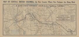
Central British Columbia Map
Central British Columbia Map
2000 Forest Development Plan (Slocan)
2000 Forest Development Plan (Slocan)
Mineral Deposit-Land Use Map
Mineral Deposit-Land Use Map
Distribution of Solid Mineral and Petroleum Resources in British Columbia
Distribution of Solid Mineral and Petroleum Resources in British Columbia
Mineral Deposit - Land Use Map
Mineral Deposit - Land Use Map
UNBC School of Planning and Sustainability fonds
UNBC School of Planning and Sustainability fonds
Maps, plans, and drawings
Maps, plans, and drawings
Kitimat-Stikine Regional District Regional Resource Inventory
Kitimat-Stikine Regional District Regional Resource Inventory
Research Subject Files
Research Subject Files
Prince George City Incorporation
Prince George City Incorporation
"Native Lands then and now"
"Native Lands then and now"
"Map of Prince Rupert"
"Map of Prince Rupert"
"Plan of official Grand Trunk Pacific Ry. Townsite of South Hazelton B.C."
"Plan of official Grand Trunk Pacific Ry. Townsite of South Hazelton B.C."
Salmon Portage area, map 93J.026
Salmon Portage area, map 93J.026
Salmon Portage area, map 93J.026
Salmon Portage area, map 93J.026
Salmon Portage area, map 93J.027
Salmon Portage area, map 93J.027


