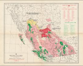
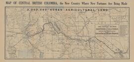
Map depicts producing mines and prospects in British Columbia and parts of Alberta.
Map depicts existing oil lines, oil lines proposed or under construction, product lines, existing gas lines, gas lines proposed or under construction, LPG lines, and LPG lines proposed in Canada and Northern USA.
Map depicts the Coast of British Columbia and Federal and Provincial proposed fishing boundaries, including the 200 mile limit.
Map depicts Prince Edward Island noting the main highways, hospitals, airports, provincial parks, beaches, golf courses, tuna fishing, and camp grounds.
Map depicts the jurisdictions of the various Indian treaties in existence in 1966, including the boundaries of: no surrenders, exempted-royal proclamation, no valid surrenders, land and hunting rights surrenders, and land surrender only. The whole of Canada is depicted in this map.
Map depicts the regional district of Kitmat, but is extensively annotated showing the proposed route of the Kitmat Truck Ferry, running through Terrace and up into the "Yukon Markets," and the Kispiox Connector, running from Prince Rupert to Hazelton and further East along Highway 16 and north along the Kispiox River.
Map depicts annotations of the freight-way routes throughout British Columbia. These routes include: the Garnet Enterprise Truck Haul from Vancouver to Terrace, the Canadian Freightways from Vancouver to Edmonton to Alaska; the Lindsay Transfer from Terrace to Dease Lake and Telegraph Creek; and the Northland Navigation roll-on and roll-off service.
Map depicts the shipping highway routes across Canada. Primary, secondary, and access routes are noted as-well as proposed routes.
Map depicts Western Canada and annotations highlight the prospective members and the member centres of the Yellowhead Interprovincial Highway Association.
Map depicts the topography around the township of Terrace, British Columbia. The Skeena River is noted, as well as the Coast Mountains and the Kitimat Ranges.
Map depicts the city of Regina, Saskatchewan, noting main arterial, visitor centre, special interest points, parks and recreational areas, elementary and secondary schools, and shopping centres. A smaller subsequent map of the business district is provided as well.
Cartoon style map of Edmonton with listings of activities and locations for Commonwealth games on the reverse of the map.
Tourist map of Corner Brook, Newfoundland depicting the various parks, streets and attraction centres.
Map depicts proposed industrial area outside of Terrace, British Columbia.
Map depicts existing harbour development in Stewart, with an enlargement of the west side of the harbour.
Map includes an annotated line indicating the city limits and the crown land surrounding the village of Kitimat.
Map shows project boundaries in Mont Ste. Marie for proposed sports training centre at a ski resort.
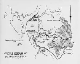
Item is a map showing the watersheds of Diana Lake, Rainbow Lake and Prudhomme Lake.
Item is a map that distinguishes the regions covered by Tree Farm Licence No. 1 granted to Columbia Cellulose and Three Farm Licence No. 40 granted to Skeena Kraft. Major locations indicated in this map include: Prince Rupert, Terrace, Hazelton, Smithers, Kitimat, Skeena River, and Nass River. Railway routes are also shown.
Item is a map of British Columbia and is a key map showing: maps published on scale 1 inch to 2 miles and summary zones of the provincial forest inventory. Map includes index of post offices correct to October 22, 1956.
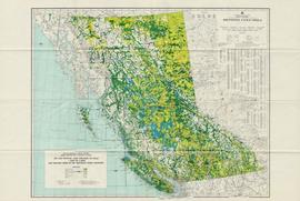
Item is a map of British Columbia's Status of Sustained-Yield Forestry Programme as at 31 December 1962. The map has been annotated to show forest area surveyed by Celgar Ltd. as base for new kraft mill.
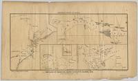
Pope, Frank L. “Sketch Map Showing the Proposed Route of the Western Union Telegraph Between Fort Frazer and the Stekine River, British Columbia. From exploration by the party under the command of Maj. Frank L. Pope Ass’t Engineer, 1866.
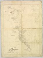
Wyld, James. "Map of the Colony of New Caledonia and the British & American Territory West of the Rocky Mountains including Vancouvers Island and the Gold Fields" by James Wyld, Geographer to the Queen & the Prince Consort, Charing Cross East & 2 Royal Exchange, London, July 16, 1858.
Map depicts the city of Prince George Boundary expansions since incorporation in 1915.
Map depicts the city of Prince George Boundary expansions since 1913.
Map depicts the city of Prince George with annotations of the boundary expansions from 1915 to 1964.
Map depicts boundaries of study areas, including major study area, community study area, and the city of Prince George boundaries.
Map depicts the city of Prince George boundary expansions from 1913 to 1974.
Map depicts to Canadian federal electoral districts for the 1993 federal election.
The item is a map that depicts subdivision lots along the Fraser River in Prince George. The subdivision is DL 745 and 747 of the Cariboo District. Map is certified by G. F. Templeton, a BC land surveyor.
The item is a reproduction of a section of survey map drafted on 18 March 1915 and revised on 23 May 1916. The reproduction was likely created in 1990. The Plan Number is 1268 and highlights the area along the Nechako and Fraser Rivers. The map details subdivisions East of Carney Street, North of Twentieth Avenue and South of Ninth Avenue. Annotations in pencil state different map scale variations and "cemetery setback."
The item is a reproduction of a section of survey map drafted in 1915. The reproduction was likely created in 1990. The Plan Number is 1268 and highlights the area along the Nechako River. The map details subdivisions East of Carney Street and North of Fifth Avenue. Some original street and avenue names have been crossed out and replaced with handwritten names. Annotation on reverse side of map states, "D.L. 343 Pl. 1268."
The item is a reproduction of a survey map drafted on 1 March 1910. The reproduction was likely created in 1990. The area highlighted is along the Fraser River. The map details subdivisions East of Ninth Street and South of Thapage Lane. Land Surveyor J. F. Templeton certified the plan. Annotation on the map states, "Pl. 727."
The item is a reproduction of a survey map drafted in January 1910. The reproduction was likely created in 1990. The subdivision is Lot 936 G. I. Cariboo District, B.C. The area covered is North of Twenty First Avenue, East of Quinn Street, South of Eighth Avenue and West of Carney Street. Annotations highlight "Owner Edgar McMickiny," "696" and "Jordan Brothel" written in red pen pointing to a specific location.
The item is a reproduction of a survey map drafted in September 1909. The reproduction was likely created in 1990. The annotations highlight owners of different lots up to approximately 1959. Th area covered is North of Fifteenth Avenue, East of Irwin Street, South of Eighth Avenue and West of Carney Street. Annotations on attached papers indicate different means of scale and measurement for the map.
The item is a reproduction of a survey map drafted in approximately 1911 and revised in May 1914. The reproduction was likely created in 1990. The annotation states, "Plan 1391" and is circled in red ink. The area covered is along the Nechako and Fraser Rivers and Northeast of First Avenue.
The item is a reproduction of a survey map drafted on 10 July 1956 and registered on 31 Oct. 1956. The reproduction was likely created in 1990. The plan number is 7782.
The item is a reproduction of a survey map drafted in July 1914. The reproduction was likely created in 1990. The area covered is along the Fraser River and east of Guelph Street. Annotations state, "PL 1409 D. L. 417 HBCo." and highlight different scales of measurement and changed street names.
The item is a reproduction of a survey map drafted in 1 Oct. 1913. The reproduction was likely created in 1990. The area covered is along the Fraser River and west of Linooln Avenue, south of Jackson Street and North of McKinley Street. Annotations state which maps and lots are adjacent to this one. An illegible signature is highlighted.
The item is a reproduction of a survey map drafted June 1912. The reproduction was likely created in 1990. The area covered is Central Fort George, South of 5th Street, East of Alden Avenue, North of 12th Street and West of Fraser Street. Annotations state, "Plan 1085 Carney Addition."
The item is a reproduction of a survey map drafted on 20 Nov. 1910. The reproduction was likely created in 1990. The subdivision is lot 2610 G. I. and part of lots 2507 and 2608 G. I. Cariboo District. The area covered is South of 8th Avenue, East of 19th Avenue, North of 8th Street and West of Quinn Street. Annotations state, "Pl. 847," and various notations regarding lot information.
The item is a reproduction of a survey map drafted on 29 Oct. 1910. The reproduction was likely created in 1990. The area covered is South of Princess Street, East of James Avenue, North of 8th Street and West of Rupert Avenue. Annotations state, "Jesse Hodgeson Crown grand in 1910 for $800..."
The item is a reproduction of a survey map likely drafted in the 1910s. The reproduction was likely created in 1990. The area covered is South of Baillie Street, East of 22nd Avenue, North of Princess Street and West of 7th Avenue. Annotations state, "Pl. 833" and various lot descriptions.
The item is a reproduction of a survey map drafted on 27 July 1910. The reproduction was likely created in 1990. The area covered is South of Reserve Avenue, East of Victoria, North of Bird Avenue and West of 9th Street. Annotations state, "#796" and highlight the date and registered owner.
