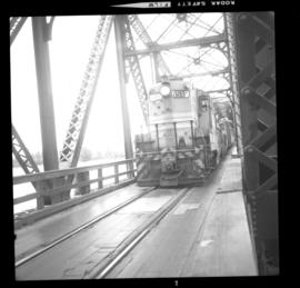
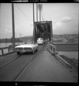
Photograph depicts the CPR Mission Bridge on the Huntingdon Branch. It shows the daily southbound way freight train at about 12:30 hours STD time, crossing the bridge. The train consisted of two locomotives, about 35 cars, and a 1920 wooden caboose. The lead locomotive was CPR 8510, GM class 0-4-4-0, built in 1954. There is a 10 mph speed restriction on the bridge.
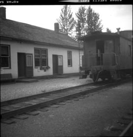
Photograph depicts the CPR at the Huntingdon/Sumas border (BC/Washington State border). A Mission way freight train is standing at about 5 pm, ready to return to Mission. The photo shows CP caboose #436733, built in 1920 out of wood. The border is about 10 ft. behind the camera.
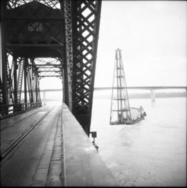
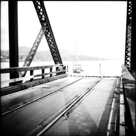
Photograph depicts the CPR Mission Bridge on the Huntingdon branch. The photo was taken from the open swing span looking downstream, with a tug and derrick (Fraser River Pile Driving Co.) fast disappearing downstream. The new road bridge in the background is about to be opened in late June 1973.
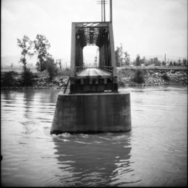
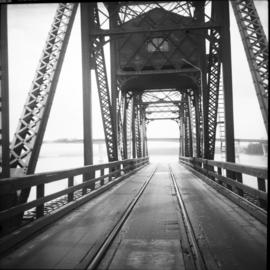
Photograph depicts the CPR Mission Bridge on the Huntingdon Branch. It shows the final box span of the bridge on the south shore, as viewed from the opened swing span. The span opened for river traffic every 2 or 3 days. The view is looking south, with downstream to the right.
Photograph depicts the CPR Mission Bride on the Huntingdon branch. The photo was taken from the open swing, and shows a tug and derrick passing swiftly downstream in the north channel of the opening. The span opens about every 2 or 3 days for river traffic.
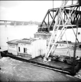
Photograph depicts the CPR Mission Bridge on the Huntingdon branch. The span opened to allow downstream passage of a tug and derrick, which passed at about 6 to 8 knots because of the freshet. Tow started at federal wharf at Mission City. The span opens for river traffic every 2 or 3 days. The view is looking east and upstream.
Photograph depicts the CPR Mission Bridge on the Huntingdon branch. The swing span is in an open position and the view is looking west and downstream. A new road bridge to be opened within the month is in the background. The bridge cabin holds a gas engine that turns the span in about 60 seconds.
Photograph depicts the Mission City rail and road bridge. It is owned by the CPR and was opened in 1891. It was used by road vehicles between 1 July 1927 and the 23 June 1973, using a one way flow system. On the latter day, a new high level road bridge was unofficially opened. By early July 1973, the CPR had removed the wooden deck planking.
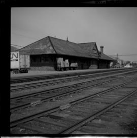
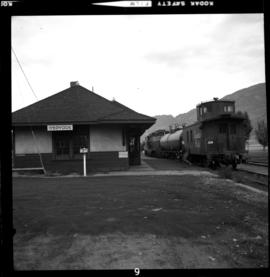
Photograph depicts the joint CPR and CN depot at Vernon. The depot office had three employees working inside. Vernon is at mile 46.2 from Sicamous, on the Okanagan Subdivision of the CPR. It has daily way freight.
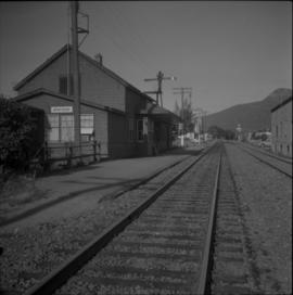
Photograph depicts the CPR depot at Armstrong. It is located about mile 32 from Sicamous on the Okanagan Subdivision. The view is looking south.
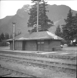
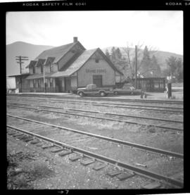
Photograph depicts the derelict CPR depot at Hope, part of the former Kettle Valley line. A spur of about 3 miles still exists between the Odlum junction with the main line on the north side of the Fraser River and this depot, and continues southeast to a point near the CNR. It is not abandoned, but little used. The Hope yard has a 47 car capacity.
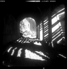
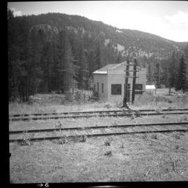
Photograph depicts the interior of a snow shed at about mile 29.0 using CPR mileages commencing at Brookmere, which is 4 miles east of Brookmere. It is on the ex CPR Coquihalla Line from Hope to Brodie Junction.
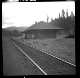
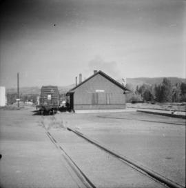
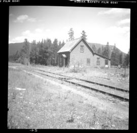
Photograph depicts the CPR line at Brookmere, 30 miles south of Merritt (now mile 108.7 on the Princeton Subdivision). Summit point is at 3200 ft. between Spences Bridge, Hope, and Princeton. The Kettle Valley Railway carved out a railway town in the wilderness in 1914/1915 to hold about 300 people. The men were train crews and track a gangs, particularly for the troublesome Coquihalla route. The photo includes the boarded up depot and the view is looking north.
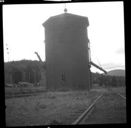
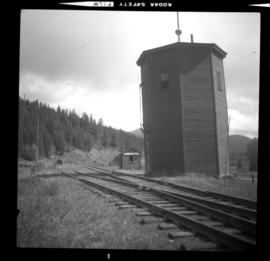
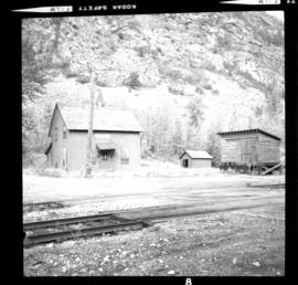
Photograph depicts an abandoned water tower on CPR line at Brookmere, 30 miles south of Merritt. The trackage on the right has had the spikes removed but the yard consists of a mixture of completely removed, partially removed, and completely undisturbed track. An elderly couple and 2 elderly bachelors are the only year-round remaining inhabitants.
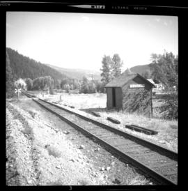
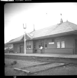
Photograph depicts the CPR line at Coalmont, BC, located about 12 miles north of Princeton and at mile 82.2 from Penticton. Close by was the former Blakeburn Coal Mine, which operated until 1940. The view is looking south.
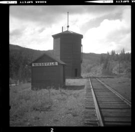
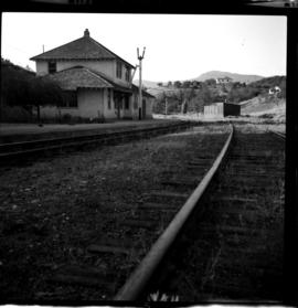
Photograph depicts the CPR line at Kingsvale, at mile 120.2 on the Princeton Subdivision between Brookmere and Merritt. It has a loop for 19 cars and sees one freight a day on Tuesday and Thursday. The view is looking north.
Photograph depicts the CPR line at Kingsvale, at mile 120.2 on the Princeton Subdivision between Brookmere and Merritt. It has a loop for 19 cars and sees one freight a day on Tuesday and Thursday.
Photograph depicts the CPR Princeton depot. The view is looking east.
Photograph depicts the CPR depot at Merritt. When the Spences Bridge to Merritt branch line was first built its principal traffic was coal taken from the mines on the south edge of the city. As late as 1923 Middlesborough Mine produced 75,862 tons/year.
Photograph depicts the West Summerland CPR station in the Okanagan. The station often was used but not permanently manned. It was located at mile 9.5 from Penticton. The view is looking south.
Photograph depicts the disused CPR Kettle Valley Railway line in Penticton. The trackage leads from the lakefront to the main yards. All the track was removed by July 1981. The view is looking northeast to the lake and the Incola Hotel.
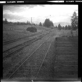
Photograph depicts the CPR rail Belfort depot passing point, approximately 5 miles north of Princeton, on the Princeton to Penticton line. The view is looking south.
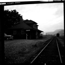
Photograph depicts the Penticton CPR depot. The view is looking northwest.
Photograph depicts the CPR Faulder depot on the Kettle Valley Railway. It is located at mile 15.5 from Penticton, on the Princeton Subdivision.
Photograph depicts the CPR Kettle Valley Railway line at Osprey Lake, approximately 38.8 miles from Penticton, at the summit between Penticton and Princeton. The passing line was removed between 1956 and 1966. A small spur holding 5 cars remains and it was used to store a heavy crane to replace bridge members. The elevation at this point is 3, 606 ft.
Photograph depicts the CPR Osoyoos station and the arrival of the daily (except Sunday) way freight train from Penticton. The depot is at about mile 36.1.
Photograph depicts the CPR line at Osoyoos at the BC Tree Fruits Ltd. warehouse and spur. This is about 1 mile north of the depot. The daily freight train from Penticton is returning from Osoyoos, having just collected 1 boxcar of fruit, backing onto caboose. This is approximately at mile 35.4 from Penticton.
Photograph depicts the CPR depot at Okanagan Falls, located at mile 10.6 from Penticton. The depot is locked and unused but it used to be the southern terminus of Skaha Lake when the line first opened in 1922. When the route along the edge of Skaha Lake was built, the Okanagan lost its barge and car slips in 1931. There is also a water pump at the right of the depot.
Photograph depicts the CPR line at Arawana, 5 miles northeast of Penticton and at mile 125.7 on the Carmi Subdivision. The photo shows the ruins of the station house and Okanagan Lake in the background. The passing loop in the foreground has been disconnected and partially dismantled. The rear track was used once or twice weekly by the way freight train between Penticton and Midway. The view is looking west.
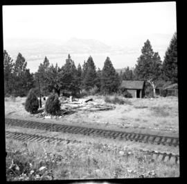
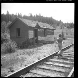
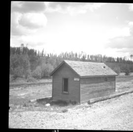
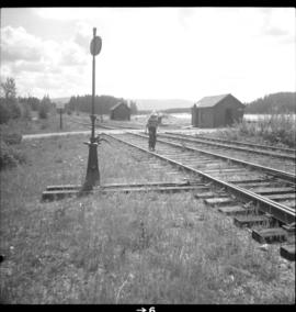
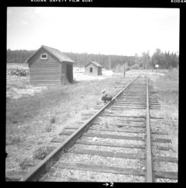
Photograph depicts the CPR line at Arawana, 5 miles northeast of Penticton. It was formerly a depot and water stop, then a passing loop and spur, and now nothing. The building in the photo is a typical track trolley shanty.
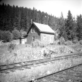
Photograph depicts the Chute depot at mile 106.5 on the CPR line in the Carmi Subdivision. It is a totally isolated location, but not reachable by road. The photo shows the only surviving large building. The rail here is dated 1942.
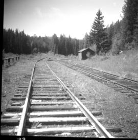
Photograph depicts the CPR depot at Chute Lake, on the Carmi Subdivision. It is located at mile 106.5 and 13.5 miles north of Penticton. The photo shows the passing track and the base of a former water tower is just behind the camera at the left. The rail here is dated 1942.
Photograph depicts Myra depot on the CPR Kettle Valley line. The depot is at mile 83.8 and is only 8 miles from Kelowna but 2800 ft. above it. Trevor Davies, aged 8 3/4, is in the foreground.
Photograph depicts the McCulloch CPR depot at mile 76.6 on the Carmi Subdivision. The depot was painted blue inside. The last passenger train was seen 17 January 1964 and the last freight train on the 19 May 1973.
Photograph depicts the McCulloch CPR depot located at mile 76.7 on the Carmi Subdivision, which is about 27 miles northeast of Penticton. The building on the right is the passenger depot, which was last officially used in January 1964. The view is looking south on the downgrade.
Photograph depicts the McCulloch CPR depot located at mile 76.7 on the Carmi Subdivision, which is about 27 miles northeast of Penticton. The rear building is the passenger depot, which was painted blue inside. The view is looking north.
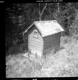
Photograph depicts the washrooms on the west side of the line, about a quarter mile from the McCulloch CPR depot building. The depot is located at mile 76.6 on the Carmi Subdivision.
Photograph depicts a section shanty at the CPR McCulloch depot located at mile 76.6 on the Carmi Subdivision. The rail here is Canada Algoma, 85 lbs. and dated to 1940. The view is looking southeast, with Hydraulic Lake in the background.
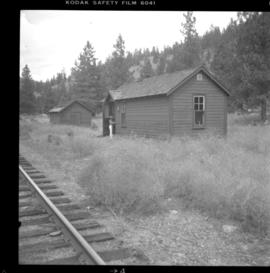
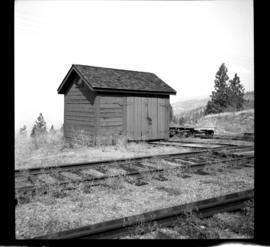
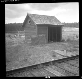
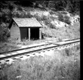
Photograph depicts a track shed about 1 mile south of Beaverdell or at about mile 43.25 on the CPR line in the Carmi Subdivision. Despite the open doors and ease of access, it was the only hut on the line found to contain track materials and correspondence. It retained 50 memos addressed to the Section Foreman [at Beaverdell?].
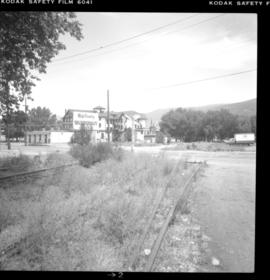
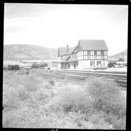
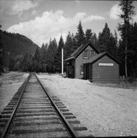
Photograph depicts the Westbridge CPR depot on the Kettle Valley Line. It is located about 11 miles north of Rock Creek and at about mile 123.3 east of Penticton. The depot house is disused and the sidings contained no cars, so there appears to be no local traffic.
Photograph depicts a booster telegraph relay station at Carmi. Carmi is located at mile 46.6 on the CPR line on the Carmi Subdivision. This is the only surviving telegraph pole between Penticton and Beaverdell. The view is looking east.
Photograph depicts the Carmi Depot located at mile 46.6 on the CPR line in the Carmi Subdivision. This is the only surviving building at the depot. The layout here consisted of 4 passing/storage tracks and 1 short siding. The view is looking north and upgrade.
Photograph depicts the Midway CPR depot located at the eastern terminus of Kettle Valley Railway. It was a subdivisional point with way freights originating at Nelson and Penticton, and running west and east respectively to Midway. There are two to 3 freights weekly from Nelson and 1 to 2 from Penticton. It lost its agency in June 1969 and all small freight [
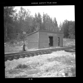
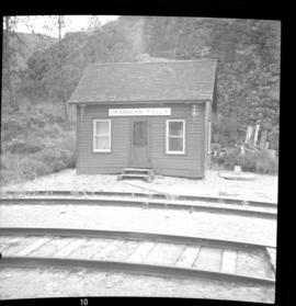
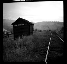
Photograph depicts the CPR line at Boundary Falls, which is at mile 121 from Nelson on the Boundary Subdivision. The view is looking west and it shows the former flag stop shelter.
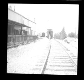
Photograph depicts the CPR line at Greenwood. There is no representative of the CPR in Greenwood now and the agency expired in June 1969. There appears to be 2 to 3 way freights per week from Nelson to Midway. The view is looking north and shows the depot house.
Photograph depicts the Grand Forks CPR depot, located at mile 94.8 on the Boundary Subdivision, which runs from Nelson to Midway (127 miles). It was originally built by the Columbia & Western Railway in 1899. IT has not seen a passenger train in years but it is still in use for administrative purposes.
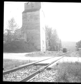
Photograph depicts the a grain elevator at Wynndel, located at mile 73.8 on the CPR line on the Nelson Subdivision. It is between Creston at mile 67.2 and Kootenay Landing at mile 83.1. Grain elevators are rare in BC and this one belongs to the United Grain Growers. The view is looking east.
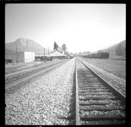
Photograph depicts the Fernie CPR station, located at mile 34.7 on the Cranbrook Subdivision, which runs from Crowsnest to Cranbrook. In coal mining days this was a busy place but now it has sidings for 153 cars and nothing else. The view is looking east.
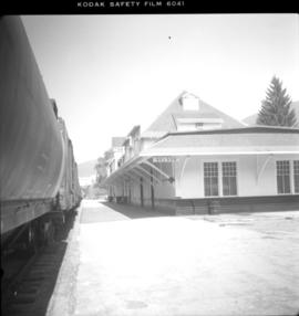
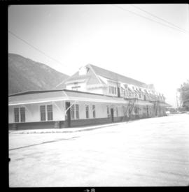
Photograph depicts the Nelson CPR depot, built in 1899. Since there are no passenger trains, freights used the front line, adjacent to the depot. The photograph was taken from the platform and shows a view looking east.
Photograph depicts the Nelson CPR depot, built in 1899 and still well-maintained. Streetcars had a terminal in this yard from 1899-1949, for what was probable the shortest street car system in Canada. The view is looking north and shows the rear view.
