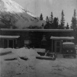
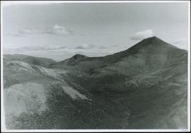
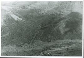
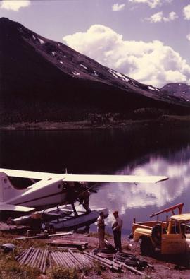
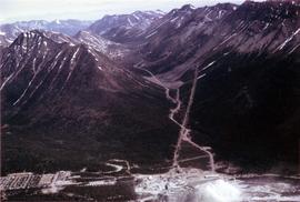
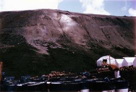
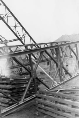
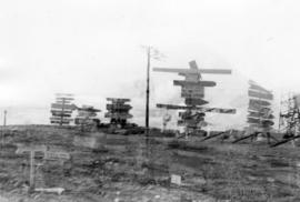
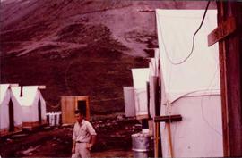
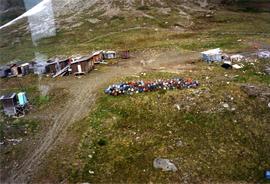
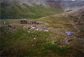
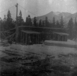
Photograph depicts first bunkhouse with lumber piles and power pole in foreground, trees and mountains in background.
Photograph depicts cookery building with truck on right, in front of door. Snow-covered lumber piles and machinery in foreground, trees and mountain in background.
Photograph depicts cookery and bunkhouse buildings from side angle. Three trucks in foreground, unidentified object on right, trees and mountains in background.
Photograph depicts tent structures in the early construction camp at Cassiar. Snow-covered area in foreground, trees in background.
Photograph depicts snow-covered mountain north of townsite, partially covered in shadow. Photo taken from north road in plant site, snow-covered road in foreground, trees behind road.
Photograph depicts range of hills, clouds in background.
Photograph depicts hill, trees in foreground.
Photograph depicts range of hills, trees at base.
Photograph depicts range of hills. Trees in valley, clouds in background.
Photograph depicts range of hills, trees in valley.
Photograph depicts range of hills, trees in valleys.
Photograph depicts valley in Kutcho Creek area, exploration camp in distance at foot of hill. The camp was set up by a crew led by Cassiar's Chief Geologist Bill Plumb.
Photograph depicts man believed to be Matt Bell standing in Kutcho Creek exploration camp. The camp was set up by a crew led by Cassiar's Chief Geologist Bill Plumb. Tents on either side, wood structure in background. Sign on wood post: "PLUMB BLVD."
Photograph depicts valley in Kutcho Creek area, exploration camp in distance. Body of water in foreground, mountains in background. The camp was set up by a crew led by Chief Geologist Bill Plumb.
Photograph believed to have been taken near Kutcho Creek, BC during an outside exploration trip led by Cassiar's Chief Geologist Bill Plumb. Bill stands to left of man believed to be Matt Bell in right foreground. Bulldozer works along talus slope in left foreground.
Bulldozer works along talus slope in centre of image. Photograph believed to have been taken near Kutcho Creek, BC during an outside exploration trip led by Cassiar's Chief Geologist Bill Plumb.
Photograph depicts a valley in the Kutcho Creek area with an exploration camp in the distance at the foot of a hill. The camp was set up by a crew led by Cassiar's Chief Geologist Bill Plumb.
Photograph depicts an exploration camp in the valley at the Kutcho Creek area in B.C. The camp was set up by a crew led by Cassiar's Chief Geologist Bill Plumb.
Photograph depicts steel drums and wooden buildings at an exploration camp in the Kutcho Creek valley area of B.C. The camp was set up by a crew led by Cassiar's Chief Geologist Bill Plumb.
Photograph depicts steel drums and wooden buildings at an exploration camp in the Kutcho Creek valley area of B.C. The camp was set up by a crew led by Cassiar's Chief Geologist Bill Plumb. An arrow points to a possible burial site.
Photograph depicts Bill Plumb at recently excavated wall of serpentinite with cross fracturing filled with asbestos fibre. Handwritten annotation on note attached to photo: "Chief Geologist Wilfred M Plub at Discovery at Clinton Creek 1963 + or -."
Photograph depicts man believed to be Matt Bell at recently excavated wall of serpentinite with cross fracturing filled with asbestos fibre. Photograph speculated to have been taken at Clinton Creek, Y.T.
Photograph depicts a geologist's hammer, believed to belong to Cassiar's Chief Geologist Bill Plumb. The hammer provides a scale for the exposed asbestos, indicating the percent of fibre in the rock as well as the expectation of grade.
Photograph depicts Cassiar's Chief Geologist Bill Plumb and unidentified man standing on shore by yellow Cassiar supervisor's truck. Airplane is parked on lake behind them, and miscellaneous equipment lies on shore at Bill's feet. Photograph speculated to have been taken at Aeroplane Lake, approximately 35 miles east of Cassiar. Bill Plumb led many expeditions for the purposes of Cassiar's outside exploration endeavours.
Photograph depicts Cassiar's Chief Geologist Bill Plumb and unidentified man standing on shore by yellow Cassiar supervisor's truck. A third man stands on Airplane parked on lake behind them, and miscellaneous equipment lies on shore at Bill's feet. Photograph speculated to have been taken at Aeroplane Lake, approximately 35 miles east of Cassiar. Bill Plumb led many expeditions for the purposes of Cassiar's outside exploration endeavours.
Bulldozer works along talus slope in top right of image. Photograph believed to have been taken during an outside exploration trip led by Cassiar's Chief Geologist Bill Plumb.
Photograph depicts a geologist's hammer, believed to belong to Cassiar's Chief Geologist Bill Plumb. The hammer provides a scale for the exposed asbestos, indicating the percent of fibre in the rock as well as the expectation of grade.
Photograph depicts the Cassiar mine valley in north mountain range. Plant and tailings pile can be seen in right foreground, and the east end of the town is visible in left foreground. Photograph speculated to have been taken during the plane ride of an outside exploration trip.
Photograph depicts the Cassiar town in foreground, mine valley and north mountain range in background. Photograph speculated to have been taken during the plane ride of an outside exploration trip.
Photograph depicts the Cassiar valley, showing the east end of town in foreground. Plant and tailings pile can be seen in right midground. Photograph speculated to have been taken during the plane ride of an outside exploration trip.
Photograph depicts a tent camp with lumber and steel drums nearby. A mountain is in the background.
Photograph depicts a cinnamon bear and Andre Beguin with camera on a rocky hill. Mountains in background.
Photograph depicts a ridge showing asbestos fibers.
Side view of the wet end of mazza machine.
Operator loading Asbestos into feeder at Welshpool Asbestos Mill in Australia.
Handwritten annotation on recto of photograph: "POURING RIBS JUNE 29/64." Photograph depicts construction workers on large wooden framework structure extending from base of crusher building. Ladders stand parallel to structure against mountainside. The boom of a crane is visible in foreground. Miscellaneous construction equipment and materials throughout.
Handwritten annotation on recto of photograph: "FORMING FOOTING RETAINING WALL JULY 4/64." Photograph depicts construction workers
standing in forms for cement laid against mountain wall on high elevation of construction site. A retaining structure made with wood planks and rebar separates mountainside dirt from cement forms. A front end loader can be seen in midground, near unidentified building. Mountain range in background.
Photograph depicts large square model of the new mill building that was built at the Cassiar plant site in 1970. Model is displayed on green material laid on floor against wall in unidentified room. Machinery modeled inside the structure is colour-coded.
Photograph depicts large square model of the new mill building that was built at the Cassiar plant site in 1970. Model is displayed outdoors on a platform that stands on four saw horses. Machinery modeled inside the structure is colour-coded. Plant buildings and mountains in background.
Photograph depicts large square model of the new mill building that was built at the Cassiar plant site in 1970. Model is displayed on platform draped with green material. Machinery modeled inside the structure is colour-coded.
Photograph depicts crane in Cassiar plant site, steel framework for dry rock storage building in background.
Photograph depicts top of framed building, mountain in background.
Photograph depicts foundation of building in Cassiar plant site. Dump truck on left, steel framed building on right, crane in background.
Photograph depicts corner of steel framed roof of building in Cassiar plant site, mountains in background.
Photograph depicts crane in Cassiar plant site, steel framework for dry rock storage building in background.
Photograph depicts steel materials for framework of dry rock storage building, mountains in background.
Photograph depicts numerous illegible sign posts on dirt road.
Photograph depicts valley and mountain range, speculated to be the Cassiar valley.
Photograph depicts crushed vehicle in wooded area.