Print preview Close
Showing 4130 results
Archival description
Maps, plans, and drawings
Maps, plans, and drawings

Visual notes from the 2020 Public Health Summer Institute
Central Fort George townsite
Central Fort George townsite
J. Kent Sedgwick fonds
J. Kent Sedgwick fonds
East Line
East Line
Penny
Penny
Geography and Natural Resources
Geography and Natural Resources
Census areas
Census areas
Photographs
Photographs
Prince George street names
Prince George street names
BC and Alberta Locations and Topics
BC and Alberta Locations and Topics
Separated photographs
Separated photographs
Research Subject Files
Research Subject Files
Parks and Outdoor Recreation
Parks and Outdoor Recreation
"Journal and Report of Preliminary Explorations in British Columbia"
"Journal and Report of Preliminary Explorations in British Columbia"
Cottonwood Island and Island Cache
Cottonwood Island and Island Cache
Quesnel, Barkerville, and Wells
Quesnel, Barkerville, and Wells
Fort Alexandria
Fort Alexandria
Flooding in Prince George
Flooding in Prince George
Mount Sir Alexander
Mount Sir Alexander
Peace River region
Peace River region
McLeod Lake
McLeod Lake

"British Columbia's Skeena Salmon"
Maps & Oversize
Maps & Oversize
Cottonwood Island
Cottonwood Island
Connaught Hill
Connaught Hill
Prince George downtown walking tour for BCHF 2003 Conference
Prince George downtown walking tour for BCHF 2003 Conference
Communities along the East Line
Communities along the East Line
Prince George cemeteries
Prince George cemeteries
Cameron Street Bridge, Prince George
Cameron Street Bridge, Prince George
Fur Trade
Fur Trade
Interior rainforest
Interior rainforest
Peyto Glacier
Peyto Glacier
UNBC Upper Fraser Historical Geography Project
UNBC Upper Fraser Historical Geography Project
UNBC School of Planning and Sustainability fonds
UNBC School of Planning and Sustainability fonds
Guest lecture on historical geography in New Caledonia
Guest lecture on historical geography in New Caledonia
"Bella Coola area Invasive Plants Distribution as per IAPP data - Feb. 19"
"Bella Coola area Invasive Plants Distribution as per IAPP data - Feb. 19"
![City of Prince George - Schedule C of the Official Community Plan - Long Range Land Use Map [May 2008 Amendment]](/uploads/r/northern-bc-archives-special-collections-1/4/3/a/43a9e75941f1542735d999de340307d163e79dffdadbf4546bb9346b63f7e734/2023.5.1.41_-_2008_May_-_City_of_Prince_George_Long_Range_Land_Use_Map_JPG85_tb_142.jpg)
City of Prince George - Schedule C of the Official Community Plan - Long Range Land Use Map [May 2008 Amendment]
Dominion Land Survey system
Dominion Land Survey system
Hatley Park, Victoria
Hatley Park, Victoria
Inventory of Prince George and region maps
Inventory of Prince George and region maps
"Central Coast Regional District (CCRD) - Blueweed, Broadleaf Plantain, Bull Thistle and Burdock"
"Central Coast Regional District (CCRD) - Blueweed, Broadleaf Plantain, Bull Thistle and Burdock"
Sutherland Colony in Brooks, Alberta
Sutherland Colony in Brooks, Alberta
Walking tour of the Millar Addition
Walking tour of the Millar Addition
Pre-emption crown land grants
Pre-emption crown land grants
The Duke of Connaught
The Duke of Connaught
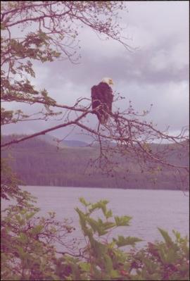
Bald eagle perched on branch above a body of water at Skidegate, BC
Fort George Canyon
Fort George Canyon
UNBC Upper Fraser Historical Geography Project
UNBC Upper Fraser Historical Geography Project
"Central Coast Regional District (CCRD) - Scentless Chamomile, Sheep Sorrel, Spotted Knapweed, St Johns Wort, Thistle spp, Water Hemlock, Western Goats beard, Wildlife Mustard, Yellow Toadflax"
"Central Coast Regional District (CCRD) - Scentless Chamomile, Sheep Sorrel, Spotted Knapweed, St Johns Wort, Thistle spp, Water Hemlock, Western Goats beard, Wildlife Mustard, Yellow Toadflax"