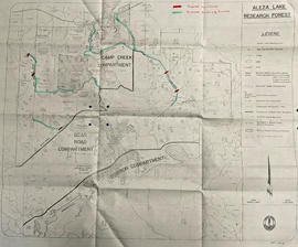
Map depicts historical rail lines in the BC lower mainland, including trackage for the BC Electric Railway, the Canadian Northern Pacific Railway, the Canadian Pacific Railway, the Great Northern Railway, and the Pacific Great Eastern Railway, among others.
Item is a hand-drawn map of a plot in the Aleza Lake Research Forest. Individual trees are marked and numbered.
Item is a small-scale reproduction of a BC Forest Service Aleza Lake Research Forest map.
Item is a hand-drawn map of a plot in the Aleza Lake Research Forest. Individual trees are marked and numbered.
Map depicts the province of British Columbia. Includes rail lines and historical notes about the province.
Item is a hand-drawn map of a plot in the Aleza Lake Research Forest. Individual trees are marked and numbered.
Item is a photocopied and annotated Aleza Lake Forest map with forest cover labels.
This map is part of Schedule B of the 1993 Official Community Plan, Bylaw No. 5909 for the City of Prince George. This particular map depicts the east area of the City of Prince George, including the Prince George Airport (YXS) and the Blackburn area.
The item is a map that depicts lot plans for the Central Fort George townsite. Reproduction of map originally produced in 1938.
This map is part of Schedule B of the 1993 Official Community Plan, Bylaw No. 5909 for the City of Prince George. This particular map depicts the northeast area of the City of Prince George, including the industrial areas on Prince George Pulpmill Road and Northwood Pulpmill Road along the Fraser River.
Item is a forest cover map for Aleza Lake Research Forest (Special Use Permit 19070). Shows experimental plots and timber sale areas.
Item is a photocopied Aleza Lake Forest map with forest cover labels annotated to show 1994 RFP study area.
Map depicts to Canadian federal electoral districts for the 1993 federal election.
This map is part of Schedule B of the 1993 Official Community Plan, Bylaw No. 5909 for the City of Prince George. This particular map depicts the central area of the City of Prince George, including the Bowl area, the VLA, the Crescents, South Fort George, Heritage, and Peden Hill.
This map is part of Schedule B of the 1993 Official Community Plan, Bylaw No. 5909 for the City of Prince George. This particular map depicts the northwest area of the City of Prince George, including the North Nechako neighbourhood and the Hart.
This map is part of Schedule B of the 1993 Official Community Plan, Bylaw No. 5909 for the City of Prince George. This particular map depicts the southwest area of the City of Prince George, including College Heights, UNBC, University Heights, and Vanway.
Map reflects forest type boundary line, bogs and swampy non-forested areas, creeks, lakes, rivers, tree species labels of spruce, balsam, and birch, stand descriptions, historical timber sale boundaries, stand history symbol, gravelled secondary roads, unimproved old roads, management compartment boundary, research forest boundary, ecological reserve boundary, and old growth emphasis areas.
Item is a Forest Cover Map, 93J-7, annotation on the back reads Summit Lake. Geographical features include Summit Lake and Crooked River.
Large scale map shows Aleza Lake Research Forest permanent sample plot 103. Includes information about live and dead trees and their species (spruce, balsam, birch, douglas fir). Also includes remeasurement history. Plot 103 was established in 1926 and is an unlogged, old growth, uneven aged, spruce-balsam stand.
Large scale map shows Aleza Lake Research Forest permanent sample plot 112. Includes information about live and dead trees and their species (spruce, balsam, birch, douglas fir). Also includes remeasurement history. Plot 112 was established in 1926 and is an unlogged, old growth, uneven aged, spruce-balsam stand.
Tourist map of Prince George depicts city area, including railway trackage.
Mylar map is a plot map of a research plot at the Aleza Lake Research Forest. Provides date the plot was established, the harvest history, the silviculture history, remeasurement history, and information about individual trees.
Map reflects forest type boundary line, bogs and swampy non-forested areas, creeks, lakes, rivers, tree species labels of spruce, balsam, and birch, stand descriptions, historical timber sale boundaries, stand history symbol, gravelled secondary roads, unimproved old roads, management compartment boundary, research forest boundary, ecological reserve boundary, and old growth emphasis areas.