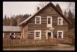
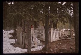
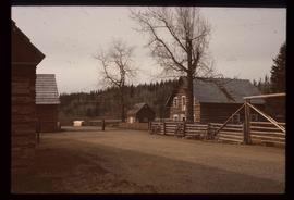
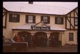
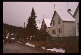
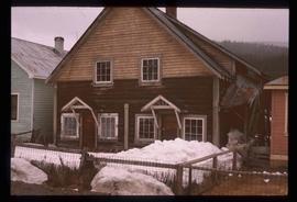
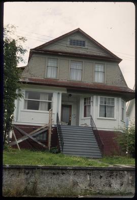
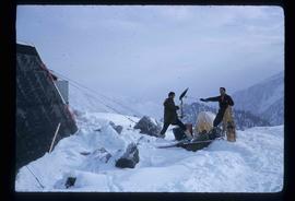
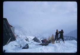
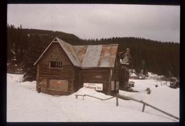
Image depicts the historic Lightening Inn in Stanley, B.C.
Image depicts an old, rotting grave marker in the Stanley Cemetery.
Image depicts a street in Wells, B.C. The Wells Hotel is present in the image.
Image depicts the Wells Museum in Wells, B.C.
Image depicts the Cariboo Road passing through the Cottonwood House Historic Site.
Image depicts the Cottonwood House.
Image depicts the Watson Mansion.
Image depicts the post office in Wells, B.C.
Image depicts the Centennial Hall in Wells, B.C.
Image depicts the town of Stanley, B.C.
Image depicts the Stanley Cemetery.
Image depicts the Cottonwood House.
Image depicts a crowd of people outside the Wells Hotel in Wells, B.C.
Image depicts a row of houses in Wells, B.C.
Image depicts a duplex in Wells, B.C.
Image depicts a street in Wells, B.C. The Sunset Theatre is located on the left of the image, and the Jack O' Clubs Hotel is the building with the green roof on the right. The hotel burned down on February 14th in 1994.
Image depicts a house at an unknown location. It is possibly an old, Australian styled home.
Image depicts an old theatre owned by Paul Aivazoff in Prince Rupert, B.C. It opened in 1935 and was closed in 1981; it has since been renovated for retail use.
Image depicts a condominium, possibly in Prince Rupert, B.C.
Image depicts a house which is possibly in Prince Rupert, B.C.
Image depicts a row of houses; it is possibly in Prince Rupert, B.C.
Image depicts the rail yards in Prince Rupert.
Image depicts an old building with a sign labelling it as a "Dining Lounge," it is possibly in Prince Rupert, B.C.
Image depicts Bobtail Lake.
Image depicts Pineview on Buckhorn Lake Road, Prince George, B.C.
Image depicts a marker for aerial photography at an uncertain location. The slide labels it as "Elizabeth Station."
Image depicts a road located somewhere near Birken, B.C.
Image depicts the Place Glacier.
Image depicts an unknown individual at the Place Glacier.
Image depicts the mostly frozen Place Creek Falls.
Image depicts two unknown individuals at the Place Glacier.
Image depicts some power lines and a forest somewhere near Birken, B.C.
Image depicts the Place Glacier. There are two unknown individuals present.
Image depicts two unknown individuals at the Woolsey Glacier.
This very large drawing shows CN leases and private property buildings on Island Cache in detail.
Zonder titelImage depicts an unidentified individual setting up some sort of pole in the snow for a process the slide labels as "snow sounding." The location is uncertain.
Image depicts a snow-covered cabin and a mountain in the distance. It is located somewhere near Birken, B.C.
Image depicts a mountain in the distance. It is located somewhere near Birken, B.C.
Image depicts a road located somewhere near Birken, B.C.
Image depicts the Place Glacier.
Image depicts the Place Glacier. There are two unknown individuals present.
Image depicts two unknown individuals at the Woolsey Glacier.
Image depicts a helicopter flying over the Woolsey Glacier.
Image depicts an unidentified individual standing next to a marker and a stake at an uncertain location.
Image depicts objects, including a flag pole, that the slide labels as "survey equipment." The slide also places it as a "Peyto icefall," on the Peyto Galcier in the Banff National Park in Alberta, B.C.
Image depicts a scenic view of a mountain and forest at an uncertain location.