File consists of a transcript of an oral history interview with Sandra Trolian.
File consists of a transcript of an oral history interview with John and Bernice Trick.
File consists of a transcript of an oral history interview with Erwin Stoll.
File consists of a transcript of an oral history interview with Horst Sander. Also includes photocopies of Horst Sander's personal records, such as a tree farm license.
File consists of a transcript of an oral history interview with Louisa Mueller. Also includes photocopies of Louisa Mueller's personal records, such as photographs.
File consists of a transcript of an oral history interview with Linda Mueller.
File consists of a transcript of an oral history interview with Mike Moore.
File consists of a transcript of an oral history interview with Coralee Madden.
File consists of a transcript of an oral history interview with Earl Lousier and Harry Gairns.
File consists of a transcript of an oral history interview with Raymond Lee.
File consists of a transcript of an oral history interview with Andre Laquerre.
File consists of a transcript of an oral history interview with Doug Homme. Also includes photocopies of Doug Homme's personal records, such as photographs.
File consists of a transcript of an oral history interview with Joyce and Brian Hards.
File consists of a transcript of an oral history interview with Arturo Garcia-Alonso.
File consists of a transcript of an oral history interview with Doug Frazier and Linda McFarlane.
File consists of a transcript of an oral history interview with Julie Fisher.
File consists of a transcript of an oral history interview with Heather (Scott) Empey.
File consists of a transcript of an oral history interview with Mr. and Mrs. Cox.
File consists of a transcript of an oral history interview with Cy Bechtel.
File consists of a transcript of an oral history interview with Ivan Andersen.
File consists of an audio recording of an interview with Sandra Trolian. Includes one original recorded audio cassette and two copies.
File consists of an audio recording of an interview with John and Bernice Trick. Includes one original recorded audio cassette and one copy.
File consists of an audio recording of an interview with Erwin Stoll. Includes one original recorded audio cassette and one copy.
File consists of an audio recording of an interview with Horst Sander. Includes two original recorded audio cassettes and two copies.
File consists of an audio recording of an interview with Louisa Mueller. Includes two original recorded audio cassettes.
File consists of an audio recording of an interview with Linda Mueller. Includes one original recorded audio cassette and one copy.
File consists of an audio recording of an interview with Mike Moore. Includes one original recorded audio cassette and one copy.
File consists of an audio recording of an interview with Coralee Madden. Includes three copies of the original recorded audio cassette; the original recording is not held by the archives.
File consists of an audio recording of an interview with Earl Lousier and Harry Gairns. Includes two original recorded audio cassettes.
File consists of an audio recording of an interview with Raymond Lee. Includes one original recorded audio cassette and one copy.
File consists of an audio recording of an interview with Andre Laquerre. Includes one original recorded audio cassette.
File consists of an audio recording of an interview with Joyce and Brian Hards. Includes one original recorded audio cassette and one copy.
File consists of an audio recording of an interview with Arturo Garcia-Alonso. Includes two copies of the original recorded audio cassette; the original recording is not held by the archives.
File consists of an audio recording of an interview with Doug Frazier and Linda McFarlane. Includes one original recorded audio cassette tape and one copy.
File consists of an audio recording of an interview with Julie Fisher. Includes one original recorded audio cassette and one copy.
File consists of an audio recording of an interview with Heather (Scott) Empey. Includes one original recorded audio cassette and one copy.
File consists of an audio recording of an interview with Mr. and Mrs. Cox. Includes one original recorded audio cassette and three copies.
File consists of an audio recording of an interview with Cy Bechtel. Includes one original recorded audio cassette and two copies.
File consists of an audio recording of an interview with Ivan Andersen. Includes one original recorded audio cassette and one copy.
The Upper Fraser Historical Geography Project was conducted by UNBC faculty and a team of researchers between 1999 and 2002. The lead researchers were Aileen Espritiu, Gail Fondahl, Greg Halseth, Debra Straussfogel, and Tracy Summerville. The project resulted in the creation of 93 oral history records and their transcripts. Participants included regional forest industry executives, politicians (including former MLA Ray Williston, local mayors and Fraser Fort George Regional District representatives), forest industry workers, and former and contemporary Upper Fraser community residents. The oral histories document the rise, consolidation and demise of the forestry-based settlements along the Upper Fraser River between 1915 and 2000.
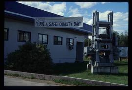
Image depicts the office at the Northwood Upper Fraser Saw Mill and a sign which reads "Have a safe, quality day." Map coordinates 54.117916, -121.943351
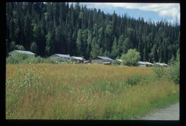
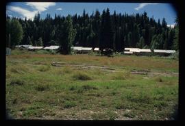
Image depicts a row of houses in Upper Fraser, B.C. Map coordinates 54°06'51.6"N 121°56'26.3"W
Image depicts a row of houses in Upper Fraser, B.C. Map coordinates 54°06'51.6"N 121°56'26.3"W
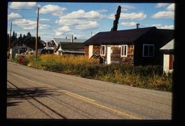
Image depicts a house in Upper Fraser with the residential area in the background. Map coordinates 54°07'02.8"N 121°56'37.5"W
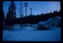
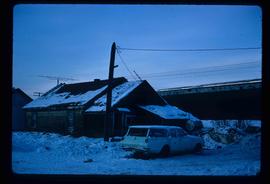
Image depicts a vehicle parked beside a small, wooden house in Upper Fraser, B.C. Map coordinates 54°07'05.7"N 121°56'38.9"W
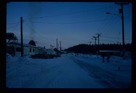
Image depicts several unidentified individuals walking along the snow-covered Upper Fraser Road with numerous buildings on either side. Map coordinates 54°07'05.7"N 121°56'38.9"W
Image depicts a row of buildings in Upper Fraser, B.C. with the store (titled "Paradise") with a Pepsi sign. Map coordinates 54°07'09.1"N 121°56'47.0"W
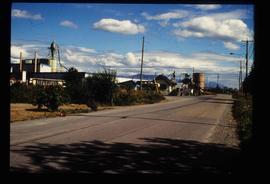
Image depicts the Upper Fraser Road running through Upper Fraser, B.C. A newer style round burner is seen in the background. Map coordinates 54°07'05.7"N 121°56'38.9"W
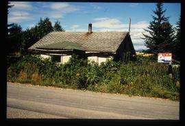
Image depicts an old house for sale surrounded by overgrown bushes in Upper Fraser, B.C. Map coordinates 54°07'15.0"N 121°57'02.0"W
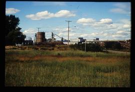
Image depicts numerous log decks at the Upper Fraser sawmill. Map coordinates 54°07'10.8"N 121°56'51.7"W
