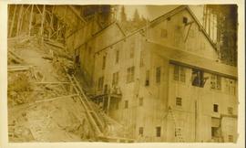
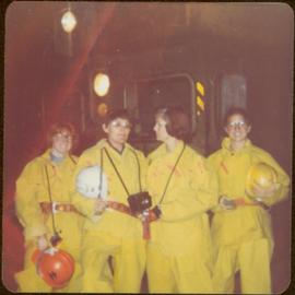
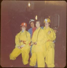
The photographs depict the geographic areas of Stewart, BC, Boundary Pass, Nelson River, Bitter Creek Glacier, Portland Canal, Red Cliff and Bear Creek; as well as the ships “Camosun” and “S.S. Prince George.” Types of subjects identified in this collection include: community life, surveying, mining and transportation (i.e. dog-sledding, horse and buggy, and the Portland Canal Short Line Railway “P.C.S.L. Rlwy”).
3 results with digital objects
Show results with digital objects
2011.13
·
Collectie
·
[between 1910 and 1930]
2011.13.58
·
Stuk
·
ca.1910-ca.1930
Part of Parker photograph collection
Photograph is a printed postcard depicting an unidentified mining building situated on a hillside surrounded by mining debris. Possibly located in Stewart B.C.
2009.6.13.45.29
·
Stuk
·
9 Mar. 1976
Part of The Honourable Iona Campagnolo fonds
Map depicts existing harbour development in Stewart, with an enlargement of the west side of the harbour.
2009.6.1.174
·
Stuk
·
1977
Part of The Honourable Iona Campagnolo fonds
Machinery visible in background.
Handwritten annotations on verso read: “Stewart, B.C.,” and “Bottom: at Granduc Copper mine with Mary Schindel, I drove the ‘Mitzie’”.
2009.6.1.175
·
Stuk
·
1977
Part of The Honourable Iona Campagnolo fonds
Machinery visible in background.
Handwritten annotation on verso reads: “John Lundquist, Mary Schindel”.
2009.7.3
·
Reeks
·
1878-1929
Part of Archdeacon W. H. Collison fonds
Maps within this series document the placer streams, islands and harbours of the Queen Charlotte Islands; as well as the mining properties located within the vicinity of Stewart, BC.