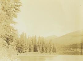
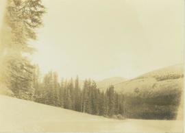
Photograph depicts a large water filled ditchline with a steamshovel and forested landscape in the background.
File consists of research material regarding railway water delivery structures, which predominantly consist of photocopy reproductions, excerpts from books, and clippings from periodicals. Includes schematic drawings of water delivery structures; information on water crane standpipes, enclosed water tanks, and steel water tanks; and a 1993 Canadian Rail article by Heaman entitled "Water--A Railway Necessity: Western Lines Increase Supply".
Item is an original typescript entitled "Water Delivery by an Irrigation District" by J.C. Wilcox and C.H. Brownlee.
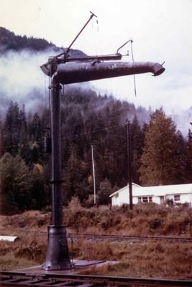
Photograph depicts a water crane on the southwest side of the Pacific Great Eastern station at Pemberton.
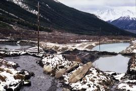
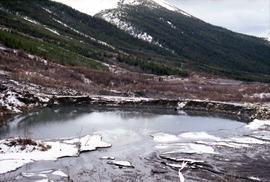
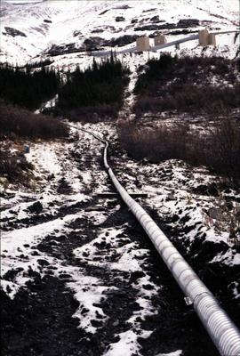
File contains 3 strips of negatives depicting water control structures inluding pipes, culverts, and holding ponds. The strips were found in a photo lab pouch annotated "Sedimentation Pond Sept 1991" and addressed to "Cassiar Mining Corp. Attn; R. Tyne."
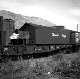
Photograph depicts water car #415319 standing on a little used spur in Nelson. It consists of a locomotive tender mounted on a flat car. It could be used as a firefighting unit, but it is merely lettered "service."
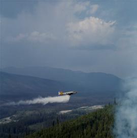
Photograph depicts a water bomber plane close to a fire near Clinton Creek.
Two people walking across ice, Nunavut
Men talk in doorway of small building, dog stand out front, Bell Rock, Northwest Territories
People standing at edge of unidentified lake in fore-midground with snowy mountain range in background
Northwest Territories
Marmot? sitting upright
Arctic ground squirrel sitting on the ground
Shadows of a group of people watchnig a stream bed from an overhead bridge
Bird circling overhead, Nunavut
Clearcut hillside
Photograph depicts benches of Cassiar's open mine. Men can be seen standing near machinery speculated to be blasthole drills in bottom left of image. Handwritten annotation on recto of photograph: "Waste Stripping Operations on McDame Mt. Ore Mining in lower right Corner.", on verso: "1961".
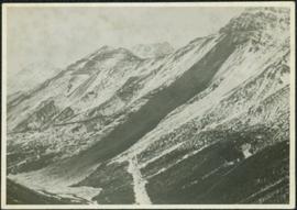
Photograph depicts large swath of dark waste down mountainside to right of valley. The waste dump is believed to be visible at top of swath on right of image. Bench mining visible on the North and South peak in background. Handwritten annotation on recto of photograph: "Oct. 25 / 65 4:25 PM."
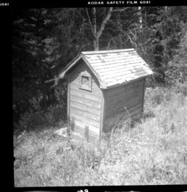
Photograph depicts the washrooms on the west side of the line, about a quarter mile from the McCulloch CPR depot building. The depot is located at mile 76.6 on the Carmi Subdivision.
Grouse ? animal tracks on the snow
Habitat of shrubs and trees and limited groundcover
File consists of:
- Canadian Rail issue no. 447 (July-August 1995) which is devoted to Canada's Railways in World War II
- Article by David Davies, "Wartime Freight in BC in WWII, 1939-1945"
- Summary piece by David Davies, "What happened in British Columbia in WWII? 1939-1945: A Review of Military Events"
Button badge promotes W.A.R.P.—Women Against Rising Prices—which was formed in Bramalea, Ontario on Feb. 15, 1979.
Warning sign on edge of Buttle Lake, Strathcona Provincial Park, Vancouver Island, British Columbia
File contains correspondence to Brian Fawcett from Warner Winter. Includes a letter to Brian Fawcett from Warner Winter, Head of the English Department in the Emery Collegiate Institute, requesting Brian's presence to assist with their celebrations of the 25th anniversary. Letter dated September 1, 1985.
Autumnal foliage at base of mountain range
Winter landscape
File contents relate to: Accounting / Payroll, Cassiar Warehouse. Document type(s) include: binder.
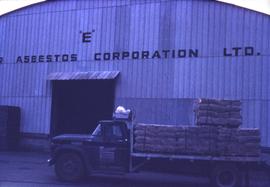
Photograph depicts a truck carrying pallets of asbestos in front of the Cassiar Asbestos Corporation warehouse.
File contents relate to: Accounting / Payroll. Document type(s) include: time cards.
File contents relate to: Accounting / Payroll. Document type(s) include: time cards.
File contents relate to: Accounting / Payroll. Document type(s) include: time cards.
File contents relate to: Accounting / Payroll. Document type(s) include: time cards.
File contents relate to: Accounting / Payroll. Document type(s) include: time cards.
File contents relate to: Accounting / Payroll. Document type(s) include: time cards.
The item is a photograph reprint originally taken between 1967 and 1975. The photograph depicts Prince George's war memorial cenotaph in front of City Hall. The address is 1100 Patricia Boulevard
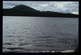
Image depicts War Lake.
Printed Material within this file are:
- Canada and the War: A New World Order.
- Punishment for War Crimes: The Inter-Allied Declaration Signed at St. James's Palace, London, on 13th January, 1942, and Relative Documents
- The Inter-Allied Review Index Vol. 1, 1941
- The Inter-Allied Review: United for Victory
- The Peace for Which We Fight. Toward New Horizons: No.3.
Photograph depicts Wapiti lake surrounded by an unidentified mountain range and a forested shoreline.
Photograph depicts Wapiti Lake surrounded by unidentified mountains and a forested shoreline.

