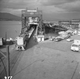
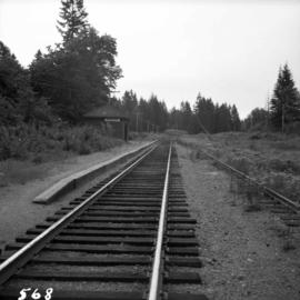
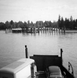
Photograph depicts a view of the Fraser River from the Albion Ferry from Haney to Fort Langley. The ferry is approaching the south bank of Fort Langley. Gulls sat on logs floating downstream; too heavy to rise after eating candlefish.
Photograph depicts the north bank of False Creek in Vancouver, B.C. The photograph was taken from the Cambie Bridge, with a view looking west.
Photograph depicts a mine 200 yards south of Moyie village, which is 20 miles south of Cranbrook. It produced silver, zinc, and lead from 1900-1910 and had a smelter a quarter mile away. The shaft was 900 ft. deep, with levels going under Moyie Lake. The head gear dates from 1925-1935 and has electric winding.
Photograph depicts a Ruston steam roller owned by Gary Wellburn in Duncan, BC
Photograph depicts a horse drawn hay rack in a field on the north slopes of Vedder Mountain, near Yarrow.
Photograph depicts the mine buildings of the mine at Coal Creek that closed in 1959. The newer buildings date to circa 1930. Much of the standard gauge trackage of Morrissey, Fernie, and Michel railway (subsidiary of the Great Northern Railway) in mine area remains. The track between Coal Creek and Fernie has not been lifted.
Photograph depicts the fire hall at Lillooet, including an old hand drawn hose reel carrier.
Photograph depicts the C.P.R. Shuswap Depot east of Kamloops.
Photograph depicts the water tower at the C.P.R. Savona Depot. The view is looking east towards Kamloops.
Photograph depicts a disused water tower 50 yards from the C.P.R. Shuswap Depot, looking west towards Kamloops.
Photograph depicts the C.P.R. Savona Depot looking east.
Photograph depicts the C.P.R. wharf-scow approach ramp at Kelowna, looking east. Okanagan Lake is behind the camera.
Photograph depicts the C.P.R. station at North Bend, B.C., from a view looking north.
Photograph depicts a C.P.R. way-freight at the disused Wellington Depot on the Esquimalt and Nanaimo Railway, 4 miles north of Nanaimo.
Photograph depicts a view of former C.P.R. steam locomotive sheds at North Bend, B.C. in the Fraser Canyon.
Photograph depicts the C.P.R. station at Spences Bridge. The view is looking south at a departing freight train.
Photograph depicts the C.P.R. depot at Spences Bridge. The view is looking south and shows a northbound freight train moving along the track.
File consists of documentary photographs taken by David Davies of public railways, mainly belonging to the Canadian Pacific Railway in British Columbia.
Photograph depicts Craigellachie station, a famous spot on the C.P.R. line. The trans-continental line was joined here on November 7, 1885, about 250 yards down the track just beyond the right hand colour aspect signal. The depot house is not manned, used by the line side crews to store equipment. In former days it was a passing point, but there are very few houses in the area now.
Photograph depicts the C.P.R. Glacier Station at the entrance to the west portal of Connaught tunnel under Rogers Pass. The station was built of logs about 1916-1920. The view is looking west.
Photograph depicts the end of the old Coal Harbour extension of the C.P.R. line from Vancouver. It was disused for several years. The view is looking east with Woodward's Marina behind.
Photograph depicts the C.P.R. terminal in Vancouver. A C.P.R. switcher is collecting cars from the "Princess of Vancouver" at about 7 p.m.
Photograph depicts the C.P.R. station at Golden, B.C. The view is looking east.
Photograph depicts the C.P.R. station at Invermere on the Golden-Cranbrook line, looking southwards. It is called the "Lake Windermere Station" built in 1916 of logs. The last mixed passenger train ran in 1962.
Photograph depicts the C.P.R. depot at Canal Flats on the Golden-Cranbrook line. The ex box car depot now is used only to make line phone calls.
Photograph depicts the C.P.R. depot at Princeton, looking east.
Photograph depicts the C.P.R. station at Invermere in the Kootenays. There is a trolley off the track on the road and the way freight switching at the station. Golden is to the left, Cranbrook is to the right, and the station building is at the immediate left.
Photograph depicts the C.P.R. station at Merritt, halfway between Spences Bridge and Brockmere Junction. The line is in active use.
Photograph depicts the Courtenay terminus of the Esquimalt and Nanaimo Railway. The view is looking north.
Photograph depicts the Cameron Lake station on the Alberni branch of the Esquimalt and Nanaimo Railway on Vancouver Island. It is no longer used but has been converted to a lodge. The view is looking west.
Photograph depicts the Malahat station on the Esquimalt and Nanaimo Railway line, 20 miles north of Victoria on Vancouver Island. The view is looking south and there are no houses anywhere in the vicinity.
Photograph depicts the Nanaimo passenger depot of the Esquimalt and Nanaimo Railway (at right) and the E & N freight shed (at left).
Photograph depicts the junction station of the Esquimalt and Nanaimo Railway at Parksville on Vancouver Island. The view is looking south.
Photograph depicts the Bowser water tower on the Esquimalt and Nanaimo Railway, 25 miles south of Courtenay. The view is looking north.
Photograph depicts the Dunsmuir crossing on the Esquimalt and Nanaimo Railway on Vancouver Island. It is 15 miles north of Parksville.
Photograph depicts the C.P.R. station in Abbotsford, looking south.
Photograph depicts Sirdar station belonging to the C.P.R. It is at the south end of Kootenay Lake and 11 miles north of Creston. There is a little used turntable behind the depot. The view is looking south.
Photograph depicts the C.P.R. depot at Oliver. There is a way freight stopped at the depot, either before or after switching.
Photograph depicts the C.P.R. freight depot at Spences Bridge. It also shows caboose #436581, built in 1913. The view is facing east towards Merritt.
Photograph depicts a view looking east from the end of the C.P.R. track at Coal Harbour in Vancouver, B.C.
Photograph depicts a former C.N.R. station at Youbou on Lake Cowichan on Vancouver Island. The track is still used to serve the plywood lumber mill at Youbou.
Photograph depicts Koksilah depot of the Esquimalt and Nanaimo Railway on Vancouver Island. It is 2 miles south of Duncan and the view is looking north.
Photograph depicts the unused C.P.R. Shawnigan Lake section house on the Esquimalt and Nanaimo Railway. It is 27.8 miles outside Victoria.
Photograph depicts a two bay locomotive shed of the round-house style at Alberni on Vancouver Island.
Photograph depicts the Cobble Hill Station on the Esquimalt and Nanaimo Railway on Vancouver Island. The view is looking south.
Photograph depicts the C.P.R. train station at Kaslo. At one time the line ran between Kaslo and Nakusp, via New Denver. It was lifted in 1915-1920. The trackage now consists of Kootenay Lake slip and about 1 mile of sidings. It is used mainly for oil (incoming) and lumber (outgoing).
Photograph depicts the C.P.R. depot at Duncan on Vancouver Island, with a view looking northeast.
Photograph depicts the C.P.R. depot at Goldstream on Vancouver Island. The view is looking towards Victoria.
Photograph depicts sheds and repair center of the C.P.R. at Victoria, near Lime Bay. The rail-liner just came in from the daily run to Courtenay.
Photograph depicts the C.P.R. Cowichan depot on Vancouver Island. The view is looking south.