Item
·
1/1/1985
Part of Mary Fallis fonds
23680 results with digital objects
Show results with digital objects
2000.6.04.3.194
·
File
·
1975-1984
Part of Barry McKinnon fonds
File consists of issues of the literary periodical entitled "Waves", including volume 4 issue 1 through volume 12 issue 4 (incomplete).
2020.4.8.1.08.172
·
Item
·
1973
Part of G. Gary Runka fonds
2020.4.8.1.08.169
·
Item
·
1973
Part of G. Gary Runka fonds
2020.4.8.1.08.171
·
Item
·
1973
Part of G. Gary Runka fonds
2020.4.8.1.08.174
·
Item
·
1973
Part of G. Gary Runka fonds
1996.2.11.1.43
·
File
·
1978
Part of Brian Fawcett fonds
File consists of an M.A. thesis by Charles Watts entitled "The Vortex Nature of Ezra Pound's 'Rock-Drill': American Historical and Economic Elements in 'Section: Rock-Drill' and Annotations to Cantos 88 and 89".

2012.13.1.50.015
·
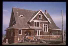
Item
·
1974
Part of J. Kent Sedgwick fonds
Image depicts the Watson Mansion at Mile 108 of Highway 97. It was built by Captain Geoffrey Watson in 1904, and was burned down by a chimney fire in 1983.
2012.13.1.6.082
·
Item
·
[197-?]
Part of J. Kent Sedgwick fonds
Image depicts the Watson Mansion.
2020.4.8.1.08.192
·
Item
·
1973
Part of G. Gary Runka fonds
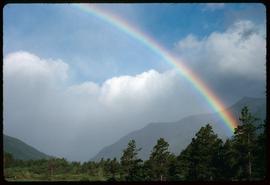
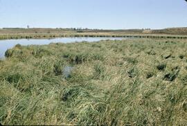
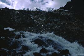
Item
·
6/1/1978
Part of Mary Fallis fonds
Waterton Glacier International Peace Park
2000.11.2.1875
·
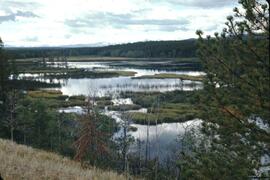
Item
·
June 1978
Part of Mary Fallis fonds
Waterton Lakes National Park, Alberta
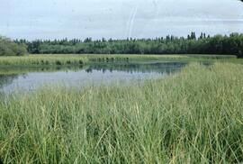
Item
·
6/1/1978
Part of Mary Fallis fonds
Waterton Lakes National Park, Alberta

2009.7.1.283
·
Item
·
1907
Part of Archdeacon W. H. Collison fonds
Wide angle view of Prince Rupert harbour taken from the water. Forest and mountains are visible in the background. Annotation on recto reads: "Prince Rupert BC '07."
2020.4.8.1.05.132
·
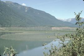
Item
·
1971
Part of G. Gary Runka fonds
2020.4.8.1.05.111
·
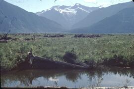
Item
·
Dec. 1970
Part of G. Gary Runka fonds
2020.4.8.1.04.108
·
Item
·
Sept. 1969
Part of G. Gary Runka fonds
2020.4.8.1.08.108
·
Item
·
1972
Part of G. Gary Runka fonds
2020.4.8.1.08.109
·
Item
·
1972
Part of G. Gary Runka fonds
2004.8.1.20
·
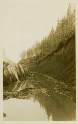
Item
·
[ca. 1935]
Part of Alexander Manson mining collection
Photograph depicts a large water-filled ditchline in front of a forested landscape.

2004.8.1.32
·
Item
·
[ca. 1935]
Part of Alexander Manson mining collection
Photograph depicts a large water-filled ditchline in front of a forested landscape.
2020.4.8.1.04.163
·
Item
·
[July 1969]
Part of G. Gary Runka fonds
2020.4.8.1.03.080
·
Item
·
[June 1968]
Part of G. Gary Runka fonds
2020.4.8.1.03.081
·
Item
·
[June 1968]
Part of G. Gary Runka fonds
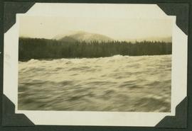
2009.7.1.160
·
Item
·
[ca. 1880 - ca. 1915]
Part of Archdeacon W. H. Collison fonds
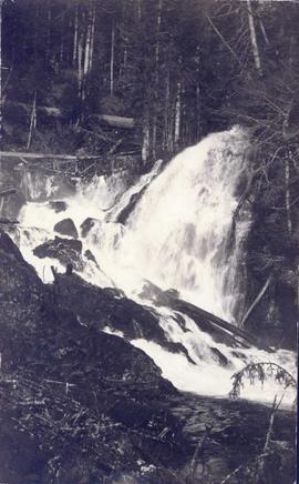
Photograph features rapids in foreground, trees and rocks in background.
Handwritten annotation on verso reads: "A waterfall on American side of the Canal. Chapt. XXVI Waterfall on Alaskan side of Portland Inlet."
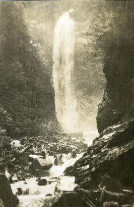
2014.10.1.461
·
Item
·
[ca. 1920]
Part of Arthur Holland Land Surveying Collection
Photograph depicts a waterfall on a rocky mountainside, an expanse of ocean in the foreground.
2014.10.1.457
·
Item
·
[ca. 1920]
Part of Arthur Holland Land Surveying Collection
Photograph depicts a waterfall on a rocky mountainside. There are snow peaked mountains in the distance.
2004.2.1.31
·
Item
·
1898-1920
Part of Reverend R.W. Large fonds
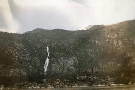
Photograph depicts a waterfall in a forested area with a riverbank in the foreground.

2004.2.1.33
·
Item
·
1898-1920
Part of Reverend R.W. Large fonds
Photograph depicts piles of wood planks and log booms in the foreground with a waterfall in the background.
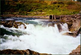
2008.3.1.22.38
·
Item
·
[ca. 1995]
Part of Bridget Moran fonds
Photograph depicts white rapids at bottom of waterfall in Bulkley River, B.C. Fishing territory visible on far right; hill on opposite shore in background.
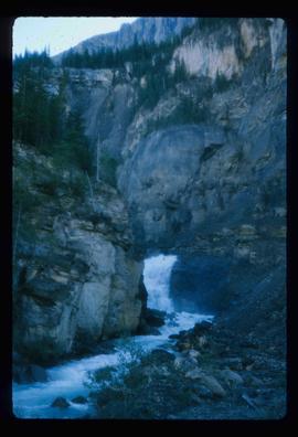
2014.10.1.454
·
Item
·
[ca. 1920]
Part of Arthur Holland Land Surveying Collection
Photograph depicts a waterfall and stream with rocky banks.

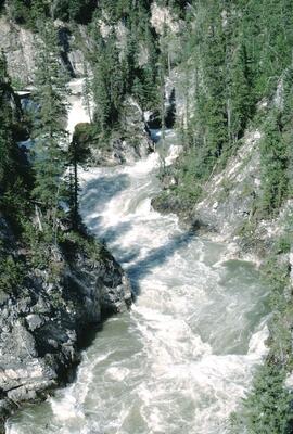
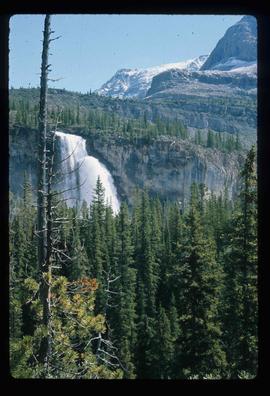
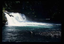
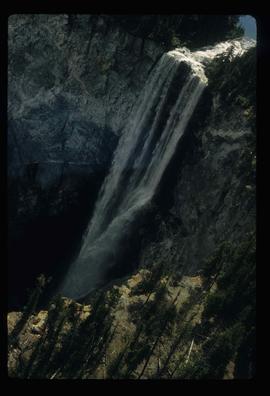
2012.13.1.56.15
·
Item
·
1973
Part of J. Kent Sedgwick fonds
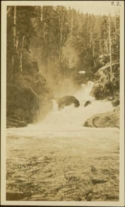
Image depicts a waterfall with a mountain peak in the background; it is most likely Mt. Robson.
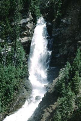
2012.13.1.56.10
·
Item
·
1973
Part of J. Kent Sedgwick fonds
Image depicts a waterfall in what is possibly the Robson River.
2012.13.1.56.12
·
Item
·
1973
Part of J. Kent Sedgwick fonds
Image depicts a waterfall on a mountain side in Mt. Robson Provincial Park.
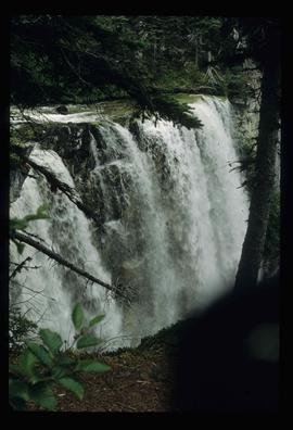
2012.13.1.46.40
·
Item
·
1980
Part of J. Kent Sedgwick fonds
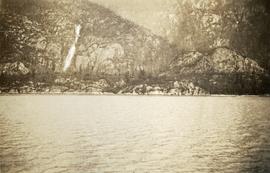
Image depicts a waterfall somewhere in South Tweedsmuir Provincial Park.
2012.13.1.84.41
·
Item
·
1994
Part of J. Kent Sedgwick fonds
Image depicts a small waterfall at an uncertain location.
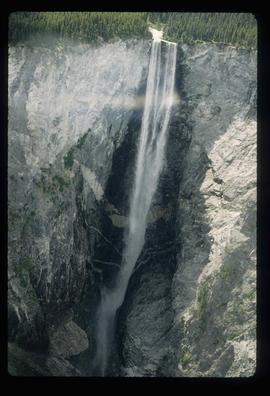
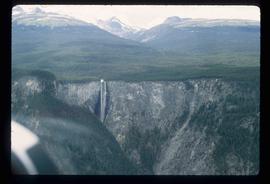
2012.13.1.46.17
·
Item
·
1980
Part of J. Kent Sedgwick fonds
Image depicts an aerial view of a waterfall in South Tweedsmuir Provincial Park.
2004.1.2.4.40
·
Item
·
ca. 1930
Part of Phipps-Mackenzie Collection
2012.13.1.46.16
·
Item
·
1980
Part of J. Kent Sedgwick fonds
Image depicts an aerial view of a waterfall in South Tweedsmuir Provincial Park.
2012.13.1.46.19
·
Item
·
1980
Part of J. Kent Sedgwick fonds
Image depicts an aerial view of a waterfall in South Tweedsmuir Provincial Park.
2020.4.8.1.05.090
·
Item
·
[June 1970]
Part of G. Gary Runka fonds
2000.1-0021-071
·
File
·
1980-1981
Part of Cassiar Asbestos Corporation Ltd. fonds
File contents relate to: Town Administration of Cassiar Townsite, Cassiar Mine - operation and administration. Document type(s) include: report. Notes: budget for projects.
Item
·
7/1/1980
Part of Mary Fallis fonds
Nunavut
2013.6.36.1.079.05
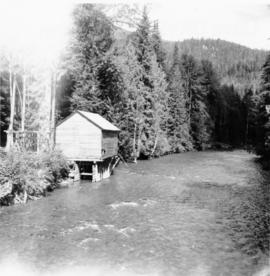
·
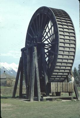
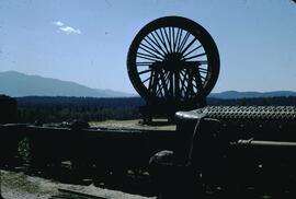
Item
·
[9 Sept. 1970]
Part of David Davies Railway Collection
Photograph depicts a working undershot water wheel on Lardeau Creek River. It was the only water wheel seen in B.C. between 1963 and 1970. It was designed to drive an electricity generating set, but it was not coupelled to the set at the time.
2020.4.8.1.03.144
·
Item
·
[July 1968]
Part of G. Gary Runka fonds
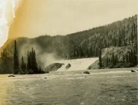
2004.1.2.1.12
·
Item
·
ca. 1930
Part of Phipps-Mackenzie Collection
Caption: "Parle Pas Rapids, Peace River"
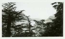
2009.21.29
·
Item
·
[ca.1932]
Part of Thomas Crosby Mission Ship Photograph Collection
Scenic landscape featuring mountains and water in background and treetops in foreground. Handwritten annotation on verso reads: "View of Bay from Hospital which was high upon a hill."
2013.6.35.46
·
Item
·
5 Feb. 1923
Part of David Davies Railway Collection
Contour plan shows layout of a water tunnel near Lyon's Creek in the CNR Clearwater subdivision.
2016.7.3.40.23
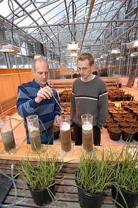
·
Item
·
2002
Part of Dr. Joselito Arocena fonds
2016.7.3.40.24
·
Item
·
2002
Part of Dr. Joselito Arocena fonds