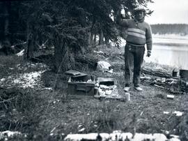
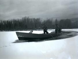
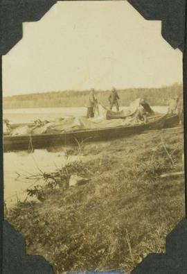
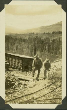
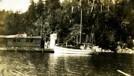
Previsualizar a impressão Fechar

Mostrar 54241 resultados

Archival description
21791 resultados com objetos digitais Mostrar resultados com objetos digitais
View up the Omineca River
2021.06.010 · Item · [Sept. 1930?]
Parte de Emil Bronlund Photograph Collection

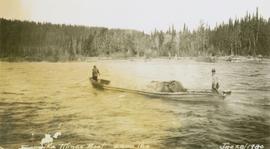
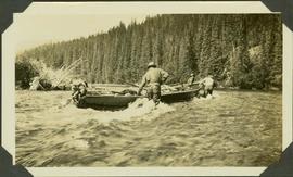
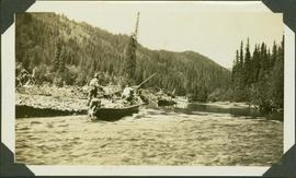
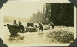
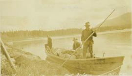
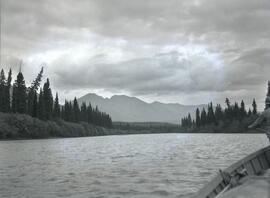
Photograph depicts a wide view of the Omineca River with a man standing on a boat in the right corner of the image. In the background the river a forested shoreline and mountain range are visible.

View west from camp on Duck Creek at Copper Mountain
2021.06.013 · Item · [July 1930]
Parte de Emil Bronlund Photograph Collection

Photograph depicts three men sitting in a circle in a clear area near a sparsely forested area in front of a snowy mountain range. The location of the photograph is noted to be at Duck Creek at Copper Mountain; however, those names may no longer be in current use. Location is assumed to be approximately 55.979291, -125.208415 near what is currently named Wasi Peak.

Alexander Manson mining collection
2004.8 · Coleção · 1930 - 1940

The Alexander Manson Mining Collection consists of 133 loose photographs documenting various aspects of the mining industry in Northern British Columbia between 1930-1940. Photographs show images of Manson Creek and Germansen Landing.

Sem título
Mary Gibson Henry publications
2008.27.1 · Dossiê/Processo · 1930-1999
Parte de Knox McCusker Collection

File consists of the following photocopied articles:

  • "Collecting Plants Beyond the Frontier in Northern British Columbia" by Mary Gibson Henry
  • "Exploring and Plant Collecting in Northern British Columbia" (1933) by Mary Gibson Henry
  • "A Thousand Miles Exploring on Horseback in Northern British Columbia" (1935) by Mary Gibson Henry
Toc H Group Photo, Kelowna, BC
2007.17.3.19 · Item · 1930
Parte de James Joseph Claxton Photograph Collection

Photograph depicts a formal portrait of a group of eighteen men standing outside the Kelowna Branch of the Toc-H Headquarters. Handwritten annotation written on paper adhered to verso reads: "Toc H. Kelowna. Front Row: Bill Brown, Owen Jones, Ford Martin, Les Harrison, Paul Wayze. Middle: Bill Benmore, Ches Coles, Bill Bredin, Bill Talbot, Larry Kelly, Lee Weston, Abie Ablott, ? Known to police only. Back: Roy Pollard, Ward Rennie, Ray Stone, Bill Hughes-Games, Joe Barns. Photo by member Bill McEwan, 1930"

2007.17.3.31 · Item · [ca.1930]
Parte de James Joseph Claxton Photograph Collection

Photograph depicts Sir Neville Chamberlain posed in full military attire. Photograph is most likely a copy print and/or a photograph taken of an image in a book or newspaper due to its extremely poor clarity. Handwritten annotation on verso reads: "Sir Neville Chamberlain, Inspector-General, R.I.C."

Totem Pole in park at Prince Rupert, BC
2009.7.1.049 · Item · [ca. 1930?]
Parte de Archdeacon W. H. Collison fonds

Photograph depicts a totem pole standing on what appears to be a large wooden deck or boardwalk, view of the city in background.

Handwritten annotation on verso reads: "Totem pole in park in Prince Rupert".

Emil Bronlund Photograph Collection
2021.06 · Coleção · 1930-1932

Emil Bronlund was in 1927 hired by Consolidated Mining and Smelting Ltd. (later known as Cominco) to take on the company's mining exploration in northern British Columbia, a position he held for almost 25 years. Bronlund had a Leica camera and took photographs during his exploratory trips.

This album of Bronlund's photographic negatives from 1930 to 1932 includes photographs of the following trips:

  • Trip to Osilinka River and Omineca River, July 1930
  • Copper Mountain on Duck Creek, July 1930
  • Wedge Creek, Sept. 1930
  • Finlay River, Finlay Forks, Parsnip River, and Crooked River, Oct. 1930
  • Prince George, Aug. 1930
  • Gola, Norway, Apr. 1931
  • Emil Bronlund and Frank Swannell survey crews at Thutade Lake, June 1931 and Sept. 1931
  • Cairn mining claim exploration for Consolidated Mining and Smelting Ltd., June-July 1931
  • Brothers Lake, Bronlund Peak, and Fredricksen Lake, July 1932
  • Sustut Lake, Sept.-Oct 1931
  • McLeod River trip, Mar.-Apr. 1932
Sem título
Lunch on Finlay River near Russell Creek
2021.06.025 · Item · Oct. 1930
Parte de Emil Bronlund Photograph Collection

Photograph depicts a sleeping dog and a man holding up a bottle standing between a small campfire and box filled with dishes. In the background of the image there is a forested landscape and a river to the right of the man.

Letter from Wolverhampton Director of Education
2001.14.2.1 · Item · 12 March 1930
Parte de Norah Banbery Doherty fonds

Letter from Wolverhampton Director of Education consists of 1 letter written to N.L. Banbery, 62 Limes Road, Tettenhall, Wolverhampton, by J.A. Warren, Director of Education, County Borough of Wolverhampton, North Street accepting Banbery's letter of resignation from the Technical School and College

Letters and Articles
2001.14.2 · Série · 12 March 1930 - c. 1963
Parte de Norah Banbery Doherty fonds

The Letters and Articles series consists of 1 letter written to N.L. Banbery by J.A. Warren, Director of Education, County Borough of Wolverhampton, 1 copy of an article written by Doherty for "Express and Star," 1 copy of an article written by Doherty for "S.T.U. Magazine," and 1 copy of an article written by Doherty for "The Woolpack"

Ingenika Mines boat
2004.1.2.4.16 · Item · 23 June 1930
Parte de Phipps-Mackenzie Collection

Annotation on recto: "Ingenika Mines boat, 6200lbs, Jne [sic] 23/1930; Ernie Wheeler". Photo depicts two men poling a freighting boat along the river.

Crooked River
2004.1.2.1.78 · Item · August 1930
Parte de Phipps-Mackenzie Collection

Item is a photograph of a survey crew poling down Crooked River with all their equipment on two boats.

Frogging on the Upper Ingenika
2004.1.2.1.82 · Item · 23 August 1930 [?]
Parte de Phipps-Mackenzie Collection

Item is a photograph of a five survey crewmen lining their boats in the Ingenika River. A.H. Phipps is on the right-front side of the boat.

Pre-Emptor’s Map, Tête Jaune Sheet
2008.2.1.17 · Item · 1931
Parte de Northern BC Cartographic Collection

Colour-coded map depicting surveyed lands respectively open and closed to preemption. Depicts land recording divisions, game reserves, communities, bodies of water, and transport routes. Includes inset of McBride townsite.

Swannell and Bronlund crews at Thutade Lake narrows
2021.06.055 · Item · [June 1931 or July 1931]
Parte de Emil Bronlund Photograph Collection

Photograph depicts a group portrait of Frank Swannell's and Emil Bronlund's crews surrounded by camping supplies, dogs, and a horse along the shore of Thutade Lake. Skook Davidson is in the back row in front of the horse. Frank Swannell is in the front row 3rd from left, petting a dog.

General correspondence
2008.27.6 · Dossiê/Processo · 1931-1955
Parte de Knox McCusker Collection

File consists of the following photocopied items:

  • Letter to Mrs. J. Norman Henry from G.G. Aitken, Chief Geographer (May 22, 1935)
  • Memorandum to Mr. F.H. Peters, Surveyor General (Topographical Survey of Canada) from R. W. Cautley, Acting Chief of Control Surveys (Dec. 17, 1931)
  • Letter to Mr. F.H. Peters, Surveyor General from F.C. Green, Surveyor General (June 22, 1932)
  • Letter to Mr. F.H. Peters, Surveyor General from Knox McCusker (Dec. 8, 1931)
  • Letter to Mr. F.H. Peters, Surveyor General from Knox McCusker (Dec. 2, 1931)
  • Letter to Mr. F.H. Peters, Surveyor General from Knox McCusker (Oct. 2, 1931)
  • Letter to unknown recipient from J. Norman Henry (Oct. 15, 1931)
  • Letter to K.F. McCusker from G.G.A. (G.G. Aitken?) Member on Geographic Board of Canada Representing B.C. (June 2, 1938)
  • Letter to unknown recipient from Gwen McCusker (Sept. 5, 1944)
  • Letter to Mrs. McCusker from Sgd. J. Clarke Williams on the occasion of the death of Knox McCusker (April 27, 1955)