Item is Map 1 of a group of five maps relating to a City of Prince George Study of Construction Aggregates by the firm Willis, Cunliffe, Tair & Company Limited. Map 1 shows development areas and population for 1984 and 1994. As the map is undated, it is unclear whether the 1984 and 1994 dates are future estimates.
Item is Map 5 of a group of five maps relating to a City of Prince George Study of Construction Aggregates by the firm Willis, Cunliffe, Tair & Company Limited. Map 5 shows drill hole locations.
This map is part of Schedule B of the 1993 Official Community Plan, Bylaw No. 5909 for the City of Prince George. This particular map depicts the northeast area of the City of Prince George, including the industrial areas on Prince George Pulpmill Road and Northwood Pulpmill Road along the Fraser River.
This map is part of Schedule B of the 1993 Official Community Plan, Bylaw No. 5909 for the City of Prince George. This particular map depicts the central area of the City of Prince George, including the Bowl area, the VLA, the Crescents, South Fort George, Heritage, and Peden Hill.
This map is part of Schedule B of the 1993 Official Community Plan, Bylaw No. 5909 for the City of Prince George. This particular map depicts the northwest area of the City of Prince George, including the North Nechako neighbourhood and the Hart.
This map is part of Schedule B of the 1993 Official Community Plan, Bylaw No. 5909 for the City of Prince George. This particular map depicts the southwest area of the City of Prince George, including College Heights, UNBC, University Heights, and Vanway.
This map is part of Schedule B of the 1993 Official Community Plan, Bylaw No. 5909 for the City of Prince George. This particular map depicts the east area of the City of Prince George, including the Prince George Airport (YXS) and the Blackburn area.
This map is part of Schedule B of the 1993 Official Community Plan, Bylaw No. 5909 for the City of Prince George. This particular map reflects the 1998 amendment to the Official Community Plan.
This map depicts the City of Prince George's plan for soil removal and deposit.
This map is the Schedule A accompanying map for the City of Prince George's Soil Removal and Deposit Bylaw No. 7022 of 1999. It depicts designated soil removal areas and M.O.T.H. gravel reserves.
This map is part of Schedule B of the 1993 Official Community Plan, Bylaw No. 5909 for the City of Prince George. This particular map reflects the 1998 amendment to the Official Community Plan.
This street map of the VLA area in Prince George includes property outlines and street numbers.
This map is the May 2006 amendment (Bylaw 7807) of the Schedule C of the 2001 Official Community Plan, Bylaw No. 7281 for the City of Prince George. This Schedule C map shows the long range land use for the City of Prince George.
This map is Schedule C of the 2001 Official Community Plan, Bylaw No. 7281 for the City of Prince George. This Schedule C map shows the long range land use for the City of Prince George.
This map is the October 2006 amendment (Bylaw 7807) of the Schedule C of the 2001 Official Community Plan, Bylaw No. 7281 for the City of Prince George. This Schedule C map shows the long range land use for the City of Prince George.
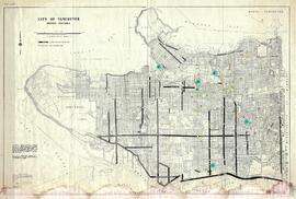
This municipal map of the City of Vancouver from 1987 shows street names and street widening information.
This map is the May 2008 amendment (Bylaw 8061) of the Schedule C of the 2001 Official Community Plan, Bylaw No. 7281 for the City of Prince George. This Schedule C map shows the long range land use for the City of Prince George.
Drawing depicts visual notes taken at the 2020 Public Health Summer Institute with the theme "Think Globally, Act Locally: Public Health and the Anthropocene". Themes related to the COVID-19 pandemic are depicted.
Map depicts the city of Prince George Boundary expansions since incorporation in 1915.
Map depicts the city of Prince George Boundary expansions since 1913.
Map depicts the city of Prince George with annotations of the boundary expansions from 1915 to 1964.
Map depicts the city of Prince George boundary expansions from 1913 to 1974.
Map depicts boundaries of study areas, including major study area, community study area, and the city of Prince George boundaries.
Map depicts to Canadian federal electoral districts for the 1993 federal election.
File consists of notes, reproductions, and clippings relating to the cemetery in Prince George. Includes: "Landscape of the Past: A brief history of the Prince George municipal cemetery" photocopied essay by Gary McKivett (1999); "RE: SFG cemetery" printed email from Robin and Barbara Fairservice to Kent Sedgwick (8 July 2008); "City of Prince George Memorandum" typescript document from the Heritage Advisory Committee (14 Mar. 1991); "The Prince George Family History Society" brochure (1991); and "City of Prince George by-law no.732" reproduction of a typescript document (Dec. 1953). Also includes "Plan of subdivision of part of Lot 925" a map reproduction depicting the lots beside the Fraser River and the original cemetery (1910).
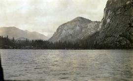
Photograph depicts a view of St'a7mes village looking north, taken from the original Government Wharf in Squamish (Newport). This wharf was built in 1902 and was temporarily replaced by other docks to the west built by the PGE Railway in 1913-14. This photograph was taken after 1914, since the houses in the photo were built by the PGE Railway Company as part of the 1914 reserves sale deal.
Further details that date this photograph between late 1914 and 1920:
- the Merrill & Ring logging operation beach camp is not depicted (opened in 1926)
- the dock from which the photo is taken fell into disrepair after 1914 and was not rebuilt until 1929.
File consists of clippings, notes, and reproductions relating to the Central Fort George townsite. File predominantly includes Kent Sedgwick's handwritten notes regarding land plots and development of Central Fort George. Includes: a map depicting Canadian National Railway plans along Hammond Street and the Fraser River (1936) and "Central Fort George lots" map depicting lot plans for the Central Fort George townsite (reproduced 1990).
File consists of clippings, notes, and reproductions relating to heritage homes in Central Fort George. Includes a "BC Rail" typescript letter from Dick Rowe at BC Rail to Kent Sedgwick (10 Nov. 1987); "Irene Jordan brothel location" handwritten notes by Kent Sedgwick (1990); and "Heritage inventory record" booklet describing heritage buildings in Prince George (1990). Also includes photographs depicting veteran housing on Burden Street in Prince George; a house at the address 510 Douglas Street in Prince George (2003); and Erle's Iron Works shop with a man outside welding the turrets for the Sikh temple (Aug. 1990).
Shows routes and ports of call from Smith Sound to Portland Canal including locations of many canneries and mines now no longer extent.
Accompanied by a 1942 job estimate cost summary sheet for the "Survey railway location west of Fairbanks" work to be done for the Alaska Western Railway project approved by a Colonel of the U.S. Army Corps of Engineers.
Series consists of an assortment of maps concerning Northern B.C. Included are topographic maps, pre-emptor’s and preliminary maps, physiographic maps, and resource (geological, game, etc.) maps.
The collection consists of an assortment of cartographic materials concerning Northern B.C. Included are topographic maps, pre-emptor’s and preliminary maps, physiographic maps, and resource (geological, game, etc.) maps.
File consists of maps and notes relating to the original Prince George city plans by Brett and Hall. Brett & Hall were landscape architects from Boston, MA who designed the original plan for Prince George, including features such as the Crescents neighbourhood. Includes photographs depicting the original plans by Brett & Hall for Prince George (2006).
File consists of newspaper clippings regarding Vanderhoof and its claims of being the geographical centre of the province of British Columbia.
File consists of material relating to the Stikine River, predominantly consisting of newspaper clippings. Includes a photocopied 1976 annotated bibliography by Thomas Buri entitled "Of the Stikine River Country and its People".
File consists of research material relating to the Omineca Gold Rush which was a gold rush in British Columbia in the Omineca region of the Northern Interior of the province. Gold was first discovered there in 1861, but the rush didn't begin until late in 1869 with the discovery at Vital Creek. There were several routes to the goldfields: two were from Fort St. James, one of which was a water route through the Stuart and Tachie Rivers to Trembleur Lake to Takla Lake and the other was overland, called the Baldy Mountain route. A third route came in overland from Hazelton on the Skeena River and a fourth route used the Fraser River and crossed over the Giscome Portage to Summit Lake, through McLeod Lake, and up the Finlay River to the Omineca River. Materials include one large photograph from the BC Provincial Archives of Machanry of the SS Enterprise at Tremblay Lake in June 7th, 1913. Other materials include newspaper clippings and two photographic negatives of the machinery of the SS Enterprise.
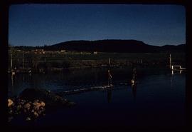
Photograph depicts two boys standing on platform extending into lake. Buildings and fenced areas can be seen on shore in background. Handwritten annotation on recto of mounted slide reads: "boys playing on the lake / Legac".
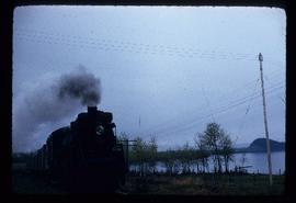
Front view of railway train. Fraser Lake believed to be visible in background, behind power lines. Handwritten annotation on recto of mounted slide reads: "Train coming to Lejak [sic]" See also item 2006.20.1.195 for image featuring similar content.
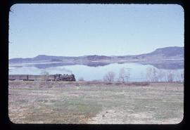
Photograph depicts the engine and first two cars of a railway train in left foreground. Water crosses midground, hills stand on opposite shore in background. Handwritten annotation on recto of mounted slide reads: "Lejak [sic] & Fraser Lake in [?]" See also item 2006.20.1.196 for image featuring similar content.
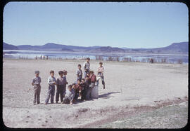
Group stands in foreground on what appears to be a wooden teeter totter. Fence crosses midground in front of water, and hills can be seen on opposite shore in background. Handwritten annotation on recto of mounted slide reads: "play ground in Legak [sic]".
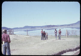
Photograph depicts a game of horseshoes in foreground. Fence crosses midground in front of water, and hills can be seen on opposite shore in background. Handwritten annotation on recto of mounted slide reads: "Playing horse [shoes?] in Legac".
File consists of notes and reproductions relating to floods in Prince George. Also includes photographs depicting a sign describing the importance of floods in Prince George.
File consists of photographs separated from other boxes and subseries depicting downtown Prince George, historic Prince George, the North Thompson region, Fort St. James historic site, Brooks, Alberta, Sinclair Mills, and Soda Creek.
File consists of notes and reproductions relating to Hatley Park, Victoria, which was designed by landscape architects Brett and Hall. Brett and Hall had also assisted in city planning in Prince George. File also contains a CD titled "RRU Archives Brett and Hall Hatley Plans" containing material about the Brett and Hall Hatley plans from the Royal Roads University Archives.
The item is a CD-R containing Kent Sedgewick's files regarding the Upper Fraser Valley history. Files include literature summaries, oral history transcripts and various other documents referring to the Upper Fraser Valley. Annotations on CD-R state, "Jun 7 '04 Kent - UF files to start."
File consists of notes and reproductions relating to the Upper Fraser Historical Geography Project done on the East Line and Upper Fraser in collaboration with the University of Northern British Columbia researchers. Includes a CD titled "Kent's Upper Fraser Files" containing Kent's research files for the Upper Fraser project (7 Jan. 2004) and a computer diskette titled "Oral Histories" containing an oral history interview with a woman (2004).
File consists of notes, clippings, and reproductions relating to flooding in Prince George. Includes: "RE: Ice Jams in Nechako River at Prince George" typescript letter from Peter Campbell to Graham Farstad (30 May 1984) and "Floods" typed document by Kent Sedgwick (1 Feb. 1996). Also includes photographs depicting low water and flooding in Prince George (1937 and 2006).


![City of Prince George - Schedule B of the Official Community Plan, Bylaw No. 5909 [1998 Amendment]](/uploads/r/northern-bc-archives-special-collections-1/d/6/d/d6d1c4e7e37fc948b97b3caa36447b52f7d2b76b13d45e3710aefee7b13840f0/2023.5.1.33_-_1998_Official_Community_Plan_City_of_PG_JPG85_tb_142.jpg)


![City of Prince George - Schedule B of the Official Community Plan, Bylaw No. 5909 [2001 Amendment]](/uploads/r/northern-bc-archives-special-collections-1/c/3/6/c36392b90696286cc6281e8cc2efbf7691c2617726495fa28db2cbdcc20e4e4c/2023.5.1.36_-_Official_Community_Plan_City_of_PG_Schedule_B_2001_JPG85_tb_142.jpg)

![City of Prince George - Schedule C of the Official Community Plan - Long Range Land Use Map [May 2006 Amendment]](/uploads/r/northern-bc-archives-special-collections-1/6/5/5/65536bc04aa97580c140131651dc357dfe5c3a1315822394f388d96940bc39cb/2023.5.1.39_-_2006_May_-_City_of_Prince_George_Long_Range_Land_Use_Map_JPG85_tb_142.jpg)

![City of Prince George - Schedule C of the Official Community Plan - Long Range Land Use Map [October 2006 Amendment]](/uploads/r/northern-bc-archives-special-collections-1/6/d/6/6d643c10801eba2ac493689972e57429dba42ec7592f54cb55151b96362d7048/2023.5.1.40_-_2006_Oct_-_City_of_Prince_George_Long_Range_Land_Use_Map_JGP85_tb_142.jpg)
![City of Prince George - Schedule C of the Official Community Plan - Long Range Land Use Map [May 2008 Amendment]](/uploads/r/northern-bc-archives-special-collections-1/4/3/a/43a9e75941f1542735d999de340307d163e79dffdadbf4546bb9346b63f7e734/2023.5.1.41_-_2008_May_-_City_of_Prince_George_Long_Range_Land_Use_Map_JPG85_tb_142.jpg)

