Showing 658 results
Archival description
Indigenous Peoples
Indigenous Peoples
Indigenous Peoples of British Columbia
Indigenous Peoples of British Columbia
"Isle Pierre, British Columbia" 1952 map
"Isle Pierre, British Columbia" 1952 map
"Isle Pierre, British Columbia" 1952 map
"Isle Pierre, British Columbia" 1952 map
"Isle Pierre, British Columbia" 1974 map
"Isle Pierre, British Columbia" 1974 map
J. Kent Sedgwick fonds
J. Kent Sedgwick fonds
Jill Singleton Collection
Jill Singleton Collection
Job 107 - Corporation of the Township of Richmond - Preparation of Background Agriculture Study for Community Plan
Job 107 - Corporation of the Township of Richmond - Preparation of Background Agriculture Study for Community Plan
Job 112 - Richmond Landfill Ltd. - Assessment of Land Use Opportunities and Conflicts
Job 112 - Richmond Landfill Ltd. - Assessment of Land Use Opportunities and Conflicts
Job 149 - BC Buildings Corporation - Land Resource Inventory of Tranquille Institution - Kamloops
Job 149 - BC Buildings Corporation - Land Resource Inventory of Tranquille Institution - Kamloops
Job 162 - Don Ference and Associates for Indian and Northern Affairs Canada - Analysis of Sequential Land Use Change - IR#172 (Montney Reserve) - Fort St. John
Job 162 - Don Ference and Associates for Indian and Northern Affairs Canada - Analysis of Sequential Land Use Change - IR#172 (Montney Reserve) - Fort St. John
Job 184 - BC Ministry of Forests and Lands, Land Policy Branch - Coastal Resource Identification Study: Desolation Sound - Johnstone Strait
Job 184 - BC Ministry of Forests and Lands, Land Policy Branch - Coastal Resource Identification Study: Desolation Sound - Johnstone Strait
Job 21 - BC Royal Commission of Inquiry, Health and Environmental Protection - Overview of Potential Land Use Conflicts related to Proposed Uranium Mining in British Columbia - Okanagan-Kettle Valley and Birch Island
Job 21 - BC Royal Commission of Inquiry, Health and Environmental Protection - Overview of Potential Land Use Conflicts related to Proposed Uranium Mining in British Columbia - Okanagan-Kettle Valley and Birch Island
Job 230 - Public Works Canada - Assessment of Alleged Soil Degradation on Skeetchestn Indian Reserve #1 - Deadman's Creek
Job 230 - Public Works Canada - Assessment of Alleged Soil Degradation on Skeetchestn Indian Reserve #1 - Deadman's Creek
Job 244 - McKay, Rivard and Co. Ltd. for Penticton Indian Band - Analysis of Land Suitability for Irrigated Crops, Penticton Indian Reserve #1 - Penticton
Job 244 - McKay, Rivard and Co. Ltd. for Penticton Indian Band - Analysis of Land Suitability for Irrigated Crops, Penticton Indian Reserve #1 - Penticton
Job 245 - Penticton Indian Band - Analysis of and Suitability for Irrigated Crops and Consultation on Water Management Strategy - Penticton
Job 245 - Penticton Indian Band - Analysis of and Suitability for Irrigated Crops and Consultation on Water Management Strategy - Penticton
Job 274 - Commission on Fraser Valley Petroleum Exploration - Advisement on Fraser Valley Land and Water Use Issues
Job 274 - Commission on Fraser Valley Petroleum Exploration - Advisement on Fraser Valley Land and Water Use Issues
Job 297 - BC Ministry of Development, Trade and Tourism - Natural Resource Tourism Inventory - Kamloops
Job 297 - BC Ministry of Development, Trade and Tourism - Natural Resource Tourism Inventory - Kamloops
Job 325 - North Okanagan Regional District - Coldstream Ranch Land Use Concept Plan - Coldstream
Job 325 - North Okanagan Regional District - Coldstream Ranch Land Use Concept Plan - Coldstream
Job 336 - W.D. McIntosh Land Surveying Ltd. - Fawcett Farm Subdivision and Consolidation - Vanderhoof
Job 336 - W.D. McIntosh Land Surveying Ltd. - Fawcett Farm Subdivision and Consolidation - Vanderhoof
Job 360 - BC Commission on Resources and Environment (CORE) - Mediation of Regional Land Use Plan - East Kootenay Table - East Kootenay
Job 360 - BC Commission on Resources and Environment (CORE) - Mediation of Regional Land Use Plan - East Kootenay Table - East Kootenay
Job 376 - Spallumcheen Indian Band, Pape & Salter - Review of Impact and Future Use of Hydro Right of Way Land by Spallumcheen Indian Band
Job 376 - Spallumcheen Indian Band, Pape & Salter - Review of Impact and Future Use of Hydro Right of Way Land by Spallumcheen Indian Band
Job 429 - Nadleh Whut'en Indian Band - Forage Land Value Assessment for Lejac Residential School Property - Fraser Lake
Job 429 - Nadleh Whut'en Indian Band - Forage Land Value Assessment for Lejac Residential School Property - Fraser Lake
Job 57 - BC Hydro - Capability Analysis and Land Use Concept Plan - West Arrow Park
Job 57 - BC Hydro - Capability Analysis and Land Use Concept Plan - West Arrow Park
Job 578 - BC Ministry of Sustainable Resource Management - Facilitation and Mediation of Central Coast Land and Resource Management Plan
Job 578 - BC Ministry of Sustainable Resource Management - Facilitation and Mediation of Central Coast Land and Resource Management Plan
Job 65 - Environment Canada, Lands Directorate - Okanagan Fruitlands: The Location, Nature, Amount and Rate of Land Use Change - Penticton South
Job 65 - Environment Canada, Lands Directorate - Okanagan Fruitlands: The Location, Nature, Amount and Rate of Land Use Change - Penticton South
Job 650 - Canoe Creek Indian Band - Overview of Issues and Concerns Related to Transmission Line Corridor Component - Dog Creek
Job 650 - Canoe Creek Indian Band - Overview of Issues and Concerns Related to Transmission Line Corridor Component - Dog Creek
Job 671 - B.C. Women's Institutes - Site C - Environmental Impact Statement Technical Review - Site C
Job 671 - B.C. Women's Institutes - Site C - Environmental Impact Statement Technical Review - Site C
Job 79 - BC Ministry of Lands, Parks and Housing - Moberly DPA - Fort St. John
Job 79 - BC Ministry of Lands, Parks and Housing - Moberly DPA - Fort St. John
"Kelowna, British Columbia"
"Kelowna, British Columbia"
"Kelowna, British Columbia"
"Kelowna, British Columbia"
Kitimat City Centre
Kitimat City Centre
Kitimat-Stikine Regional District Regional Resource Inventory
Kitimat-Stikine Regional District Regional Resource Inventory
"Kitlope Ecosites, Wildlife Viewing Zones and Cultural Interpretation Sites"
"Kitlope Ecosites, Wildlife Viewing Zones and Cultural Interpretation Sites"
"Land Use Planning in British Columbia"
"Land Use Planning in British Columbia"
L'heidli T'enneh First Nation
L'heidli T'enneh First Nation

Location & Watershed Map
"Location Map of Mining Properties in British Columbia and the Yukon Territory (including part of Northwest Territories)"
"Location Map of Mining Properties in British Columbia and the Yukon Territory (including part of Northwest Territories)"
Location Map of Mining Properties in British Columbia and the Yukon Territory (including part of the Northwest Territories)
Location Map of Mining Properties in British Columbia and the Yukon Territory (including part of the Northwest Territories)
Lockwood Survey Corporation Ltd. collection
Lockwood Survey Corporation Ltd. collection
"Lost Streams of the Lower Fraser River"
"Lost Streams of the Lower Fraser River"
Louise Burgener collection
Louise Burgener collection
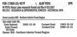
M PSYU Aleza Lake Research Forest Old File #051597
Major Oil and Gas Fields and Pipelines in Canada
Major Oil and Gas Fields and Pipelines in Canada

Major Residential Development Proposals from June 1975 to August 1977
Management and Working Plans
Management and Working Plans

Map 93I.001 annotated to show 1994 RFP study area

Map 93J.010 annotated to show transects

Map of area covered by Tree Farm Licences no. 1 and no. 40 for Columbia Cellulose and Skeena Kraft
"Map of Lower Mainland Railways"
"Map of Lower Mainland Railways"