The photograph depicts a blurred image of a yellow carpet with colourful designs.
The photograph depicts a blurred image of a yellow carpet with colourful designs.
The photograph depicts a duplex on the lot located at 4084 Old Cariboo Highway outside of Prince George, BC. The house is white stucco with a sheet metal roof. The duplex on the right side has Halloween decorations on the door and in the window.
The photograph depicts a duplex on the lot located at 4084 Old Cariboo Highway outside of Prince George, BC. The house is white stucco with a sheet metal roof.
The photograph depicts an airplane hangar at the Prince George airport. The sign on the building reads, "nt air." A white building and beige building are shown at a distance in front of the hangar.
Image depicts the Harrison House in Kersley, B.C.
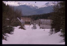
Image depicts two rows of houses in an unknown location.
Image depicts the Dunlevy Creek area somewhere near Dawson Creek, B.C. The slide is simply labelled "Dunlevy irrigation" for uncertain reasons.
Image depicts the old jail house in Soda Creek, B.C.
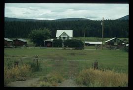
The item is a photograph depicting the exterior of old damaged buildings on the Moffat farmland. There is a fence at the entrance to the driveway with an address sign that reads "1820."
The item is a CD-R containing 310 jpg. photographs related to the June Chamberland Project.
Photograph depicts the graves of Edmund Shepherd, Elsie Rankin, and Elize Shepherd at the Soda Creek Cemetery.
Photograph depicts a monument and grave stone for Captain Frank Odin of the Steamboat Charlotte. Annotation on verso: "Capt. Odin Monument, Soda Creek cemetery, 2010".
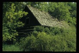
Photograph depicting an abandoned building in Soda Creek, the building surrounded by overgrown grass and trees.
Photograph depicting a dirt field surrounded by green trees.
Photograph depicting a garden and backyard in someone's personal residence.
Photograph depicting a garden and backyard in someone's personal residence.
Photograph depicting Kent Sedgwick and a dog in someone's garden and personal residence.
Photograph depicting Kent Sedgwick and a dog in someone's garden and personal residence.
The item is a photograph and negative of a survey map of the Prince George townsite South of the Nechako River and West of the Fraser River.
The item is a photograph and negative of a survey map of the Prince George townsite surrounding Connaught Park.
The item is a photograph and negative of a survey map of the Prince George townsite surrounding Connaught Park, South of the Grand Trunk Pacific railway.
The item is a photograph and negative of a survey map of the Prince George townsite surrounding Connaught Park.
The item is a photograph and negative of a survey map of the Prince George townsite. Areas highlighted are in the Nechako and Fraser River area, including Connaught Park.
The item is a photograph negative of a man and woman sitting in front of a house. They are dressed in formal attire and are drinking what appears to be a glass of wine.
File consists of notes, clippings, and reproductions relating to research conducted by Kent Sedgwick on Simon Fraser, Canadian explorer and fur trader. Includes: "Simon Fraser: The Birth of Modern British Columbia" special edition issue of the Vancouver Sun newspaper (3 Jan. 2006).
File consists of a typed document titled "Fraser Canyon Park: A proposal to the British Columbia Government" prepared by the Fraser Canyon Ad Hoc Committee.
File consists of transcript of an oral interview with Trelle Morrow regarding the architectural development of Quinson Elementary School.
File consists of notes, clippings, and reproductions relating to Mount Sir Alexander, a mountain in the Sir Alexander Area of the Continental Ranges of the BC Canadian Rockies.
This item is a photograph of a yellow parkade in downtown Prince George.
This item is a 35 mm photograph negative of the Nechako River, Prince George. Water level is very low.
Item is a photograph depicting Thomas Norton, Kent Sedgwick and a third man.
The photograph depicts a white duplex on Marston Road. The addresses on the duplex read 4603 and 4633. A blue Chevrolet truck is parked next to the building.
The photograph depicts a white workshop with a red roof at the Prince George airport.
The photograph depicts three buildings, white, beige, and blue at the Prince George airport.
The item is a photograph that depicts the front of a beige house at 321 North Moffat Street.
File consists of notes and reproductions relating to Lutheran churches in Prince George. The Connaught Hill Lutheran Church took over the original Knox Presbyterian Church in South Fort George, which later moved into the new Knox Presbyterian Church at Fifth and Brunswick Street. By 1958 there were two Lutheran Churches including Our Saviour's Lutheran Church at 3590 Dufferin, and the Zion Lutheran Church at 180 South Tabor Street in Prince George.
File consists of a note and a reproduction relating to First Methodist Church on Third Avenue, which was later moved to 1389 Ingledew Street in Prince George. File predominantly consists of printed photographs from The Exploration Place Museum database depicting First Methodist Church.
File consists of a note and a reproduction relating to St George's Anglican Church in Central Fort George.
The item is a photograph depicting the back of the house located at 2540 Hazelton Street, Prince George. The house has grey stucco and is two stories.
The item is a photograph depicting the Cameron Street bridge plaque. The short write up details the construction and significance of the bridge. Annotations on reverse side of the photograph state, "169 words."
File consists of notes, clippings, and reproductions relating to the South Fort George Elementary School.
File consists of a note relating to the Fort George Canyon Elementary School.
File consists of notes relating to the Ferndale Elementary School.
File consists of notes relating to the Cranbrook Mills Elementary School. Also includes photographs depicting the old Cranbrook Mills School (2005).
File consists of notes and reproductions relating to Roy Spurr. Roy Spurr was a one of the original owners and managers of the Eagle Lake Sawmill in Giscome. He also owned and ran the Giscome Farm Ltd. company with its subsidiary Northern Dairies Ltd.
File consists of clippings, notes, and reproductions relating to the desecration of the Lheidli T'enneh Cemetery and development of Fort George Park in Prince George. Includes: "Telephone interview with Larry Larson" typed document by Kent Sedgwick (23 June 2010). The file predominantly includes photocopied newspaper articles discussing the cemetery in Fort George park, its cultural significance, desecration, and vandalism of the cemetery.
File consists of notes, clippings, and reproductions relating to Northern Hardware in Prince George. Includes the following clipped articles from the Prince George Citizen newspaper: "Northern Hardware featured in 1938 trade magazine" (Aug. 2005); "Pioneer, former mayor mourned" (Aug. 2009); and "Moffat's life, career chronicled in new book" (2007).
The item is a photograph depicting a residential duplex house off the Cariboo Highway. It is one of three buildings that were relocated for the airport in 1957.
The item is a photograph depicting a residential duplex house off the Cariboo Highway. It is one of three buildings that were relocated for the airport in 1957.


