Photograph is a remote-sensing image of the Aleza Lake Research Forest from 1994.
Item is a report entitled "Tree Length Logging as a Silvicultural Problem in the Uneven-aged Spruce-Balsam Type of the Prince George District" by A.R. Fraser of the British Columbia Forest Service.
Item is a report entitled "Tree Length Skidding and its Influence on Residual Forest Stands in the Fort George Forest District" by L. deGrace of the British Columbia Forest Service.
Item is a "Soil Survey Report on Part of Aleza Lake Forest Experimental Station" by R.A. Fisher of the Forest Surveys Division, British Columbia Forest Service.
Item is an issue of "Forest Management Notes" on "The Results of Stand Treatment in the White Spruce Alpine Fir Type of the Northern Interior of British Columbia" by D.R. Glew.
Item is a draft of "Resource Analysis 1984, Project No. 26, Silvicultural Systems" by J. Revel.
Original photographic print included in "Northern Interior Forest Experiment Station: Report of Preliminary Investigations" by Percy Barr.
File contains correspondence regarding funding for research project and computer generated maps.
File contains reports on soil rehabilitation projects and related correspondence, photocopied tables of soil measurements, and reports on machinery costs when tilling.
File contains original handwritten metereological registers.
Floppy contains flag files (AL52-65F.dat, AL66-80F.dat) and Fortran programs (AES.for, AESEXT.for, AESFLG.for).
File contains a 1931 original copy of "The Aleza Lake Forest Experiment Station: A Brief Statement of its Purpose and Development". Includes photographs.
Item is "The North Ridge Eco-Trail Guide: Aleza Lake Research Forest".
Diagram reflects outline for the proposed Ranger Station at the Aleza Lake Experimental Forest.
Map reflects forest type boundary line, bogs and swampy non-forested areas, creeks, lakes, rivers, tree species labels of spruce, balsam, and birch, stand descriptions, historical timber sale boundaries, stand history symbol, gravelled secondary roads, unimproved old roads, management compartment boundary, research forest boundary, ecological reserve boundary, and old growth emphasis areas.
Map commissioned from Ministry of Forests Prince George Region from Madrone Consultants shows Aleza Lake Research Forest Access and Access Management. Map is 3 of 6. Map shows the following road types: all weather 1-lane gravel road, dry weather road, and proposed road access. Also shows areas for parking/turnaround, toilets, and information signs.
Map commissioned from Ministry of Forests Prince George Region from Madrone Consultants shows Aleza Lake Research Forest ecosystems. Map is 5 of 6. Map shows many sub-types of the following ecosystem types: upland, lowland wet forest, wetlands, and the Bowron floodplain benches. Ecosystem classification and mapping by Oikos Ecological Services Ltd.
Map commissioned from Ministry of Forests Prince George Region from Madrone Consultants shows Aleza Lake Research Forest site series classification. Shows ecosystem types that encompass the SBSwk1 Subzone of the Aleza Lake Research Forest.
Series contains survey notes.
File contains photocopies of survey notes from 1954.
Fonds consists of original, silent 16mm reels that portray the natural, social and land use history of the Bella Coola and Chilcotin regions named the "Natural and Guiding History of the Bella Coola and Chilcotin Regions".
Possible locations that Al Elsey filmed include: Bella Coola, Bella Bella, Anahim Lake, Alert Bay, Nimpo Lake, Bulkey Valley, the Rainbow Mountains, Tweedsmuir Provincial Park, Dean River, Bella Coola River, Tchaha Lake, the Chilcotin region, the Ulkatcho Mountains, Lassard Lake, Fenton Lake, Atnarko River, Wells Gray Park, and Holt Homestead.
Footage of steelhead salmon jumping in river channel. The location is unknown.
Footage of Dr. Triffenhagen putting mill eggs as bait on a hook for fishing. Speculated locations include the Bella Coola River or the Dean River.
Footage of title text that reads: “The Bella Coola Indians and Their ‘Food from the Sea’ Photographed by Al Elsey."
Speculated locations of the location of this footage include Bella Bella, Bella Coola or the Bella Coola River.
Footage of a lake shore and a dog, Suzie, retrieving an object from the lake. There is footage of a fish flipping around on the ice and another shot a fish swimming under the lake ice. There are also a recording of a white weasel climbing a tree
It is speculated that location of this film is either Anahim Lake or Fenton Lake.
Footage of chipmunk eating. Location of filming is unknown.
Footage of fly fishing in a river, possibly the Bella Coola or Dean River, as well as footage of a caribou herd in the high country of possibly the Rainbow Mountains.
Footage of man holding up and examining a moose head trophy in winter.
Possible locations include the Chilcotin region, Rainbow Mountains or Tweedsmuir Provincial Park.
Footage of two people, Doris and Jerry, in a rowboat on a lake.
Speculated locations include Anahim Lake, Fenton Lake or Lassard Lake.
Footage of a caribou herd.
Probable locations of filming include the Chilcotin area, Rainbow Mountains, or Tweedsmuir Provincial Park.
Man fly-fishing from river shore.
The river is believed to be the Bella Coola River or the Dean River.
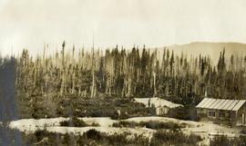
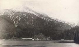
The first portion of the film begins with a map of Tweedsmuir Provincial Park and then cuts to a motor boat on a lake, possibly Fenton Lake, and men fishing on the lake. The next clip is of more men fly-fishing on a river, possibly the Bella Coola River or the Dean River. A short clip follows of two children in a boat with a man pushing them along with a rod. There is footage of the scenic landscape, which is most likely the Bella Coola Valley, and a cabin, which is believed to be Elsey's. A woman believed to be Mrs. Elsey sits on the porch and then arranges her flowers. The film shows some ducks on the lake, two squirrels playing and the Elsey's dog in a boat. Mrs. Elsey pulls the boat ashore in the next clip and then the film shows her working in her vegetable garden. There is more scenic filming of the valley and a man cutting down a tree with a chain saw. There is footage of a grouse beating it's wings, chipmunk looking for seeds, birds in a marsh, three moose in a marsh, and a bald eagle perched and flying.
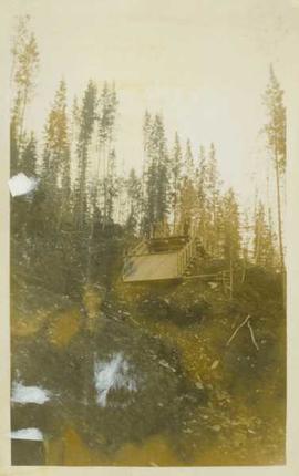
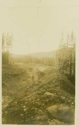
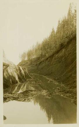
There is a break in the film and the second portion begins with footage of cabin in the mountains, a baby in a cradle, an elder First Nations woman, and a gathering of First Nations peoples by a tent. There is a shot of a picnic site sign labelled "Burnt Bridge Picnic site Parks Branch" and another sign that reads "Kalyskt Creek." There is then footage of the creek and a truck driving down a dirt road. There is then a group of people boarding a motor boat in a river and driving up and down the river, which could possibly be the Dean River or the Bella Coola River. There is then more filming of a cabin in the mountains, possibly Elsey's, and a man cleaning a large fish he caught. Then there is footage of men in a rubber raft floating down a river and fishing from the raft, and then some other men traveling in a motor boat.
There is an another break and the third portion of the film begins with footage of birds on a lake and footage from a boat showing the mountains. On land there is filming of two bears walking, men hunting the bear, killing the bear, and skinning the bear. The film cuts back to the boat and the filming the mountains along the water. The people on the boat then pull up crab traps from the water and cook the crabs on the boat. The film ends with footage of salmon jumping and a man filleting his fish catch.
Photograph depicts several log booms on the water with a forested area in the foreground.
Photograph depicts piles of wood planks and log booms in the foreground with a waterfall in the background.
Photograph depicts a man standing on the deck of a sailboat with a view of a cannery along the shoreline of Ocean Falls with mountains in the background.
Photograph depicts a distance perspective of several cannery buildings with a body of water in the foreground and a mountain range in the background.
Photograph depicts three men at a whaling station with debris on the ground and a large elevated tank in the background.
Photograph depicts several fishing boats on the water with a wooden dock in the foreground to the left of the image.
Photograph depicts a cannery in front of a forested mountains with water in the foreground.
The Alexander Manson Mining Collection consists of 133 loose photographs documenting various aspects of the mining industry in Northern British Columbia between 1930-1940. Photographs show images of Manson Creek and Germansen Landing.
Sem títuloPhotograph depicts a steamshovel at work.
Photograph depicts unidentified man standing near mining ditches.
Photograph depicts an unidentified man standing at the top of an empty wooden flume (?) situated at the top of a mountainside in front of a forested landscape.
Photograph depicts a distance perspective of an unidentified man standing in a large ditchline that runs through a forested landscape.
Photograph depicts a gravel road carved into the forested landscape.
Photograph depicts a large water-filled ditchline in front of a forested landscape.