Subseries consists of
Shirvell, ColeFile consists of a list of documents from the Department of Fisheries and Oceans that were created between 1977 and 1994 and released to the public through Access to Information Act requests or other means. The list includes requested records that were not made available because they are exempt from the Access to Information Act.
File consists of a list of documents sent to the Department of Fisheries and Oceans from the B.C. provincial government ("Attorney General of British Columbia") for the Nechako River court action. Includes accompanying memoranda regarding the list of documents in regards to preparing for the trial.
Map depicts species of forest trees in British Columbia and their regional distribution.
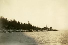
Photograph depicts a view from the ocean toward a lighthouse on a rocky ocean shore point. There are a few building near the lighthouse.
Item is an original Parks Branch report by A.T. Bergerud and H.E. Butler entitled "Life History Studies of Caribou in Spatsizi Wilderness Park 1977-78".
Item is a photocopied report by T.C. Reid entitled "Liard River Hotsprings Park Natural History Observations". The report compiles natural history observations of Liard River Hotsprings, including a water chemistry report, weather observations, botanical report, ostrich fern growth, amphibian report, mammal report, bird report, and map and photograph orientation.
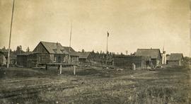
Photograph depicts a cluster of wooden buildings including a flagpole and church spire at a Lheidli T'enneh village site. Original photo identified this image as "Indian Village, Fort George".
File consists of correspondence from President Ronald Reagan to Senator Bob Packwood, May 8, 1986.
File consists of a copy of letter from J. Harold Mundie to George Baker, the Chair of the Standing Committee on Fisheries and Oceans in the House of Commons. Includes a post-it note from Harold to Don regarding the letter.
File consists of annotated drafts and a final draft of the letter Gordon Hartman sent to Prime Minister Chretien. Includes a reply to the letter from the Office of the Prime Minister.
Photograph depicts the renovated Leigh Instruments Ltd. manufacturing and engineering building.
Noranda Inc.Photograph depicts the Leigh Instruments Ltd. factory.
Noranda Inc.File consists of a paper titled "Legislative Oversight of Intelligence Services in Canada and the United States" presented by Weller at the 1985 American Political Science Association conference. This file was originally numbered to correspond with conference paper number 39 listed in Weller's CV.
Series contains survey notes.
Sub-subseries consists of legal records created or accumulated by Adam Zimmerman in his various roles with Noranda Mines (Comptroller, 1961-1966; Vice President and Comptroller, 1966-1974). Records relate specifically to the Gaspe Copper Mines Lawsuit and its appeal. Zimmerman was heavily involved in the financial aspects of the legal case resulting from the 1957 Gaspe Copper Mines strike (Murdochville Strike).
Noranda Mines Ltd.Series consists of two ledgers and two journals. The two ledgers consist of logging accounts including lumber shipments and sales as well as payroll and expenditures. The two journals include handwritten maintenance notes and loose papers of diagrams of equipment.
File consists of a fax cover sheet and original lecture notes created by Cole Shirvell for a workshop on Instream Flow Incremental Methodology.
File consists of a photocopy of a Canadian Journal of Fisheries and Aquatic Sciences (vol. 50) article by Ray Hilborn and John Winton entitled "Learning to Enhance Salmon Production: Lessons from the Salmonid Enhancement Program".
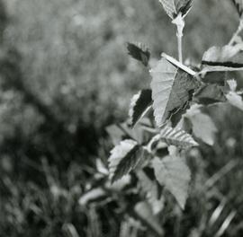
Caption describing photograph: "Leaf morphology of Betula papyrifera. Revels garden."
Caption describing photograph: "Leaf morphology of Betula glandulosa. General distribution in sphagnum bogs and muskeg through Northeast B.C. Quesnel North."
Photograph depicts several men and a dog stand on snowy ground, a canvas tent on the left. A rough hewn table on the right background.
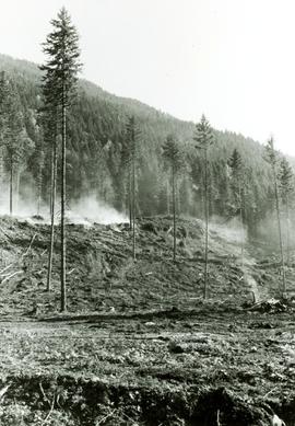
Photograph depicts a skiff of fresh snow covering a fallen tree in the foreground. Tents and suspended tarps in the midground. A haze of wood smoke drifts into the snowy forest in the background.
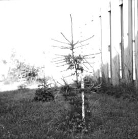
Caption describing photograph: "Larix larciana (Tamarack). Wildling transplanted Autumn 1964 from Tamarack Lake 30 miles West of Prince George. Age 6 years. Height 29", 65 leader 4", 66 growth 9". All measurement taken June 23, 1966."
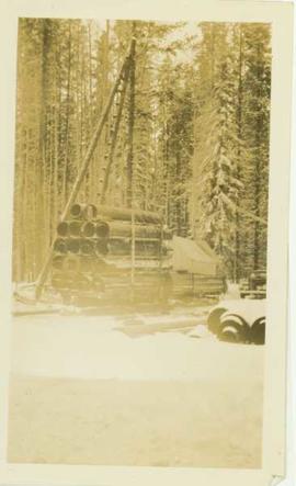
Photo depicts a large sled loaded with large metal tubing, a tent and a pile driver(?)
Photographic print contains the following writing on verso:
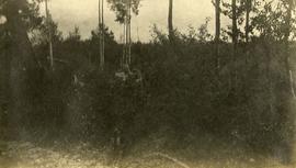
"Larch and Douglas fir seed trees under (?) seed bed preparation, 1986 Nelson BC, J Revel"
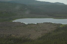
File contains images depicting various landslides near Cassiar BC. Set of 20 photographs (with 9 corresponding negative strips) date stamped June 1987 depict landslide near creek and dirt road with a Cassiar company truck. Set of 5 black and white photographs found in envelope marked "D. Stewart" are likely from 1988-1989 and depict a rockslide on the south western side of the pit mine, near the tramline. Album entitled “6200 DUMP SLIDE / SPRING, 1979” contains 34 photographs depicting aerial shots of a massive rockslide on the eastern slope of McDame Mountain, originating from the mine waste dump. Several images from album show greenish water pooling in the toe of the slide.
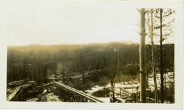
Photograph depicts a landscape perspective featuring construction of two water flumes across a narrow valley between a forested landscape.
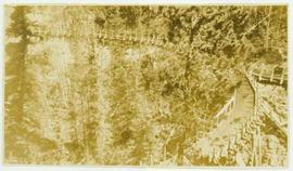
Photograph depicts a landscape perspective featuring a water flume in the shape of a horseshoe built along a forested hillside. Handwritten annotation on verso of photograph reads: "Horshoe Creek"
Photograph depicts one man standing on the bank of a river, forest in the background. The image is not in focus or possibly a double exposure.
File consists of a bound typescript book titled "Land Settlement (A report by a C.S.T.A Committee)" produced by the Canadian Society of Technical Agriculturists in 1941.
File consists of materials related to "A Short Course on Bedrock, Landform and Soils" including handouts, handwritten notes, and other materials.
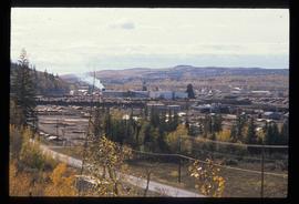
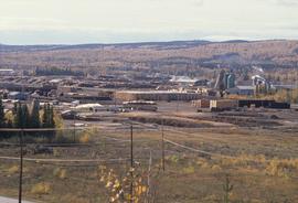
Image depicts the Lakeland Sawmill in Prince George, B.C, identified by the beehive burners; the one with white smoke belonged to Pas Lumber Co. which was bought out by Lakeland in 1987.
Image depicts the Lakeland Sawmill in Prince George, B.C.
Photograph depicts a small inland lake, trees and low hills border the lake.
File consists of outgoing correspondence from BCUC to the Lake & Stream Biological Habitat Enhancement Society as well as incoming correspondence to BCUC from the society and its representatives.
Sub-subseries consists of records relating to labour relations for Northwood Pulp and it's renamed successors Northwood Pulp and Timber Ltd. (1972-1998) and Northwood Forest Industries Ltd. (1979-1998). These records were created or accumulated by Adam Zimmerman during his tenures as the company's President and Director, as well as his Presidency of Northwood Pulp's parent company, Northwood Mills. Includes records regarding labour negotiations, union agreements, the Northern Interior Lumberman's Association, and the Pulp and Paper Industrial Relations Bureau.
Northwood Pulp and Timber Ltd.Item is an original booklet entitled "Kwadacha Park Proposal" issued by the BC Parks Branch, Department of Recreation and Conservation.
Item is an original "Kwadacha Park 1976" trip report by W.G. Hazelwood. Includes original photographic prints pasted into the report. Also includes a "Kwadacha Wilderness Park Proposal" accompanying map.
File consists of an original report entitled "The Kowesas Watershed Assessment: Summary Report" prepared by Interrain Pacific with the Nanakila Institute, the Haisla Nation, Ecotrust Canada, and Ecotrust. The report is accompanied by a map by Interrain Pacific entitled "Wildlife Habitat Capability Classification Kowesas Watershed". Also includes accompanying correspondence, a newspaper clipping, and "Kowesas River Field Notes" presumably written by Grant Hazelwood.
Subseries consists of records relating to Koninklijke Nederlandse Papierfabriek (KNP) that were created or accumulated by Adam Zimmerman during his tenure on the company's Board of Directors. Includes correspondence, reports, KNP annual reports, strategy and planning documents, financial records, merger records, and meeting materials.
Koninklijke Nederlandse Papierfabriek (KNP)File consists of an original draft copy of the "Kokanee Glacier Park Master Plan", as well as the "Background Report for Kokanee Glacier Park Master Plan" and the "Kokanee Glacier Park Master Plan: Public Handout and Questionnaire". These items are accompanied by correspondence related to the Master Plan.
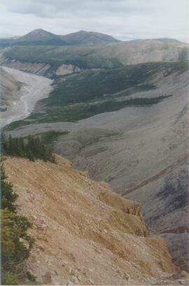
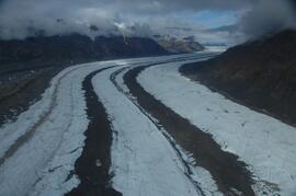
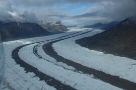
This image is part of the outbound sequence of aerial images obtained on the helicopter flight to the Klutlan Glacier study site. The sequence starts from the base camp at the White River crossing on the Alaska Highway and heads south, to a point just upvalley of the debris-covered terminus (approx. 10-15 km from Alaska border), and turning back north to the landing spot on the Generc River floodplain close to the study site (see Fig. 1 in paper).
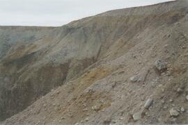
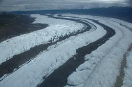
This image is part of the outbound sequence of aerial images obtained on the helicopter flight to the Klutlan Glacier study site. The sequence starts from the base camp at the White River crossing on the Alaska Highway and heads south, to a point just upvalley of the debris-covered terminus (approx. 10-15 km from Alaska border), and turning back north to the landing spot on the Generc River floodplain close to the study site (see Fig. 1 in paper).
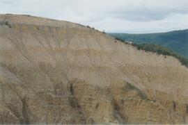
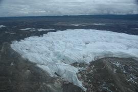
This image is part of the outbound sequence of aerial images obtained on the helicopter flight to the Klutlan Glacier study site. The sequence starts from the base camp at the White River crossing on the Alaska Highway and heads south, to a point just upvalley of the debris-covered terminus (approx. 10-15 km from Alaska border), and turning back north to the landing spot on the Generc River floodplain close to the study site (see Fig. 1 in paper).
This image is part of the outbound sequence of aerial images obtained on the helicopter flight to the Klutlan Glacier study site. The sequence starts from the base camp at the White River crossing on the Alaska Highway and heads south, to a point just upvalley of the debris-covered terminus (approx. 10-15 km from Alaska border), and turning back north to the landing spot on the Generc River floodplain close to the study site (see Fig. 1 in paper).
