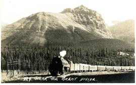
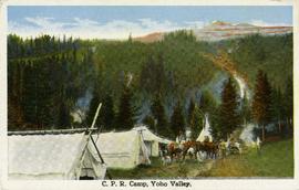
Postcard depicts the town of Field and Mt. Stephen. Near Yoho National Park in the Canadian Rockies.
Postcard depicts a snow slide scene in the Canadian Rockies.
Postcard depicts the first crossing of the Kicking Horse.
Postcard depicts a snow slide scene, west of Calgary in the Canadian Rockies with a snow plow clearing the railroad of an avalanche. Three-colour process.
Postcard depicts the passage through the shoulder of Mt. Stephen.
Postcard depicts the Van Horne Range, looking west from Field, BC
Postcard depicts a view of the CPR line in B.C.
Postcard depicts Field station in the Rockies. Man standing on the left with a bowler hat was Chris McGregor, a professional (mining?) engineer. Earliest frank seen for the postcard was in July 1906.
File consists of postcards of the Canadian Pacific Railway near Field Hill, British Columbia.
Postcard depicts a Canadian Pacific's all stainless steel scenic dome streamliner, "The Canadian," in the Canadian Rockies.
Postcard depicts the Lake Louise CPR depot.
Postcard depicts a CPR diesel electric train and Mt. Eisenhower in the Canadian Rockies.
Postcard taken at the Laggan Subdivision, the most famous photograph location on the CPR system due to its official photographer, Nicholas Morrant, 1910-1986. Possibly a 1920's view. From 1978, this location became known as 'Morant's Curve.' This view was a rarity in showing no train on the track.
Postcard depicts the Great Divide between Alberta and British Columbia, along the CPR line.
Postcard depicts a CPR streamliner crossing the Canadian Rocky Mountains.
Postcard depicts Castle Mountain found along the Canadian Pacific Railway line.
Postcard depicts totem poles at Wapla Lake Camp. The lake was the headwaters of the Kicking Horse River.
Postcard depicts a CPR scenic dome streamliner "The Canadian" in the Canadian Rockies. Taken at Morant's Curve, east of Lake Louise and the B.C./Alberta border. Looking west towards Bow River.
Postcard depicts a CPR scenic dome streamliner "The Canadian" in the Canadian Rockies. Taken at Morant's Curve, east of Lake Louise and the B.C./Alberta border. Looking west towards Bow River. Morant's Curve caled so because it was the favorite spot of official CPR photographer, Nicholas Morant, 1910-1999.
Postcard depicts 'The Gap," the entrance to the Rockies.
Postcard depicts the time when the CPR changed their image and colours and an eight car train was dispatched to tour the system and show it off. MLW Century 424 locomotives 4242 and 4239 were used and are shown with plug door box cars for newsprint and perishables at the Sabuck Range near Banff, Alberta, 1968.
Postcard depicts the Canadian Pacific Railway line where the Great Divide between BC and Alberta.
Postcard depicts Morant's Curve which was the most famous photograph location on the Canadian Pacific Railway. Here it was seeen with the Bow Range on the Continental Divide in the background.
Postcard taken along the CPR line, at a camp in Yoho Valley.
Postcard depicts the Canadian Pacific Railway from Vancouver to Lethbridge with grain empties, past Summit Lake, immediately west of the Continental Divide at Stephen, BC, on CP's Laggan Subdivision. July 2, 1995.
File consists of postcards depicting the Canadian Pacific Railway on the Alberta border and at other various locations.
Subseries consists of printed and photograph postcards depicting railways, buildings, ships, and other transportation in British Columbia.
Subseries consists of prints and negatives depicting railways in British Columbia separated from the textual records of the David Davies Railway Collection.
Photograph taken about halfway between Summerland and Princeton.
Photograph taken near Princeton. Looking west, just before dropping into a big loop.
Photograph depicts KVR (CPR) trackage between Boundary Falls and Midway. The line had not yet been officially abandoned, but it was little used, if not at all.
Photograph depicts a terminus of a boundary Subdivision on mile 126.6 from Nelson.
Photograph taken between Summerland and Princeton. Depicts the beginning of the drop into Princeton Valley, just before a big loop.
Photograph depicts the top of the grade coming out of Princeton, going east to Penticton.
Photograph depicts one of the CPR loop on the 'big loops' near Princeton, on KVR trackage.
Photograph depicts a CPR spur line (located on the right), running off from the 'main line' that went from Princeton to Penticton. The spur led to a sawmill.
Photograph depicts KVR track in Princeton.
Photograph depicts what was once part of Nicola branch. It was later truncated to a spur for oil tanks. At the time the photograph was taken, it was abandoned altogether.
Photograph taken looking downgrade at CPR track, east of Princeton.
Photograph taken east of the CPR depot in Princeton.
File consists of documentary photographs taken by David Davies of the Kettle Valley Railway line from Merritt to Midway, British Columbia.
Photograph taken at CPR Myra Canyon. On the 'Save the Trestles' expedition after a line closure at the location.