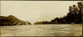
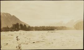
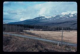
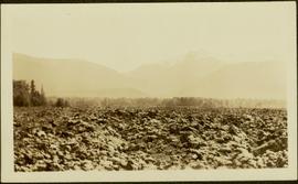
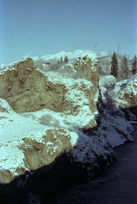
Handwritten annotation on verso reads: "Lava plain Upper Nass River". Forest and hills visible in distance across plain.
Photograph depicts buildings on shore in background, hills visible in distance.
Handwritten annotation on verso reads: "1st canyon Nass River".
Handwritten annotation on verso reads: "Lower end of canyon on Naas River. North of Prince Rupert". Forest and mountains visible on shore in distance.
Photograph depicts Iona Campagnolo and Peter Jones standing by a lake on highway 37.
Photograph depicts a damaged road and bridge from a washout on Highway 16 between Hazelton and Terrace.
Photograph depicts two people standing on a bridge over the Bulkley River by Moricetown.
Photograph depicts the aftermath of the flooded Bulkley River near Moricetown.
Photograph depicts a loader filling a truck with dirt from the damaged road near Moricetown.
Photograph depicts Iona Campagnolo and Peter Jones surveying the damage to Highway 16 from a flood.
Photograph depicts Iona Campagnolo walking by the Bulkley River with people sledding in the background.
Photograph depicts the Bulkley River and rocky bank with a red-roofed house set behind.
Photograph depicts Iona Campagnolo beside a damaged road and bridge from a washout on Highway 16.
File consists of a transcript of an oral history interview with Ken and Donna Quinn.
Photograph depicts a baby seal at C.N. log drop at Cowichan Lake on Vancouver Island.
Photograph depicts gulls at Lost Lagoon in Vancouver, B.C.
Photograph depicts fields recently cleared from virgin bush on Miracle Breach on Vancouver Island.
Photograph depicts Granite Falls near the Wigwam Inn, Indian Arm, Vancouver, B.C.
Photograph depicts Granite Falls and wharf at Indian Arm, looking west from the top of the falls.
Photograph depicts the entrance to the Squamish River at Squamish, looking upstream. The pier on the left belongs to the original logging railway, circa 1909-1925.
Image depicts a few unidentified individuals fishing in a river at an uncertain location.
Image depicts what is either the Rocky Mountains or possibly the Columbia Mountains, from McBride, B.C.
Image depicts a view of either the Rocky Mountains or possibly the Columbia Mountains near McBride, B.C.
Image depicts a view of what is either the Rocky Mountains or possibly the Columbia Mountains near McBride, B.C.
Image depicts a distant view of what appears to be a body of water, with numerous mountains in the background. The slide is labelled "Valemount reservoir."
Image depicts the peak of Mt. Robson.
Image depicts a river somewhere in Mt. Robson Provincial Park, with a bridge running over it. The slide itself is labelled "Robson station."
Image depicts Mt. Fitzwilliam.
Image depicts a heavily forested area located in the Rocky Mountain Trench, possibly near Dome Creek or Lamming Mills, B.C.
Image depicts a church school in the community of Crescent Spur, B.C.
Image depicts several buildings in the community of Loos, B.C.
Image depicts an old, boarded-up store/office in Lamming Mills, B.C.
Image depicts a small section of the area surrounding Lamming Mills, B.C.
Image depicts what appears to be a part of the old, abandoned mill in Lamming Mills, B.C.
Image depicts a log cabin somewhere in Dome Creek, B.C.
Image depicts an old, unused log cabin somewhere in Dome Creek, B.C.
Image depicts a beehive burner covered in snow in Sinclair Mills, B.C. Map coordinates 54°01'17.4"N 121°40'53.0"W
Image depicts railway tracks and buildings with a beehive burner on the left. The location is likely Sinclair Mills, B.C. Map coordinates 54°01'17.4"N 121°40'53.0"W
Image depicts two old houses surrounded by numerous trees at an uncertain location.
Image depicts a dilapidated house in Sinclair Mills, B.C.
Image depicts a field and a shack in the foreground and mountains in the background. The location is uncertain, likely Longworth, B.C.
Image depicts the Upper Fraser Road running through Upper Fraser, B.C. A beehive burner is seen in the background on the left and the mill office is seen on the right. Map coordinates 54°07'05.7"N 121°56'38.9"W
Image depicts entrance to mill yard for Upper Fraser mill in Upper Fraser, B.C. Map coordinates 54°07'10.8"N 121°56'51.7"W
Image depicts several houses, likely in Upper Fraser, B.C.
Image depicts Upper Fraser mill yard with log deck and beehive burner in silhouette across railroad tracks. Located in Upper Fraser, B.C. Map coordinates 54°07'01.5"N 121°56'29.6"W
Image depicts Upper Fraser residential area during demolition of town site. Map coordinates 54°06'51.6"N 121°56'26.3"W
Image depicts numerous piles of logs, and two unidentified individuals operating an excavator with a "thumb" attachment during the demolition of the Upper Fraser town site. Map coordinates 54°06'51.6"N 121°56'26.3"W
Image depicts numerous log decks at the Upper Fraser sawmill. Map coordinates 54°07'10.8"N 121°56'51.7"W
Image depicts an old house for sale surrounded by overgrown bushes in Upper Fraser, B.C. Map coordinates 54°07'15.0"N 121°57'02.0"W