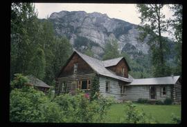
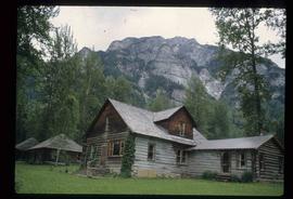
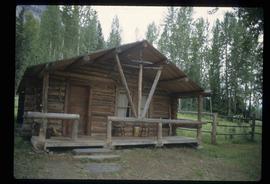
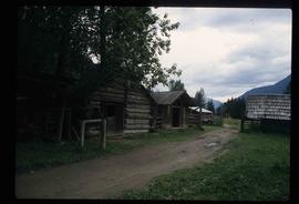
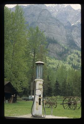
Image depicts an old gas pump at the Mount Robson Ranch.
Image depicts the Mount Robson Ranch.
File contains slides depicting places in Nelson.
File contains slides depicting the Okanagan Brigade Trail.
File contains slides depicting the Okanagan Kettle Valley.
Image depicts a view of the Okanagan Kettle Valley.
Image depicts a man fishing in the Kettle River.
Image depicts a small, ruined shed somewhere in the Okanagan Kettle Valley.
Image depicts a view of Kettle Valley, with a bridge of the old Kettle Valley Rail Road visible on a slope.
Image depicts a woman walking along a trail somewhere in Kettle Valley, B.C.
Image depicts a view of the Okanagan Kettle Valley.
Image depicts a woman walking along the trail of the Kettle Valley Rail Road.
Image depicts the Okanagan Kettle Valley, with the Kettle Rail Road faintly visible among the trees
Image depicts the trail of the old Kettle Valley Rail Road.
Image depicts a tunnel from the old Kettle Valley Rail Road.
Image depicts a man and woman standing in the mouth of a tunnel from the old Kettle Valley Rail Road.
Image depicts a woman standing inside a tunnel from the old Kettle Valley Rail Road.
Image depicts an unknown figure standing inside a tunnel from the old Kettle Valley Rail Road.
Image depicts the mouth of a tunnel from the Kettle Valley Rail Road.
Image depicts the old Kettle Valley Rail Road.
Image depicts a woman standing on the old Kettle Valley Rail Road.
Image depicts a man standing on the old Kettle Valley Rail Road.
Image depicts several unknown individuals standing on the old Kettle Valley Rail Road.
Image depicts a van on a narrow road, likely the Kettle Valley Trail.
Image depicts a hill and some power lines in Kettle Valley, B.C.
Image depicts a hill in kettle Valley B.C.
File contains slides depicting old town site plans for various cities.
File contains slides depicting Quesnelle Forks, B.C.
Image depicts a creek near Quesnelle Forks, B.C.
File contains slides depicting Runnalls.
File contains slides depicting the growth of Prince George.
File contains slides depicting St. Marie, Ontario.
File contains slides depicting old survey equipment and maps.
Image depicts Wells, B.C.
Photograph depicts the old hospital building in Wells. At the time the photo was taken, 1978, it was being used as an apartment building, and that is still its current use.
Image depicts Wells, B.C.