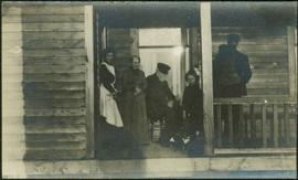
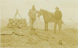
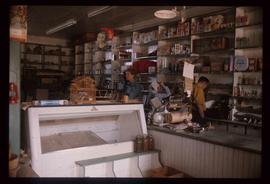
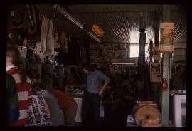
Showing 56207 results

Archival description
23665 results with digital objects Show results with digital objects
2006.20.12.46 · Item · [ca. 1940]
Part of Northern BC Archives Historical Photograph Collection

Handwritten photo album caption below this photo reads: "Ordinary 'Nose-Hanger'." Photograph depicts airplane hangar with large circles in a darker fabric to accommodate the nose and engines of plane. Large truck and stacks of unidentified packages in foreground on right. Unidentified vehicle to left of hangar. It is believed that photograph was taken at Whitehorse, YT.

Royal Canadian Air Force
Airplane signal
2004.1.2.4.20 · Item · 1930
Part of Phipps-Mackenzie Collection

Annotation on recto: "Aero. Signal 1930". Photo depicts three men and three pack dogs seated at the top of a signal marker.

2009.5.3.144 · Item · [ca. 1915]
Part of Taylor-Baxter Family Photograph Collection

Photograph depicts men in uniform standing on and around a stage coach with the sign "BREWSTER TRANSFER COMPANY." One man sits inside the coach pulled by four horses. Large building with extended porch and balcony in background. Mountains barely visible in distance. It is believed that one of the men in this photograph may be Mr. A. K. Bourchier.

Al and Skookum
2004.1.2.2.13 · Item · ca. 1931
Part of Phipps-Mackenzie Collection

Item is a photograph of A.H. Phipps and Skookum Davidson standing beside a horse and a surveying station at the top of a mountain.

2006.25 · Collection · 1961 - 2000, predominant 1961-1967

Fonds consists of original, silent 16mm reels that portray the natural, social and land use history of the Bella Coola and Chilcotin regions named the "Natural and Guiding History of the Bella Coola and Chilcotin Regions".

Possible locations that Al Elsey filmed include: Bella Coola, Bella Bella, Anahim Lake, Alert Bay, Nimpo Lake, Bulkey Valley, the Rainbow Mountains, Tweedsmuir Provincial Park, Dean River, Bella Coola River, Tchaha Lake, the Chilcotin region, the Ulkatcho Mountains, Lassard Lake, Fenton Lake, Atnarko River, Wells Gray Park, and Holt Homestead.

Al Neil
1996.2.1.1.438 · File · 1994
Part of Brian Fawcett fonds

File contains correspondence to Brian Fawcett from Al Neil. Includes a letter to Brian Fawcett from Al Neil, a member of the Professional Art Dealers Association. Card dated March 24, 1994.

Al Purdy
1996.2.1.1.499 · File · 1983, 1985, 1990
Part of Brian Fawcett fonds

File contains correspondence to Brian Fawcett from Al Purdy. Includes a letters to Brian Fawcett from Al Purdy, writer.

Alain Lefebvre collection
1992.16 · Collection · 12 February 1991

Collection contains a signed Spruce Kings hat, a signed game puck and a letter to Al Lefebvre of UNBC.

Alan Barber
1996.2.1.1.027 · File · 1990
Part of Brian Fawcett fonds

File contains correspondence from writer, Alan Barber to Brian Fawcett.

Alan Cassels, Lt. (N)
1996.2.1.1.117 · File · 1993
Part of Brian Fawcett fonds

File contains correspondence to Brian Fawcett from Alan Cassels, Lt. (N) Naval Section of Koh Kong, Cambodia. Includes a letter congratulating Brian on his book, "Cambodia", and Cassels expresses his thoughts and feelings in relation to the book. Letter dated August 10, 1993.

Alan Cooper
1996.2.1.1.146 · File · [198-?]
Part of Brian Fawcett fonds

File contains correspondence from Brian Fawcett to Alan Copper.

Alan Gasser
1996.2.1.1.243 · File · 1989, 1990
Part of Brian Fawcett fonds

File contains letters to Brian Fawcett from Alan Gasser. Correspondence includes poetry typed written by Alan Gasser. The items are dated August 1, 1989 and March 12, 1990.

Alan L. Hoover
1996.2.1.1.300 · File · 1969
Part of Brian Fawcett fonds

File contains correspondence to Brian Fawcett from Alan Hoover, Assistant Anthropologist , Department of Recreation and Conservation, British Columbia Provincial Museum. Includes letters dated February 10, and March 25, 1969.

Alan Twigg
1996.2.1.1.616 · File · 1988--1994 ; predominant 1989-1994
Part of Brian Fawcett fonds

File contains correspondence to Brian Fawcett from Alan Twigg. Includes letters to Brian Fawcett from Alan Twigg, Publisher of BC Book World regarding Brian's manuscripts. Letter predominately written 1989 to 1994.

Alan Winter
1996.2.1.1.668 · File · 1988
Part of Brian Fawcett fonds

File contains correspondence to Brian Fawcett from Alan Winter. Includes a letter to Brian Fawcett from Alan Winter, thanking Brian for review of his book. Letter dated June 25, 1988.

Alaska Highway
2012.13.1.98.59 · Item · 1999
Part of J. Kent Sedgwick fonds

Image depicts a small section of the Alaska Highway somewhere near Whitehorse, Y.T. The slide also appears to be labelled "army washing" for unknown reasons.

Alaska Highway Commission
2002.7.2.58.3 · Item
Part of H.G.T. (Harry) Perry fonds

B.C.-Yukon-Alaska Highway Commission – Map showing Highway Routes to Accompany Preliminary Report on Proposed Highway to Alaska
? January 1940
? Legend includes: 1) Existing Main Highways, 2) Roads in Northern Area, 3) Routes Under Construction.

2024.06 · Collection · 1942

Photograph album contains 134 snapshots showcasing building activity, equipment, logging, and airplanes in British Columbia and the Yukon, taken during the building of the Alaska Highway in 1942. The photographer is unknown. Many of the photographs depict Fort St. John and Fort Nelson.

Some of the photographs are captioned as follows:

  • Looking north at Fort St. John, B.C.
  • P.R.A. Bellanea and Army Norseman sea-planes on Charley Lake near Fort St. John, B.C.
  • Looking toward outlet of Muncho Lake from Float Plane
  • Fort St. John, British Columbia. Canada
  • Colonel Ingalls’ bridge across Liard River
  • Post Office & Government Telegraph Office
  • P.R.A. Camps at Fort St. John, B.C. looking N.E.
  • Post Office & Government Telegraph Office - Fort St. John - 1942
  • Army Ferry on Peace River near Taylor's Flats
  • Looking west on Main Street, Fort St. John, B.C. May - 1942
  • Looking southwest across Summit Lake
  • Public Roads Administration Headquarters Buildings. Fort St. John, B.C. - April - 1942
  • Looking southwest from south bank of Peace River from Old Highway near Taylor Flats, B.C.
  • First Army Headquarters - Fort St. John, B.C. - 1942
  • Beginnings of Fort Alcan - May 1942 - Fort St. John, B.C.
  • Road between 101 and 157
  • Other side Muncho Lake
  • Big Black Bear
  • Liard River, Canada
  • Dog Sled. Muskwa River
  • Temporary Bridge at Muskwa, B.C.
  • Another bridge in British Columbia
  • Above Fort Nelson, B.C. White spot in picture is the “moon”
  • Mountains N-106
  • Coughlin’s equipment at work west of Fort Nelson - Nov. - 1942
  • Near Mile Post 175-N descending to shore of Muncho Lake
  • First Fairbanks sign erected in Fort St. John. Apr. 1942
  • Boat used to cross the Fort Nelson River at Fort Nelson
  • Typical P.R.A. Engineers Camp at Mile 84-N
  • Fort Alcan - near St. John. British Columbia. “1942.”
  • Captain Hinze and Army beachcraft used on Army reconnaissance surveys for Alaska Highway
  • Small single motored aircraft used by P.R.A. on Alaska Highway Reconnaissance flights forced down on Gravel Bar on the Laird [sic] River near Mile 313-N
  • Near Mile 173-N looking at outlet of Muncho Lake
  • Near Mile 145 N. Toad River looking downstream
  • Looking southwest at Muncho Lake at Army operations on shore Pioneer Road. First tote road may be seen above.
  • Hudson Bay Store at Dease Lake, end of truck portage from Telegraph Creek + Wrangell. Beginning of boat freighting to lower port
  • Mile 104 n. Sugarfoot Lake
  • Mile 104 N. Sugarfoot Lake
  • Looking north from Mile 140 N. at Folding Mountains - approx. 8,000 ft high
  • Army forces along Muncho Lake
  • Malamute sled dog at Fort Nelson
  • P.R.A. location. Engineers’ Camp near Mile 165-N
  • Few miles west of Ft. St. John looking downstream at Peace River. Old Fort St. John. Buildings on near shore
  • British Columbia Police Plane in Fort Nelson River at Fort Nelson, B.C.
  • Few miles west of Fort St. John - Looking across Toad River at Little Folded Mountain near Mile 141
  • Looking northwest at P.R.A. an Oakes Camp and Alcan Highway.
  • Clouds after a rainstorm over Teslin Lake, Yukon Territory between Watson Lake and Whitehorse.
  • Toad River and Big Folded Mountain near Mile 142 N
  • Teslin Lake between Watson Lake & Whitehorse Y.K. The lake is 72 miles long
  • Whitehorse, Yukon Territory
  • Dept. of Transport Ferry on Peace River near Taylor Flats.
  • Foothills east of Rocky Mountains between Watson Lake & Whitehorse, Yukon Territory
  • Public Roads Administration (P.R.A.) Camp at Whitehorse, Y.K.
  • Whitehorse end of the White Pass and Yukon Railway from Skagway, Alaska to Whitehorse, Y.K.
  • Husky sled dog. Ft. St. John, B.C.
  • Mile 103 N. Looking east at Army Camp at Mile 102 N. - Summit Lake
  • Opening of new bridge on Sikanni River
  • Peace River Bridge has now replaced this “Ferry” - Fort St. John, B.C
  • Muskwa River new Fort Nelson, B.C.
  • Bridge across the Muskwa River.
  • View of mountains across flat between 101 - and 157
  • Plane at Fort Nelson - Ft. Nelson River
  • Moose Calves
  • Suicide Hill - J 108. Now eliminated from Alaskan Highway
  • Road Construction Equipment Center Boom - Bulldozer and Side Boom
  • Center Boom. Taken at Water Line
  • Early stages of road construction
  • Bulldozing for the Highway
  • Clearing the tinder for the Highway
  • Convoy of trucks on Alaskan Highway
  • Repair Camps off Highway
  • Mud - Mud - Mud - Mud!