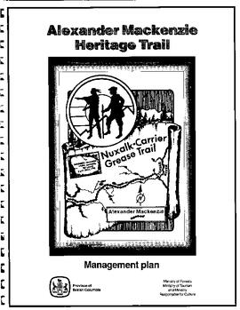
File consists of a spiral bound booklet titled "Alexander Mackenzie Heritage Trail Management Plan" prepared by the Province of British Columbia.
File consists of a booklet titled "Alexander Mackenzie Heritage Trail Master Development Plan" prepared by Parks Canada.
File consists of bound documents, plans, and reproductions. Includes: "Public input summary" spiral bound book from Parks Canada (Dec. 1985) and "Alexander Mackenzie Heritage Trail" bound book published by Parks Canada (17 July 1985).
File consists of notes, clippings, and reproductions relating to the Alexander Mackenzie monument in Prince George. Includes a photograph depicting Judge Howay at the unveiling of the original National Historic Monument to Alexander Mackenzie in Prince George on 13 June 1925 (reproduced 2009).
File consists of notes, clippings, and reproductions relating to the new Alexander Mackenzie monument in Fort George Park (renamed Lheidli T'enneh Memorial Park). Includes: "British Columbia Heritage Brigade Journey" pamphlet from Parks Canada and Canoe Sport B.C. (1985); "Alexander Mackenzie Trail Association" newsletter No. 9 (1987); "Alexander Mackenzie Voyageur Association" newsletter No. 36 (1994); and correspondence letters between John D. Adams, Supervisor of Interpretation and Heritage Site operations for the Province of British Columbia and Kent Sedgwick (Apr.- May 1986). Also includes photographs depicting the new Alexander Mackenzie monument and people at the unveiling (1985).
Handwritten annotation on verso: "11 Sep 1935, The monument is 18 feet high, they say. Some 16th century Chinese coins were found when the foundations were being dug. I heard of this the day before I left Victoria, and it seems worth enquiring into. Yours Sincerely, R (?) Bishop"; "I received medal for Bishop in 1935 in London from the Royal Geographical Society".
Photograph of a stone monument atop a small hill on a forested shoreline. Annotation on recto reads: "Alexander Mackenzie Monument, Dean Channel, Near Ocean Falls, BC."
File contains correspondence from Kent Sedgwick, President, of the Alexander Mackenzie Trail Association to Brian Fawcett.
Includes a letter of invitation to the Mackenzie Bicentennial events held in Prince George, B.C.
Collection consists of material collected by Wallace (Wally) Bergen during his involvement with the Alexander Mackenzie Trail Association. The association was renamed in 1994 to Alexander Mackenzie Voyageur Association. Includes association newsletters, brochures, news releases, a patch, a published map, and a published report.
Alexander Mackenzie Voyageur AssociationFile consists of issues of the Alexander Mackenzie Voyageur Association newsletter, formerly The Alexander Mackenzie Trail Association newletter, which was issued from 1985 to 2010.
Alexander Mackenzie Voyageur AssociationFile consists of typed documents, letters, and reports relating to the Alexander Mackenzie voyageur route near Vanderhoof. Includes: "Nuxalk-Carrier Grease Trail / Alexander Mackenzie Voyageur route" management plan annual report from the Vanderhoof Forest District (Jan.-Dec. 1994) and "RE: Alexander Mackenzie Heritage Trail" letter to the regional managers of the Prince George Forest Region and Cariboo Forest Region and the Director of the Archaeology Branch from Greg Nicoholls, the chair of the Alexander Mackenzie Heritage Trail Coordinating Committee (19 Apr. 1995).
The Alexander Manson Mining Collection consists of 133 loose photographs documenting various aspects of the mining industry in Northern British Columbia between 1930-1940. Photographs show images of Manson Creek and Germansen Landing.
Manson, AlexanderPhotograph depicts Alexandra Bridge that crossed the Fraser Canyon.
Photograph depicts the Alexandra Bridge in the Fraser Canyon. It is closed to wheeled traffic and has a grid iron deck. Photo looks east.
Photograph depicts the Alexandra Bridge in the Fraser Canyon. The view is looking northeast and depicts the Fraser River running downstream to the right of the photo. There is First Nations salmon net pole in the bottom left-hand corner.
Photograph depicts the Alexandra Bridge in the Fraser Canyon, about 20 miles north of Hope. Photo looks to east bank.
Photograph depicts the Alexandra Bridge in the Fraser Canyon. It is closed to traffic but is possible to drive a vehicle across but the road is blocked on the east bank. The bridge is in good condition. Photo looks east.
File consists of reproduced copy of "To the Memory of Alexander Mackenzie's Granddaughter and last Descendant Mrs. Heald (Alexandra Isabel Mackenzie)" originally published in 1933.
Image depicts some farmland near Alexandria, B.C.
Image depicts an old beer advertisement for Alexandria Lager, somewhere in Wells, B.C.
Photograph depicts an open field with a fence, house and shed in the midground, low treed hills in the background.
File consists of notes, clippings, and reproductions relating to Aleza Lake. Includes photographs depicting the Aleza Lake Cemetery (2001).
Floppy contains flag files (AL52-65F.dat, AL66-80F.dat) and Fortran programs (AES.for, AESEXT.for, AESFLG.for).
Floppy contains the following files: AL52-55.dat, AL56-60.dat, AL61-65.dat, AL66-70.dat, AL71-75.dat, AL76-80.dat
Floppy contains the following files: AL52-55.wk1, AL56-60.wk1, AL61-65.wk1, AL66-70.wk1, AL71-75.wk1, AL76-80.wk1, ALX52-80.wk1
File contains Aleza Lake Experiment Station Climate Station data from 1952 to 1980 and three accompanying floppies with weather data and Fortran programs.
Floppy contains the following files: AL94ENV.DAT, AL94VEG.DAT, ALZZ95.DOC, GISDAT.XLS.
The item is a photograph depicting a painting of a church at Aleza Lake by Vivian Antoniw. Note attached to the back of the picture states, "Vivian Antoniw - church at Aleza L."
Item is a photograph of a copy print that has been reproduced as a slide, resulting in low photographic quality. Location of original photograph unknown.
Item is a photograph of a copy print, resulting in a low quality photographic reproduction. Reproduced as a print, slide, and a negative. Location of original photograph is unknown.
File consists of working copies of aerial photos, vegetation tables printed from computer disk, photocopies of plot sheets, and lists identifying species.
Map is a photocopy reproduction of the "Aleza Lake Experiment Forest" map that was included in the appendix to the 1957 Aleza working plan.
Map reflects reserve boundary, roads, trails, 20 feet contour intervals, air photo centre, declination, swamps, and mile post at the Aleza Lake Experiment Forest.
Map is an original linen Aleza Lake Experiment Forest map that reflects the reserve boundary, roads, trails, 20 feet contour intervals, air photo centre, declination, swamps, and mile posts.
Map is a photocopy reproduction of the Aleza Lake Experiment Forest map that was included in the appendix to the 1957 Aleza working plan.
Map is a photocopy reproduction of the Aleza Lake Experiment Forest development map that was included in the appendix to the 1957 Aleza working plan.
Map reflects reserve boundary, roads, trails, 20 feet contour intervals, air photo centre, declination, swamps, and mile post at the Aleza Lake Forest Reserve.
Map reproduction depicts major areas of the Aleza Lake Experiment Forest.
Map is a photocopy reproduction of the Aleza Lake Experiment Forest permanent plot map that was included in the appendix to the 1957 Aleza working plan.