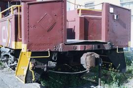
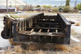
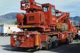
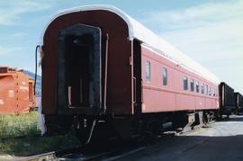
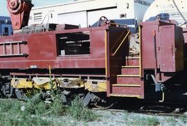
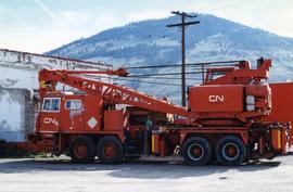
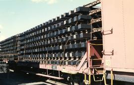
Photograph depicts a spare crane and an idler car. Visible are the details of the rear end of the idle car.
Photograph depicts details of a CN derailment that occurred in Kamloops.
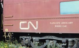
Photograph depicts the details of 3 axle trucks and car steps.
Architectural plan depicts a proposed standard 10 stall engine house with annex for machine shop and boiler room to be erected at Kamloops, BC.
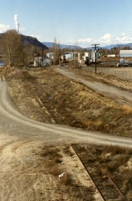
Photograph depicts the end of original 1916/17 trackage of the CNR in Kamloops. Track between a bitumen tank farm and a bridge that was not in use between about 1985 and 1995. In 1996, scrap metal was slowly piled beisde the trackside. 2-4 gondola's were visibly filled.
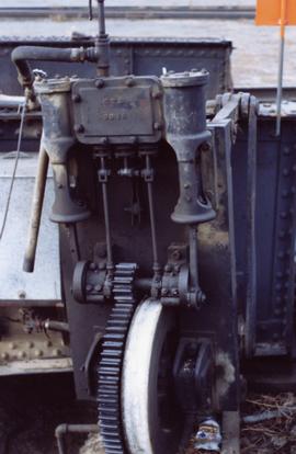
Photograph depicts an engine driven by air or steam. Taken near a turntable at Kamloops Junction.
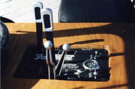
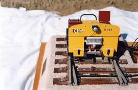
Photograph depicts the control panel of a Fairmont 2 man track car. Belt transmission.
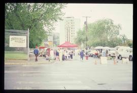
Image depicts a street, possibly in Kamloops, which has been closed for a Sunday morning Farmer's Market.
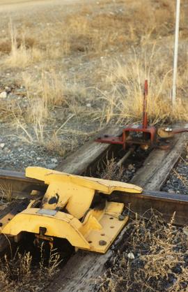
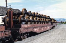
Photograph depicts a flat car wheel set carrier not related to Kamloops Auxiliary Trains.
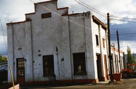
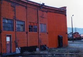
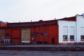
Photograph depicts a former boiler house and machine shop built in 1929. Located at the CNR Kamloops Junction.
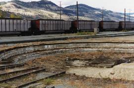
Photograph depicts a turntable that had been lifted out of a pit and set on the ground at the Kamloops Junction. Lifting had been done by two powerful sterling cranes.
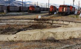
Photograph depicts a former turntable pit that was pictured immediately after the table was removed. The pit was later filled in with dirt/gravel. R.H. track wioth 2 locomotives was made into a running line. L.H. track that had a switcher was made into a dead-end spur.
Photograph depicts a former turntable pit iat the CN Kamloops Junction that was pictured immediately after the table was removed. CN lost no time in filling the pit. A running rail was salvaged by the 2141 Society.
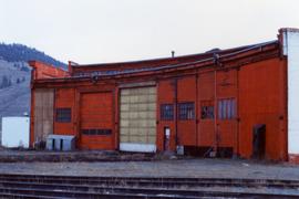
Photograph depicts a CN roundhouse that was built in 1929 at the Kamloops Junction. It was demolished in November, 1993.
Photograph depicts a CN roundhouse that was built in 1929 at the Kamloops Junction. It was demolished in November, 1993.
Photograph depicts a CN roundhouse that was built in 1929 at the Kamloops Junction. It was demolished in November, 1993. The prime reason for its demolition was not wanting to pay local taxes on a building rarely used for anything except for motor vehicles, general temporary storage, etc.
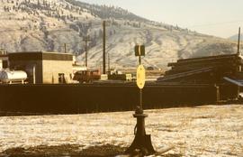
Photograph depicts a turntable where behind it a former roundhouse stood.
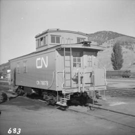
Photograph depicts a freshly painted Canadian National Railway (CN) caboose at Kamloops Junction depot.
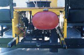
Photograph depicts details of agas tank and carrying handles.
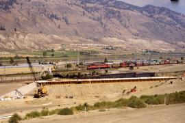
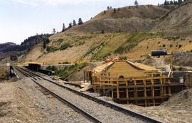
Photograph depicts an existing girder bridge, in use since 1962. A new concrete bridge was being built on the left.
Photograph depicts an old girder bridge.
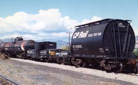
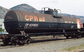
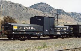
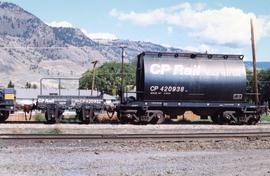
Photograph depicts a set of 4 scale testing cars, consisting of 2 sealed tank cars and 2 special purpose-made cars, one of which was 4-wheeled. Found at the CPR Kamloops yard.
Photograph depicts one of the 4 cars in a scale testing group found at the Kamloops CPR yard.
Photograph depicts a part of a group of 4 scaling testing cars found in the Kamloops CPR yard.
Photograph depicts 2 cars of the group of 4 car 'Scale Test Unit" at the CPR Kamloops yards.
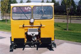
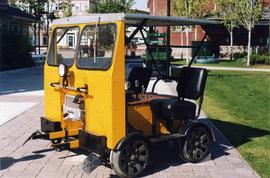
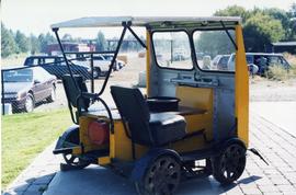
Photograph depicts a Fairmont section gang "motor car." Property of Kamloops Heritage Railway. On display at the CNR station in downtown Kamloops.
Photograph depicts a Fairmont section gang "motor car." Property of Kamloops Heritage Railway. On display at the CNR station in downtown Kamloops.
Photograph depicts a Fairmont section gang "motor car." Property of Kamloops Heritage Railway. On display at the CNR station in downtown Kamloops.
Photograph depicts a hi-rail crane that was located in the Cn Junction yards, Kamloops.
Photograph depicts a hi-rail crane that was located in the Cn Junction yards, Kamloops.
Photograph depicts the end part of an idle car nearest to a crane boom.
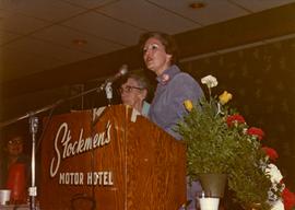
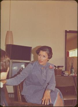
Photograph depicts Iona Campagnolo speaking at the Kamloops Liberal Convention at the Stockmen's Hotel.
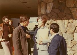
Photograph depicts Iona Campagnolo talking to men possibly at the Kamloops Liberal Convention at the Stockmen's Hotel.
File consists of records created and accumulated by Gary Runka over the course of his consultancy work for BC Buildings Corporation for the "Land Resource Inventory of Tranquille Institution" project in Kamloops. This file was numbered as G.G. Runka Land Sense Ltd. client file #149; that client number may be seen referenced elsewhere in the G. Gary Runka fonds. The Land Sense Ltd. client files generally include records such as correspondence, contracts, invoices, project reports, publications, ephemera, memoranda, maps or map excerpts, legal documents, meeting materials, clippings, and handwritten notes. File also includes 4 accompanying aerial photographs (2 with overlays) and 1 photographic print. Includes report by G. G. Runka Land Sense Ltd. for B.C. Buildings Corporation entitled "Tranquille Farm, Kamloops, B.C., Land Resource Attributes and Constraints", January 1986.
Maps include:
- British Columbia Buildings Corporation, "Tranquille School & Farm", Aug. 1979
- British Columbia Buildings Corporation, "Tranquille", Feb. 1980
- British Columbia Buildings Corporation, "Tranquille Wasterwater Management System Upgrading", Feb. 1981 (2 copies)
- R. B. Stothers, City of Kamloops, "Posting Plan of Outer Boundaries of DL 341,342 & 343 all of Group 1 KDYD; LS6,11 & 12 of Sec 25; and NW Cor Sec 25, TP 20 Rge 19 W6M KDYD, Dec. 1985 (3 copies, 1 of which is annotated)
- Untitled map of D.L. 342 & 343 etc.
- Enlargement of Untitled map of D.L. 342 & 343 etc.
- Reproduction of [1916?] "Plan of Part of Lot 343 G1 Kamloops District"
- Reproduction of Canada Department of Agriculture Water Development Branch, "General Plan - Tranquille Farm Lands", Dec. 1953
- Annotated draft map showing Red Plateau grazing permit, Tranquille Reserve, existing fence, and proposed fence, circa [198-?]
- Reproduction of Department of Lands and Forests, "Plan of Tranquille School", Oct. 1961
- G.G. Runka Land Sense Ltd., draft mylar map negative depicting Tranquille Farm entitled "Map 1: Landforms", 1985
- G.G. Runka Land Sense Ltd., draft mylar map negative depicting Tranquille Farm entitled "Map 2: Land Capability for Agriculture", 1985
- G.G. Runka Land Sense Ltd., draft mylar map negative depicting Tranquille Farm entitled "Map 3: Land Suitability for Agriculture", 1985 (with overlays)
- G.G. Runka Land Sense Ltd., draft mylar map negative depicting Tranquille Farm entitled "Map 4: Present and Surrounding Use", 1985
- G.G. Runka Land Sense Ltd., draft mylar map negative depicting Tranquille Farm entitled "Map 5: Legal and Jurisdictional", 1985
- G.G. Runka Land Sense Ltd., draft mylar map negative depicting Tranquille Farm entitled "Map 6: Proposed Land Use and Legal Parcel Replot", 1985
- BC Ministry of Environment, 92I.078.1.4.1 Orthophoto map, Jan. 1985
- BC Ministry of Environment, 92I.078.1.4.1 Orthophoto map (reproduced with overlay), Jan. 1985
- BC Ministry of Environment, 92I.078.1.4.2 Orthophoto map, Jan. 1985
- BC Ministry of Environment, 92I.078.1.4.2 Orthophoto map (reproduced with overlay), Jan. 1985
- BC Ministry of Environment, 92I.078.1.4.4 Orthophoto map, Jan. 1985
- BC Ministry of Environment, 92I.078.2.3.1 Orthophoto map, Jan. 1985
- BC Ministry of Environment, 92I.078.2.3.1 Orthophoto map (reproduced with overlay), Jan. 1985
- BC Ministry of Environment, 92I.078.2.3.3 Orthophoto map, Feb. 1985
- Partial photocopy reduction of "Soil Map of Tranquille Sanatorium Farm", 1957 (on 2 sheets)
- Department of Lands and Forests Topographic Division Surveys & Mapping Branch, "Plan of Tranquille School" original detailed large reproduction annotated in colour, October 1961
- Large original reproduction of "Plan of Tranquille School", undated, possibly circa 1958-1961
File consists of records created and accumulated by Gary Runka over the course of his consultancy work for BC Ministry of Development, Trade and Tourism for the "Natural Resource Tourism Inventory" project in Kamloops. This file was numbered as G.G. Runka Land Sense Ltd. client file #297; that client number may be seen referenced elsewhere in the G. Gary Runka fonds. The Land Sense Ltd. client files generally include records such as correspondence, contracts, invoices, project reports, publications, ephemera, memoranda, maps or map excerpts, legal documents, meeting materials, clippings, and handwritten notes. File also includes 47 accompanying photographs.
Maps include:
- G.G. Runka Land Sense Ltd., "Natural Resource Tourism, Kamloops Resource Management Area - Tourism Capability Map", Sept. 1991
- G.G. Runka Land Sense Ltd., "Natural Resource Tourism, Kamloops Resource Management Area - Visual Resource Significance", Sept. 1991
- Reproduction of BC Ministry of Forests, "Map of Rec. Proj. 900-1-3-4716 (Chuwhels Mtn Trails), June 1967
File consists of records created and accumulated by Gary Runka over the course of his consultancy work for Skeetchestn Indian Band & Mandell Pinder LLP for the "Consultation on Resource Management and Proposed Adjacent Land Development Issues" project in Kamloops Lake. This file was numbered as G.G. Runka Land Sense Ltd. client file #555; that client number may be seen referenced elsewhere in the G. Gary Runka fonds. The Land Sense Ltd. client files generally include records such as correspondence, contracts, invoices, project reports, publications, ephemera, memoranda, maps or map excerpts, legal documents, meeting materials, clippings, and handwritten notes.
File consists of records created and accumulated by Gary Runka over the course of his consultancy work for Grasslands Conservation Council of BC for the "Facilitation and Consultations for Mitigating the Fragmentation and Development of BC Grasslands Workshop" project in Kamloops. This file was numbered as G.G. Runka Land Sense Ltd. client file #593; that client number may be seen referenced elsewhere in the G. Gary Runka fonds. The Land Sense Ltd. client files generally include records such as correspondence, contracts, invoices, project reports, publications, ephemera, memoranda, maps or map excerpts, legal documents, meeting materials, clippings, and handwritten notes.
File consists of records created and accumulated by Gary Runka over the course of his consultancy work for Grasslands Conservation Council of BC for the "Development of Strategic Plan for Mitigating Fragmentation and Development of BC's Grasslands" project in Kamloops. This file was numbered as G.G. Runka Land Sense Ltd. client file #601; that client number may be seen referenced elsewhere in the G. Gary Runka fonds. The Land Sense Ltd. client files generally include records such as correspondence, contracts, invoices, project reports, publications, ephemera, memoranda, maps or map excerpts, legal documents, meeting materials, clippings, and handwritten notes. File also includes 17 accompanying photographs.
File contains slides depicting places in and around the Kamloops and Lillooet regions.
Photograph depicts Kamloops Auxiliary car #3. CN #54960 visible on the repair track after its roof renovation was completed.
Plan depicts the location of buildings occupied by the Northern Construction Company on the old Kamloops Station ground.
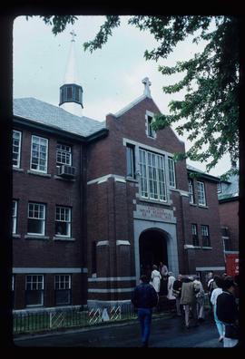
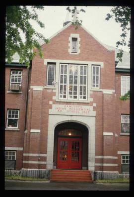
Image depicts the old Kamloops Residential School which operated until either 1977 or 1978 before becoming part of the Secwepemc Musem in 1982.
Image depicts the old Kamloops Residential School which operated until either 1977 or 1978 before becoming part of the Secwepemc Musem in 1982.
Postcard depicts Kamloops station at about 1895.
Photograph depicts a CN car carrying logs.
Postcard depicts Main Street (Victoria West) Kamloops in 1910.
Postcard depicts Main Street (Victoria West) Kamloops in 1910.
Handwritten annotation on verso reads: “Kamloops--Liberal Convention, Big Speech, Big Response”.
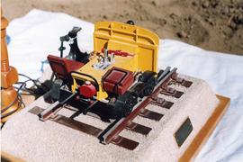
Photograph depicts a model of a 2 man track car presented to Giovanni Marra in 1973 upon his retirement as a CPR Kamloops road master. Model made by L.G. Snowden (modeller and then locomotive engineer for CPR).
Photograph depicts a model of a Fairmont track car that was presented to Giovanni Marra in 1973 and built by L.G. Snowden.
