This file contains the following photographs in both print photograph and negative format:
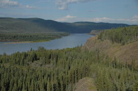
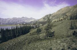
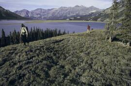
Slims River delta
Date: August 11, 2003
(location not recorded)
Print roll 5, #1-3 (Corresponding slides: Slides roll 3, #15-14)
Grizzly bear
Date: August 12, 2003
(beside Cultus Bay Rd.; location not recorded)
Print roll 5, #6-7
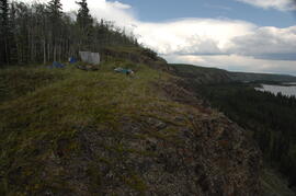
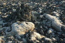
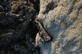
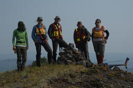
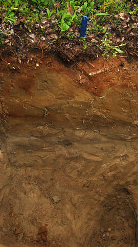
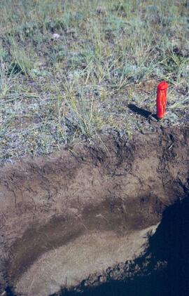
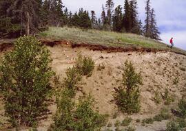
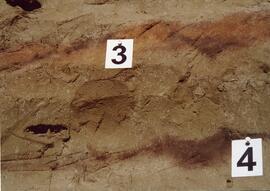
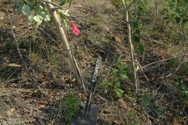
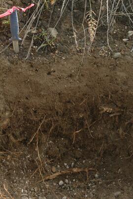
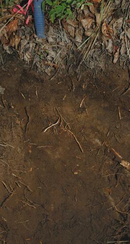
Y03-08 (Cultus Bay Rd. – at top of switchbacks)
Date: August 12, 2003
Location Coordinates: 61° 3’ 43.1” N, 138° 21’ 4.0” W, 833.8 m asl (± 5.1 m)
Site Description: good exposure of loess (35 cm) with Slims Soil over glaciofluvial terrace – pinches out downslope [note: this site was sampled because of development of buried paleosol, and was not part of biological crust study by Marsh et al. (2006)]
Sample Depths & Descriptions:
- Y03-08-01 - 45-48 cm - Ahkb (7.5YR 3/3 d; strongly effervescent)
- Y03-08-02 - 48-56 cm - Bmkb (7.5YR 4/3 d; strongly effervescent)
- Y03-08-03 - 56-70 cm - Ccab (2.5Y 5/2 d; strongly effervescent)
- (not sampled) - 70 cm+ - IICca (glaciofluvial; strongly effervescent)
- Intact sample: 56-36 cm - depth (including Slims Soil)
Print roll 5, #8-10, 17-18 (Corresponding slides: Slides roll 3, #13-11, 5-4)
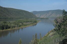
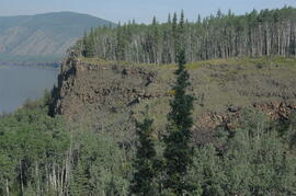
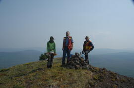
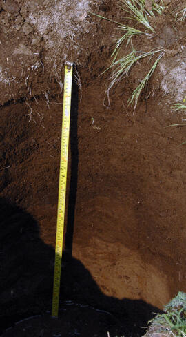
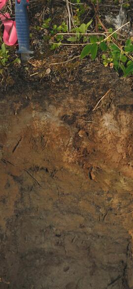
Y03-09 (cliff top on E. shore of Kluane L. at Christmas Bay)
Date: August 12, 2003
Location Coordinates: 61° 4’ 0.0” N, 138° 22’ 35.3” W, 828.3 m asl (± 7.3 m)
Site Description: ~ 60 cm loess over glaciofluvial gravels
Sample Depths & Descriptions:
- Y03-09-01 - Nostoc crust
- Y03-09-02 - Tortula ruralis – Cetraria crust
- Y03-09-03 - 0-14 cm - ACk (10YR 3\2 d)
- Y03-09-04 - 14-16 cm - Ahkb1 (10YR 2/2 d)
- Y03-09-05 - 16-18 cm - Ck1 (10YR 4/3 d)
- Y03-09-06 - 18-20 cm - Ahkb2 (10YR 3/2 d; discontinuous)
- Y03-09-07 - 20-27 cm - Bmkb1 (10YR 4/3 d)
- Y03-09-08 - 27-33 cm - Bmkb2 (7.5YR 4/3 d)
- Y03-09-09 - 33-46 cm - Bmkb3 (10YR 4/3 d)
- Y03-09-10 - 46-55 cm - Ck2 (2.5Y 5/3 d)
- (not sampled) - 55-60 cm+ - IICk (glaciofluvial gravels)
Print roll 5, #11-15 (Corresponding slides: Slide roll 3, #10-6)
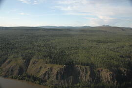
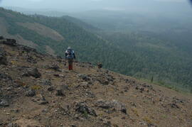
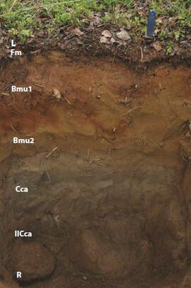
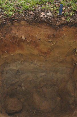
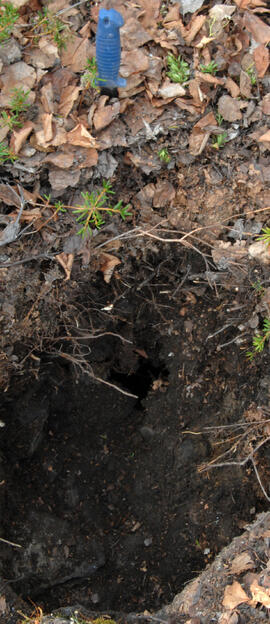
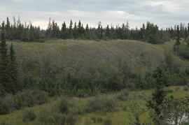
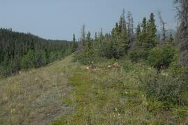
Y03-10 (shore bluff N. of Silver City)
Date: August 12, 2003
Location Coordinates: 61° 2’ 55.0” N, 138° 23’ 17.2” W, 806.7 m asl (± 7.3 m)
Site Description: 70% slope, SW aspect; vegetation: Elymus, Carex, Artemisia, Erigeron
Sample Depths & Descriptions:
- Y03-10-01 - Crust
- Y03-10-02 - 0-18 cm - ACk (10YR 4/2 m; strongly effervescent)
- Y03-10-03 - 18-25 cm - Ahkb(?) (10YR 4/2 m; strongly effervescent)
- Y03-10-04 - 25-40 cm - Ck (2.5Y 5/2.5 m; strongly effervescent)
- (not sampled) - 40 cm+ - IICk (glaciofluvial gravels; strongly effervescent)
Print roll 5, #19-22 (Corresponding slides: Slide roll 3, #3-1)
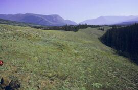
Silver City ghost town (location not recorded)
Date: August 12, 2003
Print roll 5, #23-24
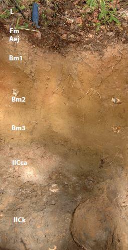
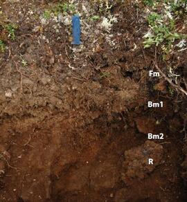
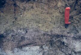
Y03-11 (Silver City road section)
Date: August 12, 2003
Location Coordinates: 61° 2’ 3.6” N, 138° 22’ 48.8” W, 806.7 m asl (± 8.7 m)
Site Description: roadcut through SW-facing hill exposes loess over glaciofluvial gravel, with 4 paleosols in colluviated loess
Sample Depths & Descriptions:
- Y03-11-01 - 0-18 cm - ACk (fresh loess)
- Y03-11-02 - 18-47 cm - Soil 1 – Bmk
- Y03-11-03 - 47-100 cm - Loess
- Y03-11-04 - 100-110 cm - Soil 2 – includes charcoal
- Y03-11-05 - 110-160 cm - Loess with secondary carbonate in root channel
- Y03-11-06 - 160-170 cm - Soil 3 – Ahk with charcoal
- Y03-11-07 - 160-170 cm - Soil 3 – Bmk
- Y03-11-08 - 170-198 cm - Loess with secondary carbonate in root channel
- Y03-11-09 - 198-202 cm - Soil 4 – Ahk – laterally continuous for ~ 1.5 m
- Y03-11-10 - 202-230 cm - Loess with secondary carbonates in roots
- Y03-11-11 - 230-255 cm - Soil 5 – Ahk – includes abundant charcoal bands
- Y03-11-12 - 230-255 cm - Soil 5 – Bmk – infilled squirrel burrows immediately below
- Y03-11-13 - 255-300 cm+ - Loess
Additional notes on modern soil & paleosols:
Soil 1
- consists of Bmk horizon material with 2 distinct colours: 7.5YR 4/3 d & 10YR 4/3 d
- loess between Soils 1 & 3 is sandier
Soil 2
- 90% Ahk material, 2-10 cm thick
- Ahk – 10YR 3/2 d
- Bmk – 7.5YR 4/2 d
- less abundant carbonate than in paleosols & loess below
Soil 3 - most of exposure has Ahk (2-5 cm thick) over Bmk (4-10 cm thick), with carbonates as for Soil 5
Soil 4 - mostly Ahk (10YR 3/2 d) material 2-8 cm thick, some Bmk (10YR 4/2 d) < 2 cm thick, with carbonates as for Soil 5
Soil 5
- complex intermixing of Ahk & Bmk material, charcoal most abundant in Ahk
- individual colour bands 2-10 cm thick
- overall dip of horizons (10° to W) is parallel to surface
- similar size & density of secondary carbonates as in loess above & below; associated with root channels, < 5 mm diameter, covering ~ 5% of surface
Print roll 5, #26-30 (Corresponding slides: Slide roll 4, #36-32)