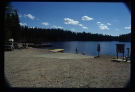
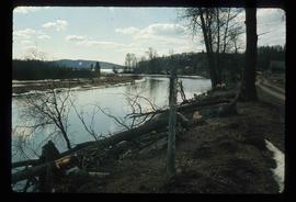
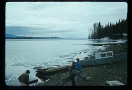
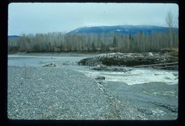
Image depicts the Bulkley River running through Moricetown Canyon.
Image depicts a stretch of road through the Bulkley Valley.
Image depicts a mountain in Smithers, B.C.
Image depicts Cottonwood Island.
Image depicts a small stream somewhere on Cottonwood Island.
Image depicts two youths fishing from the bank of the Nechako River on Cottonwood Island.
File consists of a typescript report in a duotang titled "Carp Lake Park Report: 1973" by Leon E. Pavlick.
Image depicts a view of Blackwater in the country near Punchaw, B.C.
Image depicts three men and a dog on the hiking trail near Mt. Robson.
Image depicts what is possibly the Robson River at the base of Mt. Robson.
Image depicts the Berg Glacier and Berg Lake near Mt. Robson.
Image depicts a camp of people with Mt. Robson and the Berg Glacier in the background.
Image depicts five unknown individuals somewhere near Mt. Robson.
Image depicts a group of people heading towards a glacier, possibly the Robson Glacier.
Image depicts a group of people hiking on a glacier, possibly the Robson Glacier.
Image depicts a man talking to a group of hikers, with what is possibly Mt. Robson and the Robson Glacier in the background.
Image depicts a range of mountains in the Mt. Robson Provincial Park.
Image depicts a view of Mt. Robson Provincial Park.
Image depicts an unknown individual reading inside a tent somewhere in Mt. Robson Provincial Park.
Image depicts a group of hikers somewhere in Mt. Robson Provincial Park.
Image depicts a group of people hiking through trees somewhere in Mt. Robson Provincial Park.
Image depicts a man, with what is possibly the Robson Glacier visible in the background.
Image depicts Kent Sedgwick speaking to a group of hikers.
Image depicts a view of Mt. Robson Provincial Park.
Image depicts a man looking at some papers. It is most likely Kent Sedgwick.
Image depicts a man, most likely Kent Sedgwick, using what appears to be some type of a spigot on a tree.
Image depicts a view of Mt. Robson Provincial Park.
Image depicts an unknown individual pointing at some writing on a rock; it possibly reads "ACC Aug 10 1911."
Image depicts a man holding a chain of fish on the shore of Carp Lake.
Image depicts a low rain cloud over Carp Lake.
Image depicts Carp Lake at dusk.
Image depicts a boat launch with several people nearby; it is possibly at War Lake in Carp Lake Provincial Park.
Image depicts what is possibly a small section of the Nechako River on Cottonwood Island.
Image depicts the frozen Morfee Lake just to the East of Mackenzie, B.C. The slide is also labelled "sub-boreal," referencing that it is a sub-boreal spruce zone.
Image depicts numerous trees damaged by beavers near the Nautley River.
Image depicts several unknown individuals on the shore of Babine Lake.
Image depicts a drill for blasting holes at a mine site somewhere in Granisle, B.C.
Image depicts numerous bags of blasting powder at a mine site somewhere in Granisle, B.C.
Image depicts the Fulton River.
Image depicts the mouth of the Kispiox River.
Image depicts the Bulkley River running through Moricetown Canyon.
Image depicts several unidentified individuals walking along the snow-covered Upper Fraser Road with numerous buildings on either side. Map coordinates 54°07'05.7"N 121°56'38.9"W
Image depicts a vehicle parked beside a small, wooden house in Upper Fraser, B.C. Map coordinates 54°07'05.7"N 121°56'38.9"W
Image depicts the Fraser River and the Grand Trunk Pacific Bridge from Cottonwood Island Park.
Image depicts Prince George at night from the cutbanks.
Image depicts an esker at Bednesti Lake, B.C.