The item is a photograph of the front exterior of Knox United Church at 1425 5 Avenue, Prince George.
The item is a photograph of the front and side exterior of St. Micheal and All Angels' Anglican Church. The address is 1505 5 Avenue, Prince George.
The item is a photograph of St. Mary's Parish and school at 1115 Gillett Street, Prince George. The photograph is the front of the church taken from Freeman Street.
The item is a front exterior photograph of Spruceland Elementary School at 3805 Rainbow Drive, Prince George.
The item is a photograph of exterior of a brick commercial or public building in Prince George. Two tall garages are attached to the building. The address is unknown.
The item is a photograph of Highland School at 155 McDermid Drive, Prince George.
The item is an exterior photograph of a stairwell in one of the outside courtyards at the University of Northern British Columbia, Prince George.
The item is an exterior photograph of the Library and some unique architecture at the University of Northern British Columbia, Prince George.
The item is an exterior photograph of the Dr. Donald Rix Northern Health Centre at the University of Northern British Columbia, Prince George.
The item is an exterior photograph of the entrance to the College of New Caledonia at 3330 22 Avenue, Prince George.
The item is a 35 mm photograph negative depicting the remaining lumber beams after the fire at the Bank of Montreal in Prince George.
The item is a photograph depicting a narrow staircase from the parking level to the Prince George Public Library.
The item is a photograph depicting the exterior entrance from the parking level to the Prince George Public Library.
File consists of notes and reproductions relating to Fort Alexandria (later renamed Alexandria). Fort Alexandria was an HBC trading post, ferry site, and steamboat landing in the North Cariboo, 45 km south of Quesnel. File contains photographs depicting Fort Chilcotin, the landscape and buildings (Sept. 1983 and Aug. 2006).
The item is a photograph depicting the remaining lumber beams after the fire at the Bank of Montreal in Prince George.
The item is a CD-R containing 18 Tiff images of plans for Hatley Park. The files take up 139 mb on the CD-R.
File consists of a CD, an audiocassette, and a typed transcript of an interview with Trelle Morrow conducted by Kent Sedgwick. Trelle Morrow was an architect in Prince George between 1950 and 2000 and during the interview in 2007 he was a retired member of the Architectural Institute of B.C. The interview includes discussions on the buildings Trelle Morrow contributed to in Prince George and his life surrounding his work.
The item is a photograph of a wood and white brick house in Prince George. The address is 2755 on an unknown street.
The item is a photograph of a wood and white brick house in Prince George. The address is 2755 on an unknown street.
The item is a 35 mm photograph negative of an aged white and blue trimmed house in Prince George. Address is unknown.
The item is a photograph of the Prince George Citizen office building at 229 Brunswick Street, Prince George.
The item is a photograph of Quinson Elementary School at 251 Ogilvie Street South, Prince George.
The item is a photograph of Quinson Elementary School at 251 Ogilvie Street South, Prince George.
The item is an interior photograph of a concrete stairwell with red and wooden railings. Picture is likely the interior of the University of Northern British Columbia.
File consists of notes, clippings, and reproductions relating to the Prince George Genealogical Society.
File consists of photographs depicting Soda Creek Cemetery and presumably the general Soda Creek area. Also includes photographs of a personal residence and Kent Sedgwick with a dog.
Photograph depicts the graves of Seward Rankin, Gerald Rankin, and James Rankin at the Soda Creek Cemetery.
Photograph depicts Celia M Dusseau's grave stone in the Soda Creek Cemetery.
Photograph depicting a dirt road winding between grass and trees in Soda Creek.
Photograph depicting an abandoned building in Soda Creek, the building surrounded by overgrown grass and trees.
Photograph depicting a garden and backyard in someone's personal residence.
Photograph depicting Kent Sedgwick and a dog in someone's garden and personal residence.
File consists of notes and reproductions relating to the planning of the Prince George townsite. Includes material on surveyors, Fred Burden, and town planners working with the landscape architects Brett and Hall on the development of the townsite. File predominantly consists of Kent Sedgwick's handwritten notes on townsite planning in Prince George. Includes a clipped article from the Prince George Citizen newspaper "Town planners involved landscape architects" (4 Nov. 2006).
File consists of maps and notes relating to the original Prince George city plans by Brett and Hall. Brett & Hall were landscape architects from Boston, MA who designed the original plan for Prince George, including features such as the Crescents neighbourhood. Includes photographs depicting the original plans by Brett & Hall for Prince George (2006).
The item is a photograph and negative of a survey map of the Prince George townsite surrounding Connaught Park.
The item is a photograph negative of a survey map of the Prince George townsite surrounding Connaught Park.
The item is a photograph and negative of the Fort George Herald from 12 April 1913. The front-page article is titled, "The Grand Trunk Pacific Railway CO.'s Townsite of Prince George" and contains a survey map of the Prince George townsite.
The item is a photograph and negative of the Fort George Herald from 12 April 1913. The front-page article is titled, "The Grand Trunk Pacific Railway CO.'s Townsite of Prince George" and contains a survey map of the Prince George townsite.
The item is a photograph and negative of a survey map of the Prince George townsite. Areas highlighted are in the Nechako and Fraser River area, including Connaught Park.
The item is a photograph and negative of a survey map of the Prince George townsite. Areas highlighted are in the Nechako and Fraser River area, including Connaught Park.
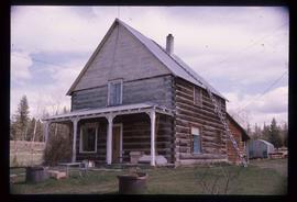
Image depicts a log house at an uncertain location.
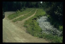
Image depicts the Dunlevy Creek area somewhere near Dawson Creek, B.C. The slide is simply labelled "Dunlevy irrigation" for uncertain reasons.
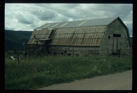
Image depicts an old barn located somewhere near Dunlevy Creek in the Dawson Creek area.
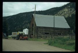
Image depicts an old barn located at a dairy farm somewhere near Dunlevy Creek in the Dawson Creek area.
The item is a photograph depicting a house with a blue car at 1705 Fir Street, Prince George. Annotation on the back of the photograph states, "1705 Fir St. - N. of F-C school at 17th."
The item is a photograph depicting the exterior of old damaged buildings on the Moffat farmland. There is a fence at the entrance to the driveway with an address sign that reads "1820."
The item is a photograph depicting the exterior of old damaged house on the Moffat farmland. There is a broken fence at the rear of the house, broken windows and a collapsed roof.
The item is a photograph depicting the exterior of old stable on the Moffat farmland.
File consists of a loose-leaf print of "A Documentary Study of the Lheidli T'enneh Cemetery Prince George" written by Kent Sedgwick.
File consists of notes and reproductions relating to a 2006 Lheidli T'enneh Cemetery presentation conducted by Kent Sedgwick.


