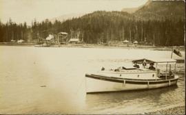
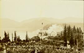
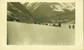
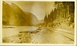
Photograph depicts large bridge and dam over a wide river, industrial structures throughout. Hills on opposite shore in background. Handwritten annotation on recto of photograph: "Coulee Dam, This is were[sic] I went this fall. Wished you had of been with me."
River in foreground, trees and cliffs in background.
Photograph depicts Jean in foreground, standing in front of wood house, miscellaneous items and furniture crossing midground. Picket fence on left, bushes in background. Handwritten annotation on recto of photograph: "Why didn't you drop off and see us when you were home? Dad came home an told me to guess whom he had seen in Edmonton and right away I said 'Uncle Alan.' Wishing you a very Merry Xmas and Happy New Year. Lots of love to both. Jean. See what lovely cuffs and collar the bear skin you sent for me some years ago made for me this winter. Nobody knows me with it on and everyone admires it." (See item 2009.5.3.100 for photograph depicting bear skin.)
Field and bushes in foreground. It is believed that this photograph was given to Lillian & A.K. Bourchier by their niece Jean.
Photograph depicts mountain in background, trees and hillside in foreground. Handwritten annotation on verso of photograph: "Mount Robson BC."
Photograph depicts a large group of women, men, and children standing and sitting on grass. Stand of trees crosses midground, forest visible in background. Handwritten annotation on verso of photograph: "Picnic at Fort George (Central) 1920." Photograph believed to have been taken at current location of Spruceland Shopping Center.
Handwritten notation affixed to verso reads: “Stikine Canyon Sept 2006”.
Stone wall runs in background. Photograph taken at Terrace Gardens, Government House, Victoria, BC. See item 2009.6.1.658 for similar image.
Road visible in background. Photograph taken at Government House in Victoria, B.C.
Handwritten notation accompanying print reads: “Terraces Gardens (I created 6 one for each of you) small”.
Photograph is one of 13 images printed from digital format on a CD-R featuring members of a group referred to as 'Terracites' (see item 2009.6.1.697) pictured in the gardens; see also items 2009.6.1.698 - 2009.6.1.710.
Hand coloured photograph of the surrounding lands and many residential buildings encompassing the Tsimshian village of Lax Kw'alaams (previously called Port Simpson). Printed annotation on recto reads: "Indian Village, Port Simpson, B.C."
Photograph of a large explosion on what appears to be a shoreline. Printed annotation on recto reads: "'Big Blast' Prince Rupert. B.C."
Photograph depicts landscape with cleared land in foreground, river in middle, building and trees in background.
Handwritten annotation on verso: "Central Fort George 1911".
Early spring landscape with roadbed and track in foreground, river in midground, and hill in background.
Handwritten annotation on recto: “PRINCE GEORGE 4-20-13”.
Photograph depicts Port Simpson in winter. Water crosses midground, hills stand in background.
Handwritten photo caption below image reads: "Port Simpson".
Four unidentified men look on, and portable buildings can be seen in background.
Handwritten annotation on verso reads: “Fairview Opening, Prince Rupert, 1/3/75”.
Photograph taken from interior of vehicle, dashboard visible in foreground. Snow on either side of highway stands at extreme height.
Trees on mountain base visible in background.
Man stands beside pickup truck on highway, hills in background.
Handwritten annotation on verso reads: “With the boss at Kivsta, Q.C.I.: May 1976, 13,000 yrs. carbondated habitation in the same location-- The real Charlottes and his counter culture protection in the rain, mist, moss and dense forest of the Haida”.
Sign in foreground reads: “Stop Bull Shitting, [Phoney (crossed out)] Ioney”.
Handwritten annotation on verso reads: “The Kitimat Oil Port Environmental Lobby, didn’t believe I killed it. I did!”
Forest in background.
Photograph of a large dock littered evidence of lumber transportation. Small buildings and stumps are on the shoreline. Annotation on recto reads: "Prince Rupert BC, '07."
Foreground shows a rocky shore covered in debris. A small crowd is visible along the coastline, and there are foggy outlines of hills beyond the water. Annotation on recto reads: "McRae Bros After the Blast 24th Apr. 13."
Foreground shows two rocky shores covered in dirt and wood debris, connected by a barely visible bridge. Annotation on recto reads: "Before the Blast Apr. 24th 13"
Photograph of a large explosion next to a huge pile of debris. Buildings are visible on either side and railroad track can be seen in the foreground. Annotation on recto reads: "The Last Big Blast, Prince Rupert BC 21 Jan 1914 McRae Bros. Photo"
Photograph of a large explosion on a rocky shoreline. A bridge is visible in the foreground and a body of water is partially visible in the background. Annotation on recto reads: "McRae Bros Moving Mountains at Prince Rupert BC Apr 24th"
Photograph of the Prince Rupert wharf. A small vessel is docked, and a large tree is in the foreground. Annotation on recto reads: "Prince Rupert Wharf & Harbor. Allen Photo." Handwritten annotation on verso reads: "766[?]"
Photograph of the SS "Distributor" in the open water, with another vessel and mountains in the background. Several passengers and/or crew are visible on deck. Annotation on recto reads: "SS 'Distributor' at Prince Rupert, BC Allen Photo 5/June/0[?]."
Close up photograph of a large residential building in a freshly clear cut area. To the right of the main building is the church and an unidentified commercial building. Annotation on recto reads: "Prince Rupert, BC 1660."
Wide angle photograph of Prince Rupert sometime during the winter. There is snow on the ground and a marge mountain range is visible in the background. Annotation on recto reads: "Prince Rupert looking East from Waterworks J.D.A Pho 5/2."
Wide angle view of Prince Rupert harbour taken from the water. Forest and mountains are visible in the background. Annotation on recto reads: "Prince Rupert BC '07."
Archdeacon W.H. Collison and an unidentified man on the "Dawn," Collison's boat. Forested hills and several buildings are visible in the background. Handwritten annotation on verso reads: "The 'Dawn' Archdeacon Collison's boat."
Photograph of a factory on the shoreline amidst a forested area. The factory is emitting steam or smoke and has a white exterior. Annotation on recto reads "Canadian Fish & Cold Storage Co. Prince Rupert BC."
Photo of the Prince Rupert harbour. Many buildings are visible along the shoreline. Annotation on recto reads: "Harbour, Prince Rupert BC. 1658." Handwritten annotation on verso reads: "Early Prince Rupert. Good view of Metlakatla Passage in distance- showery[?] Wolf Island."
Overhead photograph of Giscome buildings with Eaglet Creek running through the foreground. Handwritten annotation in pen on verso reads: “Notice the flatness of the land. Part of our community.”
Handwritten annotation in pen on verso reads: “Looking out of our classroom window up the street.” According to the donor, the car stuck in the snow belonged to his colleague, Bob White.
Photograph of a team of sled dogs pulling a load, followed by a group of men. Mountains are visible in the background. Printed annotation on recto reads: "Trail Over Bitter Creek Glacier to the Naas."
Photograph of a stretch of railroad passing by a small body of water. Mountains are visible in the background.
Photograph of a train passing through a forested area.
Photograph of a train passing over a bridge near Stewart, BC. Printed annotation on recto reads: "103 Stewart BC."
Handwritten annotation on verso reads: "Nass River canyon at flood water". A building is visible on shore in distance, and mountains can be seen in background.