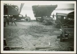
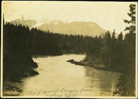
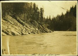
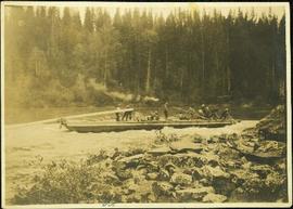
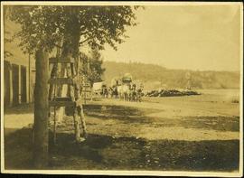
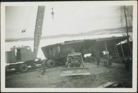
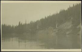
Photograph depicts what appears to be two trains and a long building on high level of river bank. Fraser river in foreground, forest trees on shore in background.
Close view of sternwheeler resting on brick supports. Building supplies and sawhorse in foreground. A man can be seen on lower deck, and another above on third deck. Handwritten annotation on recto of photograph reads: "Operator".
Handwritten annotation on verso of photograph reads: "George St. Prince George BC Photo. S Wrathall". Prince George Hotel and Cafe stand on left side of street in foreground, and many other buildings and businesses can be seen. Vehicles line the street, cut banks visible in background. Photograph believed to have been taken while George Street was being prepared for a new lawyer of asphalt.
Photograph depicts nine men standing on small dirt lane between rows of tent buildings at what is believed to have been a railway construction camp. Snow and firewood piles line the road, forest trees in background.
Photograph depicts lane in front of tent buildings flooded with water, and a man standing near doorway to first building. It is believed that this photograph may depict the Island Cache in flood, at Prince George, BC.
Photograph depicts large bridge and dam over a wide river, industrial structures throughout. Hills on opposite shore in background. Handwritten annotation on recto of photograph: "Coulee Dam, This is were[sic] I went this fall. Wished you had of been with me."
Officers are mounted on four horses in cleared area. Fifth horse stands on left, dog stands behind officers. Trees and white building visible in background. Handwritten annotation on recto of photograph: "Jas Tracey - Vanderhoof. A. Birch. Gilbert."
Photograph depicts people on river shore, and boat and buildings in midground. River bank in foreground, forest in background. Handwritten annotation on verso of photograph: "Giscombe Portage Fraser River", on recto: "Huble & Seaback on Fraser River."
Left to right: Margaret (nee Baxter) and husband Gus Lund, Bea Baxter and beau, Violet and Bob Baxter. The group stands on road wearing formal attire. Rear of car can be seen in foreground on right; power poles, log building, and unidentified structure stand in front of forest in background.
Young Bea and Margaret stand in front of Bob Baxter and mother Harriet. The group stands in a clearing, rear of soft-top car visible in foreground on right, trees in background. It is believed that this car is also featured in item 2009.5.4.16.
Margaret and Gus Lund stand on road, arms linked. Wood structure believed to be the box of a truck stands behind them on left. Power poles and forest in background behind road.
Violet Baxter's older sister Ellen and younger sister Lucy are among other unknown individuals who stand and sit on a car in the road. Ellen stands second from left, and Lucy sits in back behind other girls. Forest and hillside can be seen in background.
This booklet, published by the Cunard Steam Ship Company, Ltd., provides an overview of Canada, England's emigration agents in Canada, and of the amenities provided by the Cunard Lines to its passengers immigrating to Canada from England via steamship. Booklet was printed in England.
Four men stand around small car and one man rides in wagon, driving team of horses. Seven buildings can be see in background among trees.
Hugh and the children stand on railroad bridge. Opposite shore visible in background.
Unidentified man stands beside a car, to left of piles. Tarp covers portion of lumber pile. Log fence and trees in background.
Hugh Taylor Sr. stands between two horses, holding reigns. Hermina sits on left horse, Ellen and Violet sit in packboard on right horse. Five men sit on deck of large building with detailed porch in background on left. A fence, log shed, and wood pile can be seen in background on right. A dog stands beside Hugh. It is believed this photograph was taken at Hazelton, B.C.
Hugh Taylor Sr. stands between two horses, holding reigns. Hermina sits on left horse, Ellen and Violet sit in packboard on right horse. Five men sit on deck of large building with detailed porch in background on left. A fence, log shed, and wood pile can be seen in background on right. A dog stands beside Hugh. Handwritten annotation on verso of photograph: "Hazelton, B.C. 1910."
Photograph depicts bridge built with wooden planks and poles, with triangles built into its frame. Water rapids in foreground, opposite shore in background behind bridge. This is speculated to be one of the bridges that crossed the Hagwilget Canyon on the Bulkey River since 1859, five kilometres from its confluence with the Skeena River. See items 2009.5.1.69 - 2009.5.1.71.
Handwritten annotation on recto of photograph: "Omineca Dist Walcott Suspension Bridge West Approach - looking East May 26 - 1932". Photograph depicts two white horses pulling a wagon in front of Walcott bridge. This bridge was moved from its original location in the Hagwilget Canyon, downstream from Walcott on the Bulkley River. It is a pedestrian bridge at the time of this photograph, though it was originally used by motor vehicles. Dirt road leading to bridge in foreground, with lumber and brush piles on either side. Trees and hills on opposite shore in background.
Photograph depicts men loading a line of approximately twenty mules facing large building in background with the sign: "[WBBAILEY?] ANDCO'S OFFICE." A second sign is posted on deck of building: "ALWAYS CURES! CHAMBERLAIN'S COUGH REMEDY." More men wearing suits watch from deck. Small building in hillside can be seen in background. Annotation along bottom recto of photograph reads: "Last Pack Train leaving Ashcroft for Hazelton -1909." Handwritten annotation on recto of photograph: "CATALINE 1909".
Photograph depicts a man standing in a loaded canoe floating close to shore. Two men stand on rocky shore in left foreground. Tall hills in background, river rapids behind canoe in midground. Handwritten annotation on recto of photograph: "Parle Pas Rapids Peace River."
Photograph depicts a team of dogs and sled resting in a very flat snow-covered area. Hills in background. Handwritten annotation on recto of photograph: "ATLIN."
Photograph depicts Bert Glassey in winter gear standing with snowshoes and what appears to be a dogsled. Bushes and trees in background. Typed annotation on recto of photograph: "The Tribulations and privations of a Coroner in Northern British Columbia. April 18th, 1936. Taken in the Teslin Lake country of B.C."
Photograph depicts a dog carrying packages in grass area, fence and trees in background. Handwritten annotation on verso of photograph: "50# Pack - Some Dog".
Photograph depicts group of men walking on what appears to be a dirt road near open field. A parked plane is visible in distance, forest trees in background.
Photograph depicts crane on left of two boat hull portions being positioned together. resting on trailer flatbed pulled by truck. Men and bulldozer in foreground, body of water and hills in background.
Photograph depicts hull being transported by crane on left and flatbed pulled by bulldozer on right. Men in construction area in foreground, body of water and hills in background.
Photograph depicts two men standing in foreground, hull of unfinished ship in background. Construction supplies and materials throughout.
Photograph depicts long bridge over river. Closest pier in left foreground, opposite shore in background.
Photograph depicts Sarah Glassey wearing overalls and hat, seated on horse. Cardboard box lies in left foreground, and a team of horses pulling wagon can be seen in background. Handwritten annotation on recto of photograph: "Myself."
Two woman stand on road in front of car, trees and second parked car in background. Woman on left speculated to be Sarah Glassey. Handwritten annotation on recto of photograph: "Auntie + friend + the car."
Group of four leans against car. Bert & Sarah Glassey stand to left of unknown woman and man, field and hillside in background.
The pair walks on sidewalk, wearing hats and fur lined coats, Glassey on left. Car, power lines, and tall buildings stand in background. Photograph believed to have been taken by street photographer.
Book was published by The Allen Photo Co., of Prince Rupert, B.C. and features printed photographs and captions documenting various aspects of Prince Rupert development from 1908 to 1910.
Photograph depicts mountains in background behind forest trees. River barely visible behind bushes at bottom of photo. Handwritten photo caption on verso and recto of this photograph reads: "On the Clearwater."
Photograph depicts winding river from above, tall trees on either side and mountains in background. Handwritten photo caption on verso and recto of this photograph reads: "Top of Grand Canyon from Portage trail".
Photograph depicts a line of men standing on opposite shore and holding a long rope between them, while men on scow float close to shore in distance. River water in foreground, trees on shore in background. Handwritten photo caption on verso and recto of this photograph reads: "In the Grand Canyon."
Photograph depicts a crew of 13 men on a scow believed to be maneuvering through the Upper Fraser River at Scow's Last Lap (Scow Rapids), downriver from the Grand Canyon of the Fraser. Trees on opposite shore in background, rocky shore in foreground. Handwritten annotation on recto of photograph reads: "the last lap".
Photograph depicts the Giscome Rapids. Opposite shore in background, rocky beach in foreground. Handwritten photo caption on verso and recto of this photo reads: "Point where G.T.P. [Grand Trunk Pacific] canoe capsized at Giscome Rapids & where 3 men were drowned."
Photograph depicts men standing near three covered wagons pulled by team of horses on street. Buildings line the street on left behind trees with protective structures built around their trunks. A windmill stands near small building and woodpiles in background on right. Trees on hill are visible in distance. Handwritten annotation on recto of photograph: "Quesnel".
Photograph depicts the early settlement of Fort George. The buildings to the left of the fence are believed to be owned by the Hudson's Bay Company. The land to the right of the fence belonged to the Fort George Reserve, the home of today's Lheidli T'enneh Band who relocated to a reserve at Shelley when this reserve was sold in 1912. Handwritten annotation on verso and recto of this photograph reads: "Fort George from opposite side of Fraser River".
Photograph depicts one man seated in rear of canoe on still water. Trees on opposite shore in background. This man is believed to be a member of the Bourchier forestry crew.
Photograph depicts group of men seated on scow carrying unidentified material. One man stands on rocky shore in left foreground, leaning on plank attached to scow. A second scow can be seen behind men. Tree-covered hills on opposite shore in background.
Photograph depicts four men on conveyor, and clear view of paddle wheel. A small boat is docked to the conveyor with men and equipment. Crowd of men on shore in foreground on right, trees on opposite shore in background. Mountains visible in distance. Handwritten annotation on verso of photograph reads: "Str. Conveyor".
Photograph depicts street in McBride, wood buildings and tent buildings on either side. Small businesses and restaurants line the left side of the street. Forest slash stands in newly cleared area in foreground. Railway tracks cross right foreground, hills visible in background. Annotation on verso of photograph reads: "MC.Bride, B.C.", handwritten on recto: "1914 [Bourchier?]"
Photograph depicts men walking among stumps and log piles in forest clearing of the railway right-of-way.
Photograph depicts log buildings and tents on left shore. Fraser river in foreground, forest and hillside in background.
Photograph depicts small log buildings and loaded wagons in cleared dirt area. Building on far left has the sign "POOL HALL" posted on front . Treetops, lumber piles, and hills in background. Mountains can be seen in distance. Handwritten annotation on verso of photograph reads: "Sand Creek. B.C."
Photograph depicts bridge over Nechako River. Sloped cutbanks on opposite shore in background. Buildings and railroad tracks can be seen on town shore in right foreground.