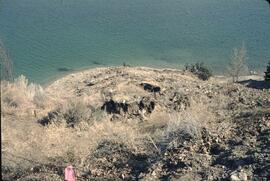
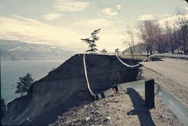
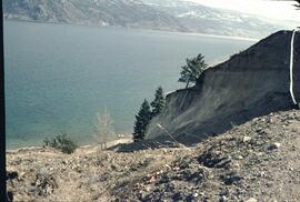
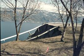
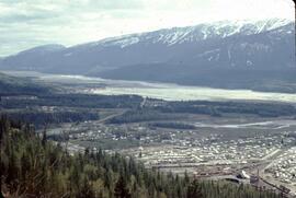
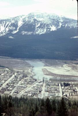
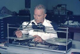
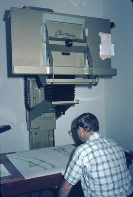
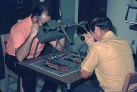
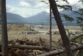
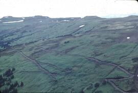
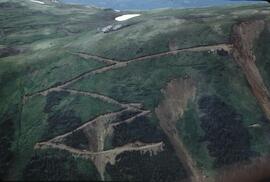
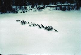
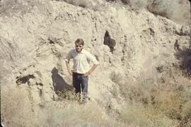
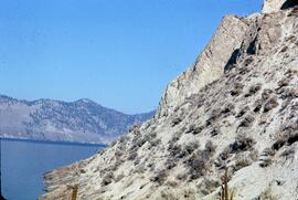
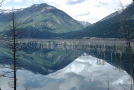
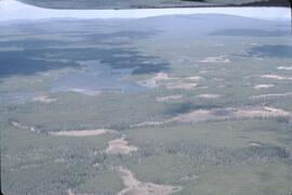
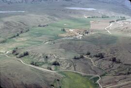
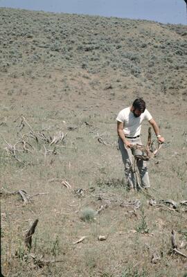
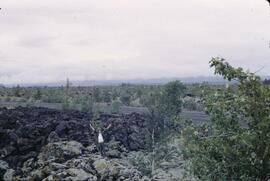
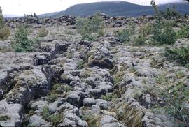
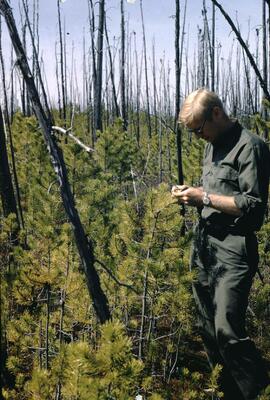
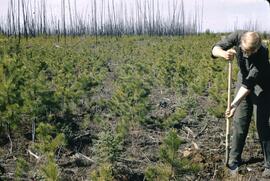
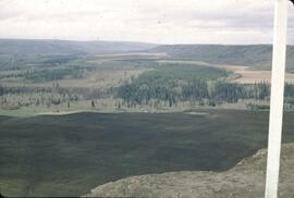
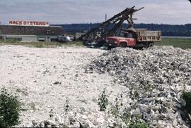
File consists of records created and accumulated by Gary Runka over the course of his consultancy work for Spallumcheen Indian Band, Pape & Salter for the "Review of Impact and Future Use of Hydro Right of Way Land by Spallumcheen Indian Band" project in Spallumcheen. This file was numbered as G.G. Runka Land Sense Ltd. client file #376; that client number may be seen referenced elsewhere in the G. Gary Runka fonds. The Land Sense Ltd. client files generally include records such as correspondence, contracts, invoices, project reports, publications, ephemera, memoranda, maps or map excerpts, legal documents, meeting materials, clippings, and handwritten notes. File also includes 32 accompanying aerial photographs.
Includes the following:
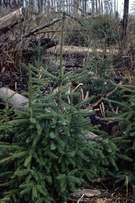
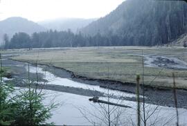
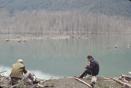
Land Use and Impact BC Hydro Right-of-Way Enderby Indian Reserve #2. Prepared by G.G. Runka Land Sense Ltd. for Spallumcheen Indian Band Negotiating Team. 1995.
Maps include:
Terra Engineering Ltd. for Spallumcheen Indian Band, "Enderby Gravel Pit, Depth to Bedrock", sheet 2 of 3, Jan. 1995.
Terra Engineering Ltd. for Spallumcheen Indian Band, "Enderby Gravel Pit, Bedrock Surface", sheet 3 of 3, Jan. 1995.
Energy, Mines and Resources Canada Surveys and Mapping Branch, "General Purpose Photomap Survey Overlay Photomap of Enderby I.R. No. 2, Kamloops Division of Yale District, British Columbia", sheet 1 of 1, scale 1:10000, NTS map sheet 82L/11, Aug. 1992. (2 copies)
Energy, Mines and Resources Canada Surveys and Mapping Branch, "Survey Overlay Photomap of Enderby I.R. No. 2, Kamloops Division of Yale District, British Columbia", sheet 1 of 3, scale 1:5000, NTS map sheet 82L, Sept. 1993. (2 copies)
Energy, Mines and Resources Canada Surveys and Mapping Branch, "Survey Overlay Photomap of Enderby I.R. No. 2, Kamloops Division of Yale District, British Columbia", sheet 2 of 3, scale 1:5000, NTS map sheet 82L, Sept. 1993. (2 copies)
Energy, Mines and Resources Canada Surveys and Mapping Branch, "Survey Overlay Photomap of Enderby I.R. No. 2, Kamloops Division of Yale District, British Columbia", sheet 3 of 3, scale 1:5000, NTS map sheet 82L, Sept. 1993. (2 copies)
Energy, Mines and Resources Canada Surveys and Mapping Branch, "Photomap of Enderby I.R. No. 2, Kamloops Division of Yale District, British Columbia", sheet 3 of 3, scale 1:5000, NTS map sheet 82L, n.d.
G.G. Runka Land Sense Ltd., overlay for "Survey Overlay Photomap of Enderby I.R. No. 2", sheet 1 of 3, July 1995.
G.G. Runka Land Sense Ltd., print reproduction of overlay for "Survey Overlay Photomap of Enderby I.R. No. 2", sheet 1 of 3, July 1995.
G.G. Runka Land Sense Ltd., overlay for "Survey Overlay Photomap of Enderby I.R. No. 2", sheet 2 of 3, July 1995.
G.G. Runka Land Sense Ltd., print reproduction of overlay for "Survey Overlay Photomap of Enderby I.R. No. 2", sheet 2 of 3, July 1995.
G.G. Runka Land Sense Ltd., overlay for "Survey Overlay Photomap of Enderby I.R. No. 2", sheet 3 of 3, July 1995.
G.G. Runka Land Sense Ltd., print reproduction of overlay for "Survey Overlay Photomap of Enderby I.R. No. 2", sheet 3 of 3, July 1995.
Energy, Mines and Resources Canada Surveys and Mapping Branch, "Survey Overlay Enderby I.R. No. 2, Kamloops Division of Yale District, British Columbia", sheet 1 of 3, scale 1:5000, NTS map sheet 82L, [1995?] - annotated
Energy, Mines and Resources Canada Surveys and Mapping Branch, "Survey Overlay Enderby I.R. No. 2, Township 18, Ranges 8 and 9, W. 6 M., District of Kamloops, British Columbia", sheet # of 3, scale 1:5000, NTS map sheet 82L, n.d. - annotated
Energy, Mines and Resources Canada Surveys and Mapping Branch, "Reference Plan of Enderby I.R. No. 2, Kamloops Division of Yale District, British Columbia", scale 1:10,000, NTS map sheet 82L/11E, revised to August 1992. (3 copies)
Reproduction of BC Hydro and Power Authority, "Plan and Field Notes of Survey of Transmission Line Right of Way through a part of Enderby Indian Reserve No. 2 TP. 18 Rge. 8 and 9 W. 6M., Kamloops Division Yale District, Province of British Columbia", 1976
Reproduction of BC Hydro drawing No. 300-T07-X15 showing transmission line through Enderby Indian Reserve No. 2", n.d.
Reproduction of BC Hydro drawing showing transmission line through Enderby Indian Reserve No. 2", n.d.
Reproduction of BC Hydro Structure Location Plan 300-T07-X16 drawn on top of "Field Notes of Survey of Transmission Line Right of Way through Part of Enderby Indian Reserve No. 2 TP. 18, R. 8 and 9, W 6th Mer., Kamloops Division, Yale District, Province of British Columbia", 1976. (4 copies)
Reproduction of BC Hydro Structure Location Plan 300-T07-X17 drawn on top of "Plan and Field Notes of Survey of Transmission Line Right of Way through Part of Enderby Indian Reserve No. 2 TP. 18, R. 8 and 9, W 6th Mer., Kamloops Division, Yale District, Province of British Columbia", 1976. (5 copies)
Reproduction of "Plan and Field Notes of Survey of Transmission Line Right of Way through Part of Enderby Indian Reserve No. 2 TP. 18, R. 8 and 9, W 6th Mer., Kamloops Division, Yale District, Province of British Columbia", Jan. 1976.
BC Ministry of Crown Lands, "82L.055 Digital", n.d.
File consists of records created and accumulated by Gary Runka over the course of his consultancy work for Quadra Planning for the "Land Use Plan Options for Colony Farm" project in Coquitlam. This file was numbered as G.G. Runka Land Sense Ltd. client file #373; that client number may be seen referenced elsewhere in the G. Gary Runka fonds. The Land Sense Ltd. client files generally include records such as correspondence, contracts, invoices, project reports, publications, ephemera, memoranda, maps or map excerpts, legal documents, meeting materials, clippings, and handwritten notes. File also includes 20 accompanying photographs.
Includes the following:
Greater Vancouver Regional District. Colony Farm Regional Park: Preliminary Agriculture Centre Concept. Draft. January 1998.
Colony Farm Land Use Plan. Colony Farm Land Use Study Steering Committee. 1995.
Colony Farm Land Use Study. Technical Background Report. Prepared by Quadra Planning Consultants Ltd. for Colony Farm Land Use Study Steering Committee. 1994.
Includes the following map:
Annotated reproduction photomap of Colony Farm property, n.d.
File consists of records created and accumulated by Gary Runka over the course of his consultancy work for BC Commission on Resources & Environment for the "Facilitation of Multi-interest Resource Management - Anahim Round Table" project in Anahim Lake. This file was numbered as G.G. Runka Land Sense Ltd. client file #327; that client number may be seen referenced elsewhere in the G. Gary Runka fonds. The Land Sense Ltd. client files generally include records such as correspondence, contracts, invoices, project reports, publications, ephemera, memoranda, maps or map excerpts, legal documents, meeting materials, clippings, and handwritten notes. File also includes 28 accompanying photographs.
Includes the following:
Anahim Round Table Resource Management Plan, including Draft Consensus Report, June 1993 and Interim Report, August 1993. Commission on Resources and Environment. 1994.
File consists of records created and accumulated by Gary Runka over the course of his consultancy work for BC Ministry of Development, Trade and Tourism for the "Natural Resource Tourism Inventory" project in Kamloops. This file was numbered as G.G. Runka Land Sense Ltd. client file #297; that client number may be seen referenced elsewhere in the G. Gary Runka fonds. The Land Sense Ltd. client files generally include records such as correspondence, contracts, invoices, project reports, publications, ephemera, memoranda, maps or map excerpts, legal documents, meeting materials, clippings, and handwritten notes. File also includes 47 accompanying photographs.
Maps include:
G.G. Runka Land Sense Ltd., "Natural Resource Tourism, Kamloops Resource Management Area - Tourism Capability Map", Sept. 1991
G.G. Runka Land Sense Ltd., "Natural Resource Tourism, Kamloops Resource Management Area - Visual Resource Significance", Sept. 1991
Reproduction of BC Ministry of Forests, "Map of Rec. Proj. 900-1-3-4716 (Chuwhels Mtn Trails), June 1967
File consists of records created and accumulated by Gary Runka over the course of his consultancy work for BC Buildings Corporation for the "Land Resource Inventory of Tranquille Institution" project in Kamloops. This file was numbered as G.G. Runka Land Sense Ltd. client file #149; that client number may be seen referenced elsewhere in the G. Gary Runka fonds. The Land Sense Ltd. client files generally include records such as correspondence, contracts, invoices, project reports, publications, ephemera, memoranda, maps or map excerpts, legal documents, meeting materials, clippings, and handwritten notes. File also includes 4 accompanying aerial photographs (2 with overlays) and 1 photographic print. Includes report by G. G. Runka Land Sense Ltd. for B.C. Buildings Corporation entitled "Tranquille Farm, Kamloops, B.C., Land Resource Attributes and Constraints", January 1986.
Maps include:
British Columbia Buildings Corporation, "Tranquille School & Farm", Aug. 1979
British Columbia Buildings Corporation, "Tranquille", Feb. 1980
British Columbia Buildings Corporation, "Tranquille Wasterwater Management System Upgrading", Feb. 1981 (2 copies)
R. B. Stothers, City of Kamloops, "Posting Plan of Outer Boundaries of DL 341,342 & 343 all of Group 1 KDYD; LS6,11 & 12 of Sec 25; and NW Cor Sec 25, TP 20 Rge 19 W6M KDYD, Dec. 1985 (3 copies, 1 of which is annotated)
Untitled map of D.L. 342 & 343 etc.
Enlargement of Untitled map of D.L. 342 & 343 etc.
Reproduction of [1916?] "Plan of Part of Lot 343 G1 Kamloops District"
Reproduction of Canada Department of Agriculture Water Development Branch, "General Plan - Tranquille Farm Lands", Dec. 1953
Annotated draft map showing Red Plateau grazing permit, Tranquille Reserve, existing fence, and proposed fence, circa [198-?]
Reproduction of Department of Lands and Forests, "Plan of Tranquille School", Oct. 1961
G.G. Runka Land Sense Ltd., draft mylar map negative depicting Tranquille Farm entitled "Map 1: Landforms", 1985
G.G. Runka Land Sense Ltd., draft mylar map negative depicting Tranquille Farm entitled "Map 2: Land Capability for Agriculture", 1985
G.G. Runka Land Sense Ltd., draft mylar map negative depicting Tranquille Farm entitled "Map 3: Land Suitability for Agriculture", 1985 (with overlays)
G.G. Runka Land Sense Ltd., draft mylar map negative depicting Tranquille Farm entitled "Map 4: Present and Surrounding Use", 1985
G.G. Runka Land Sense Ltd., draft mylar map negative depicting Tranquille Farm entitled "Map 5: Legal and Jurisdictional", 1985
G.G. Runka Land Sense Ltd., draft mylar map negative depicting Tranquille Farm entitled "Map 6: Proposed Land Use and Legal Parcel Replot", 1985
BC Ministry of Environment, 92I.078.1.4.1 Orthophoto map, Jan. 1985
BC Ministry of Environment, 92I.078.1.4.1 Orthophoto map (reproduced with overlay), Jan. 1985
BC Ministry of Environment, 92I.078.1.4.2 Orthophoto map, Jan. 1985
BC Ministry of Environment, 92I.078.1.4.2 Orthophoto map (reproduced with overlay), Jan. 1985
BC Ministry of Environment, 92I.078.1.4.4 Orthophoto map, Jan. 1985
BC Ministry of Environment, 92I.078.2.3.1 Orthophoto map, Jan. 1985
BC Ministry of Environment, 92I.078.2.3.1 Orthophoto map (reproduced with overlay), Jan. 1985
BC Ministry of Environment, 92I.078.2.3.3 Orthophoto map, Feb. 1985
Partial photocopy reduction of "Soil Map of Tranquille Sanatorium Farm", 1957 (on 2 sheets)
Department of Lands and Forests Topographic Division Surveys & Mapping Branch, "Plan of Tranquille School" original detailed large reproduction annotated in colour, October 1961
Large original reproduction of "Plan of Tranquille School", undated, possibly circa 1958-1961
File consists of records created and accumulated by Gary Runka over the course of his consultancy work for Urban Systems Ltd. for Westbank Indian Band for the "Westbank Indian Band Agricultural Community Plan - Mission Creek Site" project in Kelowna. This file was numbered as G.G. Runka Land Sense Ltd. client file #140; that client number may be seen referenced elsewhere in the G. Gary Runka fonds. Includes correspondence, invoices, memoranda, photocopied map areas, terms of reference, and handwritten notes. File also includes 2 accompanying aerial photographs.
Includes the following:
G. G. Runka Land Sense Ltd., "Draft Explanatory Notes to Accompany Mapping - Westbank Indian Band - Agricultural Community Plan - Mission Creek Site - Land Capability for Agriculture, Land Suitability for Agriculture, Hazard Lands and Geo-technical Considerations", July 1985
Arcus Consulting Ltd. for G. G. Runka Land Sense Ltd., "The Agricultural Development of the Tsinstikeptum Indian Reserve 7: Economic Considerations", August 1985
"Grazing Area - Grazing Licence - Mission Creek C.R.M.P.", January 1985
"Tsinstikeptum Indian Reserve 7: Land Capability for Agriculture", Urban Systems Ltd., 1995;
"Tsinstikeptum Indian Reserve 7: Land Suitability for Agriculture", Urban Systems Ltd., 1995;
"Tsinstikeptum Indian Reserve 7: Areas of Geotechnical Concern", Urban Systems Ltd., 1995;
"Tsinstikeptum Indian Reserve 7: Proposed Farm Units", Urban Systems Ltd., 1995;
[Tsinstikeptum Indian Reserve 7?] photomap, [1995?].
File consists of records created and accumulated by Gary Runka over the course of his consultancy work for BC Buildings Corporation for the "Land Resource Inventory of Colony Farm Institution" project in Coquitlam. This file was numbered as G.G. Runka Land Sense Ltd. client file #135; that client number may be seen referenced elsewhere in the G. Gary Runka fonds. The Land Sense Ltd. client files generally include records such as correspondence, contracts, invoices, project reports, publications, ephemera, memoranda, maps or map excerpts, legal documents, meeting materials, clippings, and handwritten notes. File also includes an accompanying 11 aerial photographs, one of which is oversize.
Maps include:
"Plan of Provincial Mental Hospital Colony Farm, Essondale, British Columbia", Department of Lands and Forests, n.d.;
"Reference Plan of Easement over portion of District Lots 23, 60, 170, Group 1, New Westminster District", Murray & Associates, April 1985;
"City of Port Coquitlam Official Community Plan Schedule B", n.d.;
"Plan of Right-of-Way through Portion of Lot 41 (Plan 53659), District Lots 22 and 67, Group 1, New Westminster District", Underhill & Underhill Engineers & Surveyors, 1980;
"District of Coquitlam Legal Metric Series", District of Coquitlam, n.d.;
"City of Port Coquitlam";
"New Water Distribution System Colony Farm, Essondale, BC", BC Department of Public Works, n.d.;
"Plan of Statutory Right-of-Way over portions of District Lots 23, 60, 168, 169, 170, 341, 343, Group 1, New Westminster District", Murray & Associates, 1985;
"Plan of Right-of-Way through portion of District Lots 22 and 60, Group 1, New Westminster District", May 1980;
"City of Port Coquitlam Official Community Plan Schedule C", n.d.;
"Colony Farm", BC Buildings Corporation, 30 June 1981 - 2 copies;
"Sketch Plan of Proposed Subdivision of Part District Lots 22 and 23 Group 1, New Westminster District showing Setbacks of Existing Buildings from Proposed Property & Zoning Lines", Murray & Associates;
"Colony Farm: Internal Drainage Improvements", BC Ministry of Agriculture Agricultural Engineering Branch, 1979;
"Colony Farm: Internal Drainage Improvements", BC Ministry of Agriculture Agricultural Engineering Branch, 1978;
"Colony Farm: Outlet Investigation", BC Ministry of Agriculture Agricultural Engineering Branch, 1978;
Untitled legal lot plan for Colony Farm area;
"Present and Surrounding Land Use", G. G. Runka Land Sense Ltd., 1984;
"Conceptual Land Use Plan", G. G. Runka Land Sense Ltd., 1984;
"Legal and Jurisdictional", G. G. Runka Land Sense Ltd., 1984;
"Drainage and Dykes", G. G. Runka Land Sense Ltd., 1984;
"Land Suitability for Agriculture", G. G. Runka Land Sense Ltd., 1984;
"Land Suitability for Agriculture", G. G. Runka Land Sense Ltd., 1984.
File consists of records created and accumulated by Gary Runka over the course of his consultancy work for Boundary Bay Farms Ltd. for the "Boundary Bay Airport Farmland" project in Delta. This file was numbered as G.G. Runka Land Sense Ltd. client file #122; that client number may be seen referenced elsewhere in the G. Gary Runka fonds. The Land Sense Ltd. client files generally include records such as correspondence, contracts, invoices, project reports, publications, ephemera, memoranda, maps or map excerpts, legal documents, meeting materials, clippings, and handwritten notes. File also includes 5 accompanying photographs.
File consists of records created and accumulated by Gary Runka over the course of his consultancy work for Reid-Collins Ltd. and Lornex Mining Corporation for the "Evaluation of Reclamation of Mine Waste Dumps Tailings Deposits and other Areas of Development at Lornex Mining Corporation Mine Site, Logan Lake, British Columbia" project in Logan Lake. This file was numbered as G.G. Runka Land Sense Ltd. client file #099; that client number may be seen referenced elsewhere in the G. Gary Runka fonds. The Land Sense Ltd. client files generally include records such as correspondence, contracts, invoices, project reports, publications, ephemera, memoranda, maps or map excerpts, legal documents, meeting materials, clippings, and handwritten notes. File also includes an accompanying aerial photograph.
Includes the following maps:
"[Forest Land Designations]", McElhaney Associates, 1981 - with 2 "End Use Land Overlays" and 2 "Present Land Use Overlays" and 1 untitled overlay by G.G. Runka;
File consists of records created and accumulated by Gary Runka over the course of his consultancy work for BC Ministry of Lands, Parks and Housing for the "Fort Nelson Deferred Planning Area (DPA)" project. This file was numbered as G.G. Runka Land Sense Ltd. client file #067; that client number may be seen referenced elsewhere in the G. Gary Runka fonds. The Land Sense Ltd. client files generally include records such as correspondence, contracts, invoices, project reports, publications, ephemera, memoranda, maps or map excerpts, legal documents, meeting materials, clippings, and handwritten notes. Includes the "Fort Nelson North Deferred Planning Area for the Ministry of Lands, Parks & Housing, Peace Region - Final Report" by Talisman Land Resource Consultants, February 1983. File also includes 186 accompanying aerial photographs.
File consists of records created and accumulated by Gary Runka over the course of his consultancy work for BC Ministry of Lands, Parks and Housing for the "Fort St. John North Deferred Planning Area (DPA)" project. This file was numbered as G.G. Runka Land Sense Ltd. client file #066; that client number may be seen referenced elsewhere in the G. Gary Runka fonds. The Land Sense Ltd. client files generally include records such as correspondence, contracts, invoices, project reports, publications, ephemera, memoranda, maps or map excerpts, legal documents, meeting materials, clippings, and handwritten notes. Includes the "Fort St. John North Deferred Planning Area for the Ministry of Lands, Parks & Housing, Peace Region - Final Report" by Talisman Land Resource Consultants, April 1983. File also includes 173 accompanying aerial photographs.
File consists of records created and accumulated by Gary Runka over the course of his consultancy work for BC Hydro for the "Capability Analysis and Land Use Concept Plan - West Arrow Park" project in West Arrow Park. This file was numbered as G.G. Runka Land Sense Ltd. client file #057; that client number may be seen referenced elsewhere in the G. Gary Runka fonds. The Land Sense Ltd. client files generally include records such as correspondence, contracts, invoices, project reports, publications, ephemera, memoranda, maps or map excerpts, legal documents, meeting materials, clippings, and handwritten notes. File also includes 12 accompanying aerial photographs.
Includes the following reports:
Sigma Resource Consultants for British Columbia Hydro and Power Authority Land Division, "Assessment of Land Capability - Wigwam, Demars, West Arrow Park, Whatshan, Needles - Arrow Reservoir Region - Final Report", July 1975
Sigma Resource Consultants for British Columbia Hydro and Power Authority Properties Division, "Arrow Reservoir Region Perspective on Resources and Settlement", 1979
Sigma Resource Consultants for British Columbia Hydro and Power Authority Land Division, "Arrow Reservoir Region Regional Resource Study", October 1975
G. G. Runka Land Sense Ltd. for B.C. Hydro Reservoir Land Management, "Explanatory Notes - West Arrow Park Land Disposal (Central Section) - Agriculture Unit Concept Plan", January 1985.
Maps include:
"Composite Plan of Central Section (Between Mosquito Creek and Dixon Creek) of West Arrow Park", 22 Oct. 1984 - 2 copies, one annotated with overlay;
"Columbia River Arrow Lakes Region: Edgewood to Nakusp", 2 Nov. 1964 - 6 different sheets showing differing mosaic units ;
"Columbia River Development Arrow Lakes Relocation Programme: Middle Narrow - BC Hydro Needles x Nakusp 138 Kv Transmission Line Route Plan", n.d. - 2 copies;
"BC Hydro Land Mosaic Columbia River Developments Arrow Project", March 1965 - 4 different sheets with annotations ;
"Composite Sketch Plan of North Section (Glendevon Area) of West Arrow Park Area", n.d. ;
"Part of Whatshan to Saddle Mountain Forest Service Road in the Arrow park-Glendevon Area";
"BC Ministry of Forests Forest Cover Series 82-K-4-d";
"West Arrow Park oversize printed aerial photograph map", ca. 1970.
File consists of records created and accumulated by Gary Runka over the course of his consultancy work for Williams Lake Field Naturalists for the "Scout Island Nature Centre" project in Williams Lake. This file was numbered as G.G. Runka Land Sense Ltd. client file #032; that client number may be seen referenced elsewhere in the G. Gary Runka fonds. The Land Sense Ltd. client files generally include records such as correspondence, contracts, invoices, project reports, publications, ephemera, memoranda, maps or map excerpts, legal documents, meeting materials, clippings, and handwritten notes. File also includes 3 accompanying aerial photographs.
File consists of records created and accumulated by Gary Runka over the course of his consultancy work for Canadian Wildlife Service for the "Update Management Plan for Alaksen Wildlife Management Area" project in Westham Island. This file was numbered as G.G. Runka Land Sense Ltd. client file #339; that client number may be seen referenced elsewhere in the G. Gary Runka fonds. The Land Sense Ltd. client files generally include records such as correspondence, contracts, invoices, project reports, publications, ephemera, memoranda, maps or map excerpts, legal documents, meeting materials, clippings, and handwritten notes.
Includes the following:
Alaksen National Wildlife Area Management Plan. Canadian Wildlife Service, Environment Canada. 1993 (draft) and 1995.
Maps include:
Hand drawn draft of Westham Island areas
Corporation of Delta, Air Photo Index, June 1990
Oversize enlargement of air photograph b&w positive of Westham Island
Oversize paper print of enlargement of air photograph b&w positive of Westham Island
G.G. Runka Land Sense Ltd., "Alaksen National Wildlife Area - Map 1: Land Capability for Agriculture", 1993
G.G. Runka Land Sense Ltd., "Alaksen National Wildlife Area - Map 2: Land Suitability for Agriculture", 1993
G.G. Runka Land Sense Ltd., "Alaksen National Wildlife Area - Map 2: Existing Habitats (1993)", 1993
G.G. Runka Land Sense Ltd., "Alaksen National Wildlife Area - Map 3: Integrated Habitat/Agricultural Management", 1993
File consists of records created and accumulated by Gary Runka over the course of his consultancy work for W.D. McIntosh Land Surveying Ltd. for the "Fawcett Farm Subdivision and Consolidation" project in Vanderhoof. This file was numbered as G.G. Runka Land Sense Ltd. client file #336; that client number may be seen referenced elsewhere in the G. Gary Runka fonds. The Land Sense Ltd. client files generally include records such as correspondence, contracts, invoices, project reports, publications, ephemera, memoranda, maps or map excerpts, legal documents, meeting materials, clippings, and handwritten notes.
Includes the following map:
W.D. McIntosh B.C. Land Surveyor, "Plan of Proposed Subdivision of the SE 1/4, SW 1/4 of Section 33, and the N 1/2 of Section 32, all in Township 3, Range 4, Coast District", 1988.
File consists of records created and accumulated by Gary Runka over the course of his consultancy work for North Okanagan Regional District for the "Coldstream Ranch Land Use Concept Plan" project in Coldstream. This file was numbered as G.G. Runka Land Sense Ltd. client file #325; that client number may be seen referenced elsewhere in the G. Gary Runka fonds. The Land Sense Ltd. client files generally include records such as correspondence, contracts, invoices, project reports, publications, ephemera, memoranda, maps or map excerpts, legal documents, meeting materials, clippings, and handwritten notes.
Maps include:
Photocopy of BC Land Commission, "Agricultural Land Reserve Plan for the Regional District of North Okanagan - District of Coldstream", 1974.
Photocopy of Coldstream topographical map
Photocopied segment of District of Coldstream map
Regional District of North Okanagan, District of Coldstream, "Official Community Plan", Sheet 1 of 2, 1987. (2 copies)
Regional District of North Okanagan, District of Coldstream, "Official Community Plan", Sheet 2 of 2, 1987. (2 copies)
Regional District of North Okanagan, District of Coldstream, "Official Community Plan", Sheet 2 of 2, 1987 - annotated and hand col. to show Coldstream Ranch
BC Ministry of Crown Lands, "Kalamalka Lake Provincial Park", July 1989
Regional District of North Okanagan, "Coldstream", May 1992.
Regional District of North Okanagan, "Coldstream Ranch Land Use Concept Plan", July 1992.
File consists of records created and accumulated by Gary Runka over the course of his consultancy work for North Okanagan Regional District for the "Coldstream Ranch Integrated Land Use Concept Plan" project in Coldstream Ranch. This file was numbered as G.G. Runka Land Sense Ltd. client file #310; that client number may be seen referenced elsewhere in the G. Gary Runka fonds. The Land Sense Ltd. client files generally include records such as correspondence, contracts, invoices, project reports, publications, ephemera, memoranda, maps or map excerpts, legal documents, meeting materials, clippings, and handwritten notes.
File consists of records created and accumulated by Gary Runka over the course of his consultancy work for Nature Trust of British Columbia for the "Consultation on Agriculture - Waterfowl Use Integration" project in Cowichan Bay. This file was numbered as G.G. Runka Land Sense Ltd. client file #305; that client number may be seen referenced elsewhere in the G. Gary Runka fonds. The Land Sense Ltd. client files generally include records such as correspondence, contracts, invoices, project reports, publications, ephemera, memoranda, maps or map excerpts, legal documents, meeting materials, clippings, and handwritten notes. Also includes three oversize aerial photographs of BC 80075 with various enlargements.
File consists of records created and accumulated by Gary Runka over the course of his consultancy work for Commission on Fraser Valley Petroleum Exploration for the "Advisement on Fraser Valley Land and Water Use Issues" project. This file was numbered as G.G. Runka Land Sense Ltd. client file #274; that client number may be seen referenced elsewhere in the G. Gary Runka fonds. The Land Sense Ltd. client files generally include records such as correspondence, contracts, invoices, project reports, publications, ephemera, memoranda, maps or map excerpts, legal documents, meeting materials, clippings, and handwritten notes.
Maps include:
Photocopy of Corporation of Delta, Master Legal Plan, M-L-F3
Annotated overlay on top of Corporation of Delta, Master Legal Plan, M-L-F3
Segment of municipal land map showing Sec. 28
Segment of municipal land map showing Sec. 2 and Canada/USA border
"Water Well Location Map" in T.P. 10 area, Surrey, 1982
Annotated and hand col. segment of Surrey municipal plan, T.P. 10 area
Photocopy of segment of Surrey municipal plan, T.P. 10 area
Photocopy of segment of Surrey municipal plan, ML-10-33
Surrey municipal plan, ML-10-34
Photocopy of segment of Langley municipal plan
Photocopy of handdrawn overlay over untitled municipal plan
Surrey municipal plan, ML-10-34
Photocopy of Langley Master Legal Plan sheet ML-10-2
Langley Master Legal Plan sheet ML-10-28
Photocopy of Langley Master Legal Plan sheet ML-10-28
Langley Master Legal Plan sheet ML-10-33
Photocopy of Langley Master Legal Plan sheet ML-10-33
Langley Master Legal Plan sheet ML-10-3
Langley Master Legal Plan sheet ML-10-2
Langley Master Legal Plan sheet ML-10-1
Photocopy of Langley Master Legal Plan sheet ML-10-1
Langley Master Legal Plan sheet segment
Photocopy of Corporation of Delta, Master Legal Plan, M-L-G1
Photocopy of Corporation of Delta, Master Legal Plan, M-L-E3
Photocopy of Corporation of Delta, Master Legal Plan, M-L-F1
Photocopy of Corporation of Delta, Master Legal Plan, M-L-F2
Photocopy of Corporation of Delta, Master Legal Plan, M-L-F3
Regional Planning Commission, "The Town of Drayton Valley", Jan. 1985
File consists of records created and accumulated by Gary Runka over the course of his consultancy work for BC Ministry of Forests for the "Consultation to Conservation of Areas Team, Old Growth Project". This file was numbered as G.G. Runka Land Sense Ltd. client file #271; that client number may be seen referenced elsewhere in the G. Gary Runka fonds. The Land Sense Ltd. client files generally include records such as correspondence, contracts, invoices, project reports, publications, ephemera, memoranda, maps or map excerpts, legal documents, meeting materials, clippings, and handwritten notes.
Maps include:
BC Ministry of Forests, Forest Cover Map Series map Timber Supply Area - Merritt and Okanagan, 82E.051, July 1983
BC Ministry of Forests, Forest Cover Map Series map Timber Supply Area - Merritt, 82E.041, July 1983
BC Ministry of Forests, Forest Cover Map Series map Timber Supply Area - McBride, 83D.092, August 1985 - annotated to show "Old Growth Short Term Deferral Application"
BC Ministry of Forests, Forest Cover Map Series map Timber Supply Area - Cranbrook, 82G.054, Aug. 1987
BC Ministry of Forests, Forest Cover Map Series map Timber Supply Area - Cranbrook, 82G.044, June 1987
BC Ministry of Forests, Forest Cover Map Series map Timber Supply Area - Nootka, 92L.014, Oct. 1986
BC Ministry of Forests, Forest Cover Map Series map Timber Supply Area - Nootka and Kingcome, 92L.022, Oct. 1986
BC Ministry of Forests, Forest Cover Map Series map Timber Supply Area - Nootka and Kingcome, 92L.023, Oct. 1986
BC Ministry of Forests, Forest Cover Map Series map Timber Supply Area - Nootka, 92L.024, Oct. 1986
BC Ministry of Forests, Forest Cover Map Series map Timber Supply Area - McBride, 93H.039, Oct. 1985
BC Ministry of Forests, Forest Cover Map Series map Timber Supply Area - Dawson Creek, 93O.057, Feb. 1988
BC Ministry of Forests, Forest Cover Map Series map Timber Supply Area - Queen Charlotte, 103F.077, Sept. 1986
BC Ministry of Forests, Forest Cover Map Series map Timber Supply Area - Queen Charlotte, 103F.086, Sept. 1986 - annotated to show "Old Growth Short Term Deferral Application - #19 S. End Eden Lake"
BC Ministry of Forests, Forest Cover Map Series map Timber Supply Area - Kispiox, 103P.020, June 1988
BC Ministry of Forests and Lands, "British Columbia Index to Timber Supply Areas", June 1987
Photocopy of BC Department of Environment, "South Western British Columbia" (1988) map, annotated to show "Conservation of Areas team Candidate Areas for Short Term Deferral - August 1990"
Photocopy of BC Department of Environment, "South Eastern British Columbia" (1976)
Photocopy of BC Department of Environment, "North Eastern British Columbia" (1976)
Photocopy of BC Department of Environment, "North Western British Columbia" (1976)
Photocopy of BC Department of Environment, "West Central British Columbia" (1988)
Photocopy of BC Department of Environment, "East Central British Columbia" (1976), with annotations
BC Ministry of Environment, "Ecoregions of British Columbia", Dec. 1988 - overlay on mylar
MacMillan Bloedel Ltd., Ian Lake, BCGS 103F 077, Revised Dec. 31, 1980
File consists of records created and accumulated by Gary Runka over the course of his consultancy work for Penticton Indian Band for the "Analysis of and Suitability for Irrigated Crops and Consultation on Water Management Strategy" project in Penticton. This file was numbered as G.G. Runka Land Sense Ltd. client file #245; that client number may be seen referenced elsewhere in the G. Gary Runka fonds. The Land Sense Ltd. client files generally include records such as correspondence, contracts, invoices, project reports, publications, ephemera, memoranda, maps or map excerpts, legal documents, meeting materials, clippings, and handwritten notes.
Includes the following:
Urban Systems Limited for Penticton Indian Band, "Water Demand Study for the Penticton Indian Band", June 1990
Includes the following maps:
Land Sense Ltd. and Craig Brownlee for Penticton Indian Band, "Annual Water Requirements and Peak Flow/Acre", July 1989.
Urban Systems Ltd., "Penticton Indian Band Future Land Use - P.I.R. No. 1 - Appendix 1", April 1990.
File consists of records created and accumulated by Gary Runka over the course of his consultancy work with McKay, Rivard and Co. Ltd. for Penticton Indian Band for the "Analysis of Land Suitability for Irrigated Crops, Penticton Indian Reserve #1" project regarding assessment of alleged soil degradation on Skeetchestn Indian Reserve #1. This file was numbered as G.G. Runka Land Sense Ltd. client file #244; that client number may be seen referenced elsewhere in the G. Gary Runka fonds. Includes correspondence, invoices, photocopied map areas, handwritten notes, photocopied legal documents, and reports.
Includes the following:
J.W. Ngai, BC Ministry of Environment, "Penticton Indian Band Proposed Irrigation Water Supply Project Preliminary Study", July 1980
"Penticton Indian Band Proposed ARDSA Irrigation Project - Potential Irrigable Areas and Distribution System", BC Ministry of Environment Inventory and Engineering Branch, July 1980
G. Gary Runka for Indian and Northern Affairs Canada, Public Works Canada, and Department of Justice, "Assessment of Alleged Soil Degradation on Parcel C, Plan 53050, Skeetchestn Indian Reserve #1"
Flynn & Associates, "Appraisal of Merryfield Leases, Deadman's Creek Indian Reserve", April 1983
John T. Crowe of Flynn & Associates for Deadman's Creek Indian Band, "Appraisal of Agricultural Land, Deadman's Creek Indian Reserve", April 1985
Maps include:
Ministry of Environment, "Brent Lake South Dam - To accompany report on Penticton Indian Band Proposed ARDSA Irrigation Project", July 1980.
Ministry of Environment, "Brent Lake North Dam - To accompany report on Penticton Indian Band Proposed ARDSA Irrigation Project", July 1980.
Ministry of Environment, "Brent Lake Storage Development General Layout - To accompany report on Penticton Indian Band Proposed ARDSA Irrigation Project", July 1980.
Ministry of Environment, "Potential Irrigable Areas and Distribution System - To accompany report on Penticton Indian Band Proposed ARDSA Irrigation Project", July 1980.
Ministry of Environment, "Brent Lake Reservoir - Cross-Sections of Dam - Storage Inventory Programme Okanagan Basin - Columbia System", Jan. 1981.
Ministry of Environment, "Brent Lake Reservoir - Topographic Map of North End of Brent Lake including existing diversion from Shingle Creek - Storage Inventory Programme Okanagan Basin - Columbia System", Jan. 1981.
Ministry of Environment, "Brent Lake Reservoir - Plan of Reservoir - Storage Inventory Programme Okanagan Basin - Columbia System", Jan. 1981.
Ministry of Environment, "Brent Lake Reservoir - Storage and Basin Data Accompanying Plan of Reservoir - Storage Inventory Programme Okanagan Basin - Columbia System", Jan. 1981.
Ministry of Environment, "Brent Lake Reservoir - General Plan and Longitudinal-Section of Dam, Longitudinal-Section and Cross-Sections of Spillway Channel - Storage Inventory Programme Okanagan Basin - Columbia System", Jan. 1981.
Ministry of Energy, Mines and Resources Canada, "Photomap of Part of Pentiction I.R. 1, I.R. 3a - Osoyoos Division of Yale District, British Columbia" with survey overlay, Sheet 1 of 5, 1986
Ministry of Energy, Mines and Resources Canada, "Photomap of Part of Pentiction I.R. 1 - Similkameen and Osoyoos Division of Yale District, British Columbia" with survey overlay, Sheet 3 of 5, 1986
G.G. Runka Land Sense Ltd. using IMC Consulting Group base map, Penticton Indian Band Map 1 - draft map with no legend
G.G. Runka Land Sense Ltd. using IMC Consulting Group base map, Penticton Indian Band Map 1 - annotated draft map showing land use
G.G. Runka Land Sense Ltd. using IMC Consulting Group base map, Penticton Indian Band Map 2 - annotated draft map showing land use
G.G. Runka Land Sense Ltd. using IMC Consulting Group base map, Penticton Indian Band Map 3 - annotated draft map on transparency (2 copies)
G.G. Runka Land Sense Ltd. using IMC Consulting Group base map, Penticton Indian Band Map 3 - draft map with no legend (7 copies)
G.G. Runka Land Sense Ltd. using IMC Consulting Group base map, Penticton Indian Band Map 3 - edited to show "Annual Water Requirements and Peak Flow/Acre"
G.G. Runka Land Sense Ltd. using IMC Consulting Group base map, Penticton Indian Band Map 3 - edited to show "Land Suitability for Irrigated Crops", June 1989 (4 copies)
Energy, Mines and Resources Canada, "Survey Overlay Photomap of Part of Penticton I.R. 1 - Osoyoos Division of Yale District, British Columbia", Sheet 2 of 5, Sept. 1986
Energy, Mines and Resources Canada, "Survey Overlay Photomap of Part of Penticton I.R. 1 - Similkameen Division of Yale District, British Columbia", Sheet 4 of 5, Sept. 1986
File consists of records created and accumulated by Gary Runka over the course of his consultancy work for Clear Cut Alternatives for the "Community of Galiano Island Sustainable Development Research Project" in Galiano Island. This file was numbered as G.G. Runka Land Sense Ltd. client file #234; that client number may be seen referenced elsewhere in the G. Gary Runka fonds. The Land Sense Ltd. client files generally include records such as correspondence, contracts, invoices, project reports, publications, ephemera, memoranda, maps or map excerpts, legal documents, meeting materials, clippings, and handwritten notes.
Maps include:
Agriculture Canada, "Galiano Island Soil Inventory", 1979.
File consists of records created and accumulated by Gary Runka over the course of his consultancy work for Public Works Canada for the "Assessment of Alleged Soil Degradation on Skeetchestn Indian Reserve #1" project in Deadman's Creek. This file was numbered as G.G. Runka Land Sense Ltd. client file #230; that client number may be seen referenced elsewhere in the G. Gary Runka fonds. The Land Sense Ltd. client files generally include records such as correspondence, contracts, invoices, project reports, publications, ephemera, memoranda, maps or map excerpts, legal documents, meeting materials, clippings, and handwritten notes.
Maps include:
Reproduction of B.C. Land Surveyors, "Plan and Field Notes of Survey of Parcel C in Deadman's Creek Indian Reserve Township 21, Range 22, West of the 6th Meridian, Province of British Columbia, Kamloops District", 1966.
Canada Land Survey, "Reference Plan of Deadman's Creek Indian Reserve, Kamloops District, Province of British Columbia", 1969.
File consists of records created and accumulated by Gary Runka over the course of his consultancy work for IMC Consulting Group Inc. for Penticton Indian Band for the "Preliminary Opinion of Agricultural Opportunities - Penticton Indian Band Economic Development Opportunities Study" project in Penticton. This file was numbered as G.G. Runka Land Sense Ltd. client file #205; that client number may be seen referenced elsewhere in the G. Gary Runka fonds. Includes correspondence, invoices, photocopied map areas, handwritten notes, and reports.
Includes the following:
Promotional booklet for Rogers Ranch
Report by IMC Consulting Group Inc. for Penticton Indian Band entitled "Draft Land Use Plan and Economic Development Strategy", February 1989
G. Gary Runka for IMC Consulting Group, "Preliminary Opinion of Agricultural Opportunities, Penticton Indian Reserve #1"
Report by IMC Consulting Group Inc. for Penticton Indian Band entitled "Proposal for Community Economic Development Opportunities Study for the Penticton Indian Band", September 1987
Maps include:
[G.G. Runka Land Sense Ltd.?], "Provisional Land Capability for Agriculture - Penticton Indian Reserve No. 1 - 82E033", ca. 1987.
[G.G. Runka Land Sense Ltd.?], "Provisional Land Capability for Agriculture - Penticton Indian Reserve No. 1 - 82E094", ca. 1987.
[G.G. Runka Land Sense Ltd.?], "Provisional Land Capability for Agriculture - Penticton Indian Reserve No. 1 - 82E073", ca. 1987.
[G.G. Runka Land Sense Ltd.?], "Provisional Land Capability for Agriculture - Penticton Indian Reserve No. 1 - 82E093", ca. 1987.
[G.G. Runka Land Sense Ltd.?], "Provisional Land Capability for Agriculture - Penticton Indian Reserve No. 1 - 82E083", ca. 1987.
[G.G. Runka Land Sense Ltd.?], "Provisional Land Capability for Agriculture - Penticton Indian Reserve No. 1 - 82E012", ca. 1987.
[G.G. Runka Land Sense Ltd.?], "Provisional Land Capability for Agriculture - Penticton Indian Reserve No. 1 - 82E011", ca. 1987.
[G.G. Runka Land Sense Ltd.?], "Provisional Land Capability for Agriculture - Penticton Indian Reserve No. 1 - 82E013", ca. 1987.
[G.G. Runka Land Sense Ltd.?], "Provisional Land Capability for Agriculture - Penticton Indian Reserve No. 1 - 82E021", ca. 1987.
[G.G. Runka Land Sense Ltd.?], "Provisional Land Capability for Agriculture - Penticton Indian Reserve No. 1 - 82E084", ca. 1987.
[G.G. Runka Land Sense Ltd.?], "Provisional Land Capability for Agriculture - Penticton Indian Reserve No. 1 - 82E003", ca. 1987.
[G.G. Runka Land Sense Ltd.?], "Provisional Land Capability for Agriculture - Penticton Indian Reserve No. 1 - 82E022", ca. 1987.
[G.G. Runka Land Sense Ltd.?], "Provisional Land Capability for Agriculture - Penticton Indian Reserve No. 1 - 82E031", ca. 1987.
[G.G. Runka Land Sense Ltd.?], "Provisional Land Capability for Agriculture - Penticton Indian Reserve No. 1 - 82E053", ca. 1987.
[G.G. Runka Land Sense Ltd.?], "Provisional Land Capability for Agriculture - Penticton Indian Reserve No. 1 - 82E063", ca. 1987.
[G.G. Runka Land Sense Ltd.?], "Provisional Land Capability for Agriculture - Penticton Indian Reserve No. 1 - 82E002", ca. 1987.
[G.G. Runka Land Sense Ltd.?], "Provisional Land Capability for Agriculture - Penticton Indian Reserve No. 1 - 82E043", ca. 1987.
[G.G. Runka Land Sense Ltd.?], "Provisional Land Capability for Agriculture - Penticton Indian Reserve No. 1 - 82E032", ca. 1987.
[G.G. Runka Land Sense Ltd.?], "Provisional Land Capability for Agriculture - Penticton Indian Reserve No. 1 - 82E042", ca. 1987.
[G.G. Runka Land Sense Ltd.?], "Provisional Land Capability for Agriculture - Penticton Indian Reserve No. 1 - 82E023", ca. 1987.
File consists of records created and accumulated by Gary Runka over the course of his consultancy work for BC Ministry of Forests and Lands, Land Policy Branch for the "Coastal Resource Identification Study: Desolation Sound - Johnstone Strait" project in Victoria. This file was numbered as G.G. Runka Land Sense Ltd. client file #184; that client number may be seen referenced elsewhere in the G. Gary Runka fonds. The Land Sense Ltd. client files generally include records such as correspondence, contracts, invoices, project reports, publications, ephemera, memoranda, maps or map excerpts, legal documents, meeting materials, clippings, and handwritten notes. Includes BC Ministry of Forest and Lands map "Coastal Resource Identification Study - Aquaculture Opportunities - Desolation Sound - Johnstone Strait", March 1987.
Maps include:
Regional District of Comox-Strathcona, "Cortes Island - Electoral Area 'I' - Zoning Map", Feb. 1974
"Quadra Island Zoning Bylaw 1986" bylaw No. 895, Schedule A map, 1986 (one map on 10 sheets)
File consists of records created and accumulated by Gary Runka over the course of his consultancy work for BC Ministry of Lands, Parks and Housing for the "Aquaculture and Associated Use Mapping" project in Sunshine Coast. This file was numbered as G.G. Runka Land Sense Ltd. client file #168; that client number may be seen referenced elsewhere in the G. Gary Runka fonds. The Land Sense Ltd. client files generally include records such as correspondence, contracts, invoices, project reports, publications, ephemera, memoranda, maps or map excerpts, legal documents, meeting materials, clippings, and handwritten notes. Includes BC Ministry of Forest and Lands map "Coastal Resource Identification Study - Aquaculture Opportunities - Sechelt-Sunshine Coast", March 1987.
Maps include:
BC Ministry of Forests and Lands, "Sechelt-Sunshine Coast Coastal Resource Identification Map", March 1987.
BC Ministry of Forests and Lands, "Desolation Sound - Johnstone Strait Coastal Resource Identification Map", March 1987.
File consists of records created and accumulated by Gary Runka over the course of his consultancy work with Don Ference and Associates for Indian and Northern Affairs Canada for the "Analysis of Sequential Land Use Change - IR#172 (Montney Reserve)" project in relation to the legal case Apsassin et al v. Her Majesty. This file was numbered as G.G. Runka Land Sense Ltd. client file #162; that client number may be seen referenced elsewhere in the G. Gary Runka fonds. Includes correspondence, invoices, photocopied map areas, handwritten notes, photocopied legal documents, and photocopied government documents.
Includes the following:
Photocopied history and compilation of government documents by A.F. Honner relating to the history of the St. John Indian Reserve, 1961
Photocopied version of a report entitled "Peace River Agricultural Land Valuation" prepared by the Department of Finance, 1954.
Maps include:
Canada Department of Agriculture, "Canada Land Inventory, Land Capability for Forestry - Fort St. John, British Columbia, Peace River Land District - 94 A/SE", 1973.
Reproduction of BC Land Registry, "Plan of Subdivision of St. John Indian Reserve No. 172 Peace River District", Plan 3986, 1947.
Agriculture Canada, "Soils of Fort St. John-Dawson Creek Area, British Columbia, Soil Survey Report No. 42", 1985.
BC Ministry of Environment, "Climatic Capability for Agriculture - Fort St. John", 1983.
Reproduction of NTS map of "North Pine, British Columbia" with annotated overlay. Date of base map 1956, date of overlay unknown.
Reproduction of NTS map of "North Pine, British Columbia sheet 94 a/7 East Half" with annotated overlay. Date of base map 1956, date of overlay unknown.
Reproduction of Canada Land Inventory Ungulate Capability for Fort St. John 94 A/SE, [197-?]
NTS "Charlie Lake, Peace River Land District 94 A Edition 3", 1985.
File consists of records created and accumulated by Gary Runka over the course of his consultancy work for Department of Indian Affairs and Northern Development for the "Impact Analysis of Proposed Mining Road Access, Casino Trail" project in Carmacks, Yukon. This file was numbered as G.G. Runka Land Sense Ltd. client file #144; that client number may be seen referenced elsewhere in the G. Gary Runka fonds. The Land Sense Ltd. client files generally include records such as correspondence, contracts, invoices, project reports, publications, ephemera, memoranda, maps or map excerpts, legal documents, meeting materials, clippings, and handwritten notes.
Includes the following reports:
Government of Yukon Department of Community and Transportation Services, "Proposed Casino Trail Route Location and Terrain Analysis Study", January 1986
Spencer Environmental Management Services Ltd. for Indian and Northern Affairs Canada, "Socio-Economic/Environmental Overview for Proposed Casino Trail", December 1985.
Maps include:
"Casino Trail Key Plan", Yukon Department of Community and Transportation Services, 17 Oct. 1985;
Annotated section of NTS map "Snag, Yukon Territory";
"(2116) MacMillan River World Aeronautical Chart", Canada Department of Mines and Technical Surveys, 1965;
Annotated combined duplicated copies of NTS maps for Snag and Carmacks, Yukon Territory;
Untitled soil map for Casino Trail area, possibly by G.G. Runka Land Sense Ltd., n.d.;
Copy of combined annotated NTS maps for Carmacks, Rowlinson Creek, and Mount Nansen, Yukon Territory showing soil types, possibly by G.G. Runka Land Sense Ltd.
File consists of records created and accumulated by Gary Runka over the course of his consultancy work for Soowahlie Indian Band for the "Physical Development Plan" project in Vedder Crossing. This file was numbered as G.G. Runka Land Sense Ltd. client file #134; that client number may be seen referenced elsewhere in the G. Gary Runka fonds. Includes correspondence, invoices, photocopied map areas, terms of reference, handwritten notes, and newspaper clippings. File also includes an accompanying oversize aerial photograph.
Includes the following:
Draft handwritten report by Gary Runka entitled "Soowahlie Resource Inventory Report - Agriculture and Forestry"
Map "Photomap of Skowkale Indian Reserve 10, 11 and Yakweakwioose Indian Reserve 12, New Westminster District, BC", Canadian Department of Energy, Mines and Resources Surveys and Mapping Branch, 5 March 1985.
File consists of records created and accumulated by Gary Runka over the course of his consultancy work for Transport Canada for the "Drainage and Integrated Land Use Investigation - Boundary Bay Airport" project in Vancouver. This file was numbered as G.G. Runka Land Sense Ltd. client file #131; that client number may be seen referenced elsewhere in the G. Gary Runka fonds. The Land Sense Ltd. client files generally include records such as correspondence, contracts, invoices, project reports, publications, ephemera, memoranda, maps or map excerpts, legal documents, meeting materials, clippings, and handwritten notes. File also includes an accompanying oversize aerial photograph.
File consists of records created and accumulated by Gary Runka over the course of his consultancy work for Richmond Landfill Ltd. for the "Assessment of Land Use Opportunities and Conflicts" project in Richmond. This file was numbered as G.G. Runka Land Sense Ltd. client file #112; that client number may be seen referenced elsewhere in the G. Gary Runka fonds. The Land Sense Ltd. client files generally include records such as correspondence, contracts, invoices, project reports, publications, ephemera, memoranda, maps or map excerpts, legal documents, meeting materials, clippings, and handwritten notes.
Maps include:
"Fraser Richmond" showing legal lots, Fraser River Harbour Commission, May 1980 ;
"Posting Plan of Portion of Sections 10, 15, 22, 27 and 28, Block 4 North; Range 5 West, New Westminster District", Crockford, Scobbie & Associates Surveyors & Engineers, Jan. 1977.
File consists of records created and accumulated by Gary Runka over the course of his consultancy work for BC Ministry of Energy, Mines and Petroleum Resources for the "Analysis of Surface Land Use Sensitivity and Subsurface Resource Exploration Opportunity" project in Victoria. This file was numbered as G.G. Runka Land Sense Ltd. client file #087; that client number may be seen referenced elsewhere in the G. Gary Runka fonds. The Land Sense Ltd. client files generally include records such as correspondence, contracts, invoices, project reports, publications, ephemera, memoranda, maps or map excerpts, legal documents, meeting materials, clippings, and handwritten notes.
Oversize documents include:
"Table 1: Surface Land Use Designation Compatibility with Sub-surface Resource Exploration", G.G. Runka Land Sense Ltd., 1983;
"Table 2: Sensitivity Ratings: Exploration Activity & Surface Land Use Designation/Orientation - Petroleum Resources", G.G. Runka Land Sense Ltd., 1983? - 2 copies (1 draft);
"Table 2: Sensitivity Ratings: Exploration Activity & Surface Land Use Designation/Orientation - Mineral Resources", G.G. Runka Land Sense Ltd., 1983?
File consists of records created and accumulated by Gary Runka over the course of his consultancy work for BC Ministry of Lands, Parks and Housing for the "Moberly DPA" project in Fort St. John. This file was numbered as G.G. Runka Land Sense Ltd. client file #079; that client number may be seen referenced elsewhere in the G. Gary Runka fonds. The Land Sense Ltd. client files generally include records such as correspondence, contracts, invoices, project reports, publications, ephemera, memoranda, maps or map excerpts, legal documents, meeting materials, clippings, and handwritten notes.
Maps include:
"Moberly River" NTS map annotated with Soils & Landforms;
"Moberly Crown Land Plan Area - Land Capability for Agriculture Interpretation" by G. G. Runka Land Sense Ltd., 1982;
"Hudson Hope" 1964 NTS map annotated with Soils & Landforms;
"Moberly Crown Land Plan Area", n.d. - 2 copies;
"Climate Capability for Agriculture 94A-SW", 1970.
File consists of records created and accumulated by Gary Runka over the course of his consultancy work for Environment Canada, Lands Directorate for the "Okanagan Fruitlands: The Location, Nature, Amount and Rate of Land Use Change (Report to Accompany Land Use Change Maps)" project in Penticton South. This file was numbered as G.G. Runka Land Sense Ltd. client file #065; that client number may be seen referenced elsewhere in the G. Gary Runka fonds. The Land Sense Ltd. client files generally include records such as correspondence, contracts, invoices, project reports, publications, ephemera, memoranda, maps or map excerpts, legal documents, meeting materials, clippings, and handwritten notes.
Includes map:
"Okanagan Fruitlands Study - Land Converted to Built-up Uses 1958-1981; Agricultural Land Reserves and Built-Up Uses in 1981; Land Use in 1981", [1982?]
File consists of records created and accumulated by Gary Runka over the course of his consultancy work for BC Royal Commission of Inquiry, Health and Environmental Protection, Uranium Mining for the "Overview of Potential Land Use Conflicts related to Proposed Uranium Mining in British Columbia" project in Okanagan-Kettle Valley and Birch Island. This file was numbered as G.G. Runka Land Sense Ltd. client file #021; that client number may be seen referenced elsewhere in the G. Gary Runka fonds. The Land Sense Ltd. client files generally include records such as correspondence, contracts, invoices, project reports, publications, ephemera, memoranda, maps or map excerpts, legal documents, meeting materials, clippings, and handwritten notes.
Includes the following reports:
G. Gary Runka, "Overview - Potential Land Use Conflicts: Proposed Uranium Mining - for Royal Commission of Inquiry Health and Environmental Protection Uranium Mining", March 1980
Royal Commission of Inquiry Health and Environmental Protection Uranium Mining, "First Interim Report on Uranium Exploration of the Commissioners", April 1979.
Maps include:
"Prairie Creek Flats (Summerland) Auger Holes with Uranium Content", D.G. Leighton & Associates Ltd., Sept. 1979 ;
"Oliver Property, South Wow Lake Area, Auger Sections", D.G. Leighton & Associates Ltd., Sept. 1979 ;
"Distribution of Uranium Exploration Mineral Claims and Radioactive Occurrences", BC Ministry of Energy, Mines and Petroleum Resources adapted by Talisman Graphics, n.d. ;
"Uranium Exploration Sites in BC", BC Ministry of Energy, Mines and Petroleum Resources adapted by Talisman Graphics, n.d.
File consists of G. Gary Runka's business card collection, which includes many unique examples of business cards from BC, Canada, and beyond. Includes cards for personal contacts and businesses as well as business contacts.
This CD-ROM contains digital records collected and produced by Gary Runka during his consultancy work for client job 593 / 601, the Grasslands Conservation Council of BC's "Facilitation and Consultations for Mitigating the Fragmentation and Development of BC Grasslands Workshop" project. Includes the following documents:
"BC Grasslands Mapping Project: A Conservation Risk Assessment - Final Report" (May 2004)
This CD-ROM contains digital records collected and produced by Gary Runka during his consultancy work for client job 593, the Grasslands Conservation Council of BC's "Facilitation and Consultations for Mitigating the Fragmentation and Development of BC Grasslands Workshop" project. Includes the following documents:
"Ecological Status Assessment For British Columbia Grassland: A Field Workbook For Ranchers" (July 2004)
"BC Grasslands Mapping Project: A Conservation Risk Assessment - Final Report" (May 2004)
"Grassland Status Assessment - Field Worksheet"
"Developing a Qualitative Approach for Assessing Grassland Ecological Condition: A Tool for BC Ranchers - Annual Report, Hamilton Commonage Grassland Monitoring Project" (March 2004)
Photograph depicts Beaver Trucking located on Kamloops Indian Reserve No. 1 on Tk'emlups te Secwepemc territory, Kamloops, BC. It had been a company since 1990 and received 2 or 3 boxcars weekly loaded with items from Toronto that were then delivered around town. Davies later noted that the business was destroyed by arson in 1997.
File consists of records relating to the Agricultural Land Commission. Includes correspondence, news releases, background information, papers, and memoranda. Highlights include:
"Merger Update: Agricultural Land Commission & Forest Land Commission" into a single Land Reserve Commission (October 1999)
Letter from the Provincial Agricultural Land Commission to all local governments re: "Cancellation of General Order #168/74"
"Agri-Tourist Accommodation in the ALR: An Agricultural Land Commission Policy" (25 June 1997)
ALC memorandum re: "General Order #726/95 - Farm Retail Sales in the Agricultural Land Reserve"
"Reserve Opinion: An Information Bulletin from British Columbia's Land Reserve Commission" issues Vol. 1, Nos. 1-4, 6, 8 (2002-2003)
Land Reserve Commission staff directory (ca. 2000)
"Growing Together: The Rural-Urban Connection" issues
"Land Reserve Commission Performance Plan 2001.02 to 2003/04"
"Farms & Forests for the Future: A Strategic Plan for British Columbia's Land Reserve Commission 2000-2005"
Photograph depicts a totem pole along a shoreline with canoes overturned at its base. A forested area is visible in the background. Pole is likely on the territory of the Wuikinuxv Nation, also known as the Oweekeno Nation whose traditional territory includes the shores of Rivers Inlet and Owikeno Lake. Annotation on recto of photograph states: "Indian Totem Pole, Rivers Inlet, B.C"
Photograph of three Tsimshian mortuary poles. Two crossed logs rest atop the three poles. Annotation on recto reads: "Indian Mortuary Poles Nr Prince Rupert BC McRae Bros."
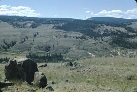
Hand coloured photograph of the surrounding lands and many residential buildings encompassing the Tsimshian village of Lax Kw'alaams (previously called Port Simpson). Printed annotation on recto reads: "Indian Village, Port Simpson, B.C."
Photograph depicts a Haida crest carving on a wooden pole in front of a house. Annotation on recto of photograph states: "Indian Totem Pole, Massett B.C."
Photograph depicts the wooden Hagwilget Bridge spanning a rocky gorge over the Bulkley River. Forested area visible in the background. Annotation on recto of photograph states: "W.W.W. Old Indian Bridge, Bulkley River"
Photograph depicts an unidentified Indigenous (Gitksan?) man standing on a porch behind a stone petroglyph found at Kispiox village along the Upper Skeena River. Annotation on recto of photograph states: "Indian stone relic unearthed at Kispaiyeks Indian Village, B.C., Upper Skeena River".
Photograph depicts a church that was built of shaped logs on the territory of the Tsal'alh Nation on the road leading to Seton Lake. Church was derelict, but still held pews, plastic flowers and small shrines.