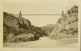
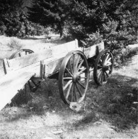
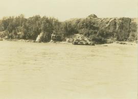
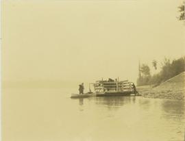
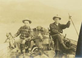
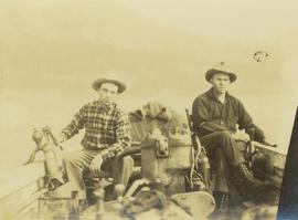
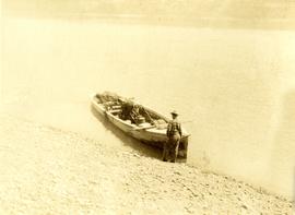
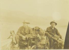
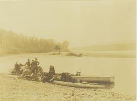
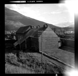
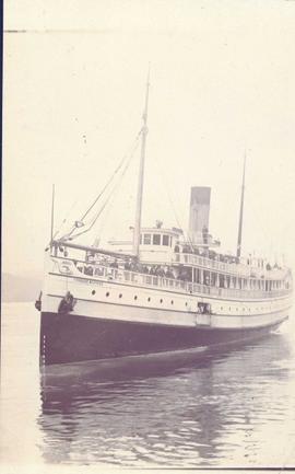
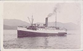
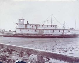
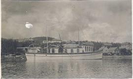
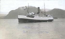
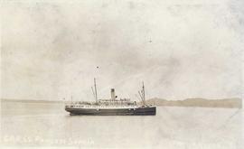
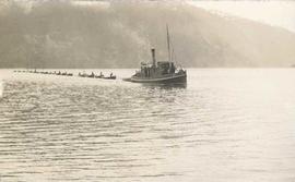
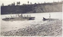
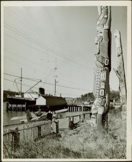
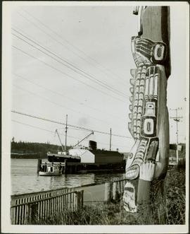
File consists of notes, clippings, and reproductions relating to the British Columbia Express Company. Barnard's Express, later known as the British Columbia Express Company or BX, was a pioneer transportation company that served the Cariboo and Fraser-Fort George regions in British Columbia, Canada from 1861 until 1921.
File consists of notes, clippings, and reproductions relating to ferry boat service in and around Prince George. Includes material regarding the Fraser River Fort George ferry; the Isle Pierre ferry; and the Miworth ferry. File also includes photographs depicting a building at Isle Pierre in the 1970s and the ferry crossing at Isle Pierre in 2005.
File consists of notes, clippings, and reproductions relating to the arrival of the railway in Fort George. Includes material on railway development and building of the railway in Fort George.
File consists of notes and reproductions relating to a brochure about the Fort George Railway and the "Little Prince" 24? gauge steam engine. Includes: "Fort George Railway" brochure prepared by Kent Sedgwick (May 1988); "Fort George Railway Society" typescript letter to George Finsterle from Kent Sedgwick (1 May 1989); and "Fraser-Fort George Regional Museum" brochure (1988).
File consists of a special edition of the Prince George Citizen newspaper titled "70 years of Rail!" (27 Jan. 1984).
File consists of a "BC Rail" special edition of the Prince George Citizen newspaper celebrating 75 years of railway (21 May 1987).
File includes calendars depicting historical Prince George that were published by the Fort George Museum. Includes the following calendars published by the Fraser-Fort George Museum: "1985 Calendar" (1985); "The arrival of the steel" (1983); "Transportation" (Jan 1986-June 1987); and "Prince George: old & new" (1980).
Photograph of a long bridge spanning two rock faces. A small settlement is visible on the lower right.
Three Indigenous men stand in a canoe poling their craft along a shoreline while one man sits and steers. An unidentified village is visible along the opposite shore.
Photograph depicts Beaver Trucking located on Kamloops Indian Reserve No. 1 on Tk'emlups te Secwepemc territory, Kamloops, BC. It had been a company since 1990 and received 2 or 3 boxcars weekly loaded with items from Toronto that were then delivered around town. Davies later noted that the business was destroyed by arson in 1997.
Photograph depicts a 4-wheeled cart located on Tsalalh Nation territory at the head of Seton Lake.
Photograph depicts the CPR line at Revelstoke. The present terminus is about 1 mile south of the mainline depot of the former Arrowhead branch line (27.5 miles long) which became submerged when Arrow Lake was raised 70 ft. in 1968-1969.
Plan depicts Granville Island industrial sites in False Creek, Vancouver. Shows revised trackage from 1955 annotated in colour by Davies.
Photograph depicts a view of the Hudson's Hope ferry seen from across the river. Behind the ferry, in the background is a rocky cliff face.
Photograph depicts three men and a child loading packs into a boat along the shoreline of an inlet at Rolla Landing.
Photograph depicts three men working to move a raft carrying two horses from Hudson's Hope ferry landing.
Photograph depicts Mac McGarvey (right) and Frank Dewing (left) sitting in a boat on the Peace River. Mac McGarvey is steering the boat while Frank Dewing is pumping water from the boat. In the background a low mountain range is visible.
Photograph depicts Mac McGarvey (right) and Frank Dewing (left) seated in a boat on the Peace River. Mac McGarvey is steering the boat while Frank Dewing is pumping water from the boat.
Photograph depicts Mac McGarvey (left) and Frank Dewing (right) getting the boat "Starvation" ready on a rocky shoreline in preparation for travel on the Peace River.
Photograph depicts Prentiss Gray (left) and Mac McGarvey (right) seated in a boat on the Peace River.
Photograph depicts five men loading packed bags into a long boat belonging to Mac McGarvey. The boat is resting near the shore of an inlet at Rolla Landing.
Photograph annotation states that image depicts a CPR warehouse located about 1/4 mile east of the Revelstoke depot, on the north side of the track. The view is looking east. Additional information provided by railway historian Tom W. Parkin: This building is the CPR icehouse at Revelstoke after a partial tear-down. The structure was built after 1929, when a similar facility near the locomotive shops was removed between 1920-29, possibly to make room for a larger turntable. The location is on the northwest edge of the CPR yards. Icehouses once made and stored blocks of ice for refrigeration of passenger coaches and (when crushed) for cooling fresh produce in "reefer cars" en route to market.
Photograph depicts the ship Princess Beatrice on the water with passengers aboard. Annotation on verso of photograph states: "Princess Beatrice"
Photograph depicts the steamship Camosun on the water with numerous passengers aboard. Annotation on verso of photograph states: "SS Camosun"
Photograph depicts the steamship Princess Kathleen on the water with tugboats in the foreground and a forested shoreline in the background. Annotation on recto of photograph states: "Princess Kathleen Photo by R.W."
Photograph depicts a side view of a ship beached on rocks, leaning heavily to the side.
Photograph depicts a ship beached on rocks, leaning heavily to one side with a forested shoreline in the background.
Photograph depicts the steamship Princess May run aground on rocks at low tide. Annotation on recto of photograph states: ""Princess May" on the Rocks, as seen at Low Tide"
Photograph depicts the steamship S.S. Princess Maquinna on the water with the stern of another ship in the foreground and a forested mountain range in the background. Annotation on recto of photograph states: "McRae Bros Prince Rupert C.P.R. S.S. PRINCESS MAQUINNA"
Photograph depicts the steamship Prince George docked on the water with buildings in the background. Annotation on recto of photograph states: "G.T.P. S.S. "Prince George"
Photograph depicts an unidentified boat run aground on a rocky shoreline.
Photograph depicts a man standing on a dry-docked boat in front of a wooden building with driftwood in the foreground.
Photograph depicts a sailboat towing two smaller canoes on the water with mountains visible in the background.
Photograph depicts several people aboard a sailboat on the water with a forested shoreline in the background.
Photograph depicts a steamboat on the water with forested mountains in the background.
Photograph depicts a boat titled Venture on the water with a mountain range in the background.
Photograph depicts a wooden boat run aground on a sandy beach. Annotation on verso of photograph states: "near Port Simpson"
Photograph depicts a river boat run aground on a sandy beach. Annotation on verso of photograph states: "Old Skeena River boat beached"
Photograph depicts the boat Westminster on the water with houses on the shoreline visible in the background. Annotation on verso of photograph states: "Westminster"
Photograph depicts the steamship Camosun on the water with a mountain range in the background. Annotation on recto of photograph states: "S.S. Camosun Port Essington B.C." Annotation on verso of photograph states: "Canada B.C. The Coast Steamer "Camosun" passing Port Essington"
Photograph depicts the steamship Princess Sophia on the water with a forested shoreline in the background. Annotation on recto of photograph states: "C.P.R. S.S. Princess Sophia Prince Rupert" Annotation on verso of photograph states: "Port Simpson B.C. J.M. Parger(?)"
Photograph depicts a man in a fishing boat in front of a line of fishing boats being towed by a tug boat on the water with the base of a mountain in the background.
Photograph depicts a line of cannery fishing boats being towed across the water with the base of a mountain in the background.
Photograph depicts a tug boat hauling a line of small fishing boats across the water with a mountain in the background. Annotation on verso of photograph states: "Tow of Cannery Fishing boats"
Photograph depicts a wooden ferry being steered by one man with two men waiting on a rocky shoreline. Annotation on verso of photograph states: "Ferry across Kishpiax at Hazelton"
Photograph depicts a man in uniform and a woman posing for a photo on a road situated between a fenced area featuring totem poles. Along the water’s edge in the background there is a float plane, wharf and the Camosun vessel. Handwritten annotation on verso reads: “Alert Bay B.C. Union Steamships Ltd.”; “Alert Bay BC”; photographer’s stamp on verso states: “W.E. Nicholson, 268 E. 10th, Vancouver 10, B.C.”
Photograph depicts a close-up of a totem pole behind a fence overlooking a wharf and a ship named Camosun. Photographer’s stamp on verso: “W.E. Nicholson, 268 E. 10th, Vancouver 10, B.C.”
Photograph depicts one man is wearing a hospital gown and on well dress man peughing a large halibut on a dock. A boat is tied to dock in the background. Handwritten annotation in pencil on verso reads: “Halibut Mamaculla”
Photograph depicts James Joseph Claxton and an unidentified man pulling a large fish onto a dock with a peugh. Handwritten annotation in pencil on verso reads: “x JJC"; "C/C Missions”