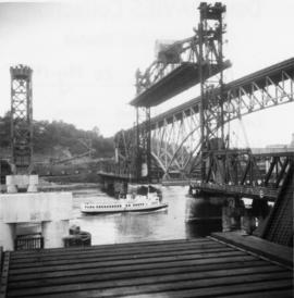
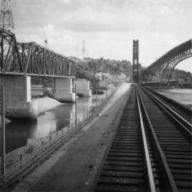
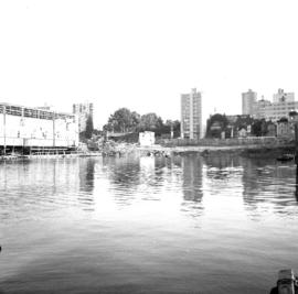
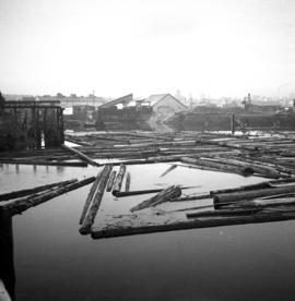
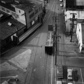
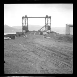
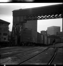
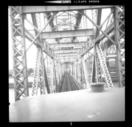
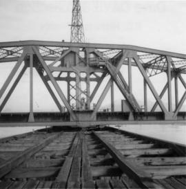
Photograph depicts a CPR bridge over Pitt River.
Photo deoicts the lifting span of an existing rail bridge that was stuck in upwards position after the north pier had been struck by a freighter, putting the towers out of alignment. Visible is a crew working at the base of the north tower.
Photograph depicts three crossing at Second Narrows in Vancouver Harbour. On the left was a new CNR bridge being built. In the middle was exsiting CN track. To the right a high level road bridge is visible.
Photograph depicts houses being demolished on Beach Ave, West End, Vancouver.
Photograph depicts a well cared for house that was empty and being stripped along with 3 other house on Barclay to make way for a high rise apartment block. Built circa 1905.
Photograph depicts a house that at the moment was being pushed up on its side by a bulldozer.
Photograph depicts a house on 10th Ave., Vancouver.
Photograph depicts a large house that was actually the Sunset Beach Lodge. The western end of the block was being demolished. Image captured the last complete block of houses on Beach Ave.
Photograph taken looking northwest at a corner house and another home to its left. They were 2 of 9 houses in this Beach Block, the last block of houses on Beach Ave.
Photograph depicts a house that had just been repainted on the north side of Pender Street.
Photograph depicts one of the few remaining inhabioted and well kept houses that still survived in the very heart of downtown Vancouver.
Photograph depicts one of the four houses on the corner of Barclay and Nicola. It was being demolished to make way for high rise apartments.
Photograph depicts HMCS Discovery Naval Reserve headquarters in located on Deadman's Island, Vancouver.
Photograph depicts the Department of National Defence Armoury headquarters of the British Columbia regiment.
Photograph depicts the demolished site of Nelson Laundries Ltd. The boiler in the foregorund was having tubes removed by a wrecker. The site was to be occupied by a Ford motor dealer.
Photograph depicts buildings of the former Vancouver-Lansdale ferry. They appeared to now be used by Kingcome Navigation Co. as well as other businesses.
Photograph depicts a little used works trailer of steam traction. Era vintage, but carried 1966 trailer plates.
Photograph depicts a tank that was found outside of the headquarters of the British Columbia Armoured Regiment in Vancouver.
Photograph depicts a road roader at work doing black top patching and that belonged to the Pavements Department of the City of Vancouver. Built by Aveling Barford Ltd., Grantham, Lincs, England.
Photograph depicts a Goodyear Blimp cruising over the Centennial Museum near Sunest Beach, False Creek, Vancouver.
Photograph depictsa former RCAF hanger. Plane was airworthy, only required engine repairs.
Photograph depicts the 1966 Armistice Day Parade at Victory Square, Vancouver. An RCMP detachment is found on the east side of the square. Looking north on Cambie Street.
Photograph depicts the CPR line adjacent to the Immigration Building at the foot of Thurlow Street. Former spur that led to Pier A is visible in the foreground. New track that led to a recently constructed rail barge slip was about to be laid across the road at the corner of the Immigration Building.
Photograph depicts the extreme west of Coal Harbour. Looking south towards Georgia Street and the West End.
Photograph taken at the intersection of Nelson and Denman Streets. Three quarters of the blook had just been cleared for a new high rise and shopping complex.
Photograph depicts a fire in the second floor bedroom of a house on Nelson Street.
Photograph taken at the intersection of Cardero and Barclay Streets, looking northeast. Captured at 925 Cardero, the Buckingham Apartments.
Photograph taken at the east end of False Creek, looking south towarsd Quebec and Ontario Streets.
Photograph depicts a house fire in West End of Vancouver.
Photograph depicts a CN boxcar that was 56 years old, having been built in 1918. It had a steel frame, but was also built with wood sides and ends. Located in Dunley Street in the CN yards on the site of the old Hastings Mill.
Photograph taken at the VIA Rail depot in Vancouver. Image captures the view end of the Grand Trunk Pacific Railway car, now called the CNR 'Nechako' #15105. Davies notes that it was normally spotted at the location as a semi-fixed installation.
Photograph taken looking westward, down Johnston Street from the Granville Bridge. Davies notes minimal clearance on the left side of the track.
Photograph taken looking eastward, down Johnston Street.
Photograph taken looking eastward on Johnston Street.
Photograph depicts the northwest part of Granville Island, taken from the Granville bridge. A spur was covered with parked cars.
Photograph taken near downtown Vancouver. Image captured the south side, just east of the centre line.
Photograph depicts an unused spur leading southward to Morrison Steel and Wire Company Ltd. The spur crosses a disused line running on the south side of Cartwright Street.
Photograph depicts the realignment of track due to the redevelopment of the south side of False Creek, Vancouver. New track was linked up and graded while old track was removed all within 7 days of the date the photograph was taken.
Photograph depicts a freight train, "Extra 382-Eastbound," passing southbound over Fraser Bridge at New Westminster.
Photograph depicts the Burlington-Northern Railroad (USA), formerly the Great Northern Railway. Visible are two GN locomotives leading the last passenger train out of Vancouver on the Vancouver-Seattle-Vancouver run.
Photograph depicts a Great Northern Railway interchange curve to CPR tracks near Raymur Avenue/ Powell Street, Vancouver. Visible is a part of an export train, consisting of 11 (dead) General Motor locomotives hauled by a GNR switcher towards the Centennial Dock area. The process of destruction was to take place in Pusan by Korean National Railways.
Photograph depicts a shay locomotive which was last steamed in service on October 9, 1973. Here, it was en-route to the National Museum of Sciene in Ottawa. It was off-loaded at the CPR dock from the Gulf of Georgia barge. Now it was to be loaded onto a depressed flat car for the trip to Ottawa.
Photograph depicts a CPR tail ferry ramp just east of Pier A3 in Vancouver Harbour. Displays the connection with the ramp (in the foreground) and the barge (in the middle distance).
Photograph depicts a CPR rail ferry slip, east of Pier A3 in Vancouver Harbour. Visible are loaded cars of pulp that came from Harmac. They were being unloaded off of an 18 car barge owned and operated by D. Yorke and Sans Ltd. This slip was the oldest extant in Vancouver. It was to be replaced or relegated by a new CPR rail slip being that already being built.
Photograph depicts a new CPR rail terminal ramp that was being built on the site of the former Pier A, Vancouver Harbour.
Photograph depicts a CPR rail ferry slip, east of of Pier A3 in Vancouver Harbour. Visible is the last car that just came off the barge.
Photograph depicts a P & O liner, the "Oriana," backing out from CPR Pier C in Vancouver. Minor assistance was needed from two cates tugs.
Photograph depicts a liner called the "Oriana."
Photograph depicts a P & O liner, the "Orcades," at CPR Pier B. It was about to sail to Hawaii and New Zealand.