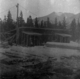
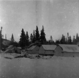
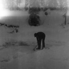
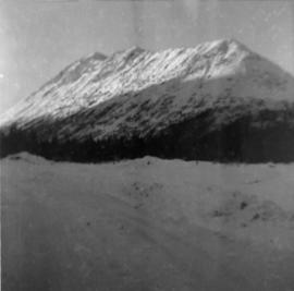
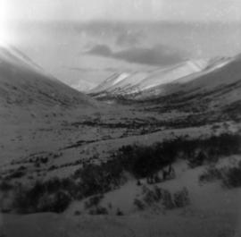
Photograph depicts snow-covered Asbestos Valley from a low altitude point on the mountain road leading to the mine.
Photograph depicts first bunkhouse with lumber piles and power pole in foreground, trees and mountains in background.
Photograph depicts tent structures in the early construction camp at Cassiar. Snow-covered area in foreground, trees in background.
Photograph depicts man with axe believed to be Ed Livingstone breaking ice over weir on Troutline Creek, ice is 8 inches deep. Snow in foreground and background, trees in background.
Photograph depicts a wet mud road in forest. It is believed that a truck is visible in the far distant background.
Photograph depicts a wet mud road in forest. Two men in foreground on left, truck in distance, one man in distance on right.
Photograph depicts snow-covered mountain north of townsite, partially covered in shadow. Photo taken from north road in plant site, snow-covered road in foreground, trees behind road.
Photograph depicts a wet mud road in forest. Truck and people on left in distance, one man in foreground on right.
Photograph depicts a wet mud road in forest. Truck in distance, woman and shadow of unknown person in foreground.
Photograph depicts a truck and two men on a wet mud road in forest. Photo taken from side of road, road in foreground, trees in background.
Photograph depicts two men in front of truck on a wet mud road in forest. Road in foreground, one man in shade on left, trees in background.
Photograph depicts back of truck on wet mud road in forest. People visible in truck, one man on left, partial image of man on far right.
Aerial photograph of Clinton Creek, south east of plant site.
Photograph depicts man on left of truck in wet mud road. Shadow of unknown person in foreground.
Photograph depicts two men bent in front of truck on wet mud road in forest. Road in foreground, partial image of man on far left, trees in background.
Aerial photograph of Clinton Creek, south east of plant site.
A collection of aerial photos of the Clinton Creek area.
Included is a flight index for 68 aerial photographs. Map depicts Clinton Creek area, identifying airfield and mine.
Aerial photograph of Clinton Creek, south east of plant site.
Aerial photograph of Clinton Creek, north west of plant site.
Aerial photograph of Clinton Creek, south east of plant site.
Aerial photograph of Clinton Creek, north west of plant site.
Aerial photograph of Clinton Creek, south east of plant site.
Aerial photograph of Clinton Creek, north west of plant site.
Aerial photograph of Clinton Creek, west of plant site.
Aerial photograph of Clinton Creek, south east of plant site.
Aerial photograph of Clinton Creek, south west of plant site.
Aerial photograph of Clinton Creek, west of plant site.
Aerial photograph of Clinton Creek, south west of plant site.
Aerial photograph of Clinton Creek, west of plant site.
Aerial photograph of Clinton Creek, north west of plant site.
Aerial photograph of Clinton Creek, south west of plant site.
Aerial photograph of Clinton Creek, north west of plant site.
Aerial photograph of Clinton Creek, south west of plant site.